-
Posts
30,715 -
Joined
-
Last visited
Content Type
Profiles
Blogs
Forums
American Weather
Media Demo
Store
Gallery
Everything posted by forkyfork
-
he didn't get 6-12
-
those 1800s stats are wild. it's gotten so much warmer
-

HIGH IMPACT Stormy Christmas (EVE and morning) 12/24-25/20 6P-10A
forkyfork replied to wdrag's topic in New York City Metro
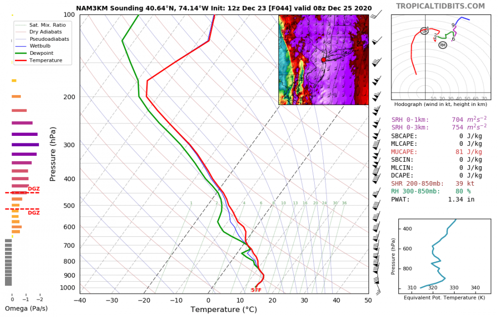
it means more stable air near the surface which would limit transfer of wind downward. the models could be too cool like bluewave mentioned but i'm still cautious about big gusts- 227 replies
-
- 3
-

-

-
- heavy rain
- flooding potential
-
(and 2 more)
Tagged with:
-

HIGH IMPACT Stormy Christmas (EVE and morning) 12/24-25/20 6P-10A
forkyfork replied to wdrag's topic in New York City Metro
- 227 replies
-
- 4
-

-

-
- heavy rain
- flooding potential
-
(and 2 more)
Tagged with:
-
i hope january has zero snow
-
i spy an inversion
-
let me know when there's a serialist pop song
-

December 2020 General Discussions & Observations Thread
forkyfork replied to bluewave's topic in New York City Metro
that pattern is not 2010 -
i was a freshman in HS and jumped out of bed at 6 am when i heard thunder
-
boxing day too. that's the benchmark for nyc
-
i have no idea which one that is
-
is it too much to ask for a storm to tuck in south of montauk and east of acy
-
how on earth did this give bgm 40 inches? this has to be climate change
- 3,762 replies
-
- 4
-

-

-

-
- heavy snow
- heavy rain
-
(and 3 more)
Tagged with:
-
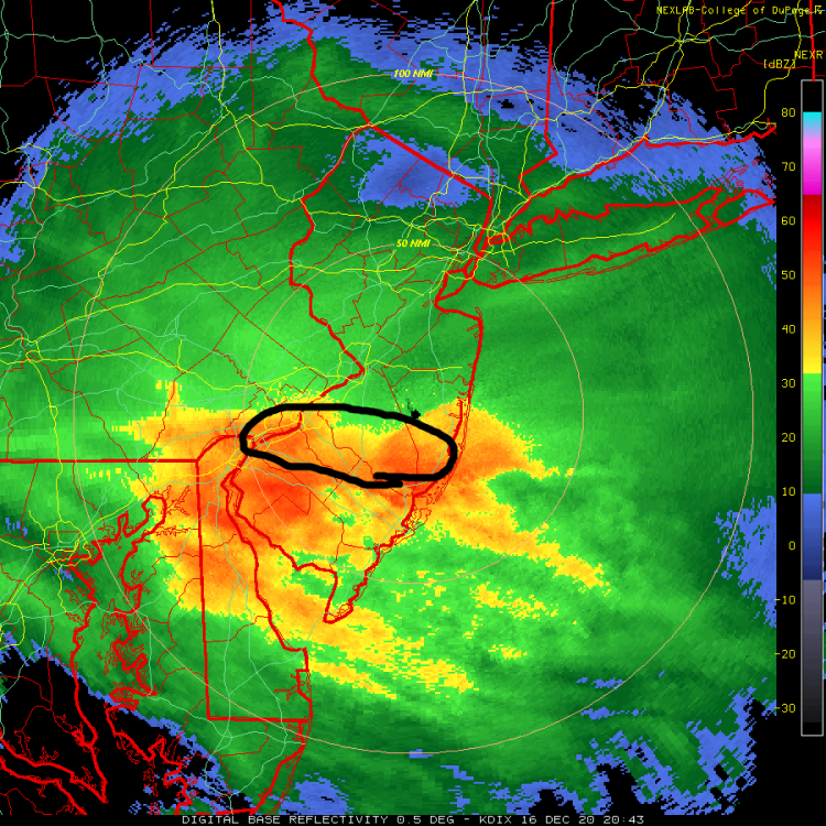
west of suffolk is good for 6-12 over the next 5 hours imo
- 3,762 replies
-
- 5
-

-

-
- heavy snow
- heavy rain
-
(and 3 more)
Tagged with:
-
thx. the nam is too fast with the warm layer for sure
-
-
agree. i just wait for the maps to come out on the better sites to do an analysis. "rgem is nw!" doesn't do anything for me
- 3,762 replies
-
- 5
-

-

-
- heavy snow
- heavy rain
-
(and 3 more)
Tagged with:
-

Active mid December with multiple event potential
forkyfork replied to Typhoon Tip's topic in New England
looks like the high presses a bit more than 12z -
if the snow isn't measured did it really happen?
- 3,762 replies
-
- 5
-

-

-
- heavy snow
- heavy rain
-
(and 3 more)
Tagged with:
-
- 3,762 replies
-
- 2
-

-
- heavy snow
- heavy rain
-
(and 3 more)
Tagged with:
-
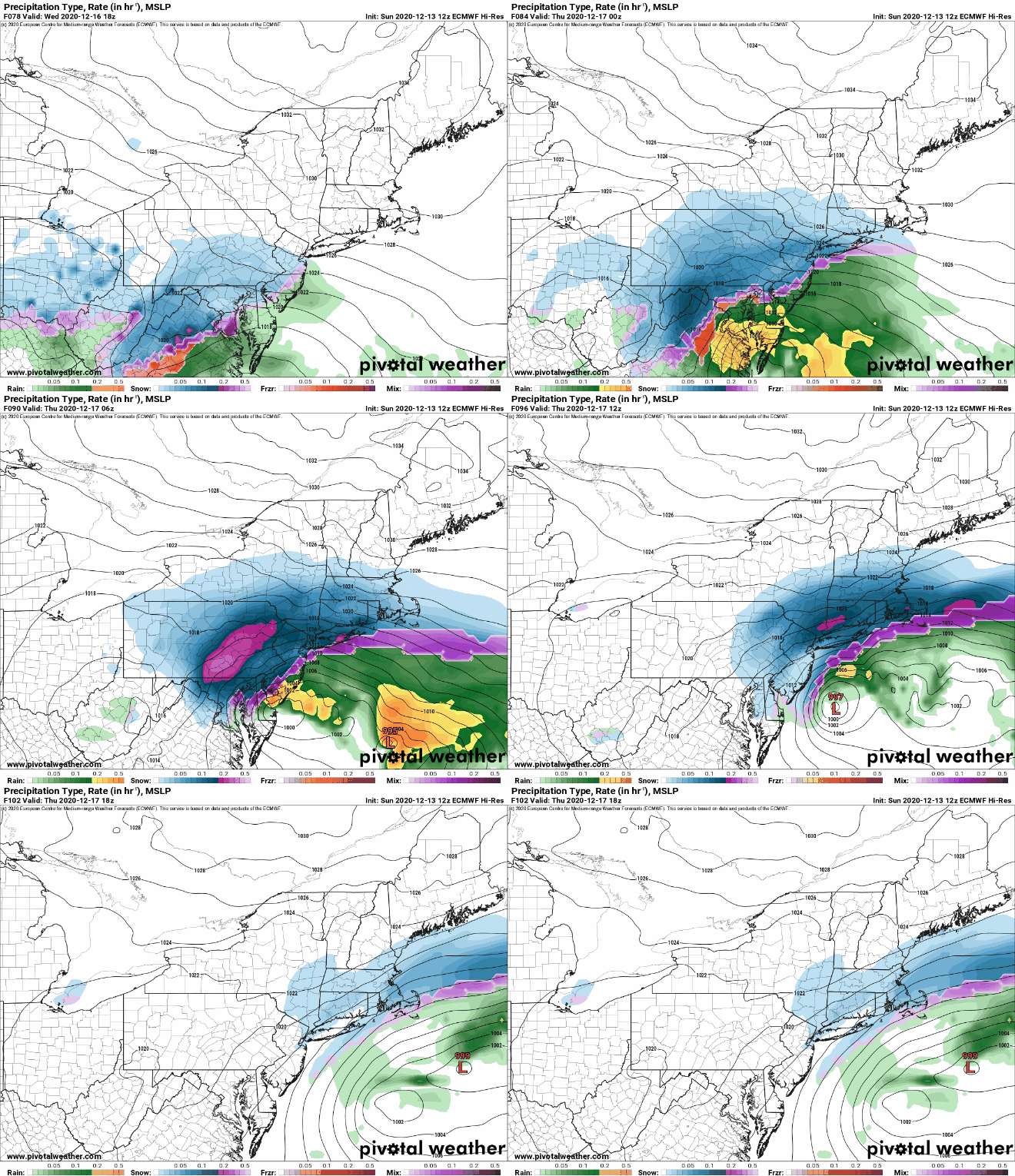
2016 plowed north because of an extremely strong s/w. this isn't quite as strong
- 3,762 replies
-
- 2
-

-
- heavy snow
- heavy rain
-
(and 3 more)
Tagged with:


