buckeye
-
Posts
8,771 -
Joined
Content Type
Profiles
Blogs
Forums
American Weather
Media Demo
Store
Gallery
Everything posted by buckeye
-
eerily still. Windows frosted over. Now it looks like we don’t break 0 degrees today
-
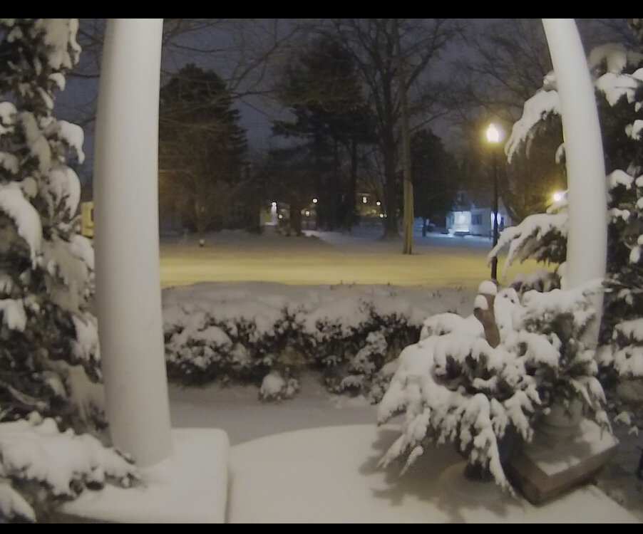
Wow we did better then expected, maybe like 4”? All calm fresh powder. -4. Ready for the ground blizzard
-
I went out a little earlier, it's a steady heavy mist/drizzle, low clouds, dismal and in the 40's. Kinda reminds me of that benign afternoon of Wednesday January 25th, 1978. In all seriousness I do think we are looking a little better here in central OH. It seems there's been a slight trend east with everything and I've seen some short model runs that give us more precip then places west. Not saying it's going to be heavy snow but I think we have a better shot of 3" + then it looked like yesterday.
-

Pre-Christmas (Dec 21-23rd) Winter Storm Part 2
buckeye replied to Chicago Storm's topic in Lakes/Ohio Valley
My sister and brother-in-law built a new house east of lakewood, OH. The back of their house is about 70' from the shoreline of lake erie. Needless to say the house will be tested tomorrow -
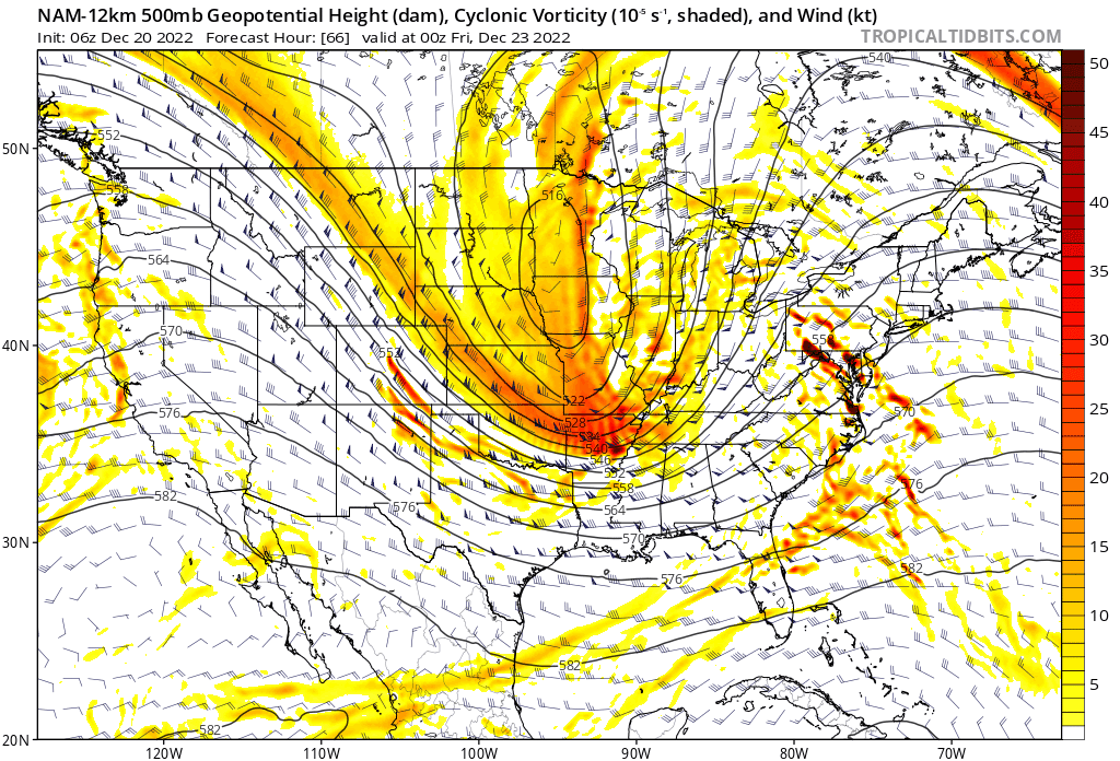
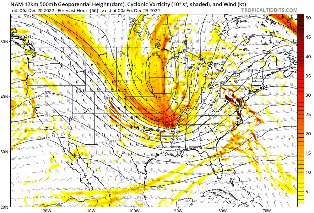
well all that's left is to fire up the radar and the meso models, kick back a few and make sure I'm up at 2am to watch this front come thru. Media is calling this a "once in a generation weather front"....may it live up to the hype and bring us more surprise then disappointment
-
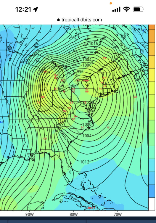
This might be the first time no one has been nam'd during a forecast cycle leading to a storm. Fully expected that at some point it would be showing a 950 low over cleveland
-
that screw zone through central OH has been showing up to some degree or another on several models. I realize that is the infamous "scioto river valley" that can screw us by trapping in warm air or helping to funnel in warm tongues but neither of those should be an issue with this set up. Oh well, with strong winds out of the nw maybe we can steal some snow from the Findlay area. I'm going with 1-12" and I realize measuring will be virtually impossible so you'll just have to trust me when I report my final obs
-
Pre-Christmas (Dec 21-23rd) Winter Storm Part 2
buckeye replied to Chicago Storm's topic in Lakes/Ohio Valley
Voice of reason…/\ -
Shape of trough, speed of front, where/when do the low(s) develop on it, how do all the pieces of energy interact. Give it 24 hours.
-
meh, it's been awhile since we've had a good ole fashioned asphalt blizzard.
-
sorry for the weenie blasphemy, (and maybe it's just my age), but /\ that's going to feel sooo good
-
I can definitely agree with that. The wind factor is a big question mark. A handle on that won't be known until the system is getting underway.
-
The gfs actually came in a bit stronger . Honestly though, I wouldn't even be looking at snowfall maps until later tomorrow. There are so many nuances with exact track, synoptic changeover time, localized squalls, etc. Still, if we were staring down the barrel of our usual central OH xmas, (brown and 40 degrees), we'd be begging for something like this. Wasn't last year when we had the xmas eve 4 incher?
-
so one of the trends I've seen in the last couple of model runs is for the trough to be less sharp, more broad. This is good and bad for us. Good because the cold comes in faster but weaker system. Hope it's just a glitch otherwise this is a strong arctic frontal passage for all of us.
-
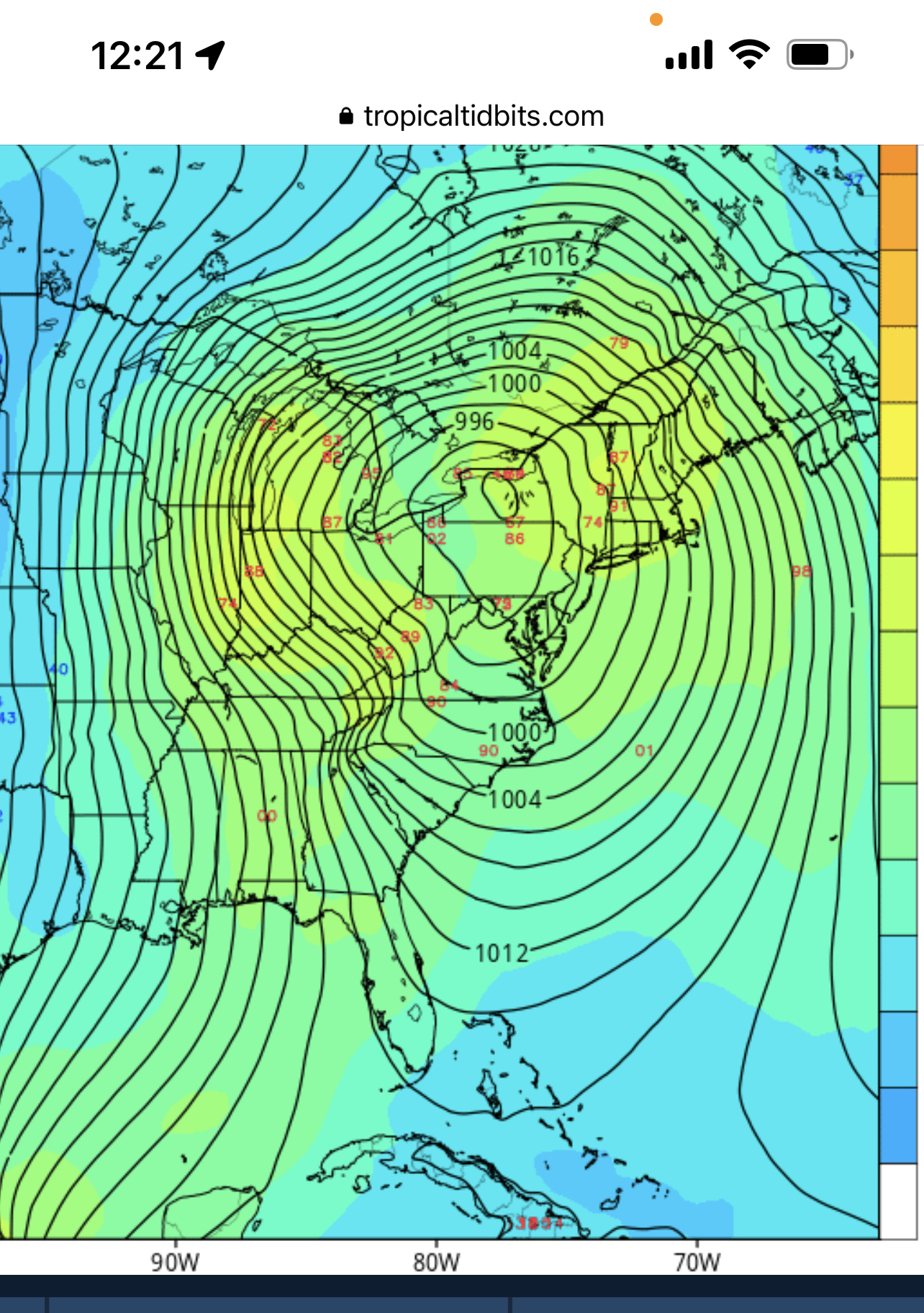
If you asked me what the best place to be right now, (outside of lake influenced areas or far nw), I'm not sure I could pinpoint it. That's what's crazy about this scenario. If you're directly north or northeast of it you get rain wrapping in as it starts to bomb, if you're directly west of it, you run the risk of the dryslot. I guess it's always best to be in closer proximity of the low itself but that's about all you can say. Either way we should see squalls, wind, and even a short period of lake effect with the trajectory of the low....not including whatever synoptic happens. Lots of localized winners and losers with this one. Interesting for sure!
-
2” in Westerville? Seems low. I don’t recall much snow on the ground left by evening after a day of fog drizzle and mild temps…and any snow that was already on the ground would have turned to glacier when we had the flash freeze and would not have been an issue in blowing and drifting. So essentially that would mean 2” of fresh snow paralyzed a city for a week and made travel impossible without a snowmobile.
-
typical historic trends and climo are for typical storms....this is not going to be a typical storm. I don't know whether the current track holds or it goes west or it goes east....nor does anyone else. I suppose this might be classified as a manitoba mauler?? If fail happens, (meaning getting the snowfall shaft), it won't be because of a warm tongue, it'll be a dryslot that screws someone. Sure there'll be rain ahead of the storm but models often underestimate how quickly the temps crash with such a dynamic system. This is not the type of system where we'll be waiting endlessly for sleet and rain to turn to snow, it'll be rain...bang...snow and wind. Whether we get 3" or a foot it's going to be a fun one. The blizzard of 78 only dropped 6 or 7 inches in a very short time and that closed the city for a week and was the deadliest and costliest winterstorm in our history. Let's not offend mother nature by complaining about dendrite growth due to high winds . Let's jus get a memorable xmas eve snowstorm that we can tell our grandkids about. Besides, I have my first grandchild due xmas day! Going to be a fun week. ' ' '
-
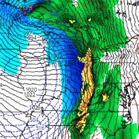
126 hr gefs…. Not exactly a set in stone track. Very dynamic system and doubtful exact track is nailed down outside of 72 hrs. Whatever happens this is a fun one to track.
-
icon, but gem is similar, a little less extreme
-
you gotta admit this would be kinda cool

-
Winter 2022/23 Medium/Long Range Discussion
buckeye replied to Chicago Storm's topic in Lakes/Ohio Valley
I wonder if the gfs still has a bias for being too far east -
Winter 2022/23 Medium/Long Range Discussion
buckeye replied to Chicago Storm's topic in Lakes/Ohio Valley
looks like the trough out west is trending more west on the models. The gfs is still digging and resulting in a coastal track while the canadian and icon are driving the ull much further north and sending one hell of an arctic front through. We need a combination of the gfs and the gem. Although I wouldn't mind an icon solution. Thunder and driving rain changing immediately to heavy snow, wind, and flash freeze to single digits would be fun....even if it only lasts an hour. -
Winter 2022/23 Medium/Long Range Discussion
buckeye replied to Chicago Storm's topic in Lakes/Ohio Valley
Forget about it…. DT saw the 12z gfs and is barking like a rabid dog. This is not just a coastal but a BFD (his words), and he’s even cutting a special vid. Any future runs showing a further nw solution will be deemed as defying physics and you will be instructed to ignore. -
With the ostracisation and subsequent disappearance of Hoosier, I was concerned over who would pick up the sub's drought monitoring duties. Looks like Alek has it handled.
-
Winter 2022/23 Medium/Long Range Discussion
buckeye replied to Chicago Storm's topic in Lakes/Ohio Valley
It’s basically what we do. Why else come here? also ukmet looks like it would go in a completely different direction with the pna ridge offf shore and trough much further west…. That would probably be Chicago special.