
BullCityWx
-
Posts
8,924 -
Joined
-
Last visited
Content Type
Profiles
Blogs
Forums
American Weather
Media Demo
Store
Gallery
Posts posted by BullCityWx
-
-
Same people cancelling winter that always cancel winter.
-
 1
1
-
-
Dang entire 12z EPS suite out by 2PM
-
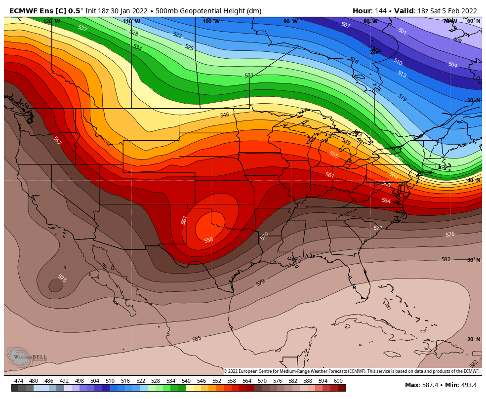
Euro could really flip the script and erase major amounts of our + departures.
-
1
-
-
9 hours ago, wncsnow said:
If this keeps trending east, it could have enough time to maintain or re-strengthen a little then move back into SC
As evidenced by the 18z NAM which would be a big deal.
-
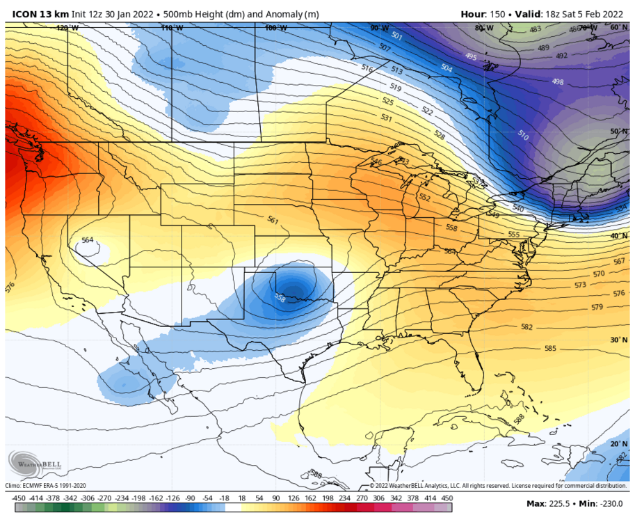

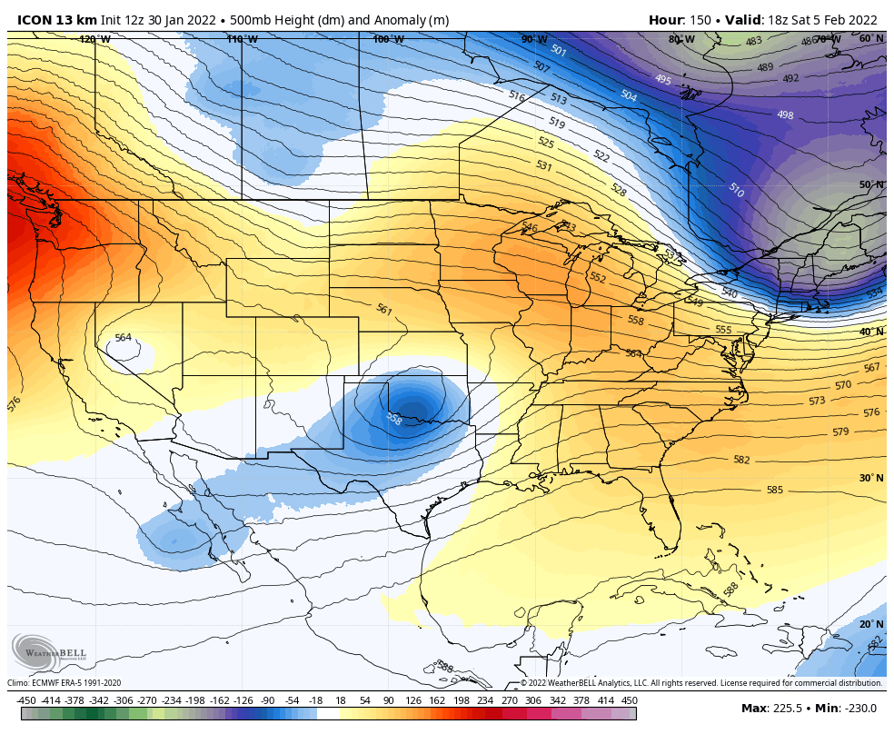
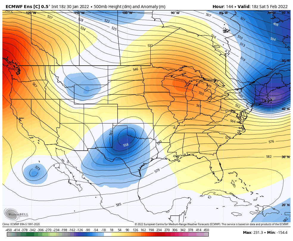
mind you the 12z ICON ended up with a major winter storm with ice along 85 and heavy snow north of 40 from the foothills to Durham.
-
2
-
 1
1
-
-
-
1 hour ago, burrel2 said:
11 of 20 gfs ensemble members shown on cod weather website show a significant winter storm for upstate South Carolina from hr 168-180. That’s an improvement from 7 of 20 on the 12z run.
Yep, signal did increase. I think this one has legs.
-
1
-
-
7 minutes ago, PackGrad05 said:
Thanks. Didn’t Realize the brief duration of warmup until I just checked the forecast.
Yeah, it’s a lot like last week, to be honest. Maybe a little warmer.
-
1
-
-
1 minute ago, PackGrad05 said:
Antecedent temperatures will be really warm. Ground and road will warm up quick.
…..that’s not how that works
-
1
-
-
1 hour ago, burrel2 said:
12z icon has the winter storm at hr 168. So for those counting the current euro, gfs, icon all have the day 7 winter storm. Only the cmc is suppressed.
Yeah it sure does. Big ice for 85ish
-
1
-
-
Just now, eyewall said:
You will need the wind to go completely calm though.
Yeah, worried about the wind evaporating stuff because it is yet again another super light snow.
-
3 minutes ago, WxKnurd said:
I think it was the ‘14 storm, @BullCityWx was reporting huge flakes just piling up down in Ft Mill and there I was sitting a couple degrees colder yet all I have was a mighty blizzard of pea sized at best flakes. Same storm, same precip shield, just was stuck with what had to be lackluster moisture transport in the dendrite growth zone. Then it switched to sleet and we had 4” on concrete and a local minima I think. The Belmont/Mt Holly/Western Meck below Mountain Island earned that surprise overperformer the other week!
I’m trying to place that storm…late January? Between the super cold snow and the big dog? If not, could it have been early 15?
-

29 degrees with a biting north wind. If we hold onto this snow until tonight, we got a shot at radiating to 8 or 9 IMO
-
1
-
-
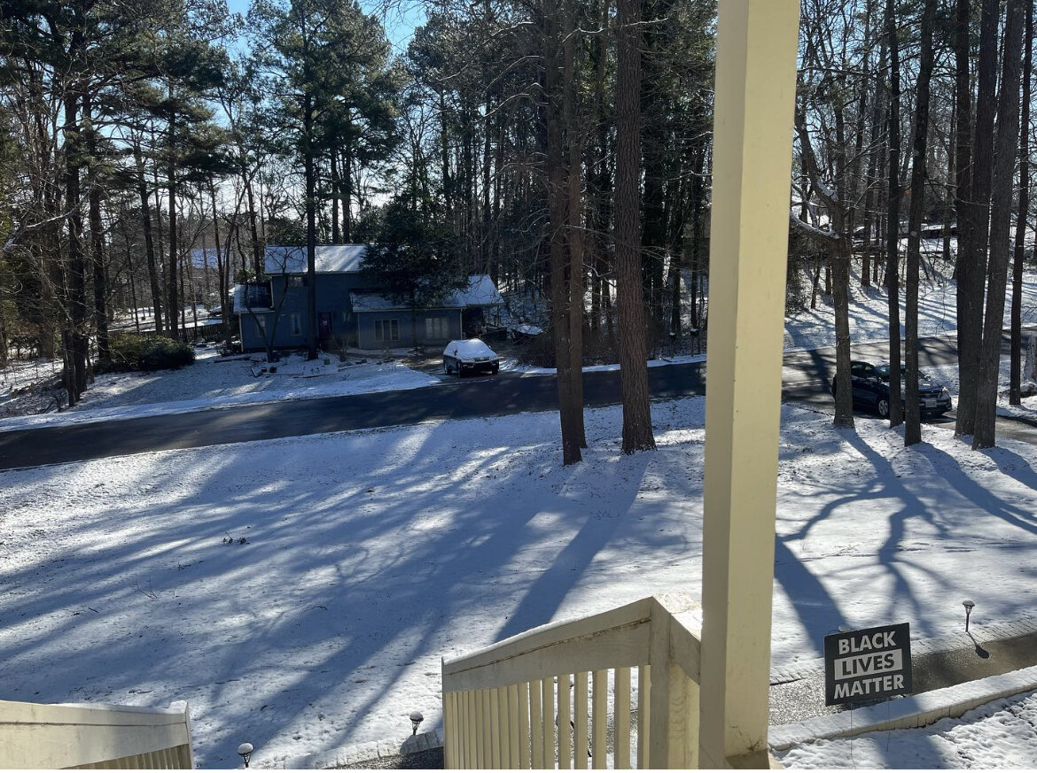
1.25 in NW Durham County. Another light, fluffy snow.
-
4
-
-
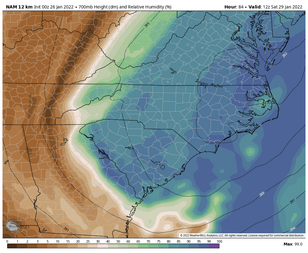
It was occluding into a comma head at 84

-
1
-
-
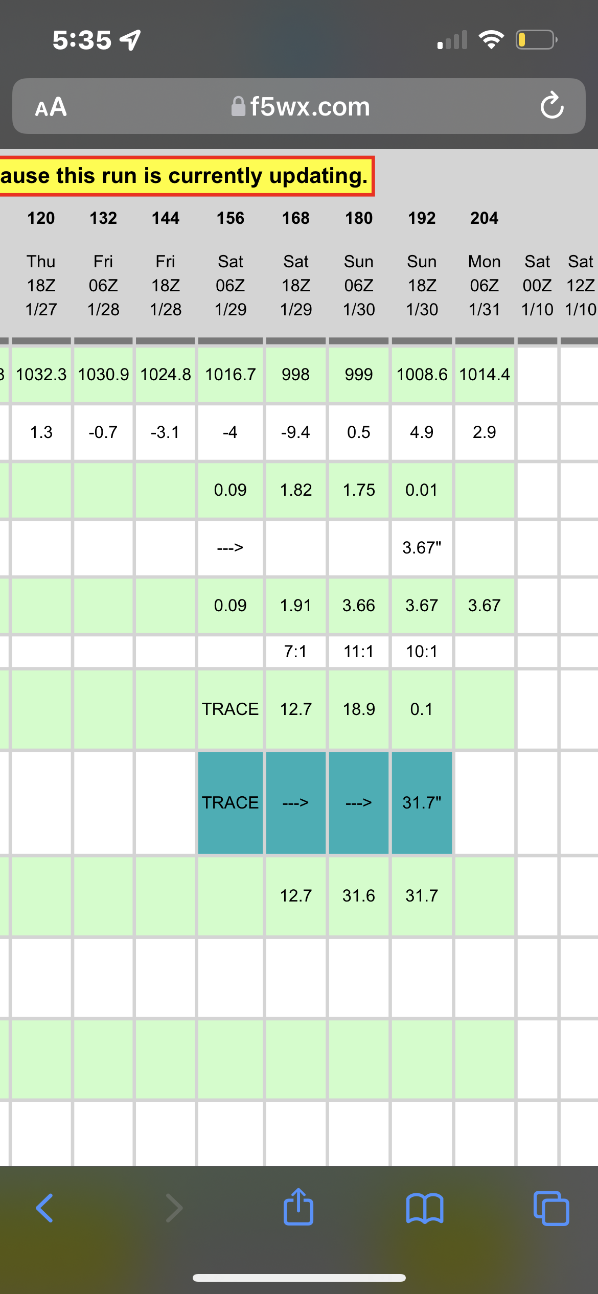
Valid for RDU
-
9 minutes ago, CaryWx said:
You think the Triangle had another 4hrs or so?
Look at those two radar frames at the end. It looks like the snow is passing Winston by 81 and it barely moves.
-
That was a foot for sure for almost all the triangle if it ran to the end of the event
-
3
-
-
1 minute ago, eyewall said:

The signal continues. We will see if we reel it in this week. The timing seems a bit faster lately. The first key piece of energy comes out of western Canada early this week around Tuesday or so. That piece will drop into the southwest than move east. The second piece drops south later in the week through the great lakes. It will be interesting to see when they start being sampled in the real world this week.Ensembles seem more encouraged this run
-
18z GFS soundings indicated blizzard as a hazard type for RDU which I have never, ever seen.
-
7
-
1
-
-
-
That would absolutely destroy Highway 12.
-
The heaviest bands don’t even arrive until 10PMish but yes, it’ll bust

-
 1
1
-
-
6 minutes ago, JoshWeather said:
nothing. NOAA says 32 and light snow, but theres nothing coming down. Just rain otherwise
It’s snowing pretty good over here with the mulch whitening up


Mid to Long Range Discussion ~ 2024
in Southeastern States
Posted
In a general sense, I feel like winters that fire off like we may fire off usually end well