
Radtechwxman
-
Posts
2,105 -
Joined
-
Last visited
About Radtechwxman

- Birthday 10/16/1988
-
This thread is dead for such a potential significant day tomorrow
-
Man models not wanting to pop anything Sat. Very perplexed by this.
-
Really unsure where to target today. Part of me wants to get on the storms near low before they line out but afraid they may get undercut. Part of me is afraid something will go east along a remnant boundary and shear vector orientation and hodograph curvature is better east. Tricky forecast today
-
2024 Short/Medium Range Severe Weather Discussion
Radtechwxman replied to Chicago Storm's topic in Lakes/Ohio Valley
I agree. But the 30% area will likely need one from evolving qlcs. And hatched area will be needed further west for tornado threat near sfc low and large hail threat with initial discrete supercells. -
2024 Short/Medium Range Severe Weather Discussion
Radtechwxman replied to Chicago Storm's topic in Lakes/Ohio Valley
Same. Enhanced days are significant weather days so going to have a hatched area definitely for wind and probably tornadoes. Makes 0 sense. -
2024 Short/Medium Range Severe Weather Discussion
Radtechwxman replied to Chicago Storm's topic in Lakes/Ohio Valley
I do agree it is a very impressive shortwave and definitely bares some resemblance to 4-26-24. However, what are your thoughts on shear vector orientation to initiating boundary? Seemed like there was a less than 45 degree component esp to west but more orthogonal to the east. If you get a prefrontal trough could be a bigger tornado threat but wondering if storms fire off DL/pacific front if they will be more of a mixed mode of lines and embedded sups. -
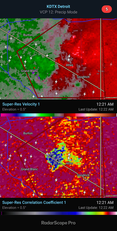
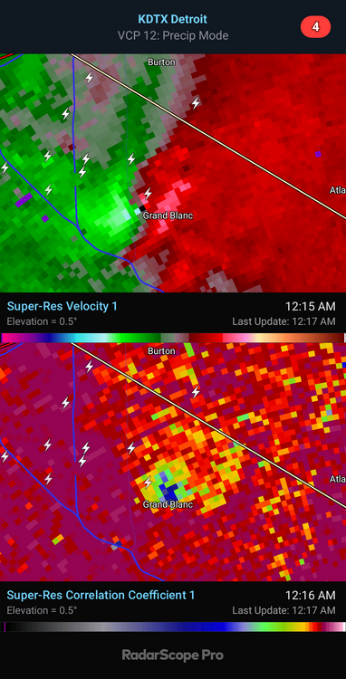
That's what I was thinking. Tight couplet. Thanks
-
Do you know which storm that's on?
-
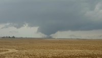
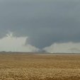
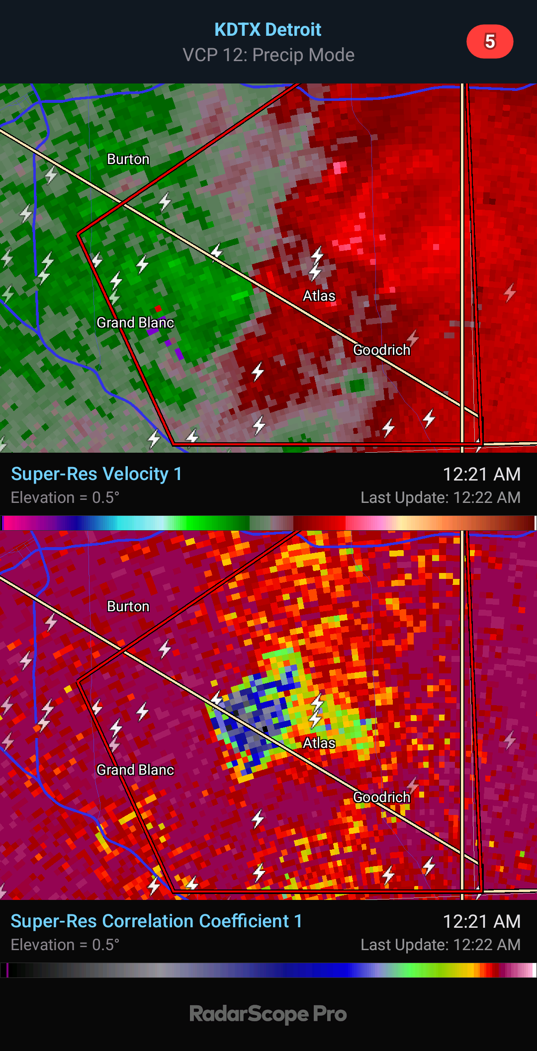
Huge debris fallout. Wow. That likely inflicted a good amount of damage in town.
-
Damaging tornado about to come into Grand Blanc. Wrapped up fast
.thumb.png.2d93c32e08d6ebdfe334b946687feaa6.png)
-
You're pushing it just a bit man. Far from a violent tornado signature. But definitely a damaging tornado at night which is still dangerous regardless.
-
There's no confirmation and no current debris signature. Impressive cell though with strong rotation.
-
Totally agree 100%. Last second moisture return esp in cold season always is a concern. Afraid moisture may be too shallow and can mix out easily like you said. It's too bad all winter we avoided big scouring cf's in Gulf overall but now that severe wx is upon us we are getting them. Ha. But as you said lapse rates will really help. Hodos have great low level curvature so wouldn't take much to produce tornadoes if storm mode avoids being too linear. I feel like wf will be very in play for your area.
-
Euro definitely the most ominous solution of all the models. Lapse rates are good esp for this north and this time of year thanks to that EML. This def bears some similarities to 2-28-17 though for that event we had a well defined wf up this way. I like that sfc winds are south to even slightly backed. Shear isn't crazy but definitely sufficient with that cape profile. Definitely am still worried about cap holding till cf moves in. That dewpoint depression and/or dryline feature could help fire storms ahead of cf if there's enough convergence on it and cap can break. Good thing is storms would likely be discrete. Sfc low is strong but wish it was more compact and not stretched out. Definitely not a perfect setup but definitely one worth chasing.
-
You're not lying. Insane


.png.c2d7312adbec4991c0f41c159527c7cd.png)