Radtechwxman
-
Posts
2,324 -
Joined
-
Last visited
Content Type
Profiles
Blogs
Forums
American Weather
Media Demo
Store
Gallery
Everything posted by Radtechwxman
-
Goes to show you that satellite estimates have errors and you just can't beat actual aircraft data. This likely was overestimated earlier with strength and just now is hitting that level
-
Wouldn't shock me but I think it's still strengthening but maybe slower than earlier
-
Same here man! Dead on!
-
They didn't miss. You can't use satellite to estimate position of their aircraft because of parallax. Radar is most accurate to see this.
-
It was satellite estimate. They don't fly planes into typhoons over there
-
LOLOLOLOLOL. 2020 strikes again
-
How close is recon to intercepting?
-
Would be shocked if this isn't cat 5 now. Crazy how it is doing these jogs south. That's bad because just more time over high octane waters
-
I can't wait to see what recon gets
-
Heard a hurricane hunter is enroute now. Eta looks absolutely impeccable on satellite now.
-
Probably not good because only gives it more time to strengthen
-
So are we now not going to get an actual data now before landfall?
-
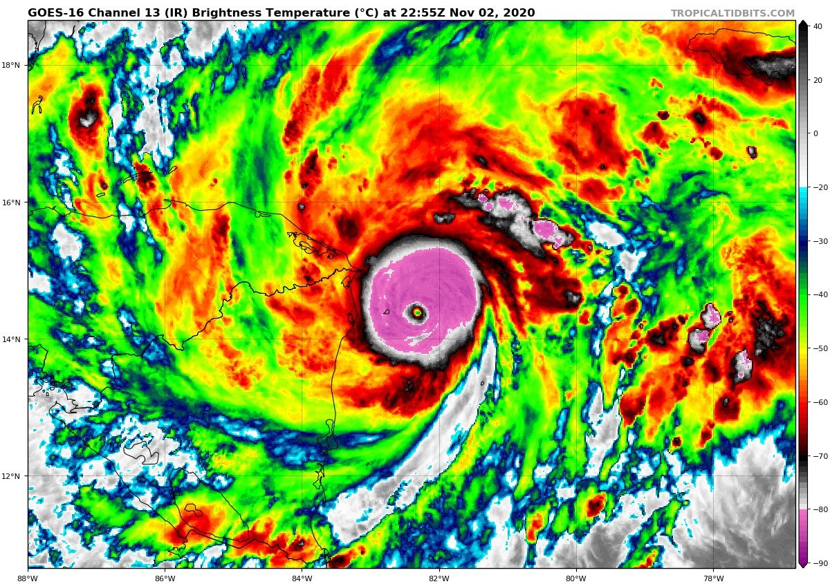
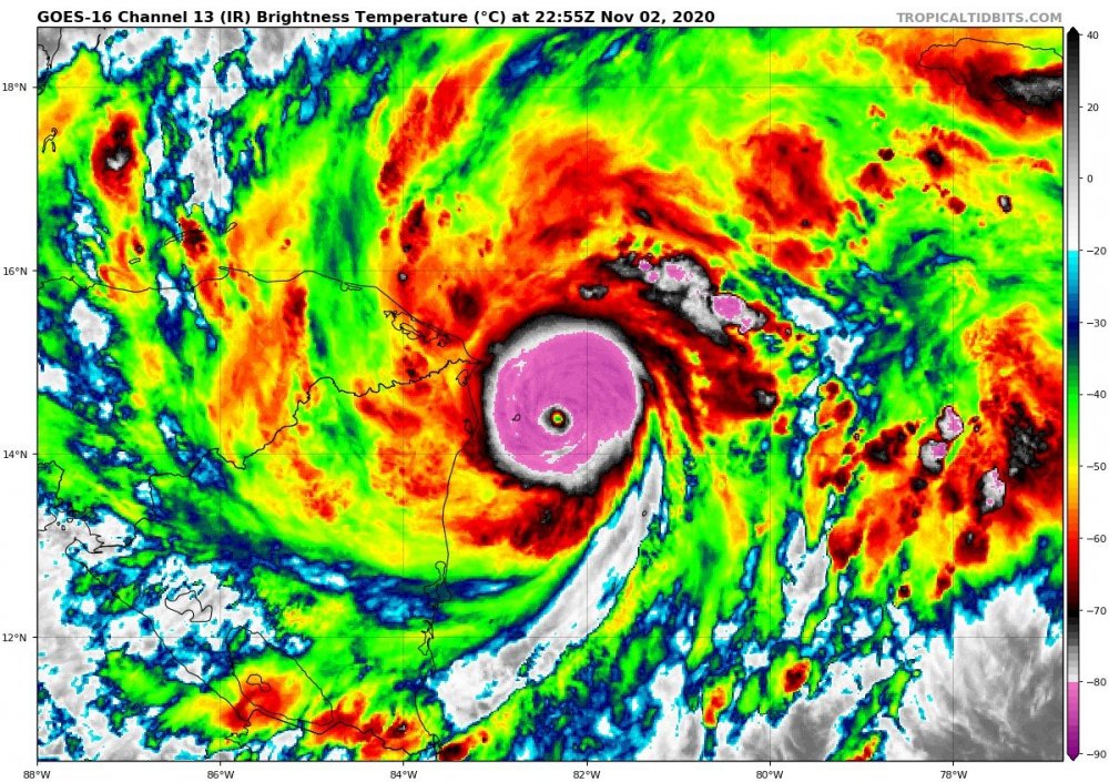
You're right it doesn't technically matter if we know the true strength but I am very curious. Pretty confident it's stronger than what the 4pm forecast stated. Hopefully we can get a recon in there before it landfalls and weakens.
-
 Goni has definitely degraded quite a bit on satellite in its inner core. Curious what the intensity is now
 -
That island definitely impacted Goni. Eye has shrink considerably after passage over it. Hopefully this can bring the intensity down some but regardless this will still be a catastrophic cat 4-5 across the Philippines
-
It's too bad there aren't recon planes to collect data in west Pacific especially since they get hit by some of the strongest tropical systems on earth. Would love to get some actual wind and pressure data from this. Probably no instrument on that island, if there even is one, wouldn't survive long enough to get the max winds and lowest pressures. Eye seems to have shrunk on latest satellite after interacting with the island. Might see intensity level off or even drop off but that's not saying much from 195mph. Truly some of the most incredible satellite imagery I seen next to Haiyan and Patricia.
-
Could be waiting on new dropsonde data. But it probably won't be enough. It sure has that look. Satellite presentation still improving as it landfalls. Craziness
-
Latest NHC full forecast out. 110mph and 970mb. Everyone freak out. It wasn't upgraded to cat 3! OMG!!!!
-
A 5mph difference between 110 and 115 isn't going to be hardly any different in impacts. Now if you're talking like 120-125 that's different
-
Why do you keep arguing this? Clearly if NHC thought this they would update the intensity. But could be a Michael like situation where it's so close to landfall that they aren't wanting to cause panic. Michael had cat 5 winds prior to landfall and they didn't upgrade it. Could be same with this. Maybe afraid they would cause panic if it suddenly hit major hurricane at landfall. Regardless of it being high end cat 2 or low end cat 3 this will have the same impacts
-
This isn't a cat 3 till NHC calls it officially. Curious if it upgrades in the last hr before landfall
-
Time is running out fast for it to hit cat 3. Forward motion is fast. I think maybe 110mph max landfall. Still very impressive. A lot like Sally that was quickly intensifying at landfall
-
I due really think that jet to the north is leading to this quick intensification prior to landfall. That northern outflow channel has really be enhanced by the jet. Great evacuation occurring and just enough warm water to provide favorable support for strengthening
-
100mph 975mb! Wow
-
Zeta has improved once again on satellite. Nice CDO with more symmetrical cold cloud tops surrounding core. Eye is trying to pop again on visible. I'm thinking this will landfall at 90mph or possibly a bit stronger based on how it's looking