cyclone77
-
Posts
18,066 -
Joined
-
Last visited
Content Type
Profiles
Blogs
Forums
American Weather
Media Demo
Store
Gallery
Everything posted by cyclone77
-
Still looking like 80+ dews for Mon and Tue. Could see some 110+ heat indices with temps in the mid 90s.
-
Could be a repeat of last year in that the hottest air temps occur in late August. Looks like a good chance MLI can top the year's hottest (93°) Mon or Tue. Some potential for dews pushing 80° as well, although we are now past peak corn sweat season.
-

Spring/Summer '24 Banter and Complaint Thread
cyclone77 replied to IWXwx's topic in Lakes/Ohio Valley
Yeah it's definitely been a pretty wimpy summer for big heat. Highest temp here was back in June with 95. MLI has only managed to hit 93, also way back in June. We did get a pretty legit stretch of extreme humidity though, with low 80 degree dews back in July. -
Glad we got the rains the past few days as the rest of the month is looking pretty quiet.
-
Quick tenth from a brief downpour a bit ago.
-
Another round of downpours dropped another 0.30" bringing the total to 2". Up to 2.22" for August.
-
Great soaker. Picked up 1.70" early this morning.
- 231 replies
-
- 1
-

-
- absolute trainwreck?
- abandon all hope?
- (and 1 more)
-
Spring/Summer '24 Banter and Complaint Thread
cyclone77 replied to IWXwx's topic in Lakes/Ohio Valley
Apparently SPC is doing a midday day 3 outlook now? Must have missed that memo. -
48 here this morning. Maybe some decent rains later this week.
-
47 here this morning. Actually got pretty chilly in the house with many of the windows open all night.
- 231 replies
-
- 3
-
-
- absolute trainwreck?
- abandon all hope?
- (and 1 more)
-
Summer 2024 Medium/Long Range Discussion
cyclone77 replied to Chicago Storm's topic in Lakes/Ohio Valley
September will be rockin -
Feels like late September today with temps in the upper 60s and near 50 dews. Pretty refreshing after the opressive humidity Monday.
- 231 replies
-
- 1
-
-
- absolute trainwreck?
- abandon all hope?
- (and 1 more)
-
What a change from yesterday's 80 degree dewpoints and 105+ heat indices. Today was spent in the 60s under a dense overcast with some occasional mist thrown in as well.
-
Summer 2024 Medium/Long Range Discussion
cyclone77 replied to Chicago Storm's topic in Lakes/Ohio Valley
Looking bone dry the first half of August around here. Quite the change compared to July. -
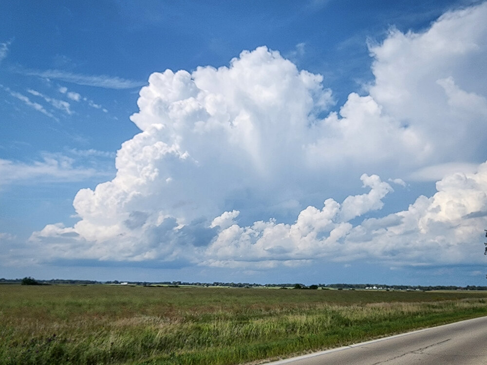
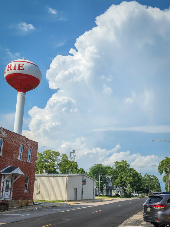
Pretty nice thunderhead boiling up just to the north-northeast. Dews have been hovering around 80 all afternoon, very oppressive. EDIT: Storm is dropping golfballs now up by Dixon.
- 231 replies
-
- 8
-
-
- absolute trainwreck?
- abandon all hope?
- (and 1 more)
-
Low 90s the next 3 days but then cooler after that. Looking pretty dry the next 10+ days from here points south.
-
On the board for August, picked up 0.23" from brief downpour from the Iowa sloppy seconds.
-
Gonna be interesting to see how the two convective areas evolve this evening out west. High-end severe in the Omaha area now moving northeast, and all the stuff up around MSP may sink southeast. Either way you slice it I'm penciling in some heavy downpours later tonight for this area.
-
0.11" of anvil rain so far has got us to the 7.00" mark for July officially. Better chance for heavier downpours tonight.
-
Pushing 7" for the month now here so if the next few days underachieve won't be a bad thing.
-
We got hammered here as well with 2.44".
-
Cedar Rapids getting hammered per usual
-
Another round of 80 degree dews on the way for Wednesday and Thursday it appears.
-
Summer 2024 Medium/Long Range Discussion
cyclone77 replied to Chicago Storm's topic in Lakes/Ohio Valley
Looks like we'll be aboard the MCS train next week. -
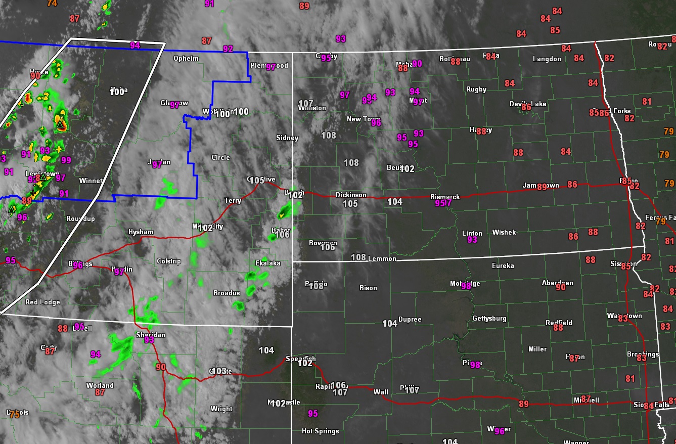
Not in our sub but impressive heat up in the Dakotas. Temps pushing 110 in western North Dakota.