LVblizzard
-
Posts
4,476 -
Joined
-
Last visited
Content Type
Profiles
Blogs
Forums
American Weather
Media Demo
Store
Gallery
Everything posted by LVblizzard
-
I’m at the northern end of that band right now. Coming down hard. 1-2”/hr rates.
-
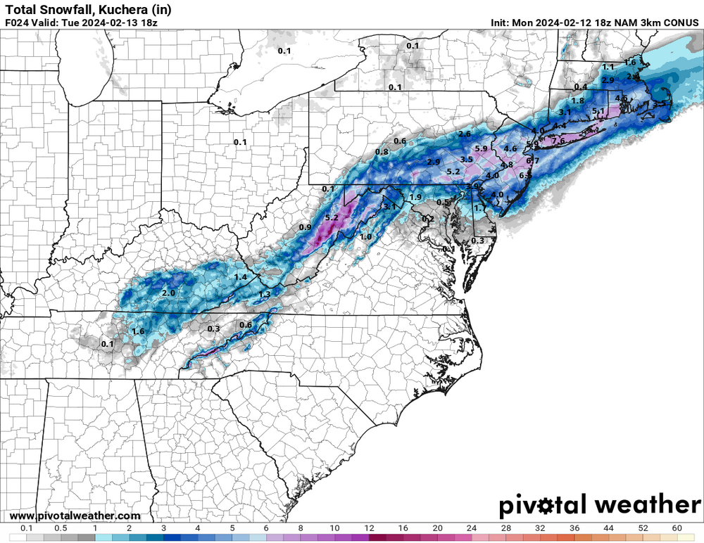
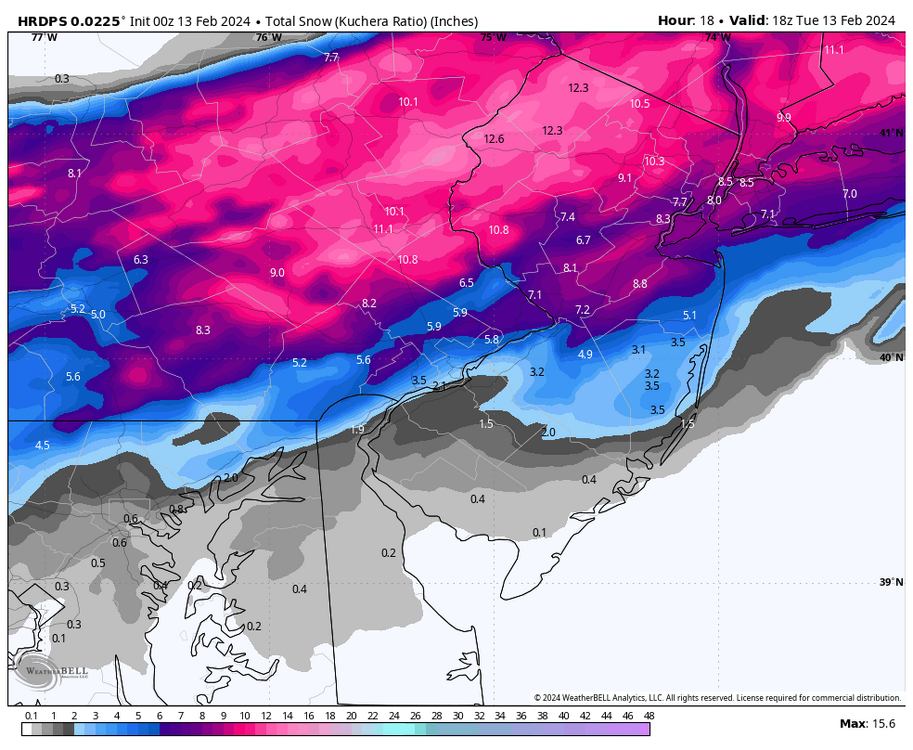
Yesterday’s 6z and 12z Euro runs busted horribly. It had 3-6” in the Poconos and they’re already approaching a foot.
-
Much colder than modeled leading to higher ratios too. Maybe those 10:1 weenie maps weren’t so far off.
-
Just woke up in Allentown and holy crap, we have half a foot already! And it looks like nothing but straight rippage on the radar for the next 3-4 hours. Could we hit a foot??
-
I mean, I’ve seen snow at 41F plenty of times before. But it’s almost always some flurries from decaying lake effect bands in the fall or spring. At KOP right now every level 850mb and below is above freezing. For now, anyway.
-
It’s raining in Allentown so I highly doubt it’s snowing in KOP.
-
Radar filling in very nicely in MD and central PA. This thing is about to get wild in 3-4 hours!
-
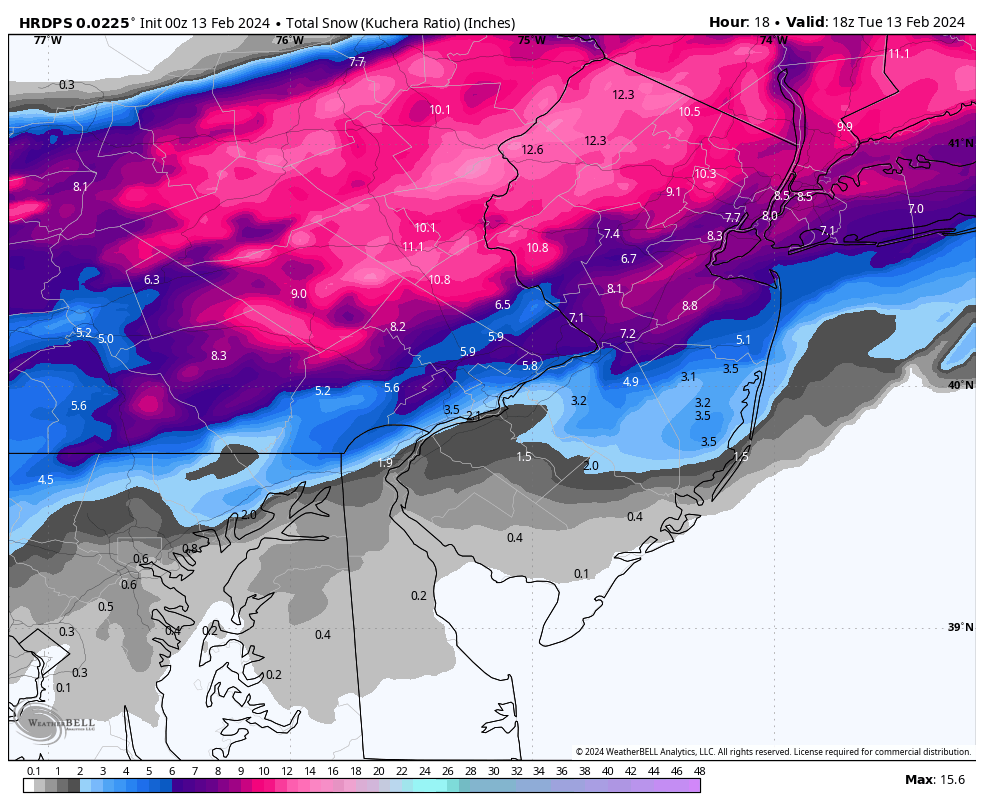
Hi-res RGEM went crazy for the LV and Poconos!
-
I just worry we get dryslotted while the Poconos and Philly burbs both get crushed. It’s happened before and it’s a concern for me with every storm like this. You never know where the banding will set up until it actually does.
-
And the latest RAP brings the heavy bands back into the LV. At this point it’s basically just entertainment looking at these unless there’s some crazy last minute trend.
-
This. This is the model I choose to believe.
-
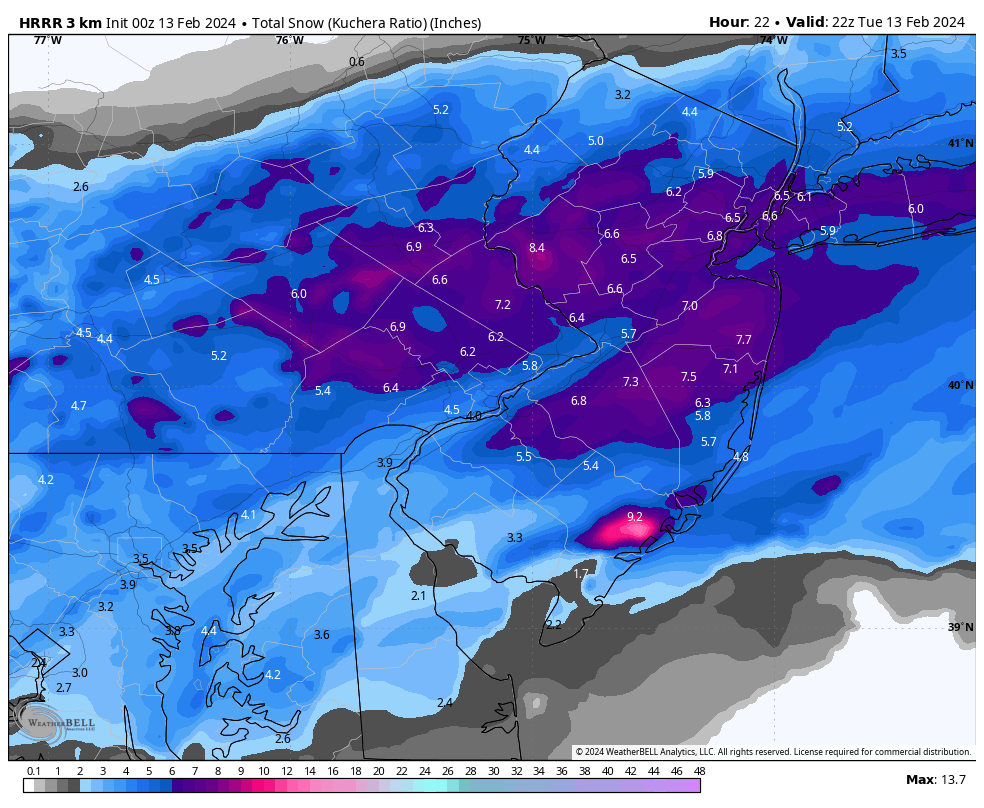
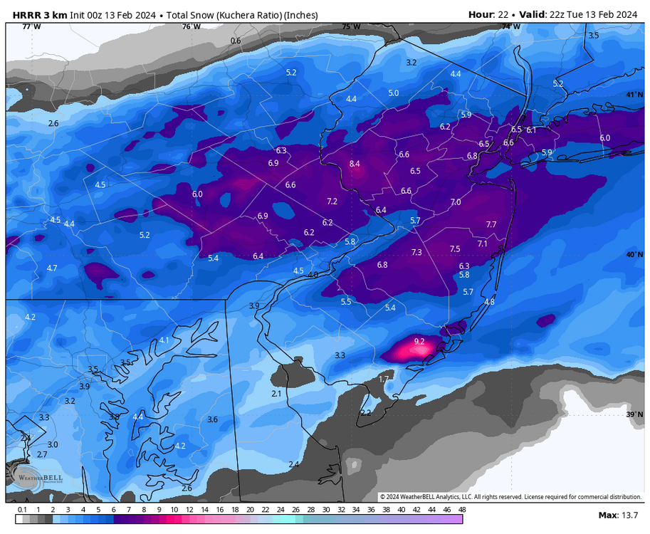
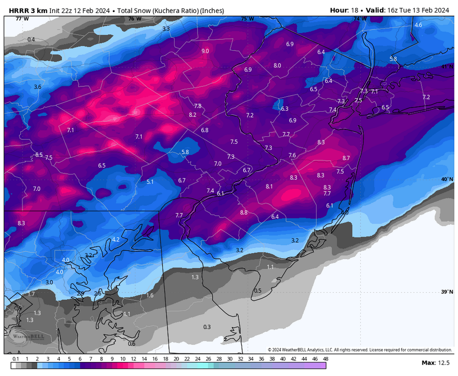
Latest HRRR ups you to 7.9”!

-
Snow reports in Collegeville and KOP on mPING. Those have to be bogus, right?
-
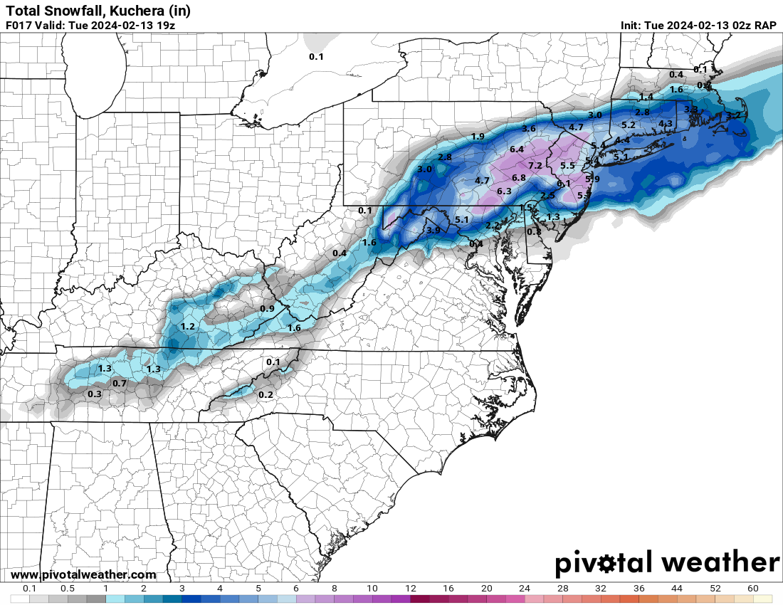
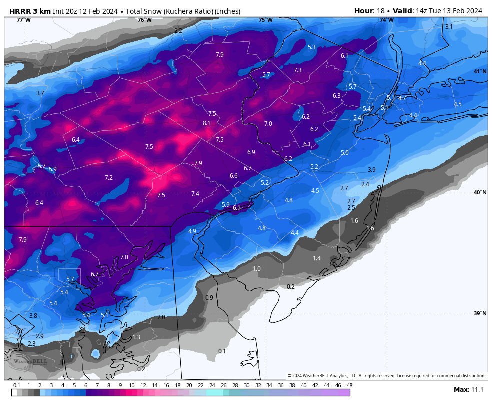
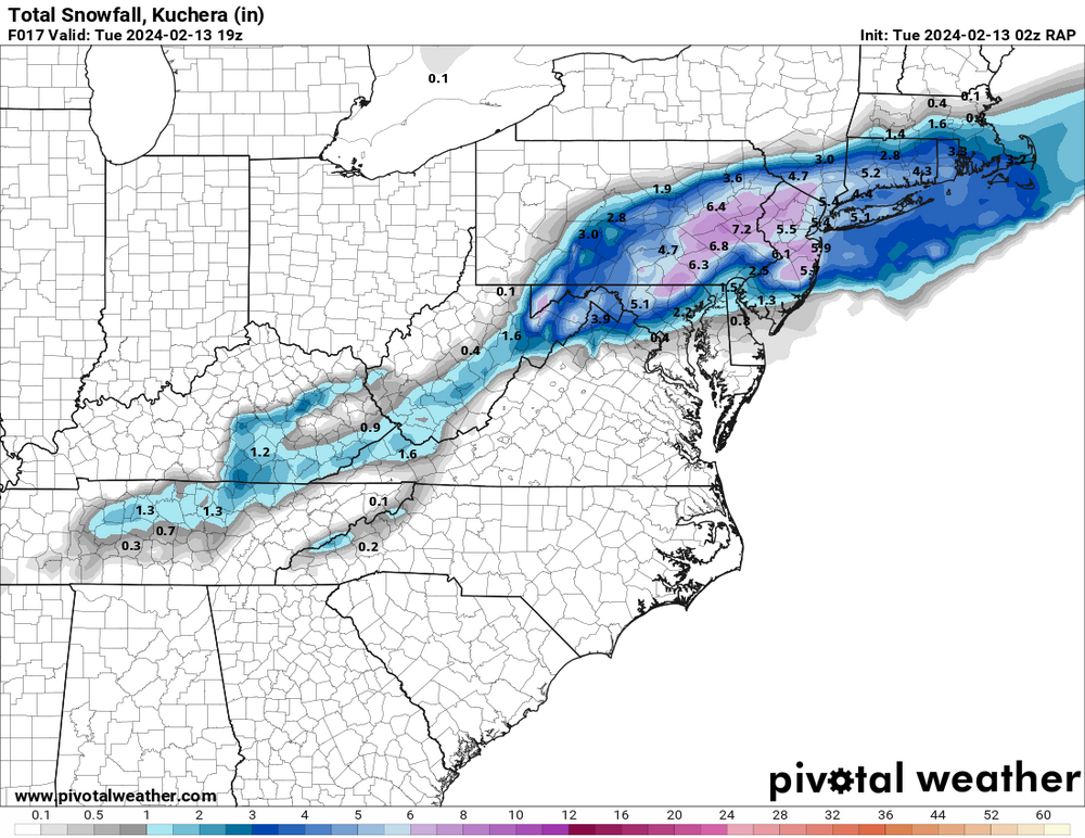
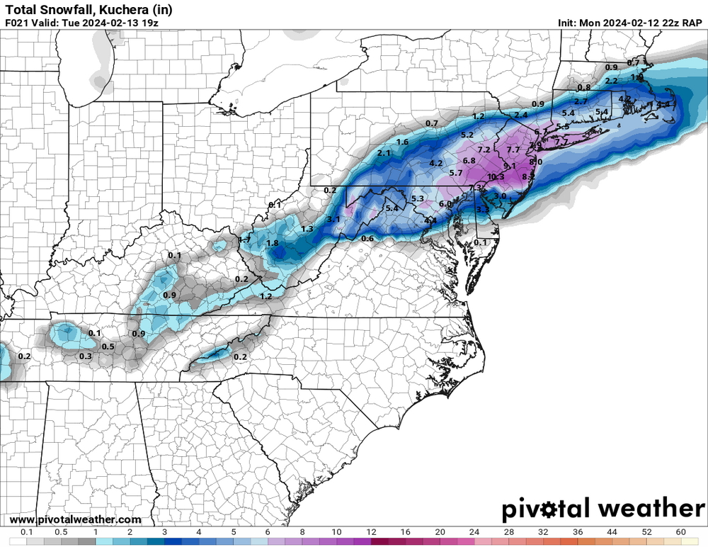
0z runs so far are not good for the Philly burbs. 3-6” now compared to the 6-12” solutions from earlier today.
-
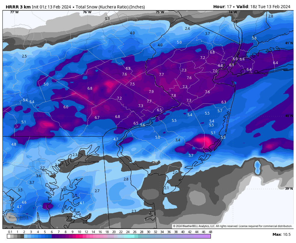
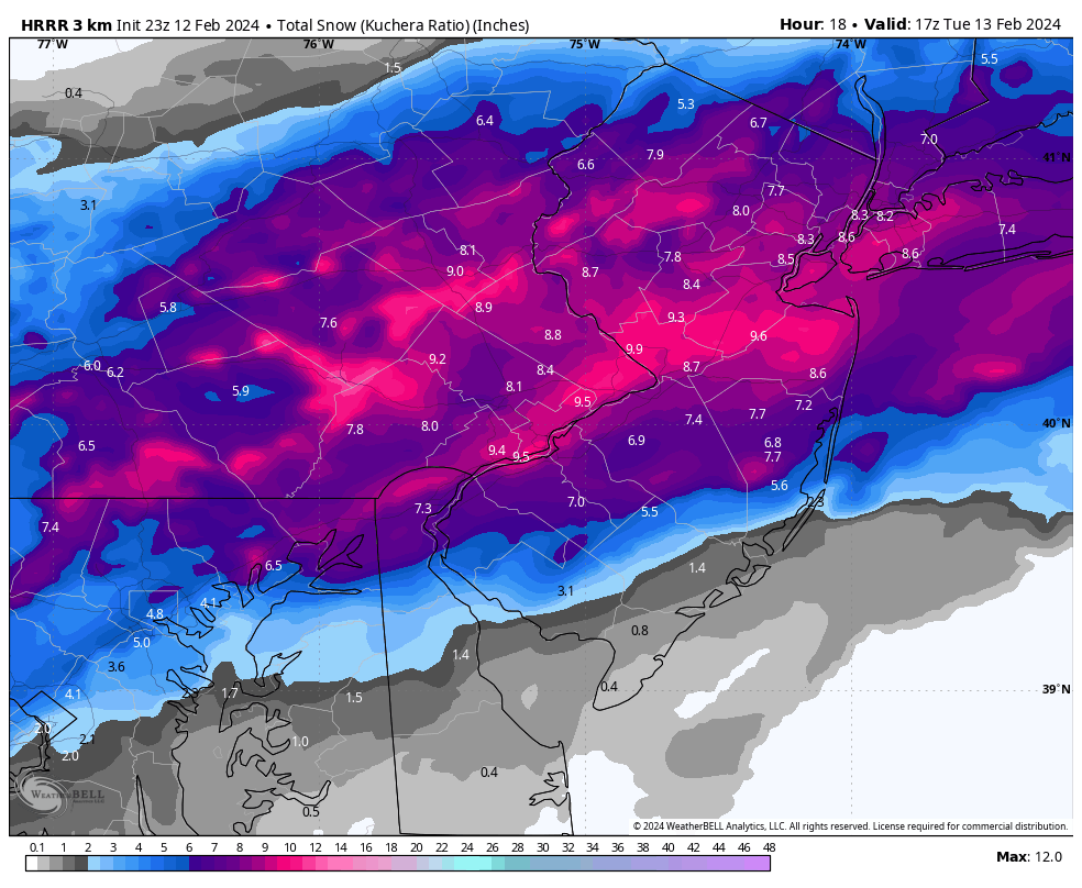
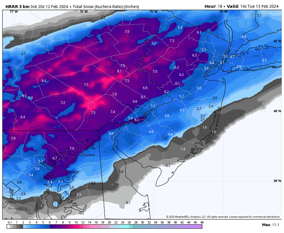
Here’s the HRRR. The RAP is similar.
-
Latest RAP and HRRR back off quite a bit. I’m getting tired…
-
Still snowing for Philly eastward.

-
For SE PA, yes, but the precip cutoff is well north. State College, Williamsport, and Scranton are close to heavy snow again. Not that it matters for this subforum but it’s a clear sign that the south trend has stopped for good.
-
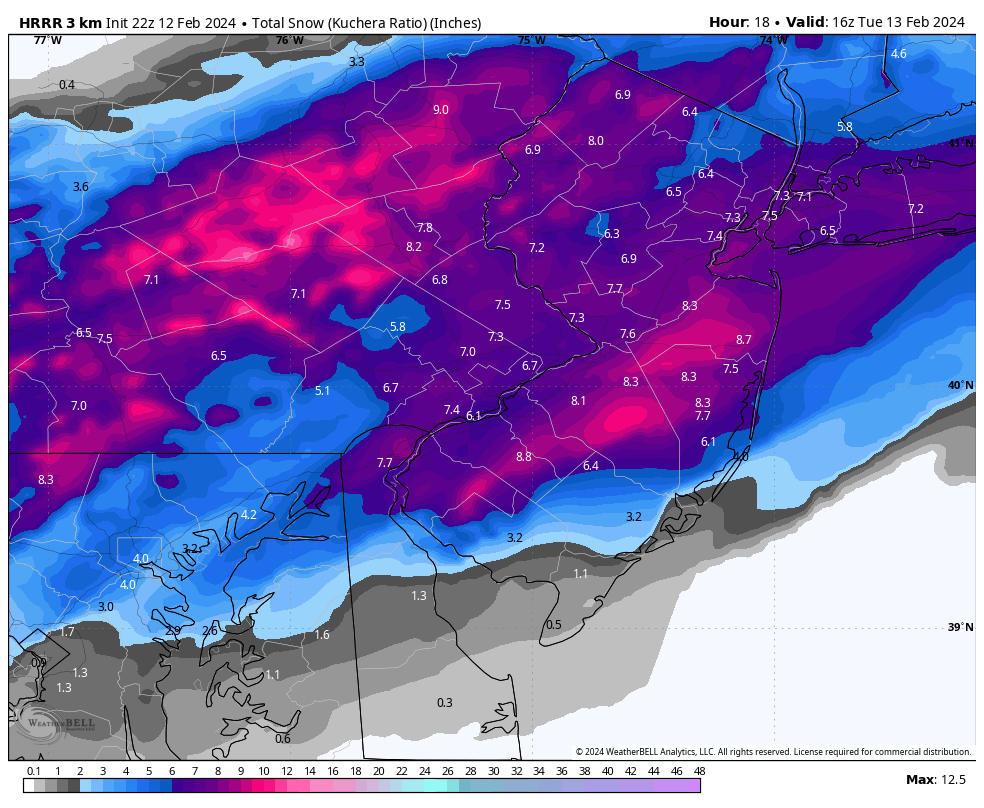
HRRR starting to come back north a little. Current radar supports that.
-
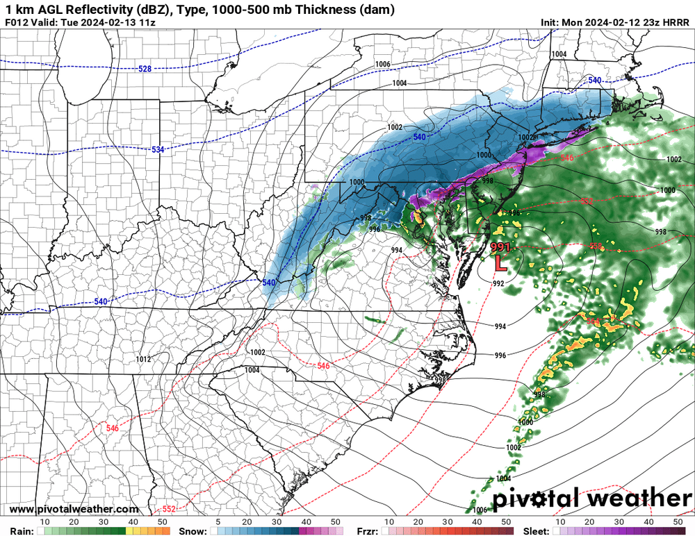
Here’s the complete run. Still snowing everywhere but the Lehigh Valley at this hour.
-
RAP continues to bullseye this entire subforum.
-
2/13 Significant/Major Winter Storm Discussion & Observations
LVblizzard replied to Northof78's topic in New York City Metro
100% agree. Short-range meso models have been steady in their past few runs. And current radar matches up with the models’ sim radar pretty well. -
The HRRR has held steady in its past few runs instead of continuing to trend south. Latest run has 6-9” for most of us with snow still falling everywhere.
-
I can’t even imagine how the forecasters in Scranton/Wilkes-Barre down to the northern Poconos are feeling right now. This was all but a lock for a major snowstorm for them. And it all fell apart just like that. Fortunately it doesn’t look like there’s enough time for this to bust badly in the Lehigh Valley. Worst case, we get like 4” of moderate snow overnight.
-
Meanwhile the 3km becomes good friends with the UKMET.