Memphis Weather
-
Posts
519 -
Joined
About Memphis Weather

- Birthday 02/17/1987
Recent Profile Visitors


-
Likely the radar imagery from Portugal is what pushed this to classification. It would probably have been declared a STS in post season analysis had they not named it today.
-
This won't be Alpha either!
-
Severe Weather for 4/19-4/23
Memphis Weather replied to Tallis Rockwell's topic in Central/Western States
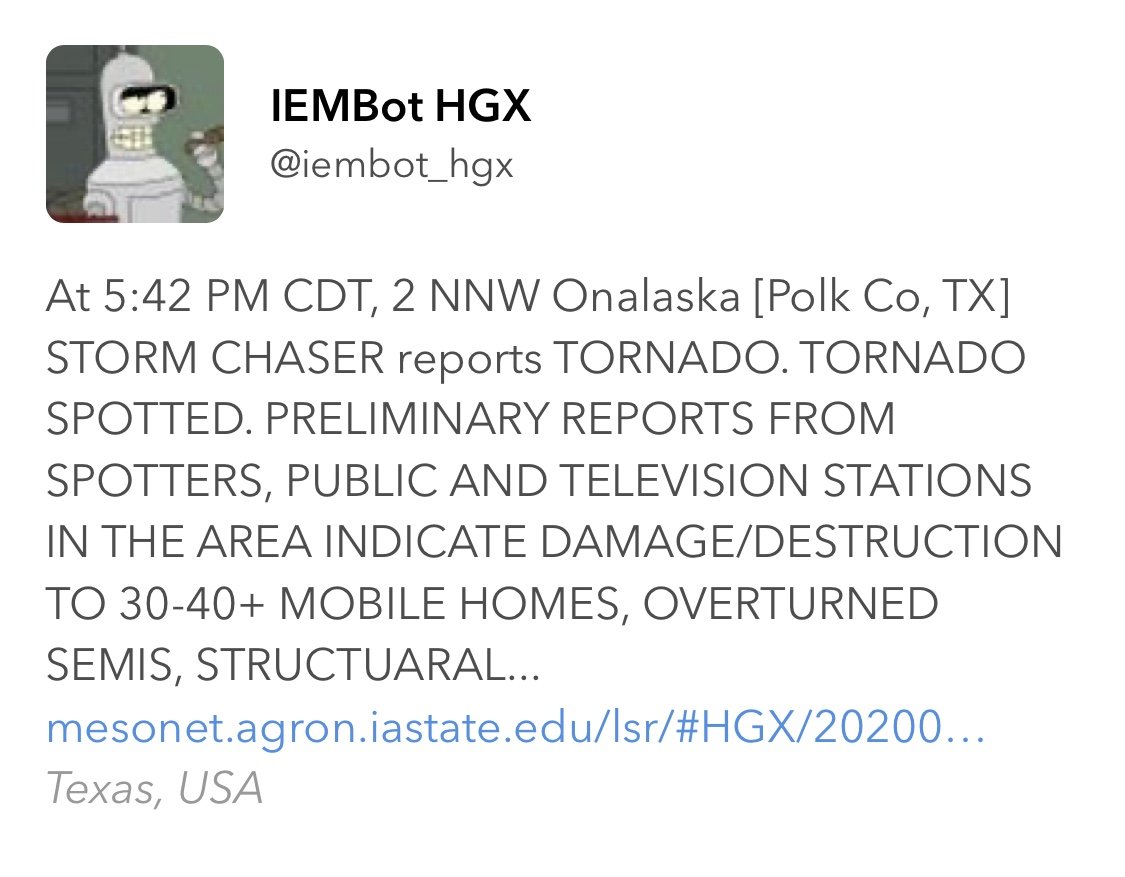
Regarding Onalaska....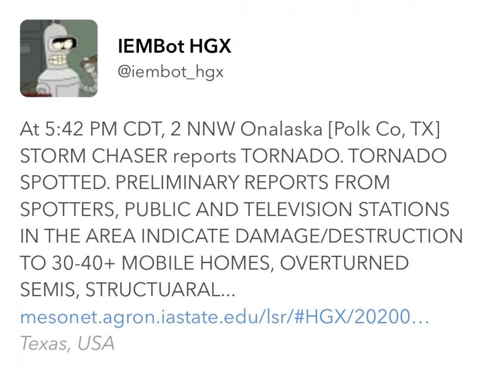
-
Severe Weather for 4/19-4/23
Memphis Weather replied to Tallis Rockwell's topic in Central/Western States
SUMMARY...SUMMARY BASED ON RECENT RADAR AND ENVIRONMENTAL DATA, A STRONG TO INTENSE TORNADO WITH POTENTIAL PEAK WINDS OF 130 TO 165 MPH (EF2-EF3) IS LIKELY ONGOING. DISCUSSION...DISCUSSION RECENT RADAR SIGNATURES FROM KGRK AS OF 2250Z REVEAL AN INTENSE SUPERCELL CHARACTERIZED BY A 0.5 DEGREE ROTATIONAL VELOCITY OF AT LEAST 70 KT. A TORNADIC DEBRIS SIGNATURE HAS ALSO BEEN NOTED ON RECENT RADAR SCANS. THESE SIGNATURES ARE OCCURRING IN AN ENVIRONMENT CHARACTERIZED BY STP BETWEEN 5 AND 6. PREVIOUS SIGNATURES WITHIN SIMILAR ENVIRONMENTS PRODUCED TORNADO-DAMAGE-ESTIMATED WIND SPEEDS FROM 130 TO 165 MPH AND CONFIDENCE IS HIGH FOR A STRONG TO INTENSE TORNADO. A LONGER-TRACK TORNADO IS ONGOING AND MAY CONTINUE BASED ON THE ROTATIONAL VELOCITY DURATION AND THE STORM MOVING WITHIN A FAVORABLE DOWNSTREAM ENVIRONMENT. -
Severe Weather for 4/19-4/23
Memphis Weather replied to Tallis Rockwell's topic in Central/Western States
Looks like that one has roped out at least for the moment -
Severe Weather for 4/19-4/23
Memphis Weather replied to Tallis Rockwell's topic in Central/Western States
Violent motion on this one. Sub vortices evident. -
Severe Weather for 4/19-4/23
Memphis Weather replied to Tallis Rockwell's topic in Central/Western States
News 9 Live stream -
Severe Weather for 4/19-4/23
Memphis Weather replied to Tallis Rockwell's topic in Central/Western States
Tornado continues to get larger -
Severe Weather for 4/19-4/23
Memphis Weather replied to Tallis Rockwell's topic in Central/Western States
Fairly large cone on News 9 now -
This is still the lead cell
-
Anything less than full devastation in Soso or any of the other small communities that have already been hit would be a miracle. The debris fallout on Correlation Coefficient is unlike anything I've seen before....
-
January 10-11 Severe Weather Threat
Memphis Weather replied to DanLarsen34's topic in Central/Western States
Small TDS on that one NE of Godley -
Devastating tornado strikes Joplin, Missouri
Memphis Weather replied to Hoosier's topic in Weather Forecasting and Discussion
Ahh, that makes sense. Thanks for the info! I have to say...its the best NWS assessment I've seen. Great coverage of the societal aspect. I'm interested now to see what the eventual changes will be...how a "impact-based" system is implemented. At the least...as CT Rain says...appears the Tornado Emergency is going to become a separate product...but appears even bigger changes will eventually come. -
Devastating tornado strikes Joplin, Missouri
Memphis Weather replied to Hoosier's topic in Weather Forecasting and Discussion
Fastest turnaround I've ever seen for a NWS assessment...4/27 report isn't even out yet. Many big statements in this one. Quotes that the warning system (and outdoor sirens) "have lost a degree of credibility"...and proposes a framework for basically a new warning system all-together. Another major proposal...implementing a new 88D VCP that allows for one-minute 0.5* slices... -
Devastating tornado strikes Joplin, Missouri
Memphis Weather replied to Hoosier's topic in Weather Forecasting and Discussion
Thanks for some great clarification there! Seems that perhaps the 225-250 estimate is still valid then. Either way...no matter the exact speeds...its just a tragic and heartbreaking sight...and the stories of you...JoMo and others continue to be incredible. The fact remains as you say that this is the deadliest tornado of the modern era and that's the most important thing to remember in terms of historical perspective.