nwohweather
-
Posts
3,696 -
Joined
-
Last visited
Content Type
Profiles
Blogs
Forums
American Weather
Media Demo
Store
Gallery
Everything posted by nwohweather
-
It really was like a strong tropical storm, Cat 1 hurricane at the heart of the storm. Unreal winds as that storm gained strength, I believe the barometer fell below 29 in Findlay, OH on Friday evening
-
I feel like the turbulence also had to be borderline extreme during the heart of the storm as well
-
A weather station by me is reporting a 78 mph gust
-
Some of the legitimately worse weather I’ve been in for quite sometime. Reminds me of a Cat 1 hurricane to be honest
-
Currently without power here SW of Toledo. My Kestrel showed gusts of 57 mph
-

March 2nd Moderate Risk ArkLaTex
nwohweather replied to Ed, snow and hurricane fan's topic in Central/Western States
The radar coverage is so rough -
Or just underestimating the power of this storm itself. 977 MB at Hour 36 is pretty bonkers for this part of the country
-
March 2nd Moderate Risk ArkLaTex
nwohweather replied to Ed, snow and hurricane fan's topic in Central/Western States
Definitely some steep lapse rates in play -
March 2nd Moderate Risk ArkLaTex
nwohweather replied to Ed, snow and hurricane fan's topic in Central/Western States
Once the warm front placement becomes clearer, I think we see a High risk tomorrow. With that kind of helicity in place there is serious risk for violent tornadoes and with a low LCL you could see some solid long trackers -
That’s why it’s a skilled profession and not called model watching
-
March 2nd Moderate Risk ArkLaTex
nwohweather replied to Ed, snow and hurricane fan's topic in Central/Western States
Great read. Also interesting to see violent tornadoes being mentioned a couple days out -
Still looking like an absolute big dog
-
Didn’t one of the Hi-Res models show this? I’d have to comb through but it showed a little blotch around Hillsdale Co that 100% verified
-
2023 Short/Medium Range Severe Weather Discussion
nwohweather replied to Chicago Storm's topic in Lakes/Ohio Valley
Awesome video! Impressive to actually see at real speed the tightening up of the rotation -
2023 Short/Medium Range Severe Weather Discussion
nwohweather replied to Chicago Storm's topic in Lakes/Ohio Valley
And there was a CC spike -
2023 Short/Medium Range Severe Weather Discussion
nwohweather replied to Chicago Storm's topic in Lakes/Ohio Valley
-
2023 Short/Medium Range Severe Weather Discussion
nwohweather replied to Chicago Storm's topic in Lakes/Ohio Valley
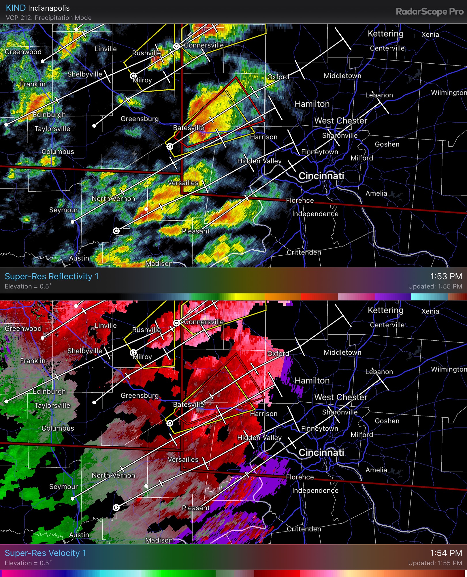
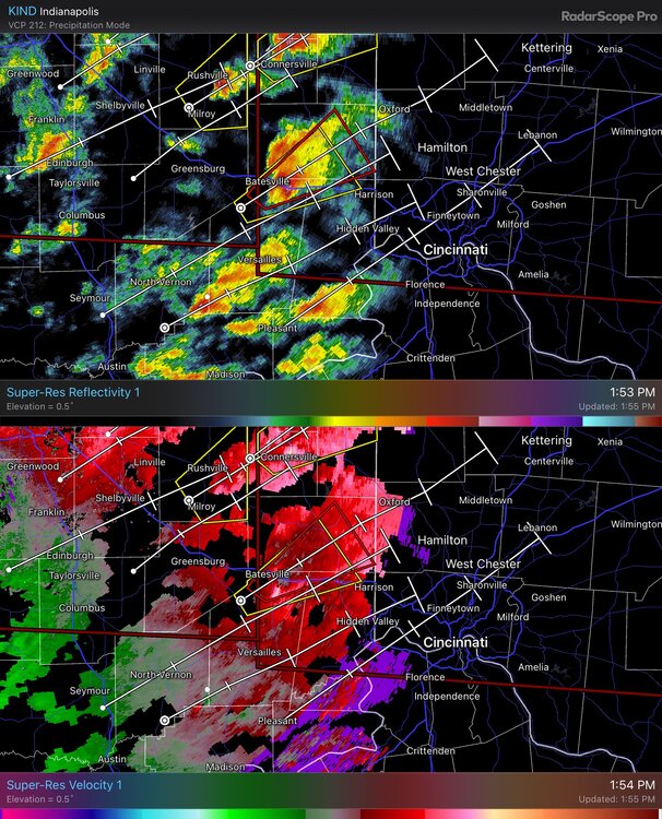
Looks like we may have a significant tornado on the ground west of Cincinnati -
The St Louis to Cleveland special right now on the Euro. I notice some solid winds on the backside of this storm as well, could be a paralyzing early March storm which was all the rage the first 10 years of this century
-
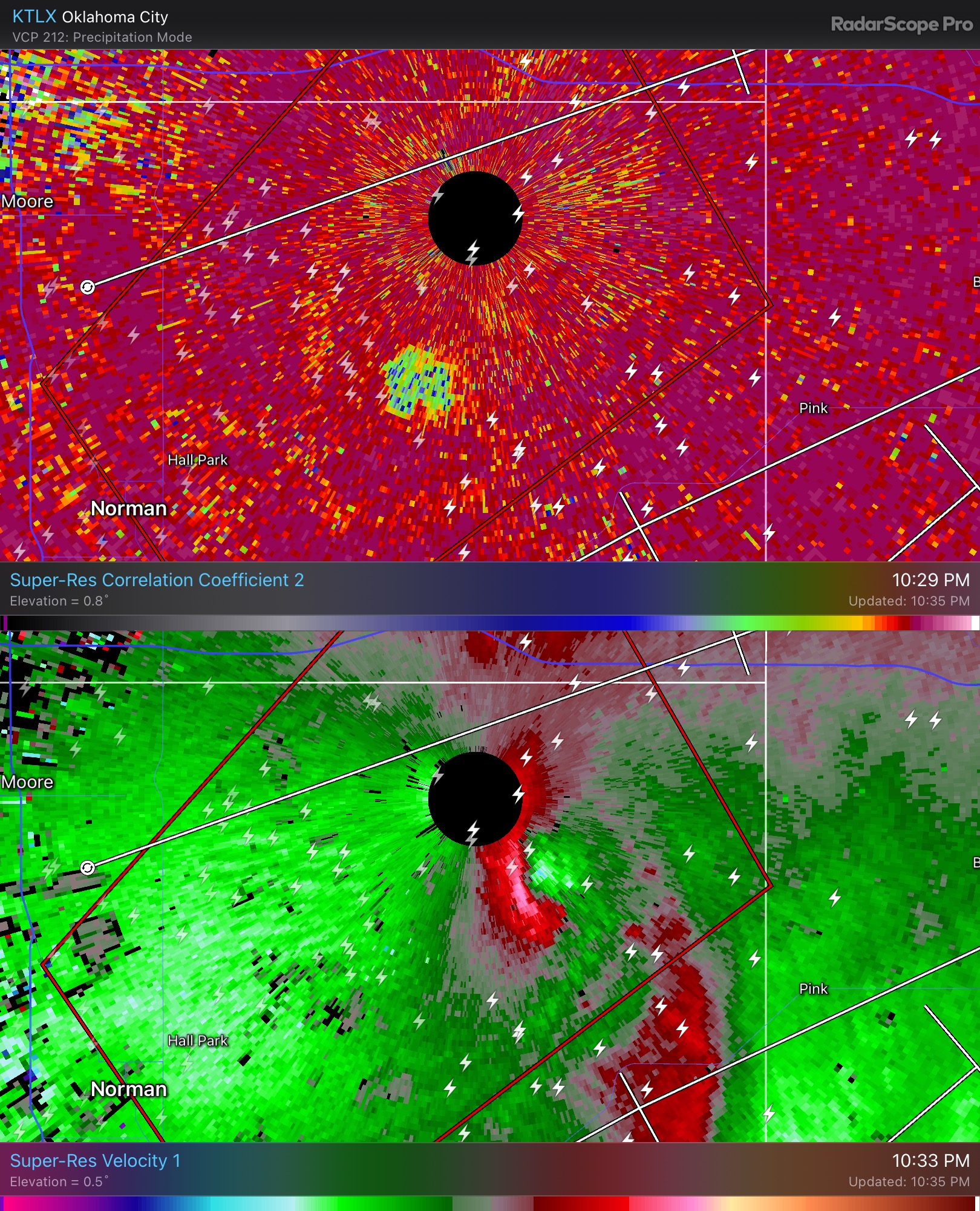
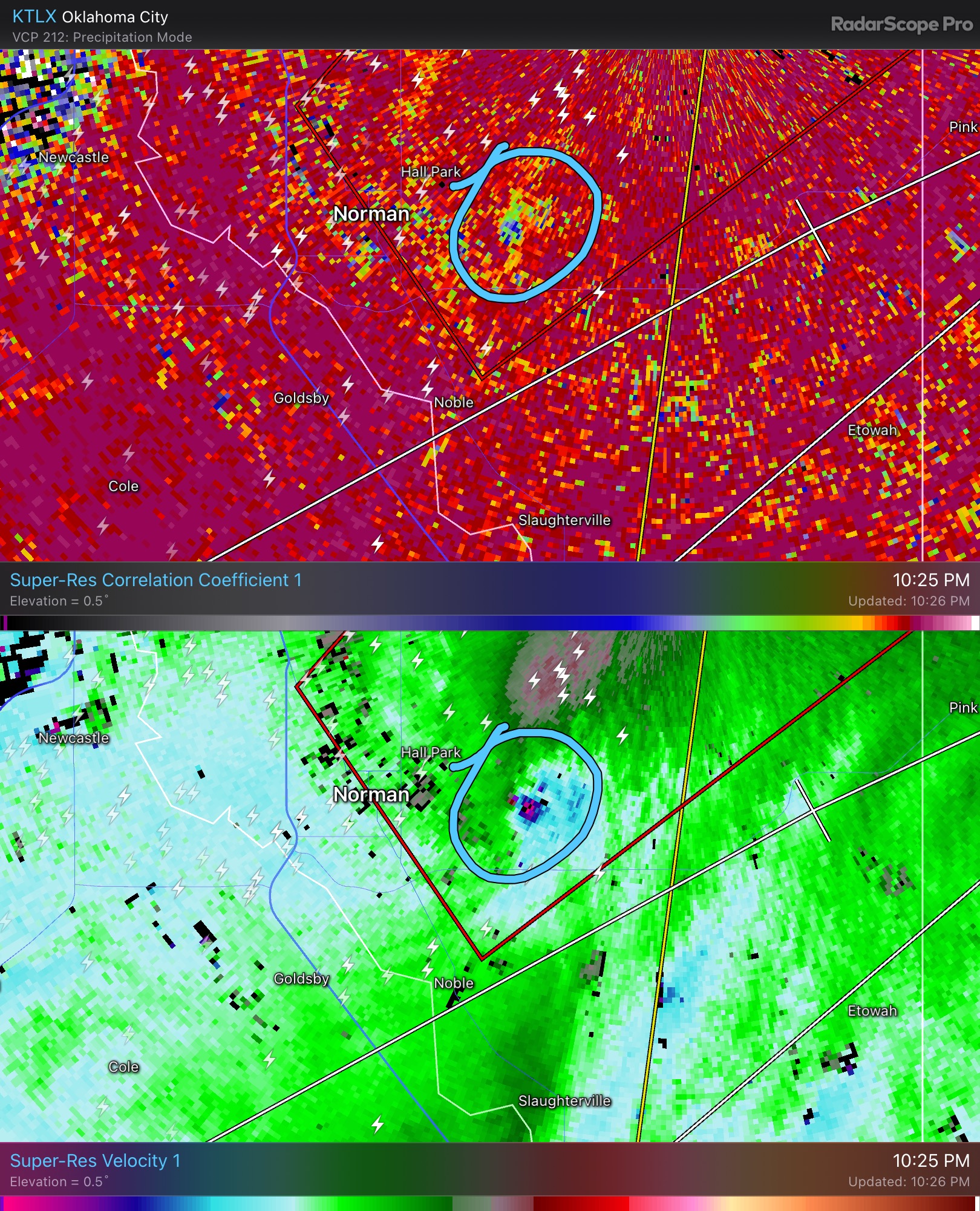
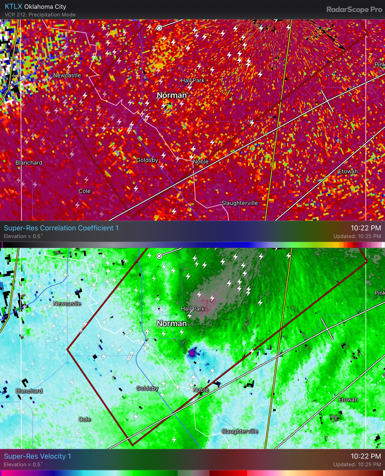
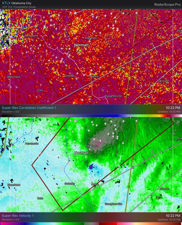
One of the wildest setups I’ve ever seen. Amazing that we were able to get that tornado around Norman
-
Might be a close miss

-
My office still does not have power and they said they are unsure when it will come back
-

-
Not great around Norman right now
-
OKC is about to get its clock cleaned. I will say I’m impressed with the gusts considering how much CIN there is. Also I notice the extreme SRH isn’t really overlapping the main line well
-
Wow they’re moving at 80 mph. Holy moly