

paweather
-
Posts
11,625 -
Joined
-
Last visited
Content Type
Profiles
Blogs
Forums
American Weather
Media Demo
Store
Gallery
Posts posted by paweather
-
-
54 is where it gets fun.
-
Just now, Atomixwx said:
That's a bowling ball of a low. Holy God.
YEP.
-
This is going to be crushing:

-
-
1 minute ago, canderson said:
Honest question: is the RGEM ever accurate?
About as accurate as the ICON maybe a bit better,.
-
Awesome Pics, guys!
-
I should say goodnight but can't:

-
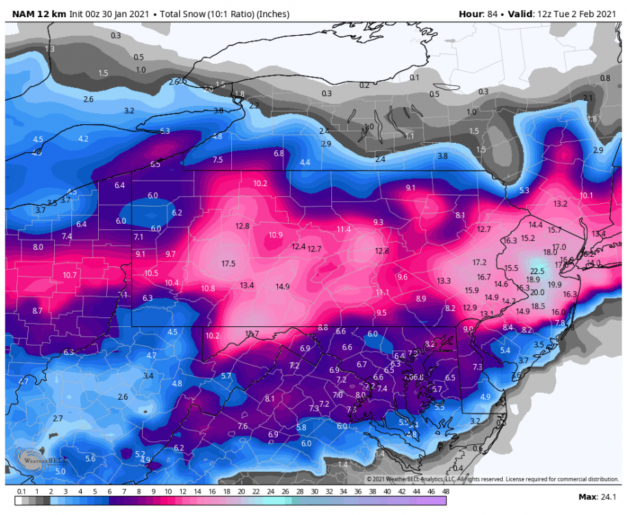
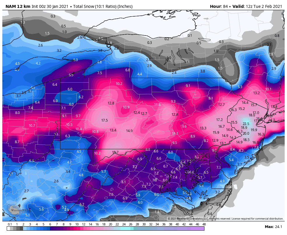
The NAM stills snows at 84 for some.
-
2 minutes ago, Voyager said:
When I saw the map on Facebook, I was wondering the same thing. What's the difference in the two zones?
Nothing other than DT.
-
13 minutes ago, MAG5035 said:
Still a huge run for everyone, the deform does get back into most of the Sus Valley late in the storm.
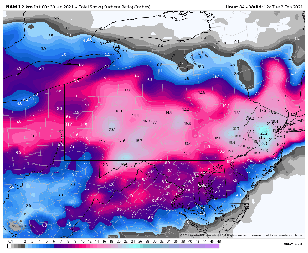
Throwing up both 10:1 and Kuchera:

Love it!
-
The NAM is a capture.
-
 1
1
-
-
Just now, Bubbler86 said:
Not saying good or bad but very different. Actually a lot of big snows do mix the whole way up to CTP.
Just wait.
-
Just now, Bubbler86 said:
Mix to CTP and dry slot. Hmm...
it's still not bad. the coastal didn't even get started.
-
2 minutes ago, MAG5035 said:
NAM's crushing through 51 so far, secondary low showing over VA beach. This is probably going to be pretty big.
For Mag to post like this I don't need even look at it!
-
OK. Are we ready for 0z yet? No sleep weekend coming up.
-
18z GFS WOOZER!
-
Just now, anotherman said:
Are they using the Euro from 2 days ago?Sold. I am checked in on the WC. I won't need to look at any more models for this event.
-
 2
2
-
-
18z RGEM is a coastal crawler.
-
Just now, anotherman said:
The ICON thinks it’s Oktoberfest.
Likely! But it has been consistent with this look. My goodness just sits and spins reminds me of a March coastal. Maybe the Weather Channel will be right?
-
Just now, Itstrainingtime said:
Hard to tell exactly, but it looks like a general 10-15" with lolli's on the ICON. Northern NJ gets buried...looks in excess of 2'?
The coastal just sits there. This is what we saw earlier from the other Global runs. What is the ICON seeing that the other Globals aren't?
-
Still the stalled look at 69. Come on you have to be right. ** and 72.
-
18z ICON still loving the TUCK.

-
Just now, Atomixwx said:
Weather channel with a 2-3 feet swath. Bahahahahahaha
What???? They looking for ratings?
-
.png.65a7ba373c3b27d38cea726c4938f332.png)

Central PA - Winter 2020/2021
in Upstate New York/Pennsylvania
Posted
Tucked stalled look on the GFS 2 days away.