

paweather
-
Posts
10,467 -
Joined
-
Last visited
Content Type
Profiles
Blogs
Forums
American Weather
Media Demo
Store
Gallery
Posts posted by paweather
-
-
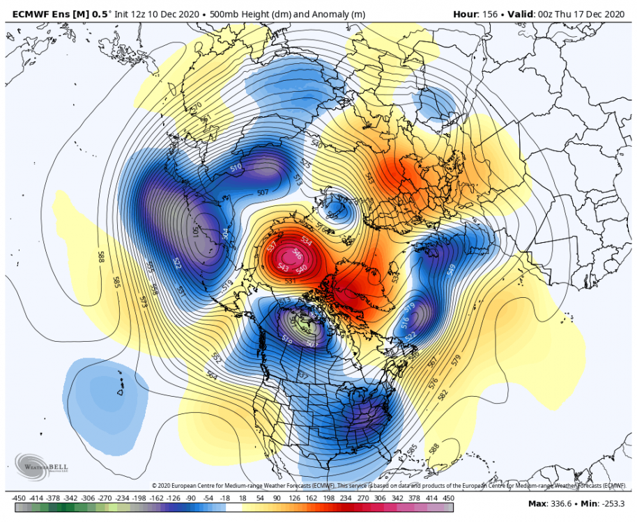
@144 I like this with many more runs to go. Signal stays strong not the 12z Euro huge amounts but it is there on this run.
-
Here is our setup:

-
As Mag wanted the first one is south of us @ 90.
-
1 minute ago, Atomixwx said:
Accuweather.com sounding the alarm for "potential blockbuster." These chips are getting heavy already...
LOL...I know social media so called weather sites are all over today with the propaganda about this event already.
-
29 minutes ago, Itstrainingtime said:
Absolutely, I eat from local restaurants at least once a week. I still miss the social aspect of talking sports at the bar.
The real sadness are the employees at these restaurants that a couple of weeks before Christmas many don't have a job and these restaurants were given no time to prepare for this, buying food to cook for the weekend and next week. This Governor?. You can certainly go to a grocery store for an hour not social distancing but cannot sit a table at a restaurant, I guess COVID knows where and when to attack. Anyways back to the weather. My one non weather post cannot wait for 0z!
-
1 minute ago, Blizzard of 93 said:
We can’t totally write off the chance for an appetizer event on Monday. There is still a chance that we should keep our eyes on.
I agree, I was looking at that earlier seems to go far enough south for a non event but there is still time.
-
Not the best Happy Hour run but the signal is still there, low is just a weaker sheer look to me. Still gets snow into C/S PA but nothing like 12z.
-
1 minute ago, MAG5035 said:
Wsmptwx FTW on the 12z Euro haha. The Kuchera map gave him about 30".
This seems to have a pretty solid showing on the ensembles today, even on the Canadian ensembles where the op whiffed today at 12z. This potential event definitely has my attention now. That NAO over the top blocking driving the storm track down is definitely a beautiful thing (hopefully not too much of a beautiful thing). The decent 500mb feature and longwave trough being modeled that drives this doesn't look overly complicated either, e.g. needing a thread the needle phase to make it pop.
Thanks MAG! Building up excitement here.
-
2 minutes ago, pasnownut said:
Not sure, but as we've all played down in the MA forum (some more than others), and one can see how taxing it can be to enjoy this sport...especially down there.
I'd guess its burnout and lack of ROI (at least thats what I've struggled w/ in the past). Of course we all know to temper expectations, but we've had more than a few rugs pulled (wrt NAO, MJO and other things) not materializing as modeled. Couple that w/ a ratter pattern like last year, and for a true snow lover, its tough.
Tombo, mitch, heavy and a few other great contributors have moved on (tombo pops in when not on his forum once in a while).
Yeah I miss those guys. Actually today in viewing it, no bad at all. Some really good maps that I cannot get access to are being posted and the EPS came in per MA very good as well on this run.
-
9 minutes ago, pasnownut said:
Seeing the big guns all pointed in a similar direction is a welcome sight for sore eyes. Lets hope goalposts dont jump too much. As the cold air is finally being seen/realized, lets hope that helps w/ coming model runs. We shouldnt see this one or the next one headed back to the lakes in coming days. Pattern supports what we are seeing.
Yep. Agreed. I am just glad we will have something to track over the weekend....HOPEFULLY! that it doesn't disappear tomorrow. Happy hour runs coming up and I'll buy today.
-
One more from the EURO and I promise, well, maybe no more for a while. :-)

-
Looks like a hit. (I stole this from MA) I don't know where to get these types of EURO maps.

-
2 minutes ago, pasnownut said:
Not sure what to think of DT anymore. Seeing how smitten he is w/ the EPS over the last few years, he's gone down w/ a lot of ships ya know.
Best lunch takeaway to me is that it seems like we are another day closer to some appreciable tracking ops. as we approach the mid term and things start to look more legit. Really glad to see the models adjusting to the tellies. Have a good rest of your day all.
Wonder what happened to Bob Chill.
-
1 minute ago, Itstrainingtime said:
Sounds like DT is all in on a Miller B for the midweek event. He's "growling" for areas N&E of the PA Turnpike...not quite "woofing" yet.
")
LOL. Yeah I'm over there as well just for the EURO run.
-
EURO seems to be looking good for PA.
-
And of course the Canadian 12z is out to sea after it was a great run yesterday. Welcome to another Winter full of model runs.

-
4 minutes ago, pasnownut said:
heres that panel shat shows what I'm talking about. You can see the closed contours over southern Ill. next frame, its of NC coast and right where we want it. again its just a run, but its a nice run.

Thanks for the visual of it. And your right only one of many to come.
-
1 minute ago, pasnownut said:
verbatim, its an early early transfer (which is what we'd want) as antecedent cold isnt too strong.
As depicted, its a best case scenario, as it wouldnt warm the thermal fields too much, so we' basically have a cleaner look to the storm.
Makes sense. Instead of a more northern transfer look. It transfer early and looks more like a Miller A.
-
Just now, Itstrainingtime said:
Agree, and good.
Yep, let's hope this trends good on the EURO. Where do you find good EURO maps? I use Pivot weather but would prefer something like the GFS type maps.
-
13 minutes ago, Itstrainingtime said:
Very true! I took a quick glance at that snow map and the razor sharp edge in Jersey jumped out at me - didn't even see the gradient across Lanco.
I only trust a Miller B when the snow is falling and piling up. I refuse to buy into anything before that point.
I don't think the 12z GFS is a Miller B.
-
12z GFS Hello!


-
6z GFS WOW a bit more inland, Congrats C Pa - Not here. But lots of tracking for sure over the next 5 days.

-

CONSECUTIVE DAYS WITHOUT MEASURABLE SNOW.

-
And then you have the GFS that is slower and warmer. But plenty of time left only 100 more model runs.

Central PA - Winter 2020/2021
in Upstate New York/Pennsylvania
Posted
My good luck by going to bed before the EURO because while I was up nothing was looking good. Thanks Mag!