

paweather
-
Posts
10,485 -
Joined
-
Last visited
Content Type
Profiles
Blogs
Forums
American Weather
Media Demo
Store
Gallery
Everything posted by paweather
-
Happy Hour bringing back the January 3rd idea of course too warm right now:
-
GFS model has backed off a bit for SCPA on the ice threat 0z and 6z both show the high to the north being pushed out quicker. We will see what today brings.
-
Interesting a little Ice Storm on New Years:
-
Thanks Bliz and Mag I was really hoping there would have been something to track over the holidays.
-
It should be interesting after Thursday’s rain.
-
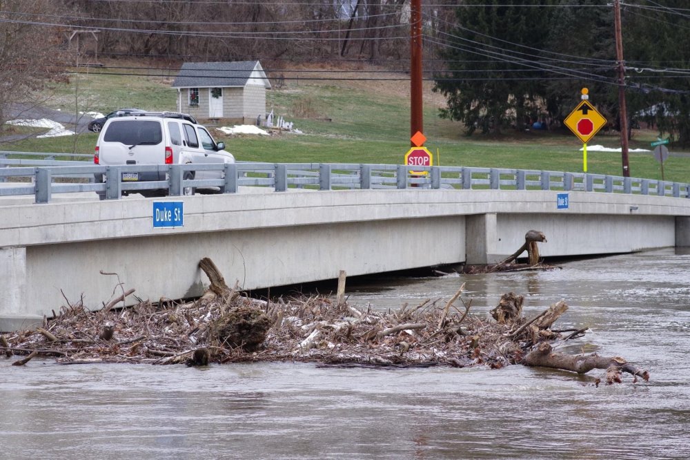
Swatara Creek near Hershey this morning:
-
Looks like a repeat from Christmas Eve on NYE.
-
Wow!!! What a surprise.
-
Thanks Blizz! Let’s hope.
-
Puking snow! Oh dang sorry rain
-
Agreed. This front is hardly making it to the east all day with a surge of moisture continuing to come up from the south.
-
Just plain crazy. Hope you make out OK!
-
That is insane given how low the river has been. The stream of moisture fetch from the gulf up to the East Coast is also insane.
-
Merry Christmas, Everyone! Let’s hope for a Xmas gift in the word of snow the next couple of weeks.
-
It’s called 2020.
-
Yep your exactly right about that! No matter what happens bring on 2021!
-
Let's hope next week brings a snow bang to 2020.
-
That is a nice heart.
-
Yeah, we don't usually do well with post frontal snow even if it is modeled. Lots of rain for sure.
-
This artic front has been modeled for days since last week, this means business going to bring Christmas in with a bang both a lot of rain and maybe some snow on the backside.
-
Yeah, Even this 999 Low off the coast doesn't match the precip shield you think it would have and cold air available that is why I posted it.
-
Well now:
-
Just came back from Raystown over the weekend. It was absolutely picturesque with snow cover sitting on top of the mountain and it even snowed yesterday before we left. Now, catching up looks like there is excitement coming up.
-
Yes, I was thinking about that if it does stay back too much it might get suppressed. And yes I know for sure failing is much easier than winning if your talking about the Cowboys.
-
There is shot for sure! I want energy to stay back on the artic front.


