

USCAPEWEATHERAF
-
Posts
8,736 -
Joined
-
Last visited
Content Type
Profiles
Blogs
Forums
American Weather
Media Demo
Store
Gallery
Everything posted by USCAPEWEATHERAF
-

Perhaps a Coastal Storm on March 2nd for SNE????
USCAPEWEATHERAF replied to USCAPEWEATHERAF's topic in New England
Obviously got is go -
Perhaps a Coastal Storm on March 2nd for SNE????
USCAPEWEATHERAF replied to USCAPEWEATHERAF's topic in New England
Just about to say that. I got to bed when I am tired, I slept all afternoon yesterday. -
Perhaps a Coastal Storm on March 2nd for SNE????
USCAPEWEATHERAF replied to USCAPEWEATHERAF's topic in New England
There is a strong potential for thunder snows in SE MA and RI on Saturday. -
Perhaps a Coastal Storm on March 2nd for SNE????
USCAPEWEATHERAF replied to USCAPEWEATHERAF's topic in New England
This is my proof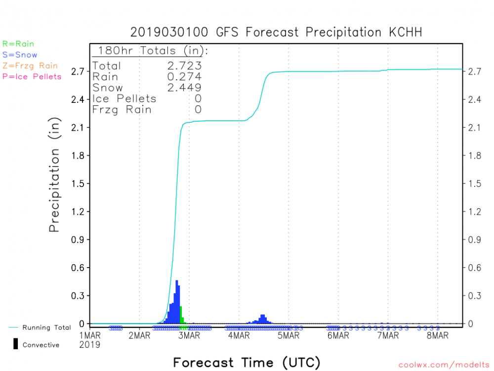
-
Perhaps a Coastal Storm on March 2nd for SNE????
USCAPEWEATHERAF replied to USCAPEWEATHERAF's topic in New England
GFS coolwx.com sounding for CHH shows 24"+ of snow for Saturday. -
Perhaps a Coastal Storm on March 2nd for SNE????
USCAPEWEATHERAF replied to USCAPEWEATHERAF's topic in New England
Wow I hope it slides just a tad southeast in the end. -
Perhaps a Coastal Storm on March 2nd for SNE????
USCAPEWEATHERAF replied to USCAPEWEATHERAF's topic in New England
00z CMC looked great, 12" over the Cape -
Perhaps a Coastal Storm on March 2nd for SNE????
USCAPEWEATHERAF replied to USCAPEWEATHERAF's topic in New England
I have the same issue with cameras, I tend to blink when the flash goes off. -
Perhaps a Coastal Storm on March 2nd for SNE????
USCAPEWEATHERAF replied to USCAPEWEATHERAF's topic in New England
I agree Will, although the GFS is not as strong with the surface low as the EURO is, I think there is time still for that to change. -
Perhaps a Coastal Storm on March 2nd for SNE????
USCAPEWEATHERAF replied to USCAPEWEATHERAF's topic in New England
I thought you didn't like looking at those snow maps? -
Perhaps a Coastal Storm on March 2nd for SNE????
USCAPEWEATHERAF replied to USCAPEWEATHERAF's topic in New England
GFS increased QPF what were you looking at? -
Perhaps a Coastal Storm on March 2nd for SNE????
USCAPEWEATHERAF replied to USCAPEWEATHERAF's topic in New England
No you don't, remember Blizzard of 2015? -
Perhaps a Coastal Storm on March 2nd for SNE????
USCAPEWEATHERAF replied to USCAPEWEATHERAF's topic in New England
Really?? Wow. I am sorry it came out like that, but you would understand if your winter was close to as bad as mine. -
Perhaps a Coastal Storm on March 2nd for SNE????
USCAPEWEATHERAF replied to USCAPEWEATHERAF's topic in New England
Good, I wasn't sure I was clear enough. -
Perhaps a Coastal Storm on March 2nd for SNE????
USCAPEWEATHERAF replied to USCAPEWEATHERAF's topic in New England
Even for a fast-moving storm center, the models are now producing over 2" of QPF. -
Perhaps a Coastal Storm on March 2nd for SNE????
USCAPEWEATHERAF replied to USCAPEWEATHERAF's topic in New England
AS long as the models trend towards a stronger system overall, the SE ticks can start. I like a 988mb low about 25 miles southeast of the benchmark. -
Perhaps a Coastal Storm on March 2nd for SNE????
USCAPEWEATHERAF replied to USCAPEWEATHERAF's topic in New England
Marine layer shouldn't be an issue. -
Perhaps a Coastal Storm on March 2nd for SNE????
USCAPEWEATHERAF replied to USCAPEWEATHERAF's topic in New England
I don't want rain. -
Perhaps a Coastal Storm on March 2nd for SNE????
USCAPEWEATHERAF replied to USCAPEWEATHERAF's topic in New England
Tremendous banding and lift present with this storm. -
Perhaps a Coastal Storm on March 2nd for SNE????
USCAPEWEATHERAF replied to USCAPEWEATHERAF's topic in New England
please I do not want rain. No rain, we can have rain on Monday, not the Saturday system. -
Perhaps a Coastal Storm on March 2nd for SNE????
USCAPEWEATHERAF replied to USCAPEWEATHERAF's topic in New England
Yeah so is the Reggie, which takes credit away from the trend of the 00z NAM. Even the 21z SREFs went more QPF. -
Perhaps a Coastal Storm on March 2nd for SNE????
USCAPEWEATHERAF replied to USCAPEWEATHERAF's topic in New England
Then how is he saying its a massive hit? -
Perhaps a Coastal Storm on March 2nd for SNE????
USCAPEWEATHERAF replied to USCAPEWEATHERAF's topic in New England
I am not trusting the mesoscale models lately given their track record, I will cave towards them for now when the rest of the global models come in at 00z and they agree with them. -
Perhaps a Coastal Storm on March 2nd for SNE????
USCAPEWEATHERAF replied to USCAPEWEATHERAF's topic in New England
I'm not in the bullseye, I promise -
12z runs have come in and I have gone ahead and issued my first snowfall map. 12" could be the maximum for SE Plymouth to the Canal region as NE winds enhance the snowfall with mixing issues across the Islands.


