

LongBeachSurfFreak
-
Posts
9,247 -
Joined
-
Last visited
Content Type
Profiles
Blogs
Forums
American Weather
Media Demo
Store
Gallery
Posts posted by LongBeachSurfFreak
-
-
35 minutes ago, JonClaw said:
GFS has dewpoints getting into the mid-50s tomorrow. It'll be a pleasant 4th.
That’s actually super ideal for fireworks. The lower dews mean less smoke clogging up the sky.
-
 1
1
-
 1
1
-
-
33 minutes ago, SACRUS said:
76/ 69 clear. Great stretch of summery weather coming up, warm - hot today, mainly clear and dry - 80s - low 90s in the hotter areas. Passing storms tonight, look to stay mainly north and will make way for a gorgeous fourth of july - beach - bbq - bay - fireworks and outside dry- sunny warm mainly 80s / some 70s shores and north.
Sat - mon - warm - hot / humid 80s to low/mid 90s in the hot areas - hottest looks monday - onshore component keeps heat focused inland.
Beyond there overall warm - hot , humid and wetter - see onshore frequency. Way beyond continues to see ridge building heights east with heat following for a hot close.

Rare day where severe is less likely in central Jersey severe ally then north and east of the city.
-
1
-
-
1 hour ago, forkyfork said:
shear could be better but this is a good wind sounding
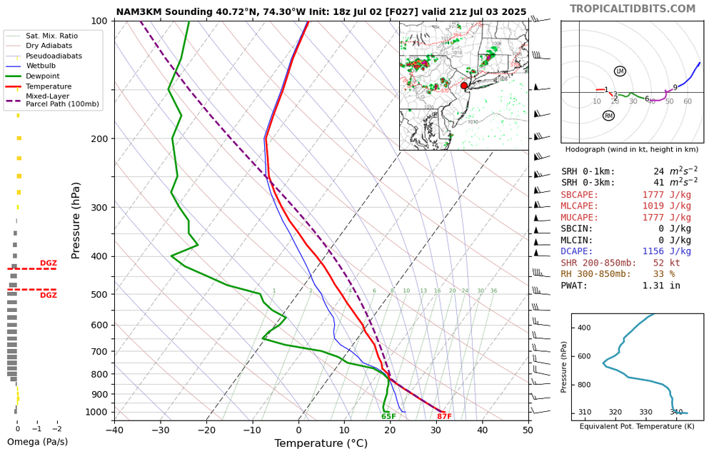
That’s a pretty good sounding for around here. Someone is going to pull off damaging winds. I like the setups where storms come down from CT for the island. Some of the best wind events historically have been in that setup.
-
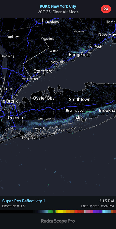
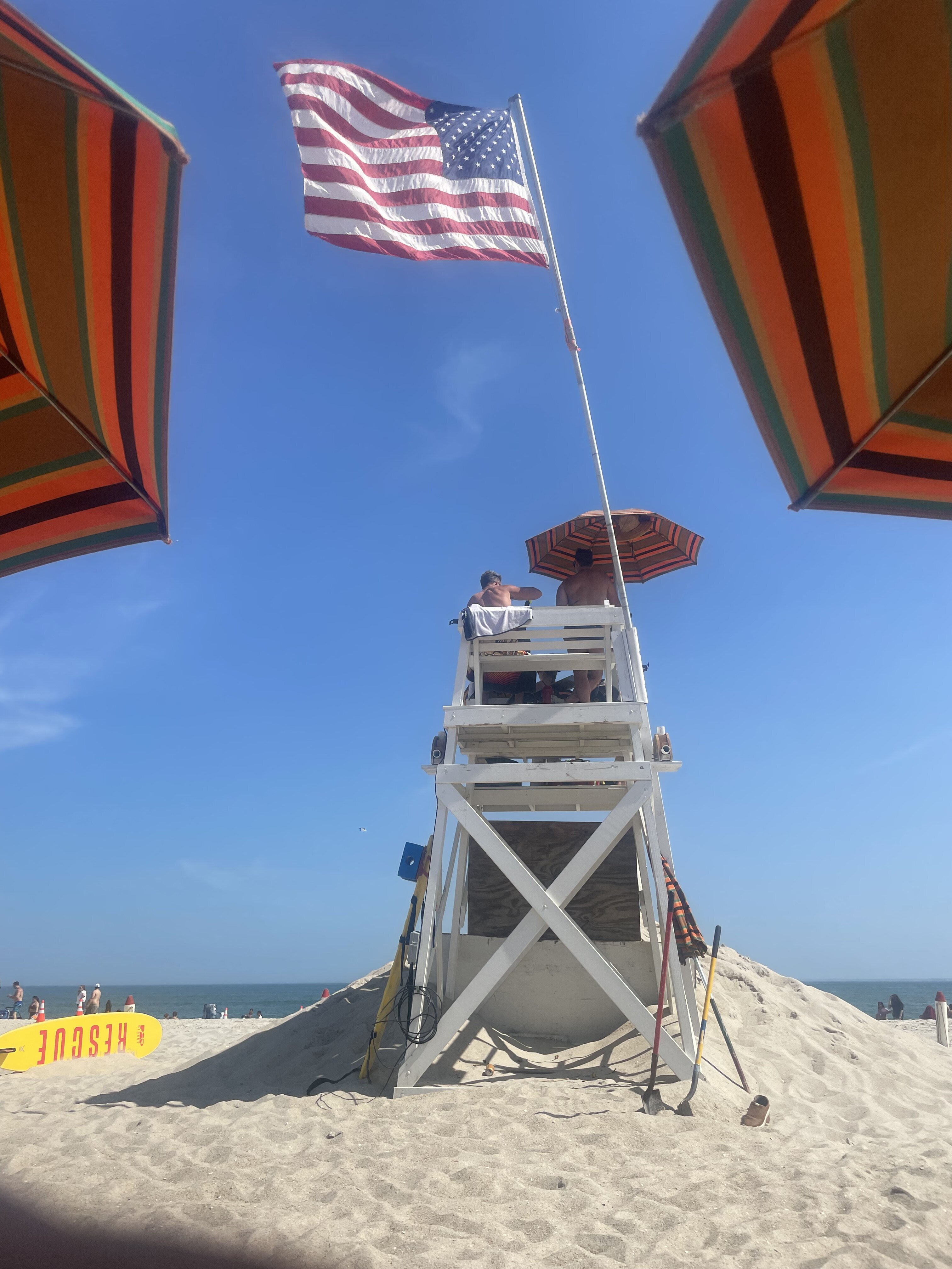
Currently light rain with thunder at jones beach. We just cleared the beach.
-
1
-
-
Continuous lightning right now with the cell skirting the south shore. Haven’t seen lightning this prolific in a while. Only managing light rain in lynbrook.
-
1
-
-
1 hour ago, steve392 said:
Drizzle. What looked very promising just completely dried up. I'm trying to understand what was over nenj/nyc are to cause it to literally evaporate?
Marine stability, no focusing mechanism for convention. Need lift, like a strong seabreeze front or warm/cold front. Tomorrow we should at least see some precipitation.
-
2
-
-
33 minutes ago, lee59 said:
Looks like first batch says no to Long Island.
Absolutely zero surprise there.
-
1 hour ago, Brian5671 said:
Grass is drying out here quickly over the past couple days. Could use a shower-hopefully tonight-tomorrow looks drier now on 12z runs
Likely scattered convection, likely the usual suspects the big winners. Coastal central Jersey being the perpetual jackpot.
-
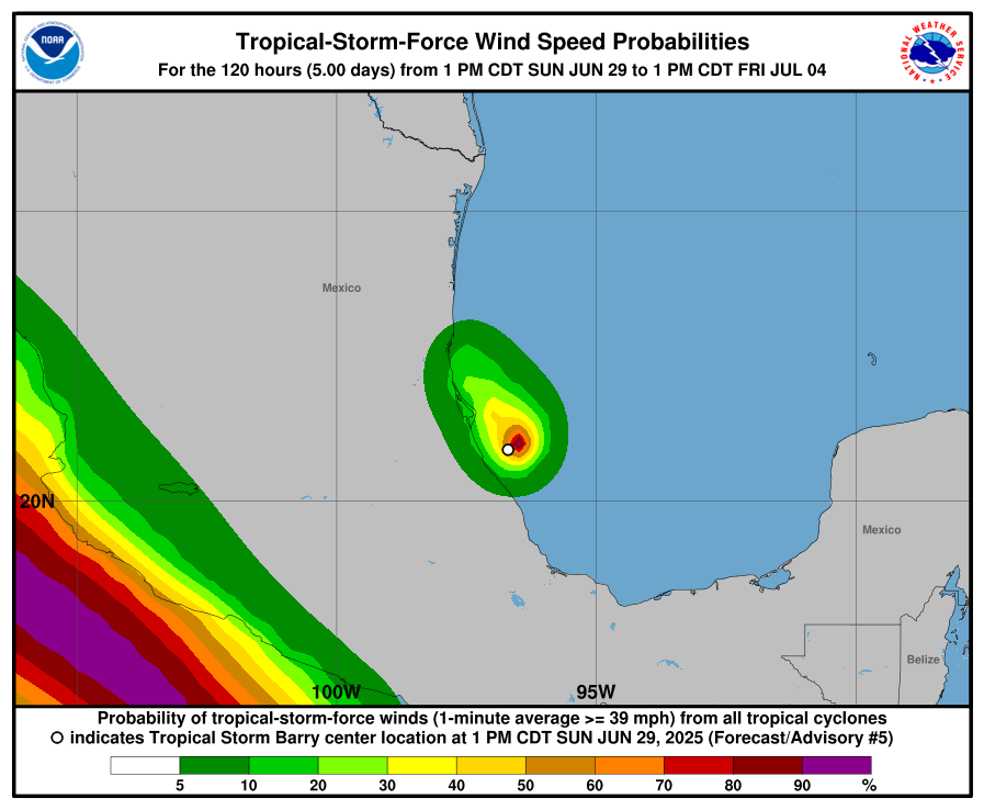
This image really puts things in perspective of how small this tropical storm is in comparison with the Epac system.
Atlantic really struggling to produce anything meaningful while adding named storms.
-
 1
1
-
-
1 hour ago, WxWatcher007 said:
Yeah, pull the politics out of it—this sounds like a classic case of bureaucrats making decisions that don’t work in the real world.
How many times have we sat here thinking tropical storm/hurricane X is “about to take off” or “is weakening due to an ERC” or “we need a center fix for the 00z models” only to have MW or recon data blow away our preconceived notions?
I mean my goodness. Who wants to try to forecast if a cane off the east coast of Florida is about to undergo RI based on that quality of data below when recon is six hours away?
Exactly. This has major real world implications. Especially in the age of marine heatwaves and unprecedented RI. The way people react to a cat 2 and a cat 5 might mean not evacuating and potentially deaths.
-
3
-
-
15 hours ago, LibertyBell said:
People need to stop creating concrete jungles, not only is it cooler outside of the city, it's also less polluted and much easier to sleep at night and breathe clean air with far lower rates of asthma.
So we should abandon cities and destroy rural areas and turn them into endless suburbs.
The reality from the perspective of the planet is the EXACT OPPOSITE. We want more people in tightly packed cities and less McMansions on quarter acre lots. Upstate NY reforesting over the last century is a great example of what we want to see. -
11 minutes ago, psv88 said:
Still 84 and muggy at home. Missed all the rain, the beach got a nice storm
Missed jones to the east and west. We had a possible shark attack today I’m sure it’s all over the media
-
18 minutes ago, Rjay said:
Pretty cool
Really starting to drop off at JB. Should swing around shortly and the temp will shoot up from mid 80s to mid 90s right on the ocean. Tonight’s going be a steam bath.
-
7 minutes ago, LibertyBell said:
just hit 103.6 again what sea breeze lol
There it is, fully kicking in now. Only a matter of time before it gets there.

-
3
-
-
1 minute ago, hooralph said:
Just reached KNYC and it’s clocking a bit over 97 at the moment. In fairness, the station gets a bit of sun as you can see. It’s not shrouded in the trees. General assessment from my walk: 99-100 in the blocks on the UWS and 97 ish in the park.
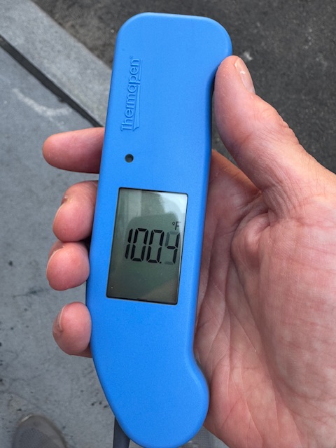
the 100.4 was Madison Ave
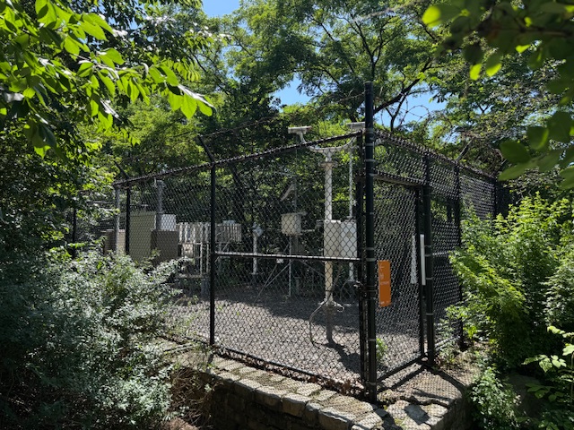
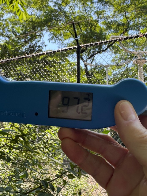
Awesome thank you for that! It obviously has allot to do with the fact that it’s just in a green space.
-
Park 91 is a joke as usual.
winds WSW now at jones beach. Just enough onshore component to make it bearable here
-
97 on the southern state just now on the truck thermometer.
-
13 minutes ago, Sundog said:
Cars have dew on them, we must have had some radiational "cooling" all the way down to the whopping mid 70s haha
Park and EWR look to have matched yesterdays lows.
-
1 minute ago, psv88 said:
It’s still early for high heat out here, ocean is still cold.
Yep, without an offshore wind it’s fine. It’s next to impossible to maintain an offshore flow the entire day when the water temp is in the 60s.
-
7 minutes ago, psv88 said:
Beautiful evening out there, cooled down nicely, 78
Yeah it’s honestly not that bad on the south shore right now. Tomorrow morning while the wind is NW should be the worst for the coast.
-
Just now, LibertyBell said:
Good, keep it there :-)
Today’s not the day for record heat on the island. It’s always been about Tuesday.
-
Sea breeze is officially here at jones beach. Was dead calm 45 minutes ago. Temps already coming down
-
2
-
-
It’s all going to come down to wind direction for the coast today. EWR is a lock for 100 coming of a low of 82.
-
55 minutes ago, Rjay said:
This is the best shot in a while but I have my doubts. 99 sounds about right.
NYC 95 and EWR 110.
July 2025 Discussion-OBS - seasonable summer variability
in New York City Metro
Posted
Allot of would depend on just how high of a rooftop. I would love to see obs from the top of the Nordstrom tower at 1550’. (Highest flat roof in nyc)
Probably averages double the snowfall of the park. Not only a few degrees cooler due to height but also high enough to be out of the heat island near the ground.