

LongBeachSurfFreak
-
Posts
8,888 -
Joined
-
Last visited
Content Type
Profiles
Blogs
Forums
American Weather
Media Demo
Store
Gallery
Everything posted by LongBeachSurfFreak
-

September 2019 General Discussions & Observations Thread
LongBeachSurfFreak replied to Rtd208's topic in New York City Metro
One thing I can agree with are warm falls. Above normal water temps and lack of sea ice causing a seasonal lag in the arctic for starters. After that the arctic will continue to get cold for the foreseeable future with the complete lack of solar insolation. So cold air will be available. It’s just a matter of the local pattern, can we access that cold air or not. I think we are safe as far as snow chances for a while. My thought is more of a boom or bust type of scenario. With some winters still providing epic periods and blockbuster storms. -
September 2019 General Discussions & Observations Thread
LongBeachSurfFreak replied to Rtd208's topic in New York City Metro
Pretty blatant troll post. Do you have anything to back this up? -
September 2019 General Discussions & Observations Thread
LongBeachSurfFreak replied to Rtd208's topic in New York City Metro
Takes some serious wind to snap a healthy London Plane. Over 80mph easy. After a great severe season this year we are in one the most boring stretches of weather I can remember. Days and days of watering ahead for me. -
September 2019 General Discussions & Observations Thread
LongBeachSurfFreak replied to Rtd208's topic in New York City Metro
That’s exactly how you pull it off with soil moisture running so high to our SW. I’m really hoping for a pattern change ASAP -
Verbatim that’s another gradient winter, displace that 100 miles north (which is nothing at this lead time) and it’s lights out for most on this sub forum.
-
SNE "Tropical" Season Discussion 2019
LongBeachSurfFreak replied to Torch Tiger's topic in New England
Direction of movement is wrong and fetch size (for us) is relatively small. I wouldn’t call it a prolific swell producer unless that crawl materializes. That Bermuda zone is an excellent swell source for us though. Until it slows it’s going to be a run of the mill moderate swell something like 3.5’ at 11/12 seconds on the buoys -
September 2019 General Discussions & Observations Thread
LongBeachSurfFreak replied to Rtd208's topic in New York City Metro
Another front another precip bypass. Not a drop of rain. -
September 2019 General Discussions & Observations Thread
LongBeachSurfFreak replied to Rtd208's topic in New York City Metro
It will find a way to not rain in the city or on the island today. Getting dry -
September 2019 General Discussions & Observations Thread
LongBeachSurfFreak replied to Rtd208's topic in New York City Metro
Hoping we are not headed into a long dry period after yesterday’s precip fail. I am life guarding this week at Robert Moses field 5. Finishing up season 21. Today has the feel of a dry nor’easter with sand blowing side ways down the beach. The surf isn’t huge but it’s definitely elevated. -
September 2019 General Discussions & Observations Thread
LongBeachSurfFreak replied to Rtd208's topic in New York City Metro
Another day another precip miss for the city and the western island. Amazing how after bypassing us things go nuclear again for the east end and SNE. -
SNE "Tropical" Season Discussion 2019
LongBeachSurfFreak replied to Torch Tiger's topic in New England
Came pretty close to tropical storm conditions on the beaches of Long Island. Sheets of rain with winds sustained around 30 with gusts to the low 40s. Anyone now what the peak gusts and rain totals were at ACK? The amazing thing about Dorian was the lack of true large surf. The ENE moment meant all the captured fetch was moving away from LI/NE. We have seen much much larger waves with storms out by Bermuda. (Gert 99, Fabian 03 and Bill 08) Those storms were moving towards us before recurving and ejected huge swells due to captured fetch. Takeaway, direction of movement is more important then proximity -
Gloria is my first weather memory. Watching LIPA remove the top of the big Norway maple in front of my house after it split and took down the power lines. I would have loved to have been a little older for that one. Probably the strongest winds during my life time with a brief period of 90mph gusts with what was most likely a sting jet caused be extra tropical transition.
-
SNE "Tropical" Season Discussion 2019
LongBeachSurfFreak replied to Torch Tiger's topic in New England
This is definitely another Juan, which had some of the most prolific tree damage of any storm in the north east. Probably on par with 1938 in Ct and RI. Once you get over 90mph our trees just fall apart. -
September 2019 General Discussions & Observations Thread
LongBeachSurfFreak replied to Rtd208's topic in New York City Metro
Hard to not go with that during the peak of the season. But there are definitely some factors adding to normal climo. -
September 2019 General Discussions & Observations Thread
LongBeachSurfFreak replied to Rtd208's topic in New York City Metro
Getting some pretty solid gusts now at Jones beach estimating into the 30s. Waves are really starting to build now as well. Tonight’s 2am high tide should produce some washovers. I’m planning on coming down to get some shots -
September 2019 General Discussions & Observations Thread
LongBeachSurfFreak replied to Rtd208's topic in New York City Metro
Pouring sideways at Jones beach. Still awaiting the main swell from Dorian -
September 2019 General Discussions & Observations Thread
LongBeachSurfFreak replied to Rtd208's topic in New York City Metro
Just had a blitz of heavy rain and strong winds at Jones beach. The rain definitely mixed down some winds. Swell has yet to arrive. Here’s my view for the day.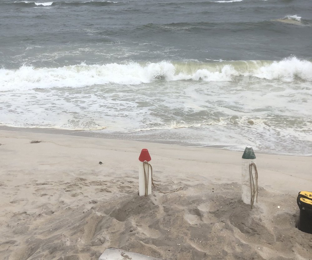
-
Hurricane Dorian Banter Thread
LongBeachSurfFreak replied to Jtm12180's topic in Tropical Headquarters
NYC bans anyone from entering the water. Including surfers. Canceling a long run body surf competition Saturday during premium conditions. Talk about over reactionary -
September 2019 General Discussions & Observations Thread
LongBeachSurfFreak replied to Rtd208's topic in New York City Metro
The calm before the storm here at Jones beach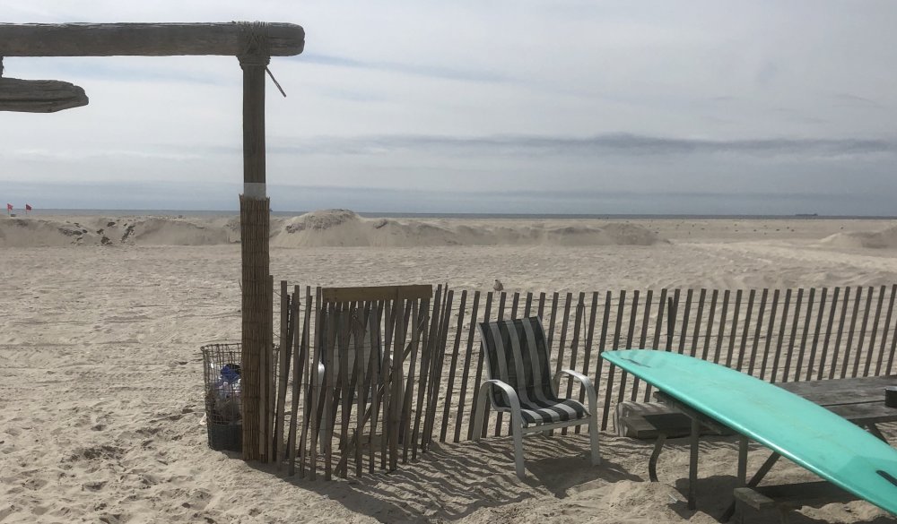
-
September 2019 General Discussions & Observations Thread
LongBeachSurfFreak replied to Rtd208's topic in New York City Metro
Another front that had jumped the city only to fire when getting offshore. Not sure what mechanism is causing this but it has happened several times recently -
September 2019 General Discussions & Observations Thread
LongBeachSurfFreak replied to Rtd208's topic in New York City Metro
Not a drop on the uws. The predominant thunderstorm track this summer has been south of the city. -
September 2019 General Discussions & Observations Thread
LongBeachSurfFreak replied to Rtd208's topic in New York City Metro
True, but 38 was far far far worse for areas east of the Nassau Suffolk border. Cat 3 winds and a tremendous surge that can only be estimated between 15-20’. Then there’s 1635 which is the king of north east hurricanes -
September 2019 General Discussions & Observations Thread
LongBeachSurfFreak replied to Rtd208's topic in New York City Metro
Check out the obs from the ny harbor buoy as the special marine warned storm went by. Def could have been a water spout in the vicinity https://www.ndbc.noaa.gov/station_page.php?station=44065 -
August 2019 General Discussions & Observations Thread
LongBeachSurfFreak replied to bluewave's topic in New York City Metro
Starting to get some swells from Dorian at Jones Beach with some minor wash overs. The real show will come next weekend when Dorian heads east of the Outer Banks and our area is no longer shadowed. There could be major beach erosion and wash overs then. -
SNE "Tropical" Season Discussion 2019
LongBeachSurfFreak replied to Torch Tiger's topic in New England
Not a great swell producer for Long Island and New England. Its an issue of fetch more so then strength. The tiny size just isn’t going to cut it for creating much swell with periods over 12 seconds. Any captured fetch will be aimed towards the SE. I still think we see some swell with sets to maybe 5-6’ for south facing beaches. But with swell periods below 13 seconds beach washovers and erosion seems unlikely.


