

LongBeachSurfFreak
-
Posts
8,888 -
Joined
-
Last visited
Content Type
Profiles
Blogs
Forums
American Weather
Media Demo
Store
Gallery
Everything posted by LongBeachSurfFreak
-

August 2020 General Discussions & Observations Thread
LongBeachSurfFreak replied to Rtd208's topic in New York City Metro
Nice storm about to rocket off the ocean into western Nassau. -
That’s the main takeaway. This isn’t like most storms in the past were the strongest winds were from the NE or E. It’s going to be a straight onshore wind with minimal loss from land friction. I expect tree damage and power outages will be wide spread. The one saving grace is the fact that sandy took out so many large old trees.
-
I think he’s talking about in his area. Storms racing north have historically had enhanced winds on their eastern sides. Just think of a much weaker version of 38 or hazel. There will be damaging winds from the city East. Trees are in full leaf and the wind direction will be somewhat unusual.
-
Agreed, maybe JFK hits 60 but overall it’s 40-50 away from the island. The south shore was of JFK may gust to 70 somewhere with the LLJ enhancement
- 1,530 replies
-
- 1
-

-
- heavy rain
- rip current
- (and 1 more)
-
Ripping and I mean ripping onshore flow currently at Jones.beach. The death of any severe event for the island
-
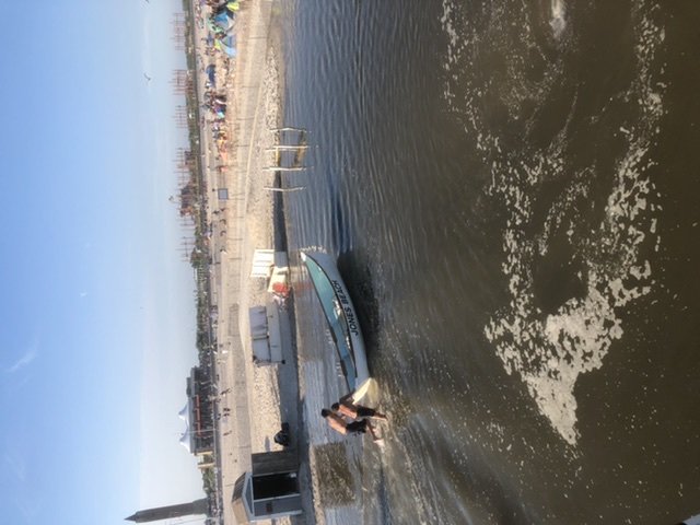
We had some surprisingly big long period ground swell at Jones beach yesterday. It led to some rescues and the eventual closing of the water due to a severe injury in the shore break. The remarkable thing was, this swell was created when there was just a large trough open wave. Tropical storm force winds extended out 405 miles and shows the power of fetch in swell generation. We have seen major beach washovers

- 1,530 replies
-
- 5
-
-

-
- heavy rain
- rip current
- (and 1 more)
-
I have been a life guard at Jones beach for 21 years and I truly believe this whole thing has gotten so blown out of proportion. I have seen sharks numerous times and we just don’t tell the general public. It’s the ocean and there are sharks. There has never been a shark attack on a human in NY in modern times. The risk is so incredibly small, you have a better chance of winning powerball then being attacked.
-
38 and carol were the only legit majors during modern times. 1821 and 1630 are thought to be majors. There was another in the 1300s based on core samples. Obviously they were exceedingly rare for good reason. I suspect that’s about to change
- 1,530 replies
-
- 1
-
-
- heavy rain
- rip current
- (and 1 more)
-
Gloria was supposed to rock LI as A major. Obviously that Did not happen. We have seen time and time again with storms taking a similar track that land interaction removes categories. In order for us to ever get a real major we need a 38 redux with a storm on a NNW track avoiding said land interaction
- 1,530 replies
-
- 1
-
-
- heavy rain
- rip current
- (and 1 more)
-
July 2020 General Discussions & Observations Thread
LongBeachSurfFreak replied to Rtd208's topic in New York City Metro
That’s exactly the problem. We start to loose the effectiveness of the sea breeze. The warm water does help considerably with our severe chances though. -
July 2020 General Discussions & Observations Thread
LongBeachSurfFreak replied to Rtd208's topic in New York City Metro
LI can get exceptionally hot on the right winds. CPK needs a couple more dry days, to dry out the vegetation. It doesn’t feel that hot yet on the UWS -
July 2020 General Discussions & Observations Thread
LongBeachSurfFreak replied to Rtd208's topic in New York City Metro
It’s not 80 right on the beaches today. More like 70. Any westerly component in the wind will up well enough to drop temps at the beach -
2020 Atlantic Hurricane Season
LongBeachSurfFreak replied to Windspeed's topic in Tropical Headquarters
That’s the best looking wave coming off Africa at this time of year I can remember. If it were peak season I would expect a long track major. It’s just so early. -
Except we got jumped with the storms. I was shocked at how dry things were at my parents house yesterday, seems Wednesday’s storms managed to weaken just enough before reaching there. Let’s see if things come together today. I have a feeling we get missed just to the south
-
Looks like a wet micro burst to me. We could play back the radar loops and see if there was any rotation detected. this evening should produce a few more severe storms in our area. Leaning towards central and south jersey.
-
Excellent storm driving home from garden city to lynbrook. Not severe though as winds were 40ish in gusts. Lighting was the main show, with some epic bolts
-
July 2020 General Discussions & Observations Thread
LongBeachSurfFreak replied to Rtd208's topic in New York City Metro
Good thing we had the drought busting tropical storm last week (Nassau County) as we head into another hot dry period. To me it looks like the flow will be prohibitive for convection at the coast as we have seen time and time again this summer -
July 2020 General Discussions & Observations Thread
LongBeachSurfFreak replied to Rtd208's topic in New York City Metro
I’m thinking allot of late bloomers and Caribbean cruisers, which end up close to the east coast and in the gulf. Very interesting times on the way! -
Suns out in Brooklyn. Had some legit flooding on the way from manhattan
-
I wouldn’t say that, that band has some very heavy tropical rain embedded with off the charts rates. The stuff over eastern Pa is more stratiform type rain with lighter rates. If you get into the band for a while you can quickly add up some decent totals.
-
Agreed, I could see JFK gusting to 50. The cough shore barrier islands to 60 with a direct onshore flow off the ocean.
-
Water temps (at least at the surface) are way above normal. I would think in the future our area will be much more prone to local development like this.
-
July 2020 General Discussions & Observations Thread
LongBeachSurfFreak replied to Rtd208's topic in New York City Metro
Not after all the rain we are about to get. Weeds and foliage for the loss. -
Nws really downplaying any wind potential for the island. I think there will be more wind then forecast, these hybrid type systems are generally good wind producers in the SE quadrant
-
July 2020 General Discussions & Observations Thread
LongBeachSurfFreak replied to Rtd208's topic in New York City Metro
The back door front squashed the storms before they could make it to the island. Had three drops in wantagh and a couple hundredths in lynbrook. Luckily the coast did relatively well last week. I think we all make up for it Friday
