LongBeachSurfFreak
-
Posts
8,883 -
Joined
-
Last visited
Content Type
Profiles
Blogs
Forums
American Weather
Media Demo
Store
Gallery
Everything posted by LongBeachSurfFreak
-
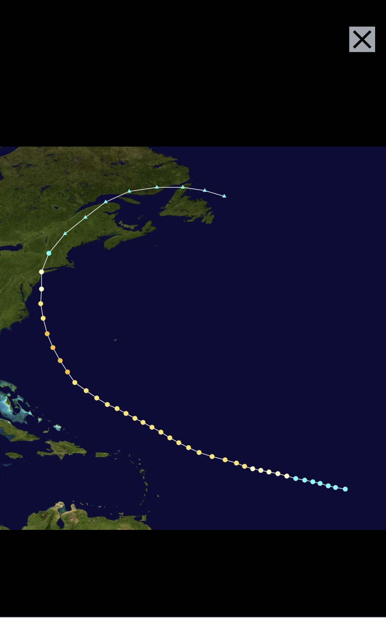
Hazel went up the Appalachians and had tremendous land interaction and weakening. The reason our area experienced strong winds so far removed from the center was due to the trough. 38 was an extremely powerful and deep hurricane rocketing north. So it had very little time to weaken. The Empire State Building had a 125mph gust during 38. I read a ton of news articles about both storms and my conclusion is based off the amount of tree damage reported in Central Park. So it’s not exactly purely scientific.
-
They did not have accurate anemometers back then. The Hazel gust is highly misleading, it comes from the Battery. The wind was SE and had a funneling effect through NY harbor. Based on tree damage, the winds during Hazel were not the strongest ever in Manhattan. 1938 had significantly more tree damage, and likely higher winds.
-
Believe it or not, 1893 was the last time a hurricane made landfall in the 5 borros.

-
Well there goes the rain free day. Super raw outside. Yes April often does suck here.
-
I’m starting to think that the record rains in the Midwest will have a feed back to a much wetter warm season pattern this year.
-
I’m referring to the precip in western Pa which has a different trajectory. Hopefully when it arrives it’s just a few showers.
-
Radar truth says otherwise. We have seen the models off by a 100 miles. I’m routing for a dry day, I just don’t see how we escape that much precip incoming.
-
It’s going to pour today. The radar is fully lit up over PA.
-
Perfect spring day (maybe a little more sun) took my gfs dog for a run in Hempstead Lake Park.
-
I think it’s more like 10%. Tends to dump cold into Eurasia. Seems like grasping for straws.
-
At Jones Beady currently, dense fog and a brutal onshore wind. The ocean is a beautiful turquoise, as it often is the time of year with the water still so cold.
-
Yeah I’m one house from malverne on Franklin. I’m still getting to know the area. Grew up in wantagh, 4 years in Maryland for college and then 7 years in Long Beach. Definitely miss Long Beach for obvious reasons, but this area is super convenient to anywhere and it snows just a little bit more.
-
Yeah we live close to each other. Good to keep honest on obs!
-
Yep, just ran to 5 corners fitness, in between. Rolling thunder in the distance.
-
Depends on what. I would wait until after next week for even cold hardy veggies. This is specific for our area which radiates like crap.
-
It’s definitely possible. Still lots of snow across eastern Canada. CAA is the only way the park can approach freezing this time of year.
-
Fully agree, something like .000001 I was just thinking of a way to make it happen.
-
I was just looking at the radar down there. It’s not often you see that many Tor warned super cells that close together.
-
Of course it’s possible. If we have an exceptionally dry year and then we get one of those crazy heat domes they had in pac nw. That had 10,000 year temps in BC Canada. There were places that beat their all time records by 20 degrees. Europe has had some too just not as prolific. It’s only a matter of time.
-
Not surprised. The micro climate in midtown is pretty nuts. There are London Plane trees in Rockefeller center that do not lose all of there leaves some winters…
-
A truly severe drought, one that empty’s NYC’s reservoirs is one of the worst disaster scenarios I can think of.
-
Best post I have seen in years, literally just started laughing. For midtown Manhattan, right on the money.
-
The crazy part of that event, the snow accumulated more efficiently then during some of those big storms in March. (In the city) Shows that it can still happen this time of year with very cold 850s and rates. Could be a big severe day in the mid west today.
-
Super weighted question. It’s a yes and no that’s very location specific. Locally I would expect average wind speeds to decrease as there will be less arctic air to create cold air advection. CAA often drives our longest periods of sustained winds. Even more locally for the coast, summer sea breezes will decrease as the ocean continues to warm. On the high end I would suspect our highest wind gusts to increase, with stronger thunderstorms and hurricanes.
-
Had enough sun finally to warm things up a bit to near 70. Onshore flow is pretty strong now and temps dropping. That will prevent severe storms from making it to the island, but I wouldn’t be surprised to see some thunderstorms.