

CoraopolisWx
-
Posts
2,945 -
Joined
-
Last visited
About CoraopolisWx

Recent Profile Visitors


-
Classic
-

Pittsburgh/Western PA Winter 2024-2025 Thread
CoraopolisWx replied to Rd9108's topic in Upstate New York/Pennsylvania
Decent little system this evening. Another band entering PA, should give northern Allegheny county some decent rates. -
Pittsburgh/Western PA Winter 2024-2025 Thread
CoraopolisWx replied to Rd9108's topic in Upstate New York/Pennsylvania
Have to see if the NS vort hanging back a bit becomes a trend, or just a momentary blip. -
Pittsburgh/Western PA Winter 2024-2025 Thread
CoraopolisWx replied to Rd9108's topic in Upstate New York/Pennsylvania
I think I had more days off that school year, than all the rest combined. Lol. -
Pittsburgh/Western PA Winter 2024-2025 Thread
CoraopolisWx replied to Rd9108's topic in Upstate New York/Pennsylvania
A true I-79 classic. -
Pittsburgh/Western PA Winter 2024-2025 Thread
CoraopolisWx replied to Rd9108's topic in Upstate New York/Pennsylvania
Wow, don’t see those speeds too often. -
Pittsburgh/Western PA Winter 2024-2025 Thread
CoraopolisWx replied to Rd9108's topic in Upstate New York/Pennsylvania
THE PITTSBURGH PA CLIMATE SUMMARY FOR JANUARY 14 2025...VALID TODAY AS OF 0400 PM LOCAL TIME.CLIMATE NORMAL PERIOD 1991 TO 2020CLIMATE RECORD PERIOD 1871 TO 2025WEATHER ITEM OBSERVED TIME RECORD YEAR NORMAL DEPARTURE LAST VALUE (LST) VALUE VALUE FROM YEAR NORMAL ...................................................................TEMPERATURE (F) TODAY MAXIMUM 18 359 PM 70 1932 36 -18 29 MINIMUM 10 829 AM -6 1964 21 -11 11 AVERAGE 14 29 -15 20 PRECIPITATION (IN) TODAY 0.02 1.15 1999 0.11 -0.09 0.05 MONTH TO DATE 0.66 1.39 -0.73 2.38 SINCE DEC 1 3.37 4.23 -0.86 5.18 SINCE JAN 1 0.66 1.39 -0.73 2.38 SNOWFALL (IN) TODAY 0.4 3.5 1917 0.4 0.0 1.0 MONTH TO DATE 9.3 5.6 3.7 4.2 SINCE DEC 1 15.0 13.3 1.7 5.3 SINCE JUL 1 15.8 16.1 -0.3 5.9 SNOW DEPTH 3 By tomorrow, we should break even for the first time in about 3 years. -
Pittsburgh/Western PA Winter 2024-2025 Thread
CoraopolisWx replied to Rd9108's topic in Upstate New York/Pennsylvania
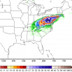
Update focused on handling band of light to locally moderate snow showers across the central CWA, in a band that likely has its origins from WNW flow off of southern Lake Michigan. 12Z PBZ sounding shows saturation through most of the dendritic growth zone beneath an inversion at around 760mb. Many of the CAMs did not handle this well, with the NAM3km nest being the one model that has something close to reality. -
Pittsburgh/Western PA Winter 2024-2025 Thread
CoraopolisWx replied to Rd9108's topic in Upstate New York/Pennsylvania
Glad to hear that. There’s some valley floor locations in the lower mon valley, that have probably been in the single digits the past two winters. It’s been a rough stretch for snow totals down that way for awhile. -
Pittsburgh/Western PA Winter 2024-2025 Thread
CoraopolisWx replied to Rd9108's topic in Upstate New York/Pennsylvania
Hopefully one of the few times WAA can benefit us. Having the nose of the confluence east of the apps could produce a slight inverted trough. This feature has benefited us in the past. -
Pittsburgh/Western PA Winter 2024-2025 Thread
CoraopolisWx replied to Rd9108's topic in Upstate New York/Pennsylvania
Wow, McKnight Rd around Peebles and Babcock is like another world. -
Pittsburgh/Western PA Winter 2024-2025 Thread
CoraopolisWx replied to Rd9108's topic in Upstate New York/Pennsylvania
Cranberry special right now. -
Pittsburgh/Western PA Winter 2024-2025 Thread
CoraopolisWx replied to Rd9108's topic in Upstate New York/Pennsylvania
https://www.ncdc.noaa.gov/stormevents/eventdetails.jsp?id=206605 Sunday mornings forecast reminds me of this event. I remember being glad I flew out the day before, instead of that morning. -
Pittsburgh/Western PA Winter 2024-2025 Thread
CoraopolisWx replied to Rd9108's topic in Upstate New York/Pennsylvania
Yeah, noticed on the higher elevation cams, a solid coating on the grass. -
Pittsburgh/Western PA Winter 2024-2025 Thread
CoraopolisWx replied to Rd9108's topic in Upstate New York/Pennsylvania
Flash freezing conditions could be an issue, along with the potential squalls.
