CoralRed
-
Posts
383 -
Joined
-
Last visited
Content Type
Profiles
Blogs
Forums
American Weather
Media Demo
Store
Gallery
Everything posted by CoralRed
-
6:37a. It was very dark and parking lot light came on at 6:30. We have gotten faint lightening and thunder but not at same time. Wind is getting noisy and some rain is coming down. The long lead in is nerve wracking. Now the two dining room windows are making the low pitched noise they make when wind really gets going. By the way, original 1940s windows were replaced a few years ago and the new ones "sing" too but not nearly as often.
-
5:15p: Wind has picked up in Williamsport. Now W 28 G50. High was supposed to be 75 but went to 84. Dropped to 82 in last 15 minutes NWS noted air is drier than expected which may limit storms later. It has been a long time since we had big storms here and I have to admit I am not in the mood tonight for a lot of thunder and lightening. Enough Middle Eastern booms on the TV, for one thing. I saw on Twitter that Jordan took out about the same number of things we did. Good thing they came through. Anyway, I just checked and storms that had been on border are now about ready to drop into second row of counties which includes Lycoming. So whatever is coming will be here soon. Storm Warning just issued.
-
Williamsport is about what you would expect. 75 now, low only going to 52 overnight. We are clouding up though which is too bad and will have lots of clouds and rain for the rest of this week.
-
Thank you canderson and Porsche for the photos. They turned out great, especially considering what you had to work with. So we can look back in the years ahead and see a realistic style photo and an artistic style photo of the April 8, 2024 afternoon eclipse for our area right here.
-
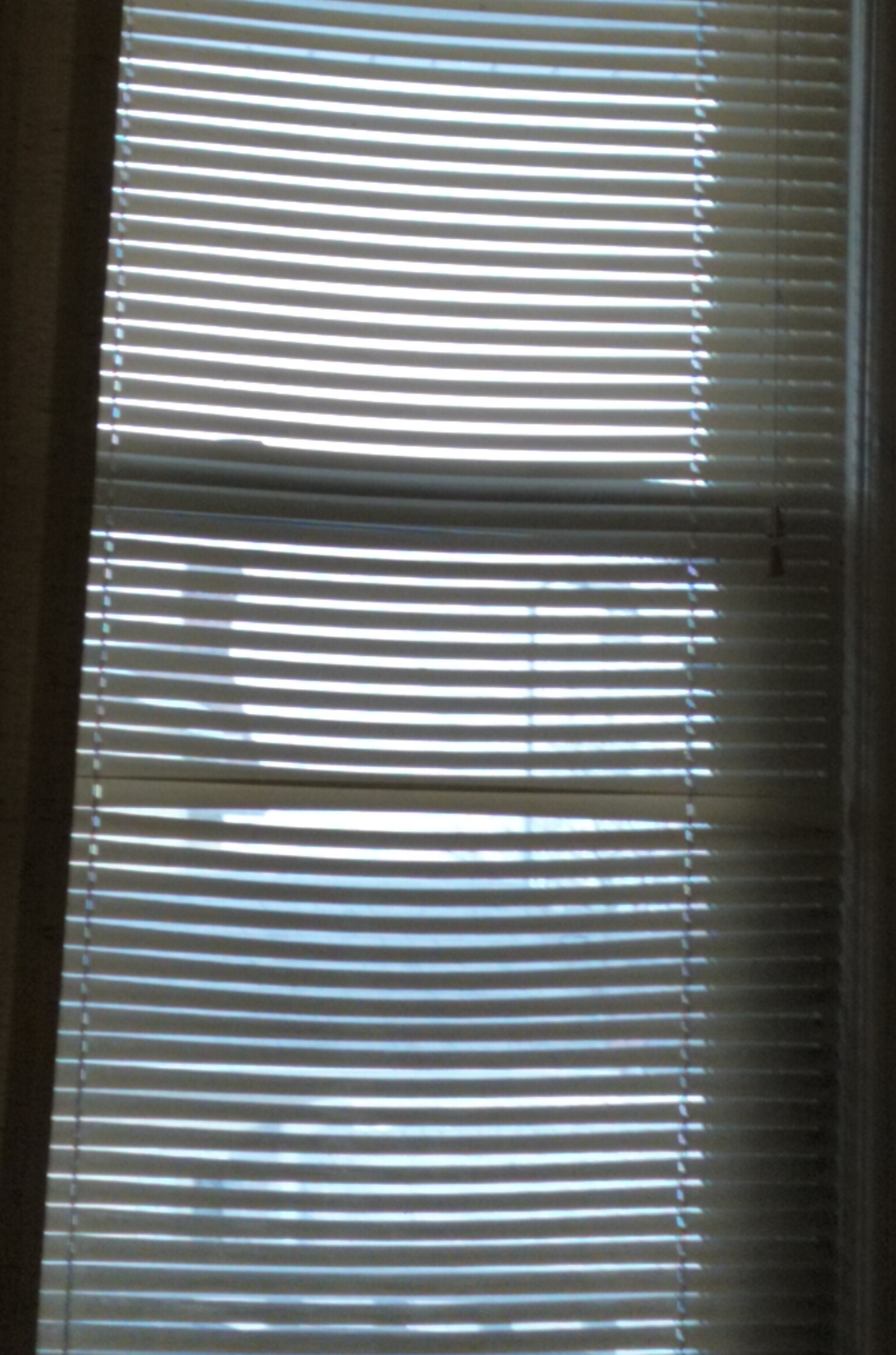
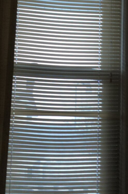
3:15p: The Williamsport report is coming to you from the loveseat because it is not worth getting up and going out on the porch for. When I look out the window it looks like we are going to get snow, which of course we won't at 59 degrees. What had been mostly light gray clouds now are mostly medium gray. Ugh. You know it's bad when the picture from inside wouldn't look better taken outside. I do hope more than just canderson can see something worth seeing.
-
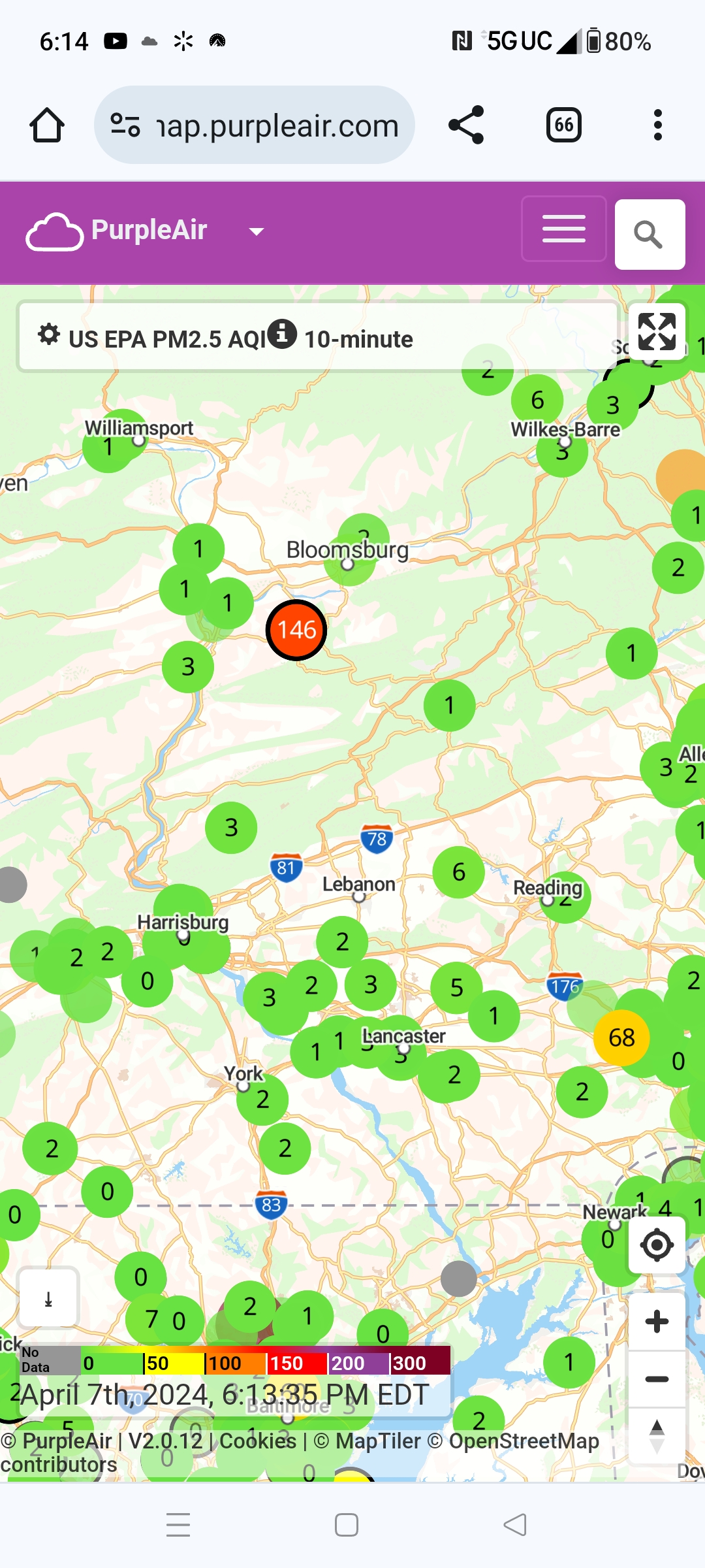
Look what came up when I happened to hit purpleair.com also known as last summer's Smoky Air website. Look at all those single digit readings including some just 0s and 1s. I am shocked we can get such clean air here in Williamsport. What a great day, right? If only this had been eclipse day!

-
Did anybody else besides me watch this? It is pretty interesting and I wondered what people thought. It was full of surprises. One came close to home as landfall was predicted about where I lived for years in downtown Jersey City about ten blocks from the Hudson River. Another point of interest to me was evacuating NYC area. How could it be done in a matter of days? I thought about that during Katrina as the struggles of people in New Orleans were on TV and later when Superstorm Sandy paid us a visit. There are so many more residential towers and less undeveloped land to absorb water than there once was.
-
Jesus, just checked in first time tonight or maybe even all day. Wasn't expecting all this activity. Still 67 in Williamsport, TV says our rain coming soon. We will only drop down to 54 overnight and only go up to 57 as our high tomorrow. I expect to be up for awhile and will check back.
-
I may be speaking just for me, I may be speaking for many -- but I feel I need to see a picture of that. No dog of any size could do that in our bathroom. And a 130 lbs dog is same size as an adult woman. So the next time you get a chance, could you treat us to some laughs and take a picture to share with us? Please say yes!
-
I posted a few heat-related tidbits earlier. I just found another one: Canada is already putting out Western province forest fires, ahead of their normal fire season. I never saw anything on the news about Canada adding lots of new money, manpower and firefighting equipment to their budget. Without lots more money, they will still let a lot of fires go so I figure another bad summer for them could mean another bad summer for us. I do not want to see smoke values of almost 500 and be told to stay indoors. But based on this fire scientist's remarks, it could happen again. https://x.com/queenofpeat/status/1761496677779755329?s=20
-
2:45p: Temperatures in Williamsport. We are cold up here vs the rest of you. Only 34 at the airport. I see we are going down to 19 overnight. Looking at the 14 day forecast, the coldest night is 24. I would not be surprised if we don't make it back into the teens again this winter. Next two weeks have lots of 50s and even some 60s. We shall see. I just hope we don't have a hot summer. I saw last week that whatever they call it designated hurricane creation zone in the Atlantic was at July temps now, a first. Yikes! Last month I saw temp map of Australia that was all light brown, that was how hot it was there. Enjoying the sun up here, that's for sure, after so little of it recently.
-
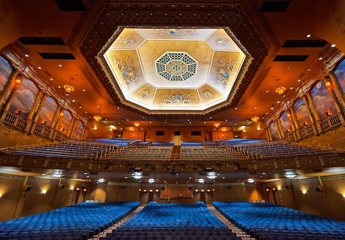
I am so glad the show was worth the trip. I am going to do a little Williamsport promotion here. This is Williamsport's gorgeous Community Arts Center. It was the Capitol Theater when I was in school. We lost all three of our downtown movie theaters as far as first run movies were concerned by 1980. The newest one was demolished. The Rialto was taken over by a church and with a lot of help and hard work, the Capitol was transformed into this big beautiful space. No one would expect little Williamsport would have this gem but we do. If there's a show up here you're interested in, please come. You won't be sorry!
-
NWS has Montoursville Airport, 5 miles away from Williamsport, down for .01 at 18:54 and 20:54 last night, for grand total of .02 over last 24 hours.
-
This one was hard to pin down and once it looked like things were becoming clear at last, there was the big move south. We never did have a handle on it. It is still 36 at 1:45a at Montoursville Airport and while we are in blue for snow, lots of rain still happening in middle of the state like above Harrisburg. I figure things could go several ways for everybody and we will just have to see.
-
NWS and others say Williamsport gets almost nothing at under 2. AccuWeather still sticking with the prior program. I do not know why: TONIGHT'S WEATHER MON, FEB 12 Snow; rain mixed in early, accumulating 4-8 inches; slippery conditions may lead to travel disruptions Lo: 34° Tomorrow: 1-3 inches of snow early in the morning; mostly cloudy and breezy; storm total 4-8"; dangerous travel in the morning with some improvement in the afternoon Hi: 41°
-
Less than two hours ago NWS had Williamsport at 6-9 in its Winter Storm Warning. They did say in their Discussion that things had shifted south but they were holding off on changing northern predictions for the time being. Now here is what they say: less than 2. So I guess there won't be much to report about up here. I am very happy for the people getting lots more than they thought. Tonight Rain and snow showers, becoming all snow after 4am. Low around 32. Light northeast wind increasing to 5 to 9 mph in the evening. Chance of precipitation is 80%. Total nighttime snow accumulation of around an inch possible. Tuesday Snow showers likely, mainly before 9am. Cloudy, then gradually becoming mostly sunny, with a high near 37. Northwest wind 9 to 14 mph, with gusts as high as 28 mph. Chance of precipitation is 60%. New snow accumulation of less than a half inch possible.
-
I noticed this over at weather.gov. We broke some records due to warmth. Between big drops in gas prices on the world market finally translating into lower UGI rates and a warm winter overall, I must say I am glad my gas bills are finally less: .CLIMATE... The following temperature record occurred during the mild weather on Friday and Saturday: FRIDAY FEBRUARY 9TH: -High of 58 degrees at Williamsport tied the record set last year. -High of 62 degrees at State College broke the previous record of 59 degrees in 2001. SATURDAY FEBRUARY 10TH: -High of 53 degrees at Bradford tied the record set in 2001. -Low of 35 degrees at Bradford tied the record maximum low temperature set in 2002. -Low of 41 degrees at State College broke the previous record maximum low temperature of 39 degrees set last year.
-
I wish there were a lot more people here from the northern part of the state, not just us here in North Central PA but NE PA too. But there aren't. So we rely on you guys further south to keep things going. You do us a pretty big favor, if you think about it. You all keep the subforum going and I am very grateful for that. The northern handful can just chime in with opinions and reports as best we can.
-
Me too! I am in Williamsport and very curious as well. Looks like we could get something worthwhile out of this. I wasn't expecting that. Earlier today wunderground had just 1.4.
-
2:23a. Surprised to realize we are way off our westher.gov temp prediction -- by 10 degrees. I wonder if we will drop more? Are they going to update forecast? Current conditions at Williamsport - Lycoming County Airport (KIPT) Overnight Mostly cloudy, with a low around 16. Southwest wind around 6 mph. Fair 6°F Humidity 76% Wind Speed Calm Barometer 30.10 in (1020.3 mb) Dewpoint 0°F (-18°C) Visibility 10.00 mi Last update 18 Jan 1:54 am EST
-
Hi there. I am glad you spoke up this time when visiting us. Please feel free to chime in any time when you come to check out Lancaster weather. I am up in Northcentral PA in Williamsport. We have a cousin with her kids and grandkids down in North Carolina who come up here.
-
I just checked and we are due for more rain and warmth here in Williamsport than when I last checked overnight. Temp 54 at 11p, 53 at midnight then by 7a Wednesday down to around 40 where we stay for daylight hours tomorrow. About 2.25 on rain, before was under 2. We have been getting more snow too but of course that won't last on ground for long. Temps dropped a bit since snow started, from 36 around 8a to 33 now. Very glad I don't have to leave house later when rain and wind pounding.
-
Major bust up here too in Williamsport. Montoursville Airport and rest of Lycoming County didn't even hit 4" when yesterday the ranges were something like 6-12 I think. One report was under 3"! Honestly I am relieved though. I got one of the viruses going around Saturday before Christmas, it is still hanging around and i am not in the mood for picking my way through snow and ice. I can only thank God the rain on Tuesday and moderate temps should get rid of this pretty quickly. So I am sitting here very grateful things worked out as they did. But really surprised too, considering how far north we are.
-
Hard to know what to think for Williamsport as of 4:45p. Certainly looks like we will get more than I figured. Winter Weather Warning still up and issued past noon says 4-8. Now for Williamsport, NWS says: Saturday Snow, mainly after noon. High near 34. Light east wind becoming southeast 5 to 10 mph in the morning. Chance of precipitation is 100%. New snow accumulation of 3 to 7 inches possible. Saturday Night Snow. Low around 30. East wind 5 to 7 mph becoming light and variable after midnight. Chance of precipitation is 100%. New snow accumulation of 2 to 4 inches possible. For Southern Lycoming which includes us too of course, NWS says: Saturday A chance of snow in the morning, then snow in the afternoon. Snow accumulation of 4 to 6 inches. Highs in the lower 30s. Southeast winds 10 to 15 mph. Chance of snow near 100 percent. Saturday Night Snow. Total snow accumulation of 4 to 8 inches. Near steady temperature around 30. Northeast winds 5 to 10 mph with gusts up to 20 mph, becoming north after midnight. Chance of snow near 100 percent.
-
Happy New Year, one and all, from Williamsport. I looked back to see if anyone else put this up and it looks like they haven't. As all eyes are looking ahead for snow, I am going to take us back a second to 2023 heat records. These are booby prizes of course in a warming world that we all wish weren't getting hotter, but still, we have two winners. Funny to think Williamsport hit its record for most snow of 25" just a few years ago on Dec. 16-17 2020. NWS said: 2033 was the warmest year on record in Williamsport, and tied for the second warmest in Harrisburg. RECORD ANNUAL AVERAGE TEMPERATURE STATISTICS VALUE YEAR Harrisburg (MDT) 56.9 2021 (2023 & 2020 = 56.7) Williamsport (IPT) 53.9 2023 (Supplants 2012 (53.8)) 11 of the top 13 warmest years on record have occurred since 1998 at Harrisburg (134 full years of continuous records). 9 of the top 13 warmest years on record have happened at Williamsport (128 full years) since 1998. 86 (of the possible 366) daily max temp records at Harrisburg have occurred since 2000, while only 35 min temp records have occurred in that same time period. Similarly for Williamsport,there are 83 daily max temp records on the books from the 2000s, while there are only 34 min temp records since 1/1/2000. In 2023: Harrisburg has set/tied 6 daily max temp records in 2023, and no min temp records. Williamsport very similar, scoring 4 daily max temp records,