dta1984
-
Posts
1,732 -
Joined
-
Last visited
Content Type
Profiles
Blogs
Forums
American Weather
Media Demo
Store
Gallery
Everything posted by dta1984
-
Always appreciated forecast! I'll be pulling for a slightly E track, but can't complain to 8-12" .
-
Euro looks to be holding and not bumping too far nw.
-
Looking good for the I 71 areas in Ohio
-
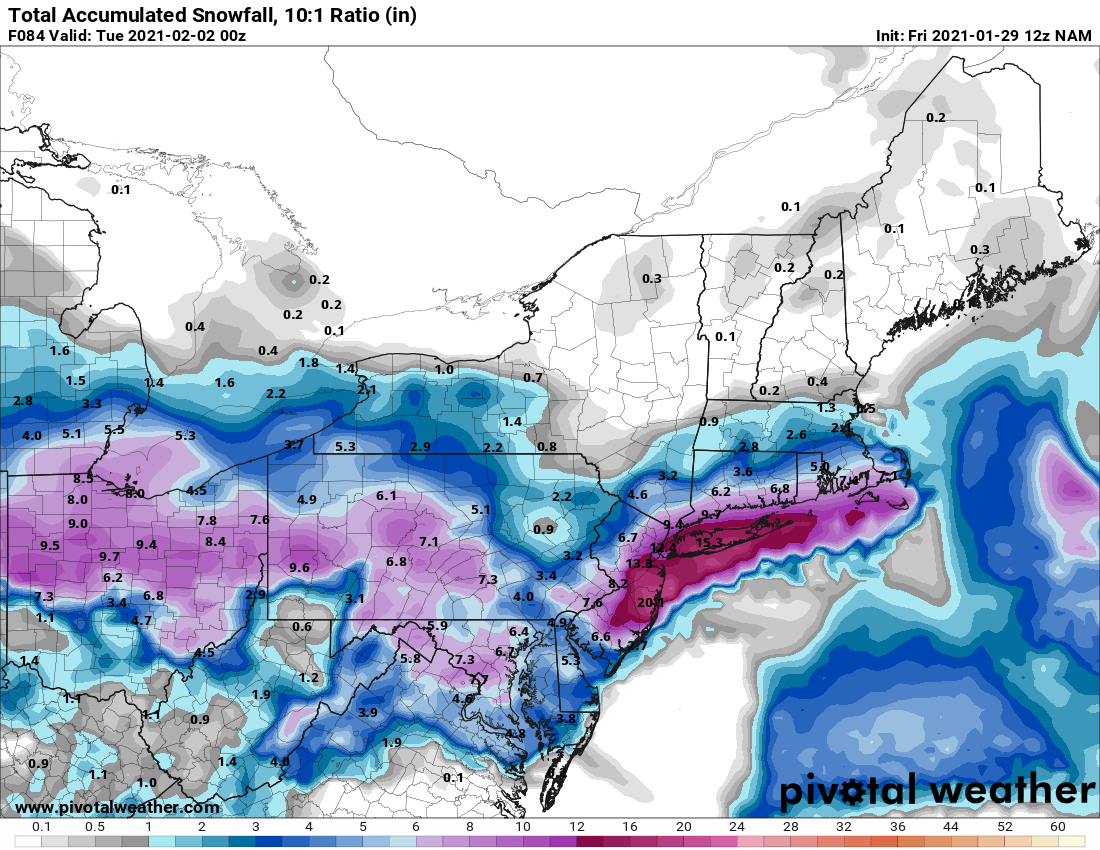
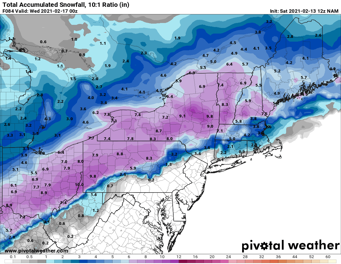
Pretty good looking mean @ 10:1 for the I 71 area in Ohio

-
Ya seems like an over correction. Let's see how the rest of the runs go today. 12z hrr seems to show lake shore areas getting some enhancement.
.thumb.png.f906ac33df4a207aac0a9c1f5446e721.png)
-
Welcome back Buckeye, I totally agree with your first paragraph Glad to see a spread the wealth storm for all of Ohio. Classic 2004 or 2008 style would be nice.
-
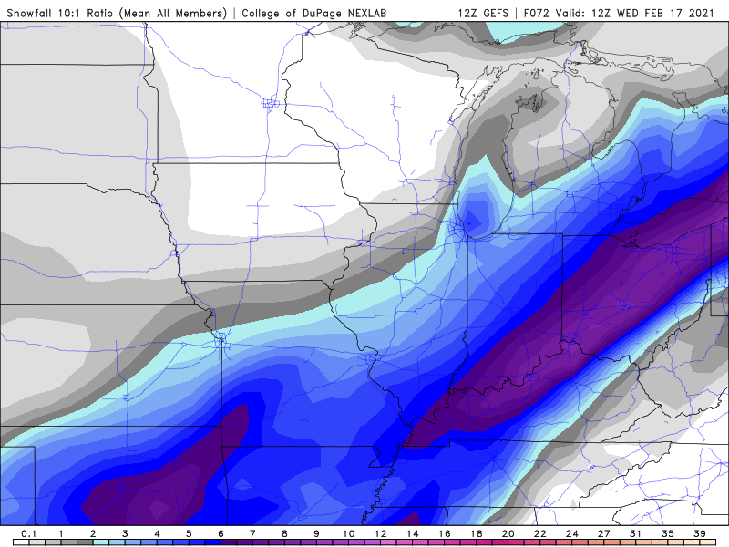
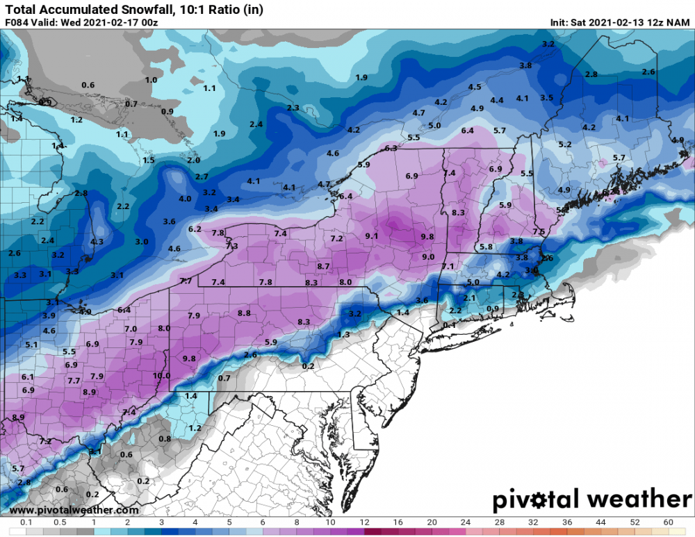
So far, morning runs have mostly been good to Ohio. The Nam is getting a little uncomfortable with sliding southeast. At 10:1, still looking like a 6"+ event.
-
Lol but the Chinese govt doesn't lie! Here's a gem about the Wuhan virus. Almost as good as the pics of all those people (actors) in Wuhan collapsing in the streets last Jan.

-
That's better than nothing I suppose... We've had alot of smaller snowfalls lately, itching for a bigger storm. Maybe next week....
-
Why would a healthy (under 65), not at risk person take it?
-
It is important the side effects are known so people can make a rational decision if they want to take this experimental vaccine. No reason for any healthy person under 65 to take it.
-
Yikes that was fast. Persistent on and off snow the past few days..... amounting to 3.5" since Sunday. Hopefully a bigger storm to track this weekend.
-
Nice surprise this morning. Cle mentioned 290 flow, which is perfect. Could see 2-4" being possible, looks like at least an inch down.
-
Noticed the scroll display screen in downtown Chardon has a screen for snowfall to date. Just about 5" more than what I've measured so far.

-
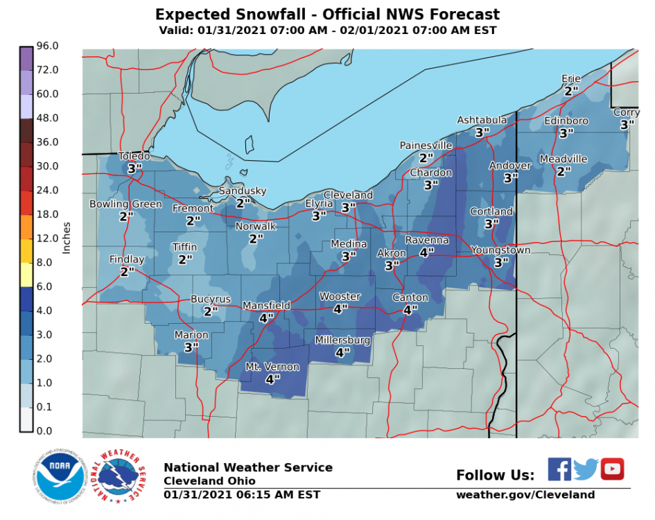
Hopefully there's a good burst of snow over the weekend. A few models show widespread 4-6". Certainly will have good ratios.
.thumb.png.a940f041c7bdb55652b253dcb8742d35.png)
-
Not sure what you've got, but the bottom few inches out here is pretty solid. I doubt it all melts... especially if the high temps come over night.
-
Didn't get a chance to measure this morning, but looks to be around 2" new. More than I expected looking at the radar, but ratios helped.
-
Picked up another 1", 1-2 in the fc for the rest of the day. Looks like some arctic air makes an appearance next week. That'll surely freeze the lake quickly.
-
I've got 1" so far this morning, snowing lightly, but looks to be a break soon. The Cle forecast and some short range models have an odd finger of higher accums in eastern Geauga. Interested to see how this plays out.
-
Possibly dry air from north winds off the lake? Not sure, but it is weird the low totals some models show around Cleveland as NEOH mentioned above. The NAM is higher resolution, so I'm curious how it and some of the other short range models handle that area as we get closer. Seems most runs today were a tick up in amounts, hopefully that continues.
-
Beat me to it! Haha. Here's the higher res 3k ...still snowing at the end.
.thumb.png.cb13de817c04f6e208585e895be92934.png)
-
Seems like a good call. 12z Nam was a slight increase from previous runs for us too. General 4-6" across the area. This was the first run with sampling I believe.

-
How's this setup for lake enhancement? Seems like cle mentioned it in one of their discussions.
-
A 3-6" snowfall sounds fine to me. No need to get worked up at this point.
.png.5a0931b9e59f59a5477b16777dfd803a.png)


.png.048724708787d18f5f9767dc2b07d2bb.png)

.png.84e2af113e066e3ccbc805afb9b70e86.png)