-
Posts
26,403 -
Joined
-
Last visited
Content Type
Profiles
Blogs
Forums
American Weather
Media Demo
Store
Gallery
Everything posted by Allsnow
-
Discussion-OBS snow event sometime between 06z Thu 2/20-12z Fri 2/21?
Allsnow replied to wdrag's topic in New York City Metro
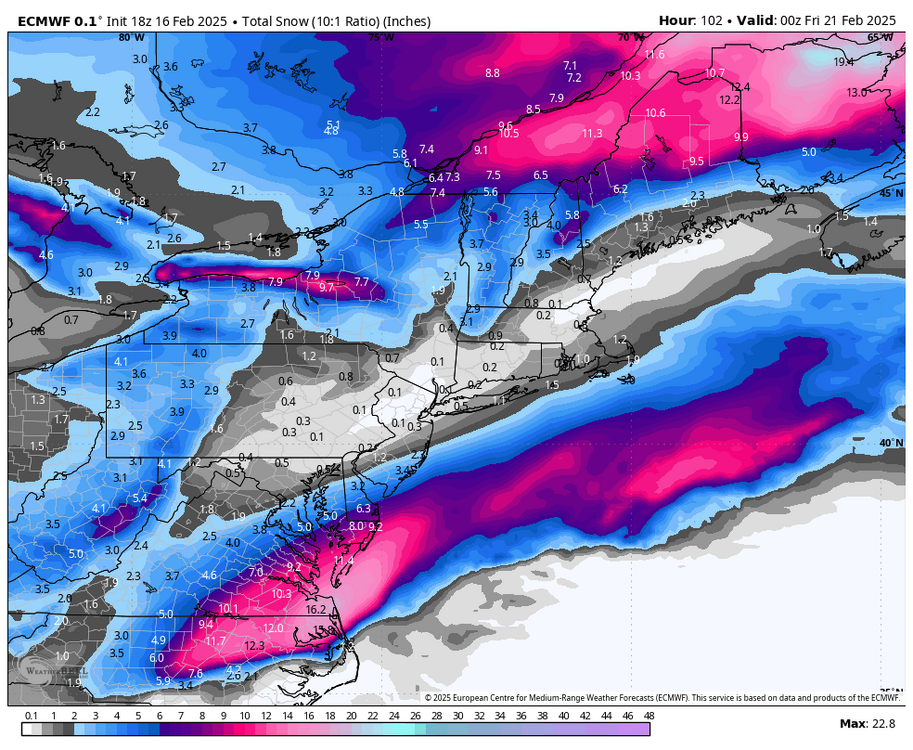
Confluence stronger on the euro -

OBS-Nowcast Noon Saturday 2/15-Noon Monday 2/17
Allsnow replied to wdrag's topic in New York City Metro
- 475 replies
-

OBS-Nowcast Noon Saturday 2/15-Noon Monday 2/17
Allsnow replied to wdrag's topic in New York City Metro
Warm front was further south then forecasted some of these places never thawed out. Going to be bad with the winds- 475 replies
-
- 1
-

-

OBS-Nowcast Noon Saturday 2/15-Noon Monday 2/17
Allsnow replied to wdrag's topic in New York City Metro
Still only 40- 475 replies
-
- 1
-

-

OBS-Nowcast Noon Saturday 2/15-Noon Monday 2/17
Allsnow replied to wdrag's topic in New York City Metro
Still 38 here- 475 replies
-

Discussion-OBS snow event sometime between 06z Thu 2/20-12z Fri 2/21?
Allsnow replied to wdrag's topic in New York City Metro
Poof i don’t see much past this threat on the 20th -

Discussion-OBS snow event sometime between 06z Thu 2/20-12z Fri 2/21?
Allsnow replied to wdrag's topic in New York City Metro
Good news is this will probably be the last letdown this winter. EPS is warm to start Morch -

Discussion-OBS snow event sometime between 06z Thu 2/20-12z Fri 2/21?
Allsnow replied to wdrag's topic in New York City Metro
The op definitely seems to be an outlier if you follow the icon ensembles. What did it have for 06z? -

Discussion-OBS snow event sometime between 06z Thu 2/20-12z Fri 2/21?
Allsnow replied to wdrag's topic in New York City Metro
Those huge euro op runs a few days ago had very little support from the eps -

Discussion-OBS snow event sometime between 06z Thu 2/20-12z Fri 2/21?
Allsnow replied to wdrag's topic in New York City Metro
Rgem looks horrible -
IGONE Misses everyone except Se Va
-

Discussion-OBS snow event sometime between 06z Thu 2/20-12z Fri 2/21?
Allsnow replied to wdrag's topic in New York City Metro
Icon misses everyone from dca-north -
This might be it for the winter….need to reel This one back in a bit
-

Discussion-OBS snow event sometime between 06z Thu 2/20-12z Fri 2/21?
Allsnow replied to wdrag's topic in New York City Metro
Icon sw looks a bit stronger and confluence a tad weaker -

OBS-Nowcast Noon Saturday 2/15-Noon Monday 2/17
Allsnow replied to wdrag's topic in New York City Metro
Like clockwork… Take the under- 475 replies
-
- 2
-

-
-
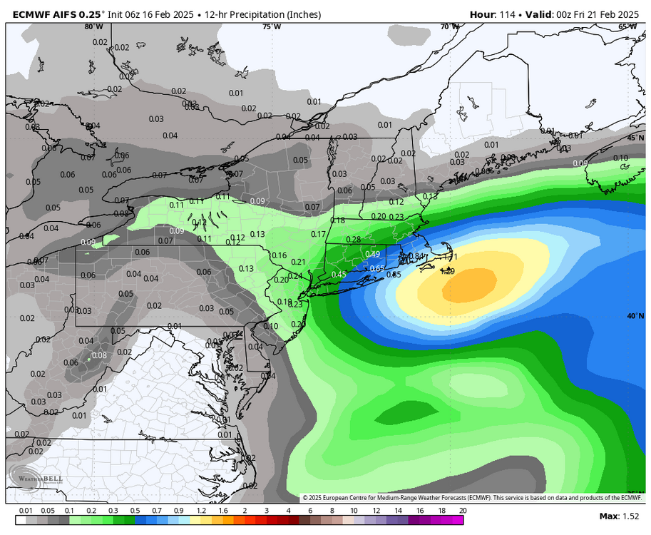
AI 06z says congrats southeast mass
-

Discussion-OBS snow event sometime between 06z Thu 2/20-12z Fri 2/21?
Allsnow replied to wdrag's topic in New York City Metro
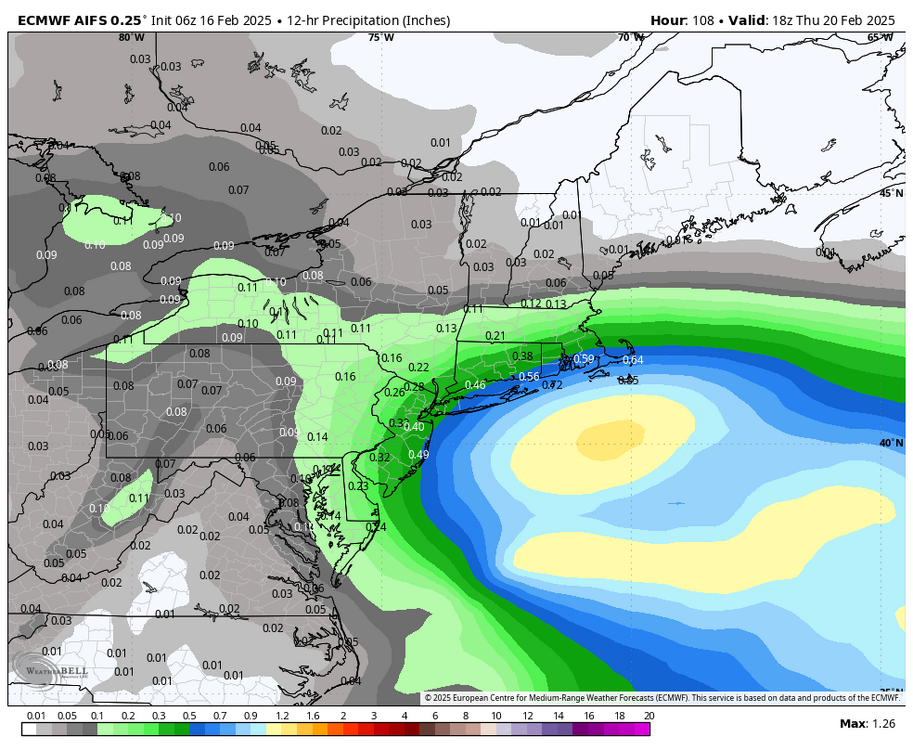
AI shifted west a hair Good Hit for Li and se jersey -

OBS-Nowcast Noon Saturday 2/15-Noon Monday 2/17
Allsnow replied to wdrag's topic in New York City Metro
Beach it- 475 replies
-

OBS-Nowcast Noon Saturday 2/15-Noon Monday 2/17
Allsnow replied to wdrag's topic in New York City Metro
Wow- 475 replies
-
- 2
-

-
It’s a path to victory as the tpv is usually very crushing for us on the east coast. We would just need the confluence to continue to weaken
-

Discussion-OBS snow event sometime between 06z Thu 2/20-12z Fri 2/21?
Allsnow replied to wdrag's topic in New York City Metro
Didn’t really want to see the euro/eps take a step back at 06z. Sometimes these off hour runs do odd things but we need to see a good trend at 12z -

OBS-Nowcast Noon Saturday 2/15-Noon Monday 2/17
Allsnow replied to wdrag's topic in New York City Metro
If it even gets that far north- 475 replies
-
- 1
-


