Allsnow
-
Posts
26,462 -
Joined
-
Last visited
Content Type
Profiles
Blogs
Forums
American Weather
Media Demo
Store
Gallery
Everything posted by Allsnow
-
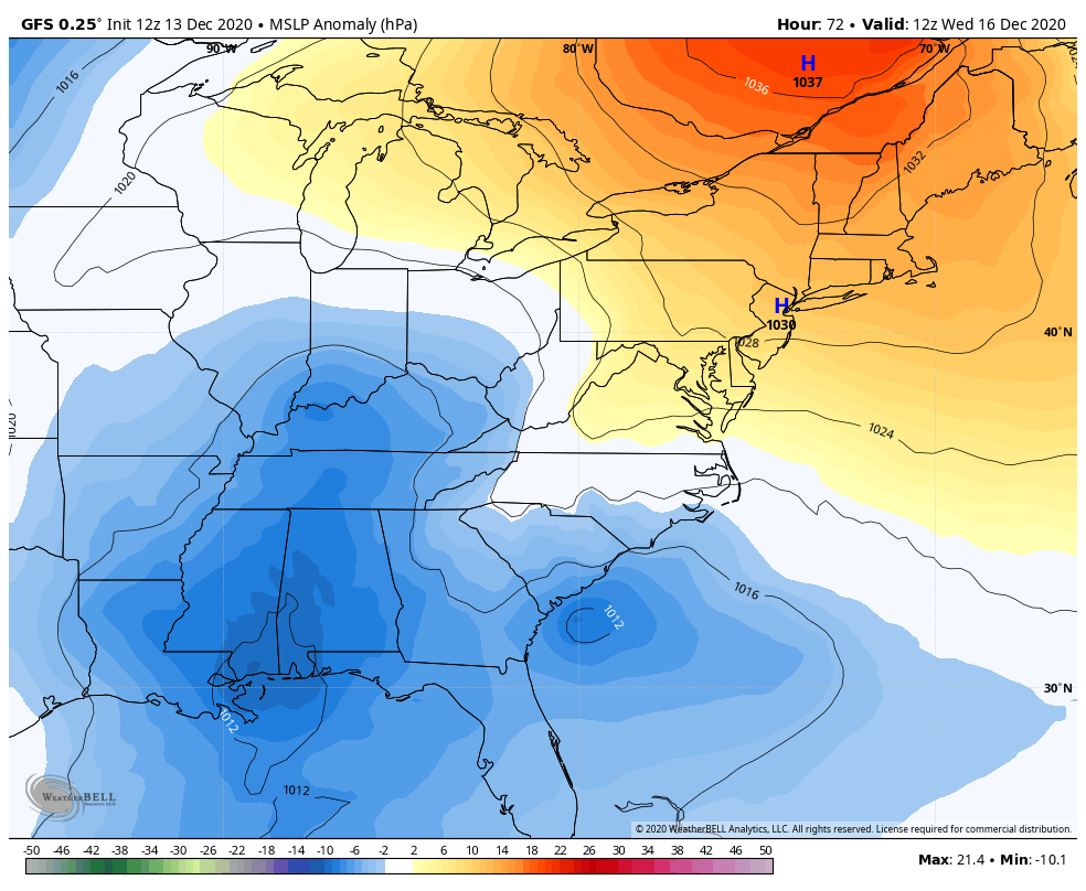
 The confluence and wave spacing Will help us. The incoming storm on the west coast won’t allow the ridge to be too sharp.
- 3,762 replies
-
- 1
-

-
- heavy snow
- heavy rain
- (and 3 more)
-
CCB!!!
-
Stronger confluence and High Euro ticked southeast. Crush job
-
Nice call. That should swing the ccb through the metro
- 3,762 replies
-
- 1
-

-
- heavy snow
- heavy rain
- (and 3 more)
-
Definitely further north and weaker. But the high is in a better spot.
-
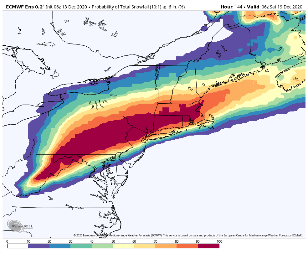
RGEM fwiw is 4-8 before any rain concerns. Should be big thump with this
- 3,762 replies
-
- 2
-
-

-
- heavy snow
- heavy rain
- (and 3 more)
-
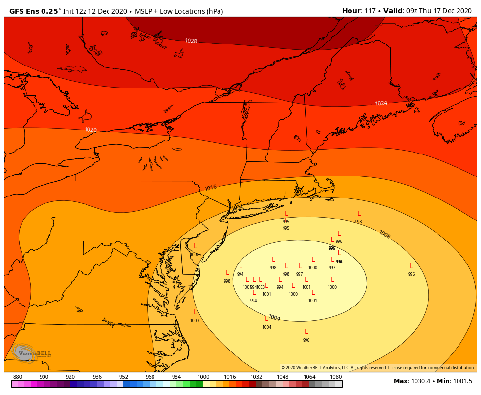
The GEFS are way south lol
-
But the nam....
-
700mb closed off at hour 90 this is going to be a big hit
-
No. They’re doing away with it
-
Gfs is stronger with the confluence through hour 57
-
Yes it can, it’s the 84 hour nam !!! Cmon
-
It actually is and one of the reasons they are scraping the model next year
-
It’s silly to put any stock in the nam until it’s 24-36 hours out
-
It’s amazing how consistent the models are in bringing significant snow to nyc. Usually when you have blocking the models latch on to a idea early because it can only come so far north. Going to be a nasty cutoff in sne
- 3,762 replies
-
- 3
-
-
- heavy snow
- heavy rain
- (and 3 more)
-
Bill what’s your thoughts on the gefs, ggem, eps, euro, and icon all showing a similar evolution?
- 3,762 replies
-
- 1
-
-
- heavy snow
- heavy rain
- (and 3 more)