-
Posts
26,403 -
Joined
-
Last visited
Content Type
Profiles
Blogs
Forums
American Weather
Media Demo
Store
Gallery
Everything posted by Allsnow
-
- 3,762 replies
-
- 1
-

-
- heavy snow
- heavy rain
-
(and 3 more)
Tagged with:
-
- 3,762 replies
-
- 3
-

-

-
- heavy snow
- heavy rain
-
(and 3 more)
Tagged with:
-
- 3,762 replies
-
- 3
-

-
- heavy snow
- heavy rain
-
(and 3 more)
Tagged with:
-
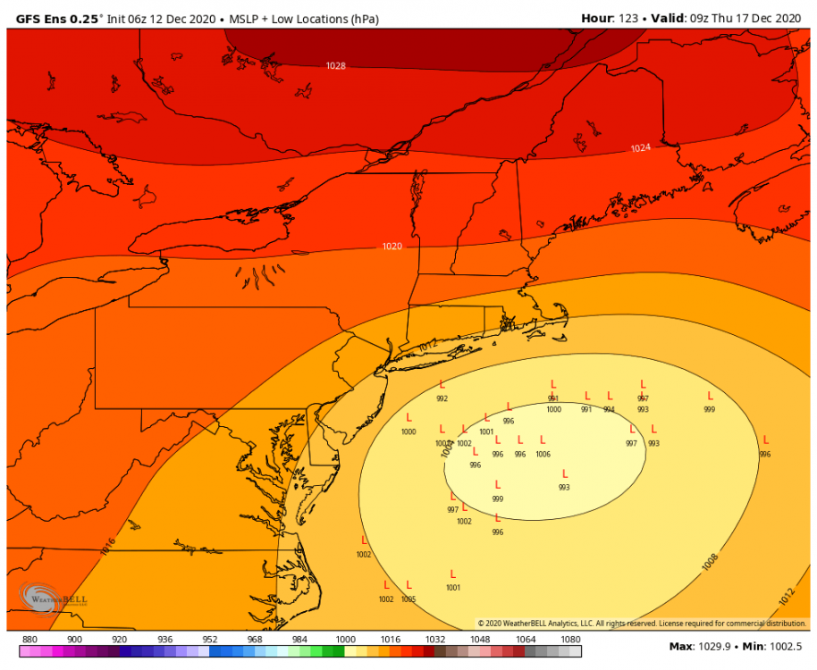
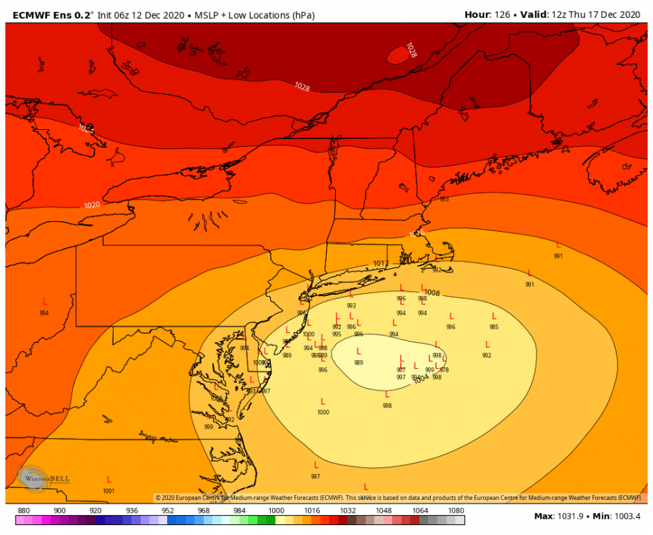
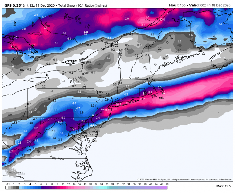
The confluence will make or break this event.
- 3,762 replies
-
- 1
-

-
- heavy snow
- heavy rain
-
(and 3 more)
Tagged with:
-
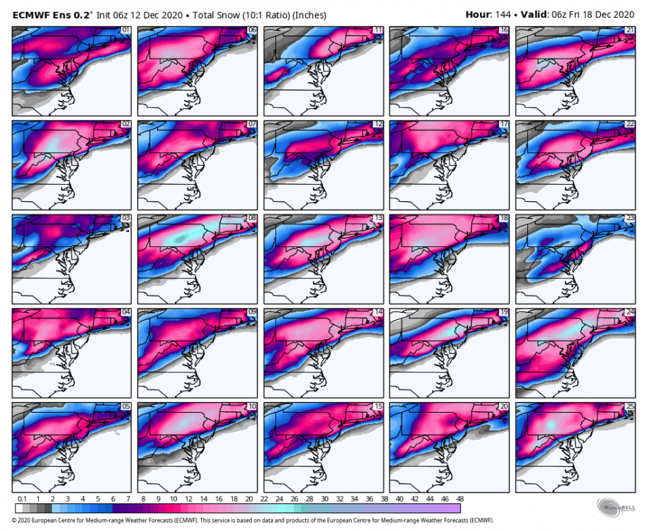
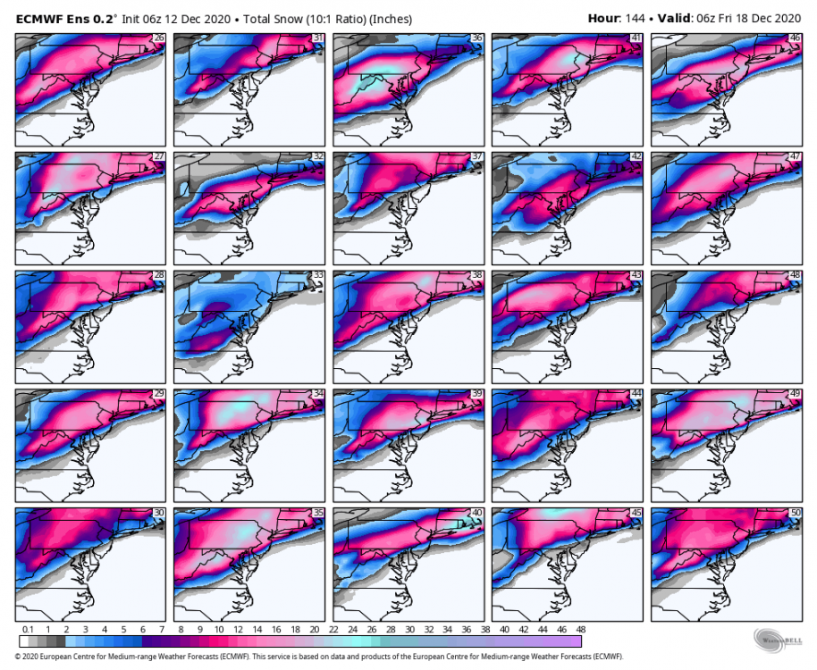
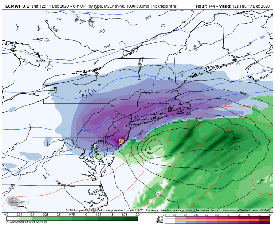
Why have the Costal storms tracks return? Monday and Wednesday will now make it 4 for the month
- 3,762 replies
-
- 2
-

-
- heavy snow
- heavy rain
-
(and 3 more)
Tagged with:
-
- 3,762 replies
-
- 3
-

-
- heavy snow
- heavy rain
-
(and 3 more)
Tagged with:
-
- 3,762 replies
-
- 1
-

-
- heavy snow
- heavy rain
-
(and 3 more)
Tagged with:
-
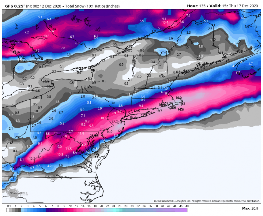
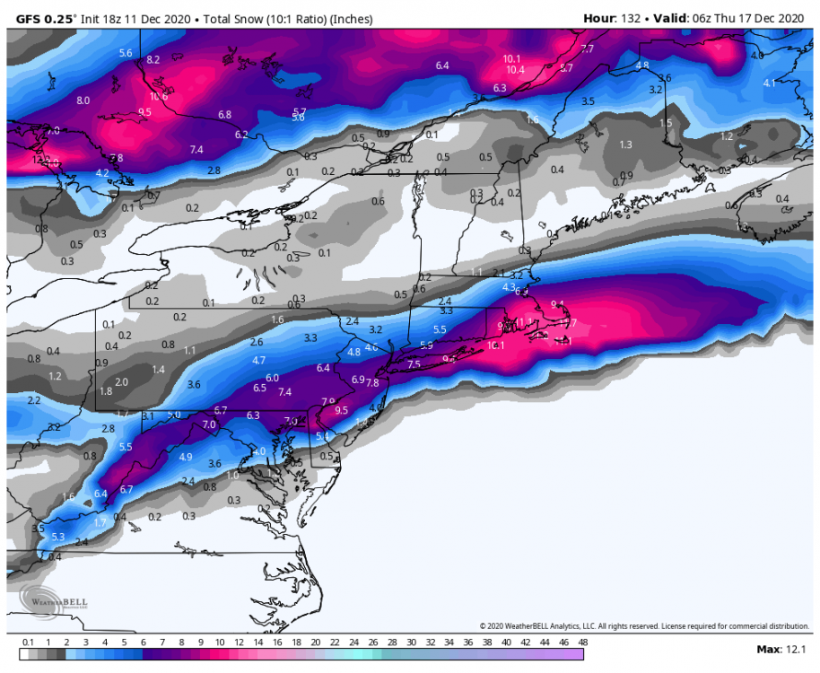
Continuing the trend of better pna and stronger confluence on the 18z Gfs. Should have a big hit again this run
- 3,762 replies
-
- 1
-

-
- heavy snow
- heavy rain
-
(and 3 more)
Tagged with:
-
December 2020 General Discussions & Observations Thread
Allsnow replied to bluewave's topic in New York City Metro
-

December 2020 General Discussions & Observations Thread
Allsnow replied to bluewave's topic in New York City Metro
Great discussion today with you @bluewave -

December 2020 General Discussions & Observations Thread
Allsnow replied to bluewave's topic in New York City Metro
Yeah, now it seems the long range modeling is defaulting to the Niña pattern but in reality it is something different. We have been kicking the can on the Niña pattern now. Perhaps it comes in February idk -

December 2020 General Discussions & Observations Thread
Allsnow replied to bluewave's topic in New York City Metro
-

December 2020 General Discussions & Observations Thread
Allsnow replied to bluewave's topic in New York City Metro
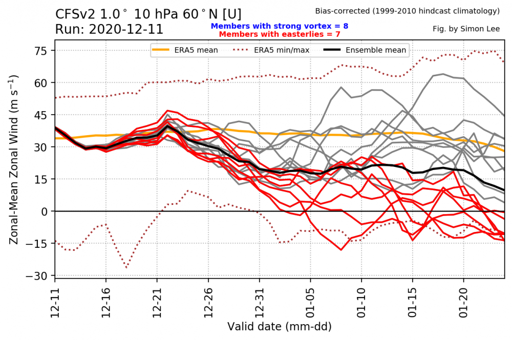
The blocking is a result of the wave 1 hit on the vortex. It’s displacing it off the pole. Hopefully we continue to keep it weak to maintain blocking -

December 2020 General Discussions & Observations Thread
Allsnow replied to bluewave's topic in New York City Metro
Eps went towards the gefs for the end of the month today. I think the gefs have a better handle on the mjo. We should be weekly into p7 by the end of the month -
That’s why you need to root for the confluence to hold strong. The pac isn’t going to be textbook for this.
-

December 2020 General Discussions & Observations Thread
Allsnow replied to bluewave's topic in New York City Metro
It’s like something out of 10/11 playbook with how quickly the blocking came -

December 2020 General Discussions & Observations Thread
Allsnow replied to bluewave's topic in New York City Metro
Just a ridiculous block and -ao on the eps. This isn’t in the long range either


