Allsnow
-
Posts
26,403 -
Joined
-
Last visited
Content Type
Profiles
Blogs
Forums
American Weather
Media Demo
Store
Gallery
Everything posted by Allsnow
-
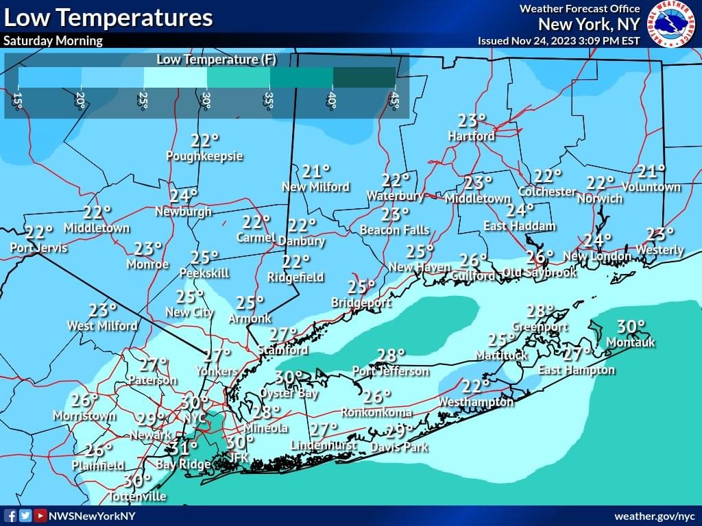
Surface temps not getting out of the 30’s a pretty impressive to end November
-
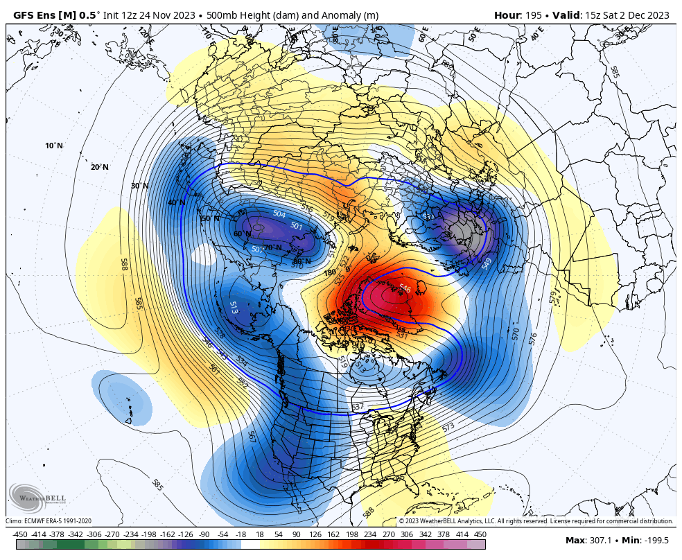
12z euro is a good reminder why the -nao is useless with a awful pacific
-
-
-
Euro still showing snow shower potential Tuesday afternoon. Perhaps some ocean effect for LI
-
We were spoiled…
-
January like temps for today and early to mid week.. @Brian5671 can finally stop posting the models keep pushing the cold back
-
What does that have to do with the quoted post?
-
Nyc 30
-

Prediction of the first snowfall for the NYC area.
Allsnow replied to MJO812's topic in New York City Metro
March 10th -
26
-
9pm 34
-
KNYC 36 now
-
I think we all need to remember how unsuccessful these blocking episodes have been with the poor pacific
-
Down to 39 already with strong north wind. Nyc definitely hits 32 tonight CITY SKY/WX TMP DP RH WIND PRES REMARKS Central Park CLEAR 39 19 44 N10G21 30.26R WCI 32 LaGuardia Arpt PTCLDY 40 21 46 NW20G30 30.23R WCI 30 Kennedy Intl PTCLDY 39 21 48 NW23G31 30.23R WCI 28 Newark Liberty PTCLDY 40 20 44 N25G31 30.24R WCI 29 Teterboro Arpt CLEAR 37 19 48 NW14G21 30.24R WCI 28 Bronx Lehman C N/A 37 21 52 NW13G24 N/A WCI 29 Queens College N/A 39 21 48 NW17G33 N/A WCI 30 Breezy Point N/A 41 N/A N/A N22G29 N/A Brooklyn Coll N/A 39 21 48 N17G29 N/A WCI 30 Staten Island N/A 39 21 48 N16G29
-
Nws forecast Will end the growing season in NYC

-
Click bait…have we not witnessed this type of blocking with a poor pac the last few years?
-
Would be a better airmass but the trough is pretty far east
-
The flow is off the west coast as the ridge isn’t poleward to bring a better airmass into Canada. You will be blocking pac air
-
There is no cold air source on that map. The cooler 850’s is probably from active rainy/stormy pattern
-
Ugly pac
-
That’s pac air coming into the conus with +epo. the ridge out west is way to flat
-
Euro has upper teens low 20’s for the area Tuesday morning
-
12z euro over .50 now
-
It’s all speculation at this point… Let’s finally see some pac improvements to help our snow chance or this -nao will just become another waste