wdrag
-
Posts
5,045 -
Joined
-
Last visited
Content Type
Profiles
Blogs
Forums
American Weather
Media Demo
Store
Gallery
Everything posted by wdrag
-
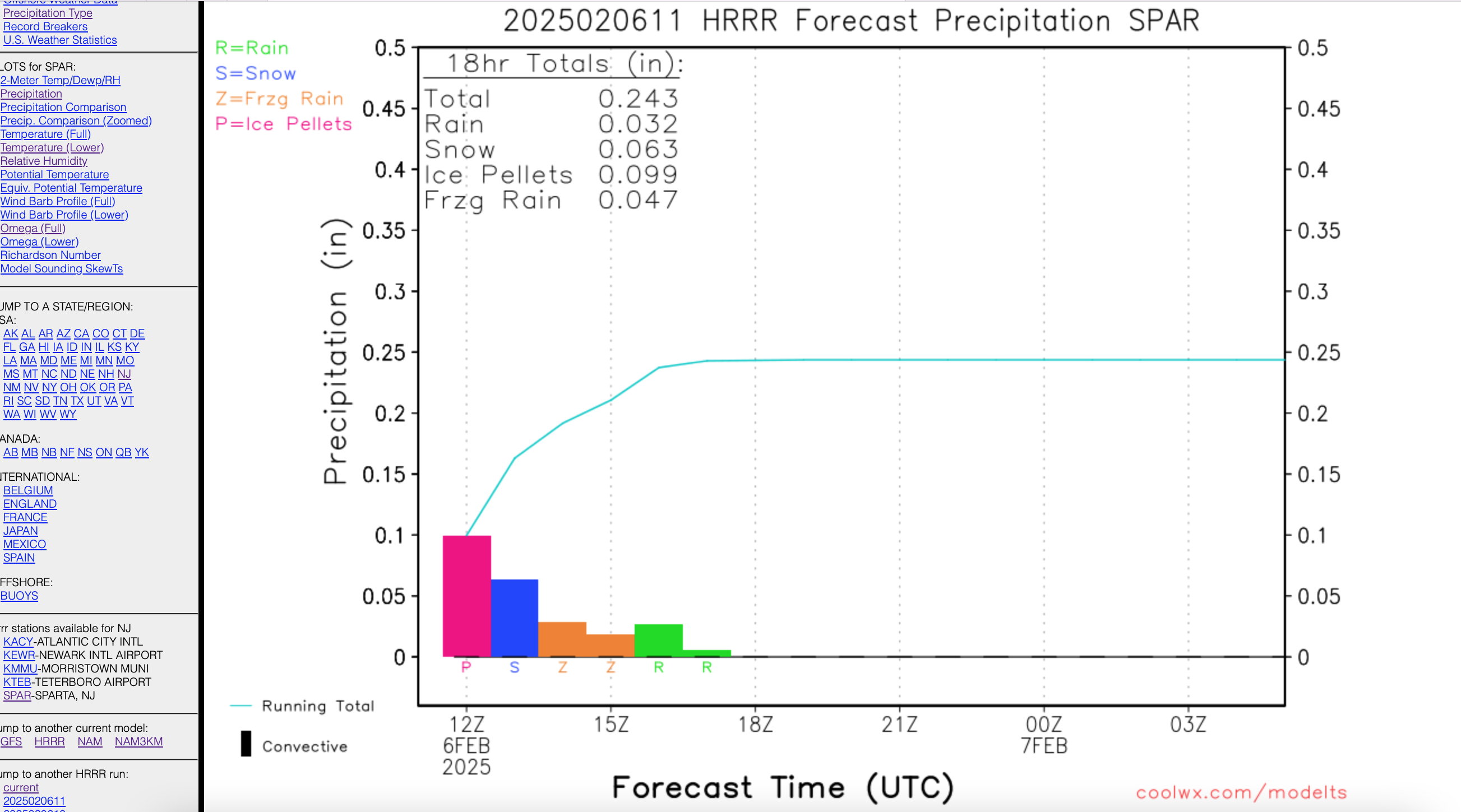
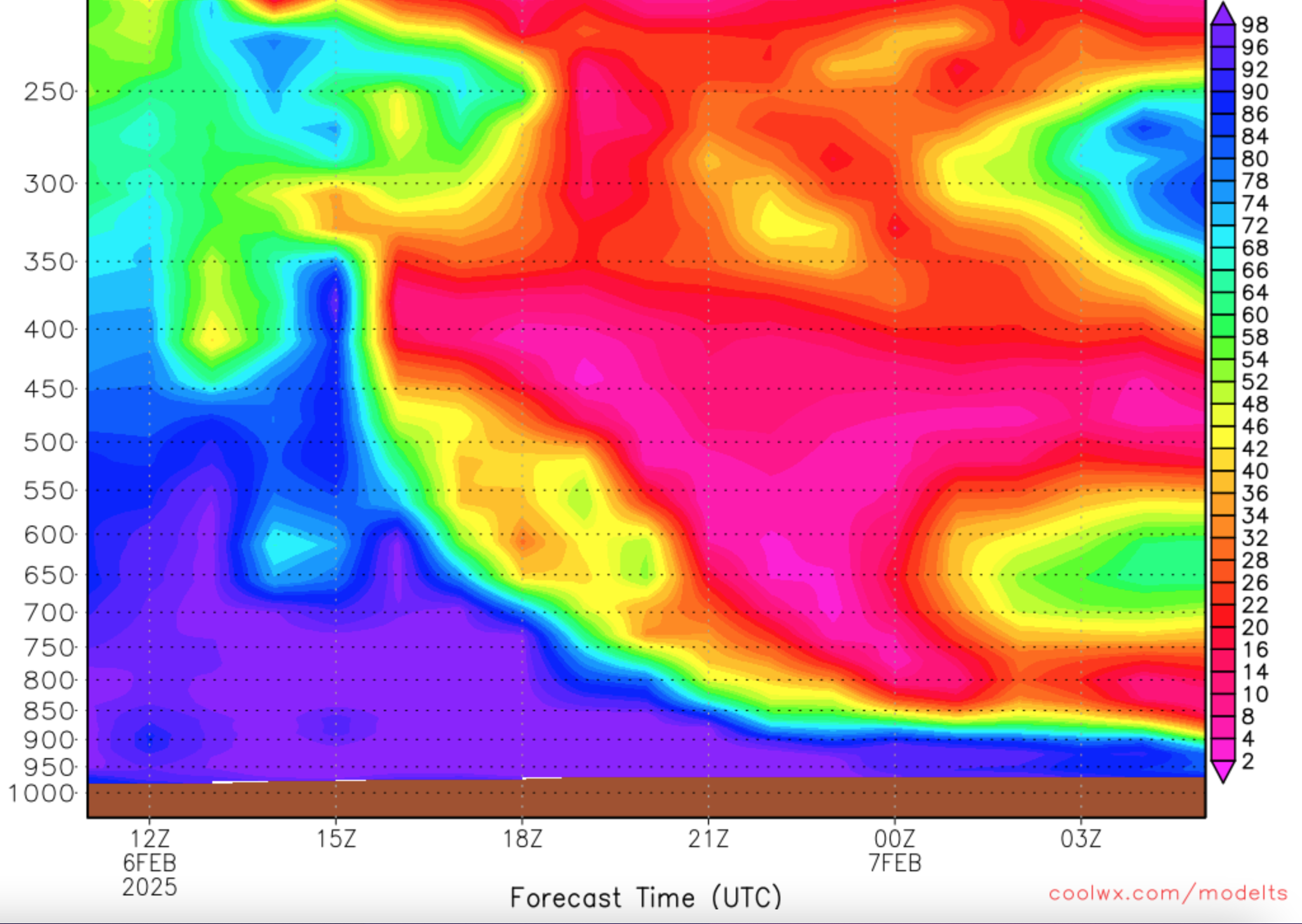
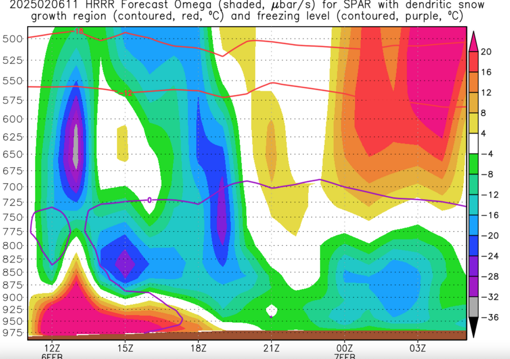
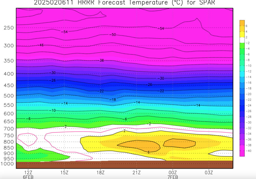
You may not fed that parts of interior se NYS and far nw NJ have gone over to a fine small flake light snow since *A. When you're on the margins, it takes far too much work to examine very location but this is vicinity where I live from the HRRR. Attached the high RH which is still up to 400MB, vertical profile below freezing for an hr or two near 13z all the way up, and the Omega which is poking up into the ideal DGZ that is saturated for couple hours now and so it's snowing. HRRR picked up on. it.


-
Good catch... in fact I think it I known though I dont have the stats at hand that most of the of accidents occur in advisory criteria OR LESS snow/ice. When its blinding out folks dont travel and reduce risk. AND most of our snow events, I think Don can vouch for this again, most of our daily snowfalls are under 3", even out here in rural nw NJ. VERRRRY Good catch.
-
I have to go by the OB.
-
NYC CP 0.08 last hr, all snow and still 3/4S- at 7A OB with temp near 31F. My guess CP is somewhere between 1/2-1" of new snow... 0.15 past 3 hrs but sleet mix. Will be interesting to see what they have had.
-
You're explanation is imo, excellent and why we do what we do for kind of improving traveling life, when travel is not necessary or can be delayed. We love the flakes but it's the frozen-freezing that is the problem. Well stated. I'll addd while Im here... the NAM is the so called winner on less snow and more IP... but its not nil and if you're getting snow this morning its your win. Wantage NJj has had very little snow so far. We are 0.4" sleet and down to 21F at 630AM Finally: maybe the city and Island are OK on roads... am not quite sure though I check Cams around CP. Feedback will be helpful. But overall I think this advisory is a success... imperfect yes, but not worth mentioning BUST. We'll look at this later today to see what has occurred. Probably starting a multi day cover all bases thread at 4P for the 11th-15th or 11th-14th, something like that so the complaints about multi threads are minimal. Can trim that when its obvious the focus should. be on a particular embedded event. And while it's a thread... am wary of thinking 3+ for NYC... these systems are deviating a bit and so the ensemble blend I think is best for that 11th-15th period.
-
Wantage NJ 0.2" sleet in the past hr 21.4. Snow mixed at times past 1a5 minutes. If you're gotten snow accumulation by this time, you are blessed.
-
There is no punting to the next event after Valentines Day (VD), at least not clearly marked out to me. We have to get what we can by then and I keep Don's stats in mind when discussing expectations. From what I can tell the snow action primarily shifts to the I84 corridor northward after VD and so I wont' say it's now or never this winter because the pattern suggests more opportunities will emerge the last week of Feb into early March but I'm not confident that we'll be in as good a position as we are now--- and now it's thread the needle.
-
Plan is to issue a new thread around 4-5PM tomorrow for probably 2 wintry events 2/11-15, one of which may be major snow storm, the other might be a south grazer. Not looking at anything beyond the 15th. Did buy 5 gallons of 4cycle fuel for my Ariens today and probably need to use the blower at Noon tomorrow for 2-3" here in Wantage NJ, topped. by a little sleet-freezing rain. Am offline 730P-3A. Thanks for your patience on the multi threads.
-
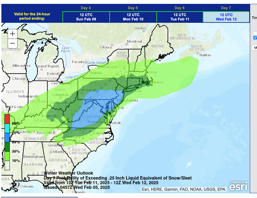
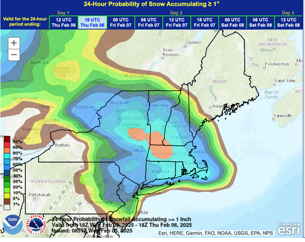
Midday Wednesday 2/5 D7 ensembles from WPC. Holding steady.
-
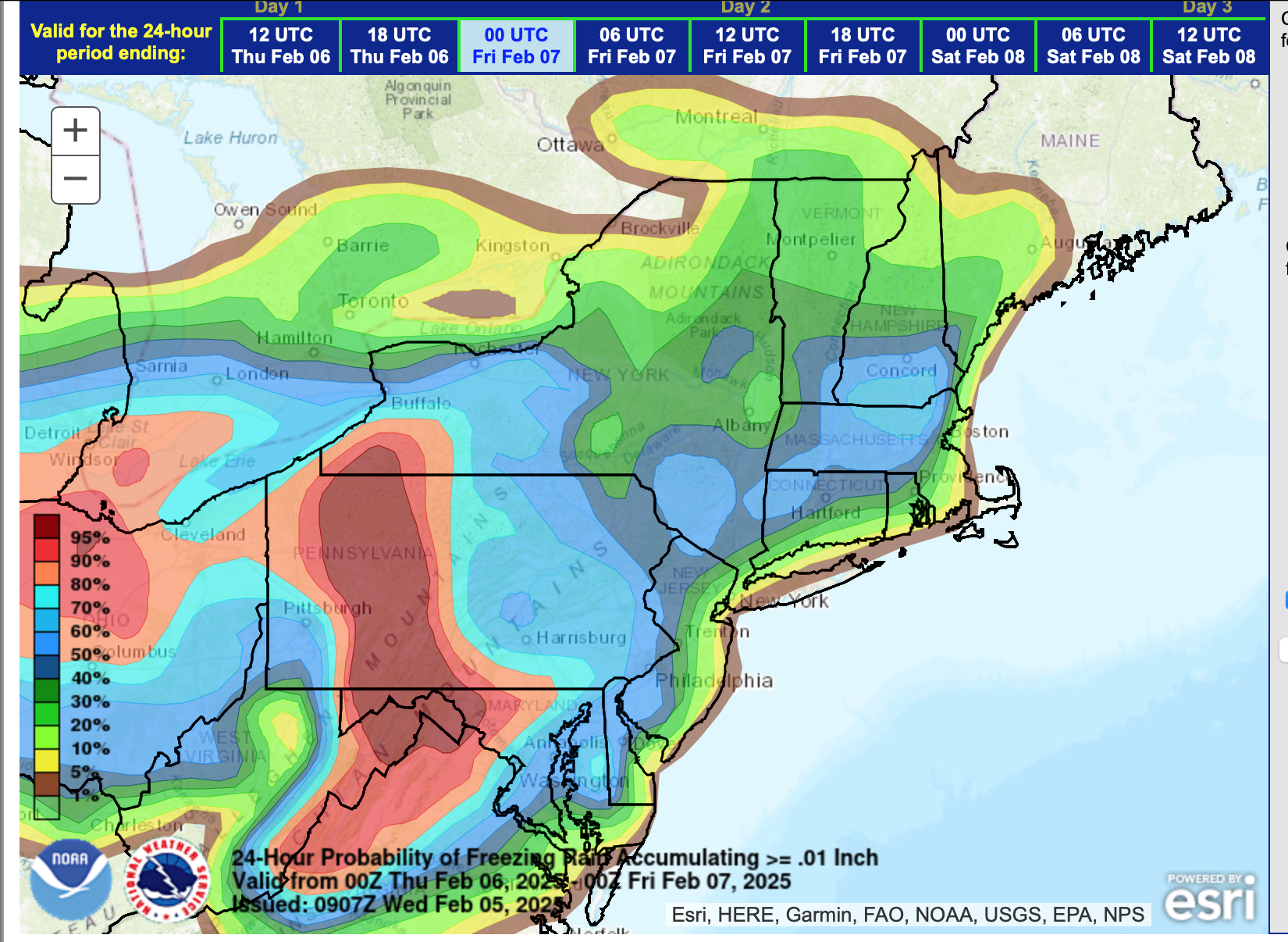
WPC ensembles. continue increasing probs for >.25" frozen I95 northwestward (see the midday attached). I dont profess anything LI....
-
agree and nearer the marginal snow thickness, generally heavier qpf, some of which yields snow.
-
Hi! I've seen some comments on too many threads... When it rains it pours-so to speak, or in this case we've been begging for snow in NYC, but it doesn't all come at once. The various threads respond to the model prognosis and of course allow the obs for each event. I understand about pain... switching back and forth. The next thread will incorporate multiple days, and possibly 2 or 3 grazers, or one or 2 larger events. It will title something like this: "Discussion and OBS for the M-Fri Feb 10-14...1-3 wintry event(s)/or possibly a moderate-major winter storm" I do want to eliminate Feb 6 thread, before starting the latter.
-
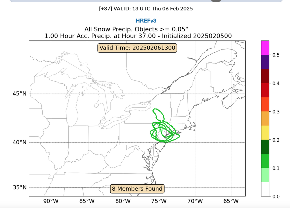
This will probably be 1/4S+ or 1/2S for an hour or two between 6A-9A tomorrow morning ... not a routine 1/2-1"/HR snowfall rate drive. Maybe if this had occurred at 11PM, you'd get by tomorrow morning with less impaired travel, but not the case. Based on last nights SPC HREF...both versions of the HREF say the same thing. I could see tomorrow morning turning convective as well... iso lightning strike? mPing will be helpful tonight... also you'll see the bright band get going in the morning and probably rapidly intensifying echos toward 6AM. For those who have radar scope etc CC will interesting.
-
I like this a lot...my experience too. Wonder if folks ar underpaying impacts coming tomorrow morning. Going to be pretty intense I think between 4A-10A. new 06z/5 EC demonstrates with S+ pockets (red on Pivatol).
-
Never really sure...we'll see if this really happens.Maybe we'll have a spring flood season if we can get a deep snowpack in the interior... by March 1. Dont' know but guidance offers the option. Pattern via 00z/4 GEFS only, looks favorable into the first week or two f March, even if we lose the ne Canada block since the 5H ridge will probably pop again in AK and modeling still has an active storm track lower Mississippi Valley through the Ohio Valley into the mid Atlantic states (Nina).
-
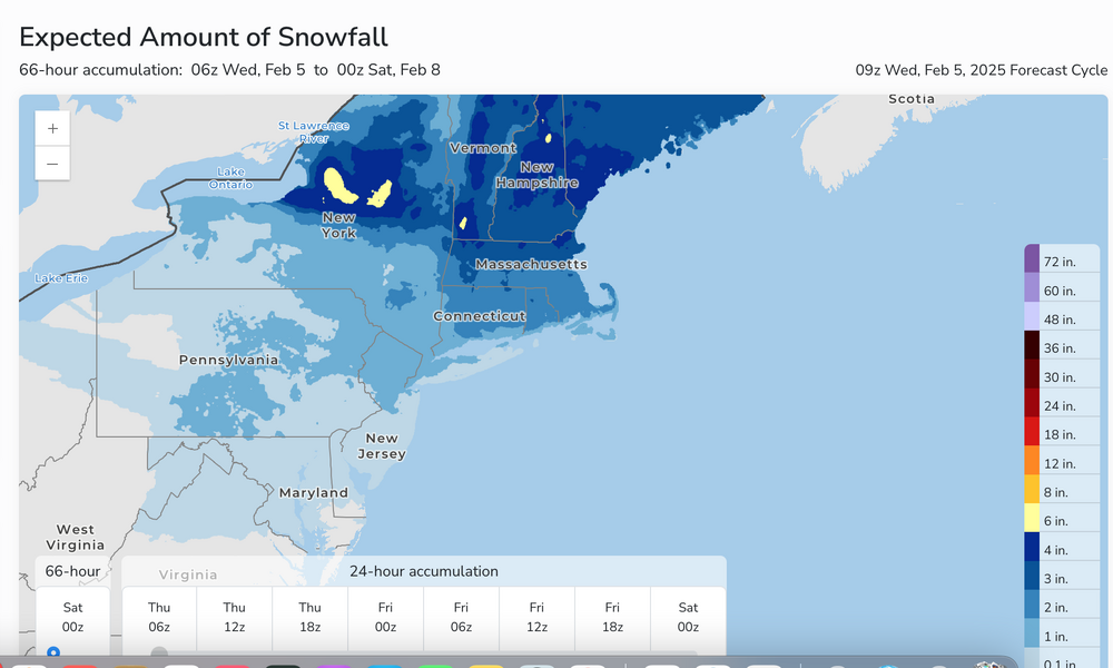
This is a tease... and might be an inch or more too high but the last 5 cycles of the 00z/GEFS has offer 4+" of melted w.e. to I80 southward (yellow) in the next 23 days... impressive if this occurs. This data extends beyond what I've shown here... it trickles in between 02z-03z the next day. Example: the 00z/4 GEFS extended beyond 16 days wasn't available to me until about 03z/5.
-
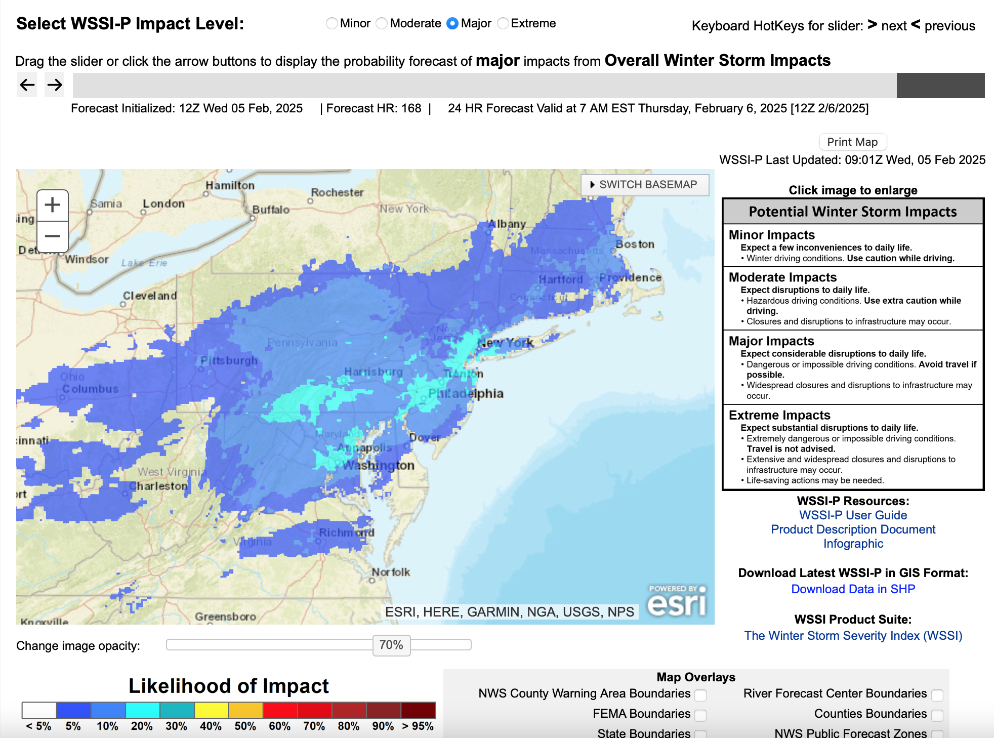
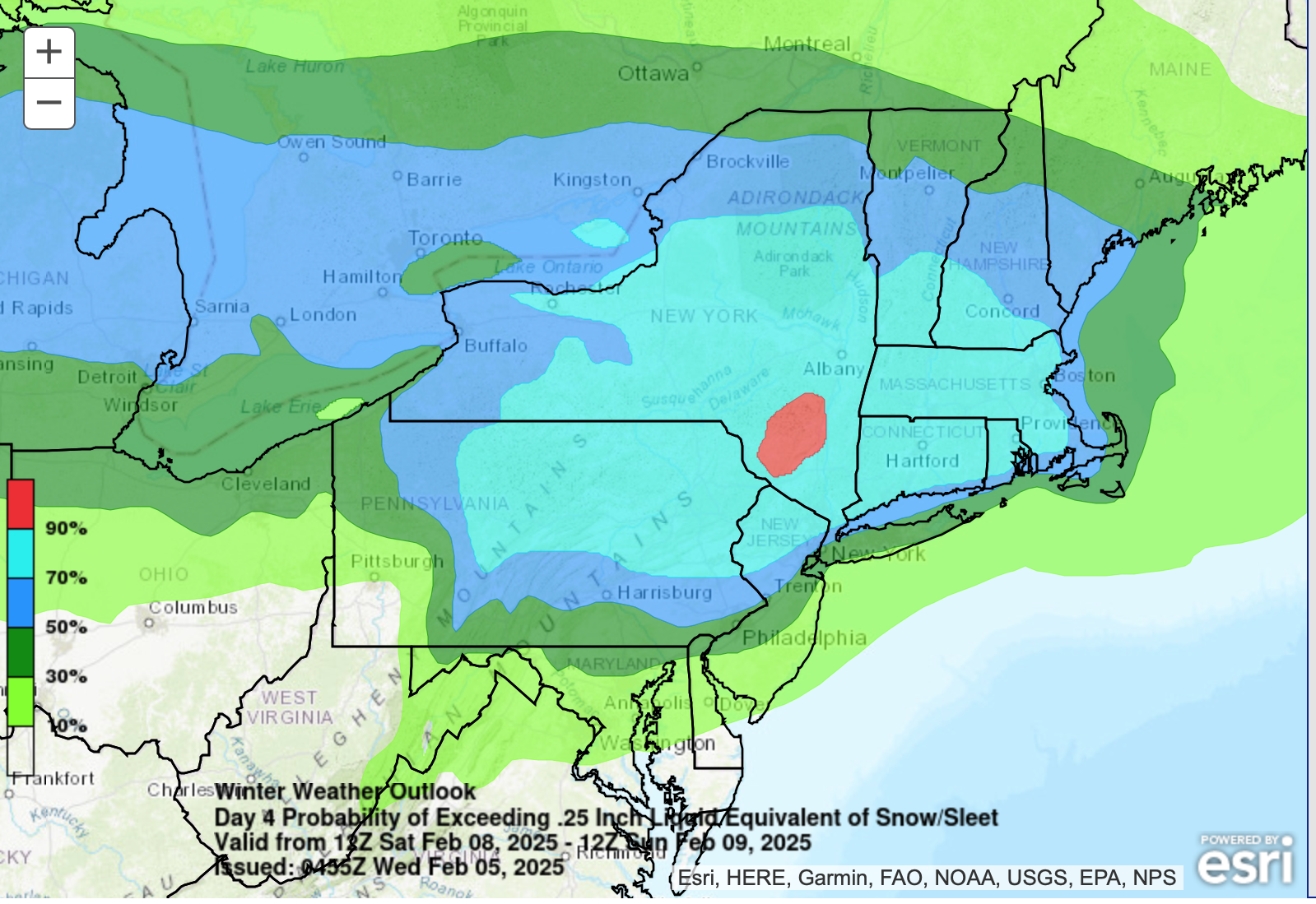
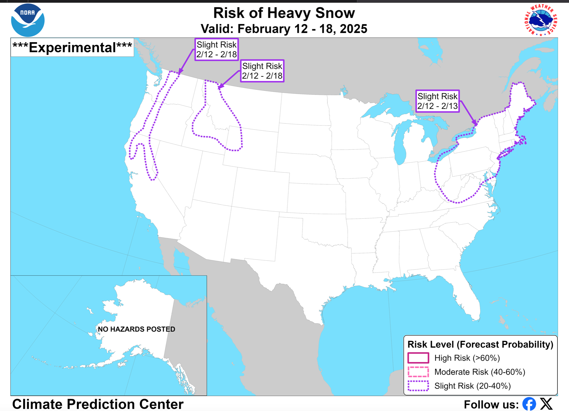
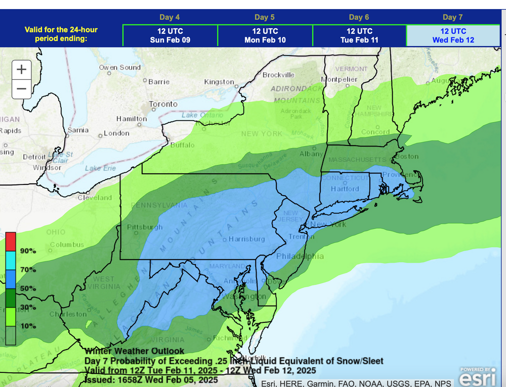
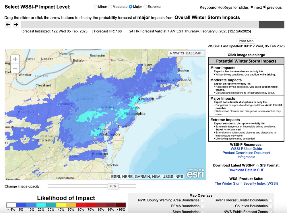
WPC D7. attached and the early WSSI-P which has low probability of a major winter storm I95 corridor...first time I've ever seen in this short time this experimental product is publicly available this season. If subforum, sentiment changes this afternoon, I can start the thread for 2/10-15 and leave it wide open for what may transpire.
-
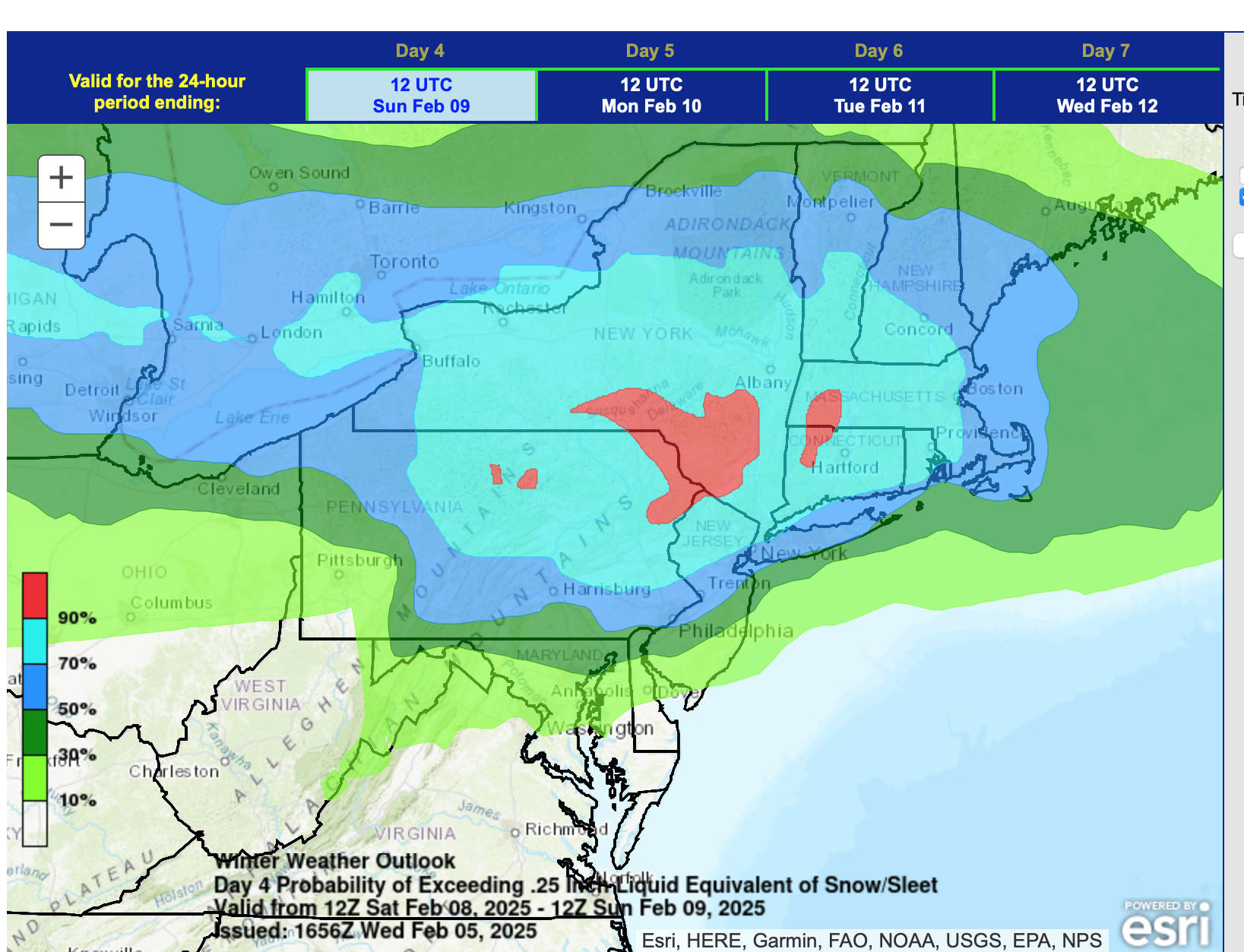
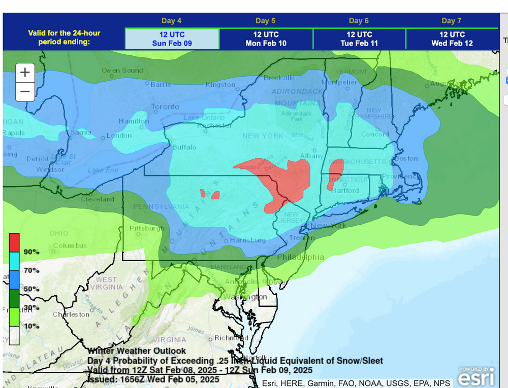
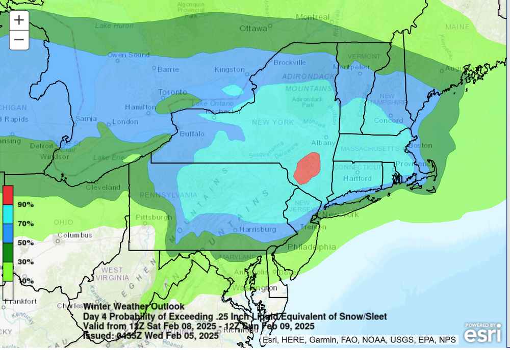
WPC updated overnight D4 outlook now... probs are very high interior. I95 eastward is still problematic with mix etc.
-
Hopefully this is all self explanatory... just use the legends and the notes on the graphics. Thanks.

-
No thread but am thinking keeping threads simple and just going for one thread Feb 10-15. I'll wait til Thursday afternoon before starting as guided yesterday.
-
Little worried that this could be sleet instead of snow, therefore cutting accums down considerably. Will watch trends next cycles but it does look slippery at sunrise Thu.
-
Good sign and RGEM kind of snowy as the RAP.
-
As fwiw from my experience: SPC HREF can run a degree or two cold so that ZR might be little too expansive"at times"... but not always. HRRR can run a degree or three to warm, especially beyond 24 hours... RGEM and GGEM: Tends to be a slightly warmer model (note the discourse on the failed RGEM holding r/s line w of NYC for the 1/19 event). The reason I bring this up... if models show pcpn and especially inside 60 hours, the Canadian is showing more snow... it needs to. be considered as a sign that other modeling may be running too warm and rainy. Staying the with RGEM/GGEM...tends to run a little amped... a bit too much qpf but a nice Indicator of drizzle flurries.
-
This doesn't often happen in the the I95 corridor... so I think it is a good indicator we have a winter snow or winter mixed storm coming. CPC tends to be conservative. I noticed when they had it for the western part of the I84 corridor earlier this winter there was a winter storm. And, to my knowledge this is the only avenue the NWS-CPC has for broadcasting a possible extensive and/or large event for week two This is not your frequent slight risk of severe in summer where we still have some difficulty discerning extensive coverage vs isolated and also the power of the storms. This I think of more akin to a MDT summer risk, though I never was asked about this before. Hope that helps regarding my perspective=value and public benefit.
-
No thread yet but CPC maintains...see below. If and when a thread from myself, will follow morning group input and start 4PM ish Thursday the 6th.