wdrag
-
Posts
5,544 -
Joined
-
Last visited
7 Followers


About wdrag

Recent Profile Visitors
20,195 profile views


-
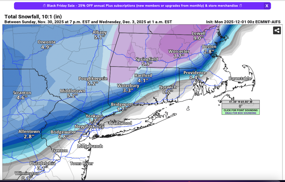
And my last group of graphics: Check out the 08z/2 HRRR and the resultant snowfall... cherry picked that HRRR but its what I used for a local FB post. Scary good science (at least at times close in).


-
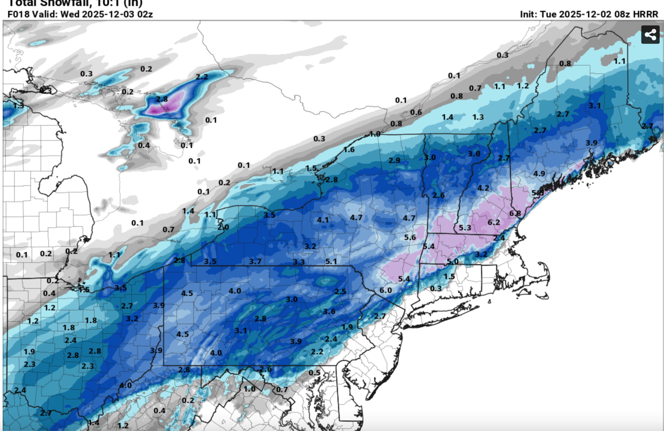
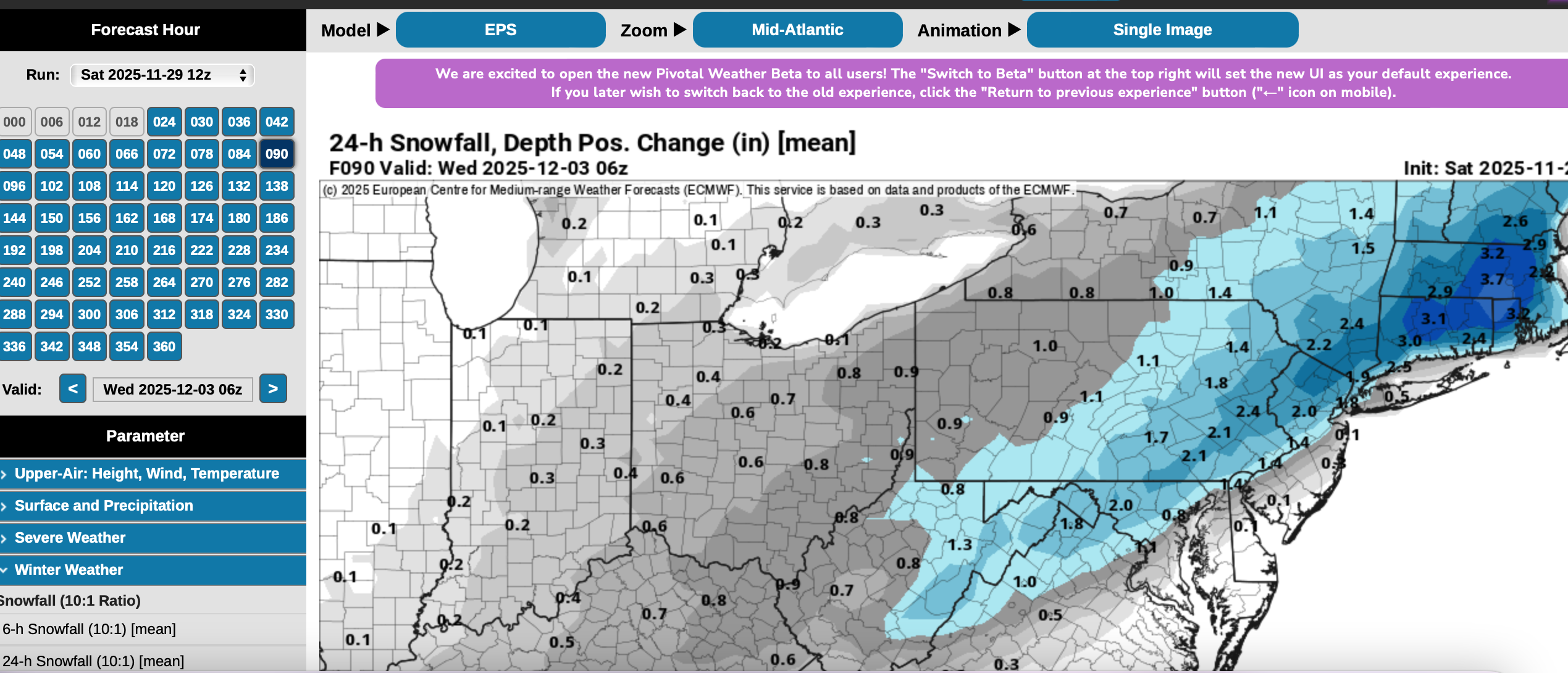
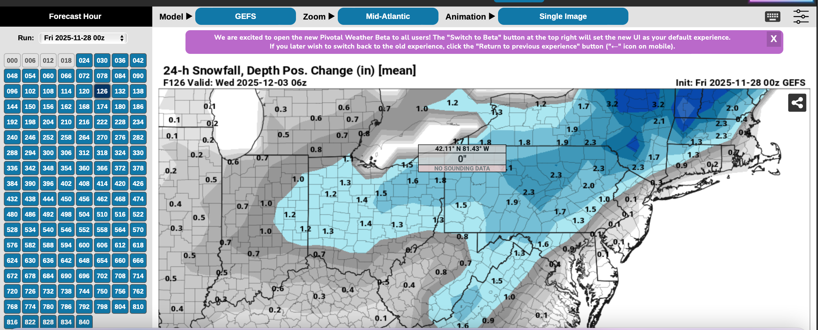
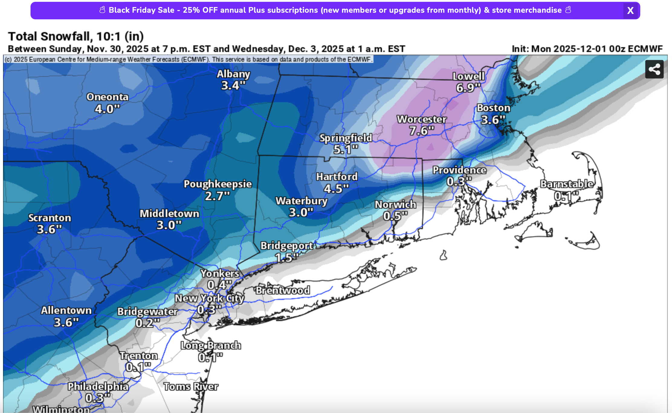
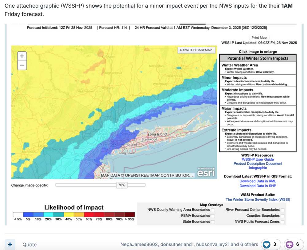
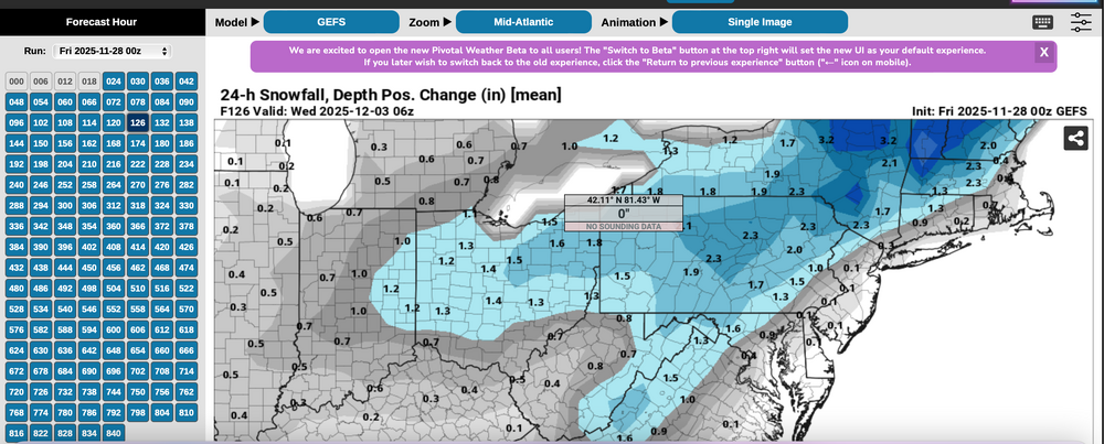
Indulge me for a moment on Thread reasoning despite the fact that all snow/ice was just inland from I95 and therefore missed the bulk of our members (no mPing sleet NYC). I say bulk of our members because I'm not sure we know how may are on here from coastal locations vs inland...I'm pretty sure its not 50 to 1. At Go time last Friday, a thread was made with the following basics. First the WSSI-P... MINOR impact. Yellow was the threat area and CORRECT with significant snow/ice during the morning-midday hours. I will use WSSI P yellow or higher probs for closer in threads during the future. We do have an ample amount of interior folk interested in winter activity. I hadn't heard anything negative from a moderator. So... the yellow thread area in the Friday guidance, even though a 40% threat for D5 is pretty decent for automated guidance. The numbers... plenty of beneficial rainfall for the coasts, AND the snowfall in the interior (doesn't show ice). Now, check the GEFS Modeled 24 hour Positive snow depth change!!!! against the the EPS same...except I could not go back to the Friday version, so I sued Saturday, but you see the EPS was HEAVIER AND WRONG. I hung may hat on what I thought was a better model. From my view: WSSI-P is a tool that should be used by all regarding impact. AND, the EPS (Ecmwf) is not as advanced as I thought it was.... This leaves the door open to more future choices... and am disspoiinted in EPS performance.


-
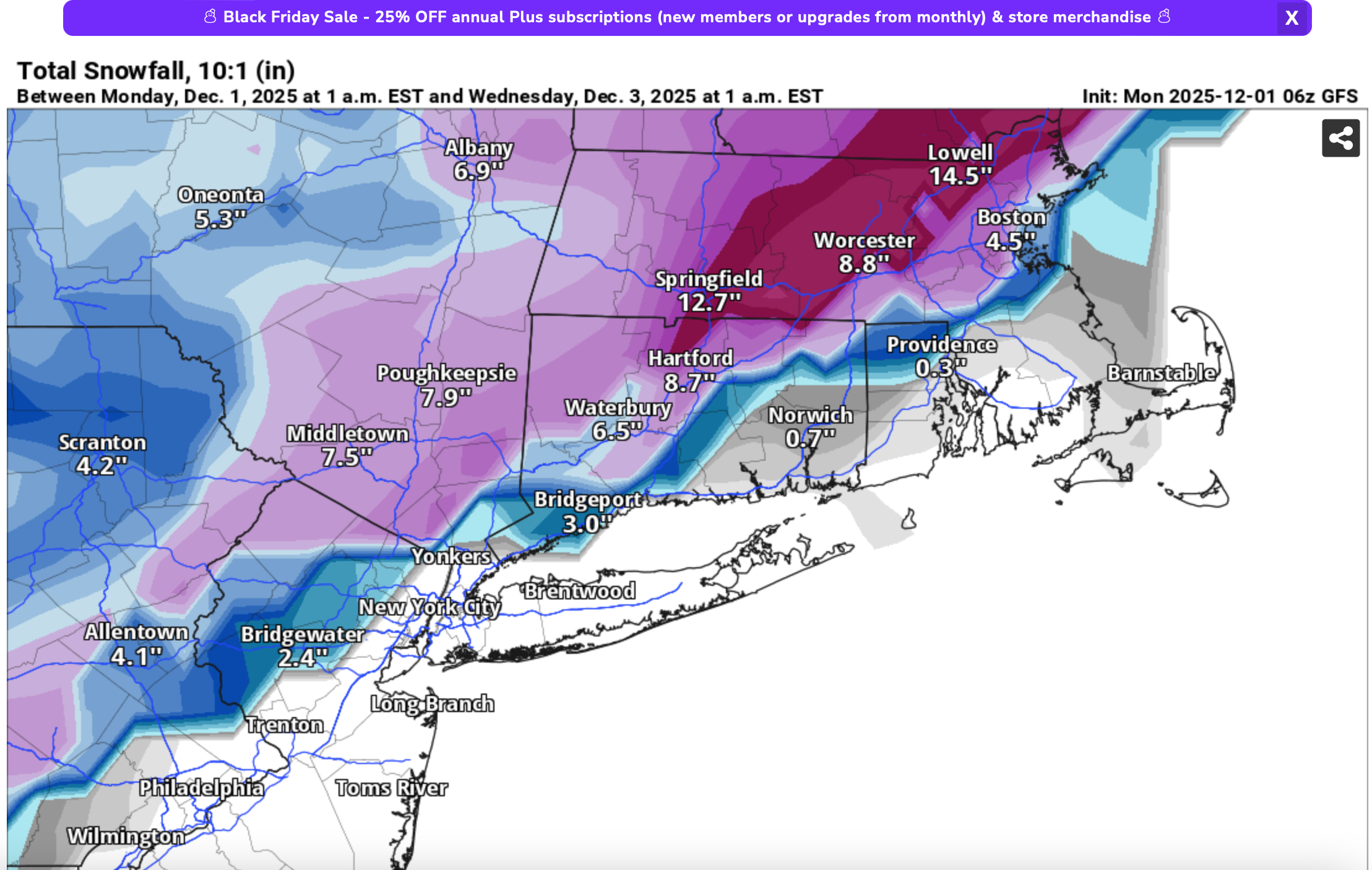
Reality check for one ensemble indicator: GEFS best and most consistent from 29/00z cycle through todays cycle on the se edge of the 24 hr positive snow depth change, and max axis snow depth change. EPS initially far too far se but slowly corrected Northwest. Ditto CMCE.
-
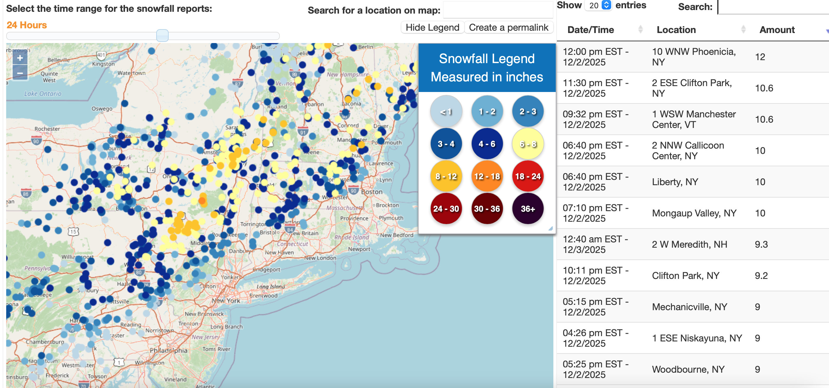
Wantage 2.3" mostly sleet at 1PM 28.8F.
-
Multiple reports in Wantage NJ around 2" just before Noon and still snowing.
-
Wantage NJ...this part 1.2". looks like general 1-1.5" in SC right now and down to near Great Meadows in Warren County where I think its mixed or ice.
-
fwiw... heading for nw NJ... a widespread area of mdt-heavy snow over ne pa and heading ne. vsby aob 1/2 mi there.
-
My guess is mPing will have multiple snow flurry - ice pellet reports I95 corridor including within 10 MI NYC at 12z... too warm for acc NYC and probably measuring too late 830AM. n/c to headline... not worth shortening up the time frame 6 hours or completely eliminating the coasts from spotty .1? - agreed highly unlikely coastal occurrence of measurable snow sleet. Mesoscale changes in wind direction due to strong Pres falls to our south could tuck in slightly cooler air toward 17z but for now... let it fly as NWS posted/overall modeled. will check back at 830A Tue.
-
all 12z modeling including the future FV3, REGEM, NAM and HRRR slightly warmer. not good for reaching forecast snow values unless we can get some decent snow increase rates by 18z.
-
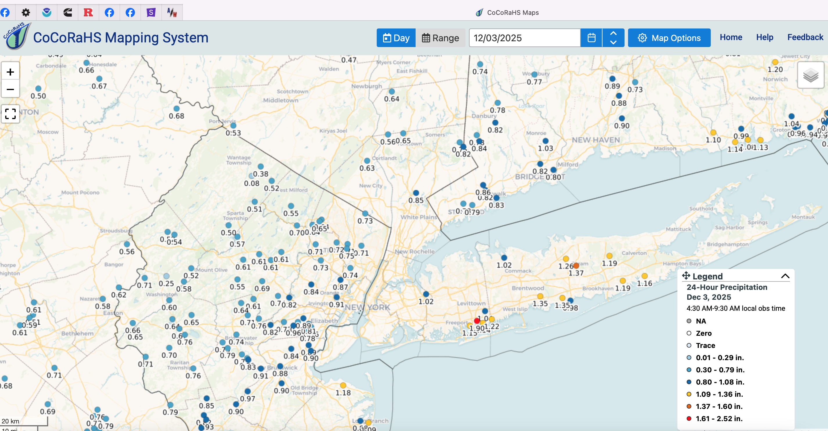
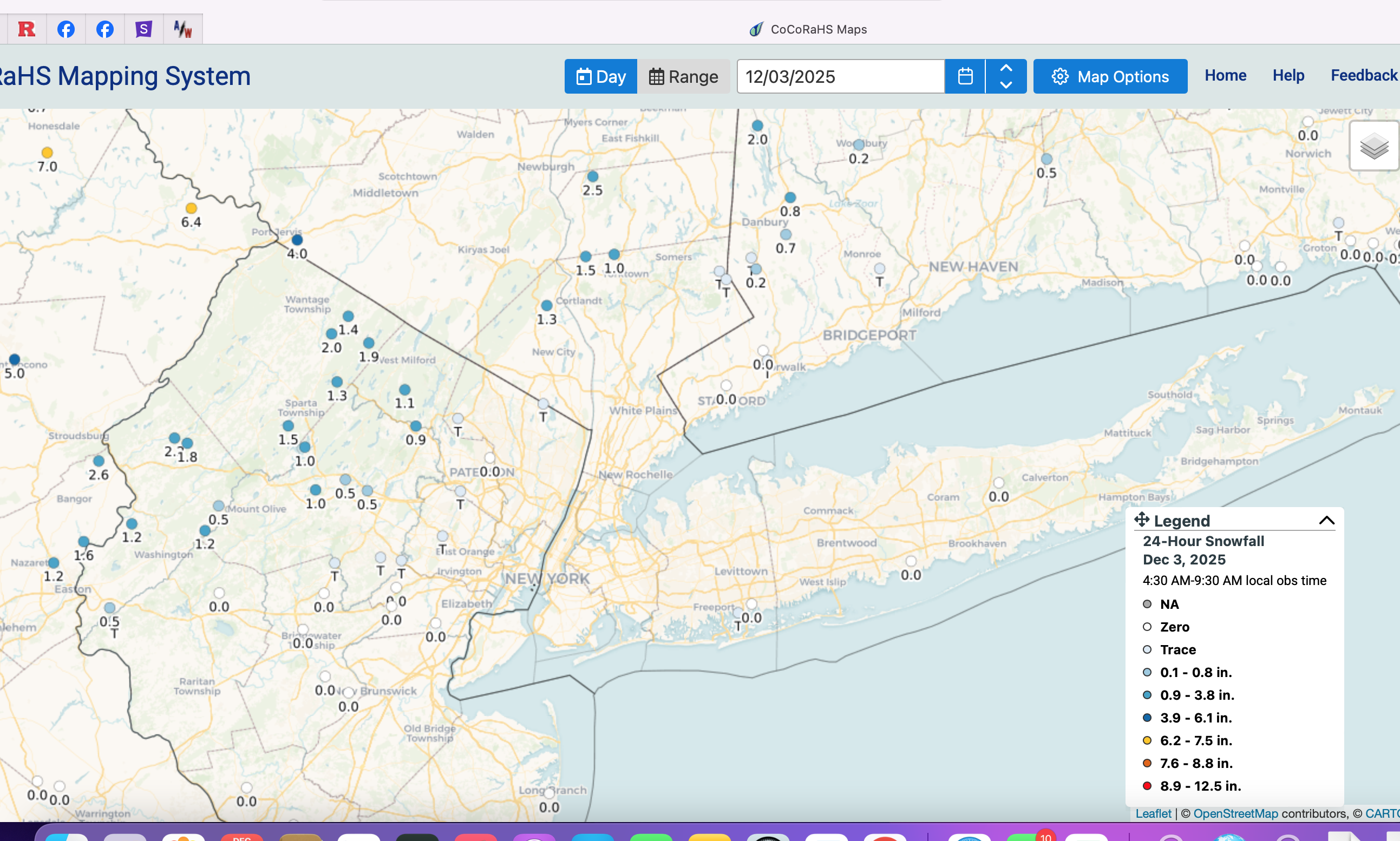
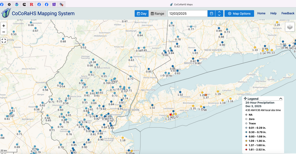
Forum moderators may still redefine the headlining thresholds. Have heard from one. I do not hide behind reiterating the obvious variabilities and I don't want to be too wordy.. come to bat...see the ball and give it my best swing at an encompassing useful set of info and go from there. No one should complain tomorrow if there are any morning delays. The complaints can be profuse if its overkill and I'll stomach the wrong headline. All the NWS and non-NWS tools that I know ion were balanced applied. We on the forum gave useful days lead time and information on how to consider a disruptive event even if for only a few hours whether air or sfc travel. mPing event coming to NYC I think despite the warmer cycles. NYC probably no go on measurable sleet snow due to temps at sunrise near 36. CoCoRaHs obs Wed am as well as posters and ASOS/AWOS will answer. For now... edge snow snow-sleet-ice just nw of I95.
-
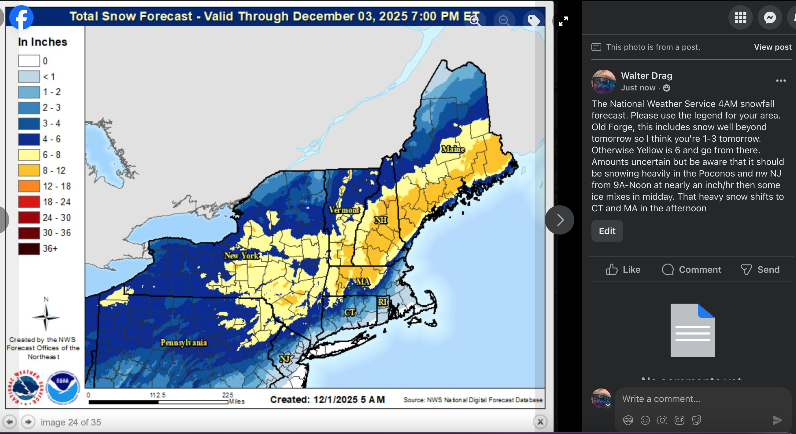
Added the NWS snowman that weren't into the 4AM forecasts, and the side bar notes are my opinion. Will check back at 5P.

-
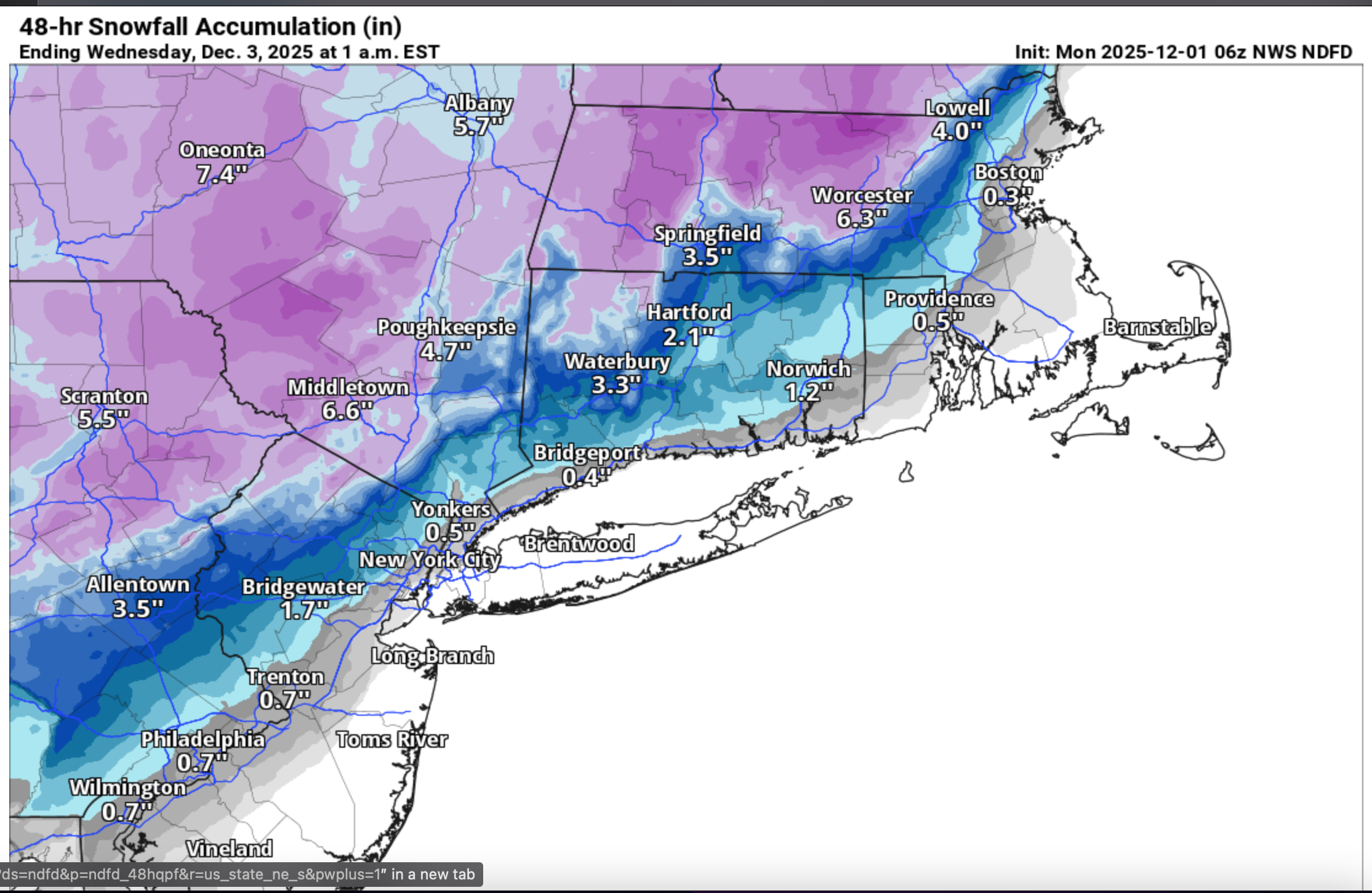
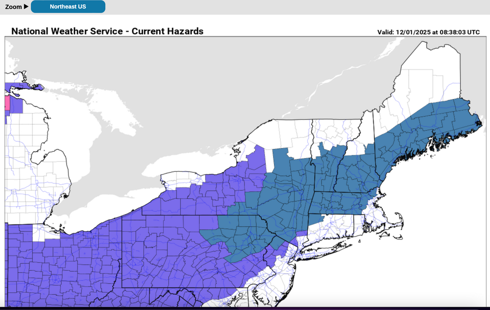
Regarding the NAM: I've no idea what will replace it or will it have a FOUS? That said... the NAM is a bit whacked. First it had very little south of I84 min earlier cycles, now its gone ballistic Poconos to BOS. I've not used this in my personal briefing. I do add for your interest, something that we can all evaluate with the Wed morning CoCoRaHs data. imo, play the numbers conservative. I do think 1"/hr snowfall rates from just north of KABE into nw NJ tomorrow morning 9A-Noon, then rain or mixed. mPing may be of value for NYC. 4AM advisory and watches in purple and blue. Then various model outputs from the 00z/1 cycle.


-
I've noted the adverse comments on storm interest. I'll review any MODERATOR impression on value added for this thread. This has been accurately portrayed in advance, I think, and the thread still looks pretty good as of 5AM today. Moderator just tell me if you dont want a headline for the forum on an event like this. Thanks... Walt
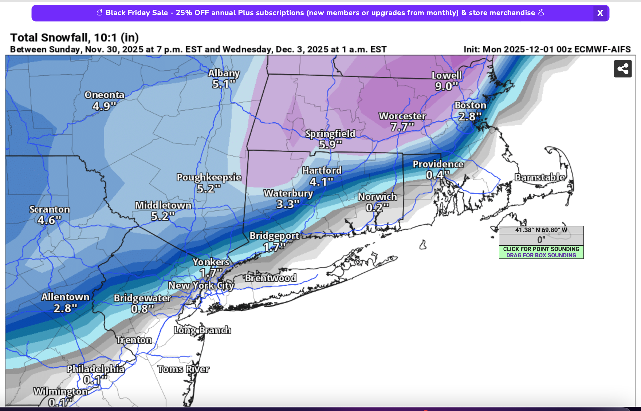
-
ECAI is NO warmer than its 06z version... holding firm, in the range of noise whether any 5-10 mi slight south adjustment is worthy of significance. What I aw was some slightly colder T/TD's compared to the 06z version... Not sure whether NYC CP can hit 40... looks slightly colder upper 30s mostly rain but am not changing anything in previous threadline or I95 considerations. Maybe tomorrow I'll adjust to a moderate impact 6" event nw hills NJ-Poconos through interior se NYS w CT and interior MA. I think a low improbability wet snow ice tree limb breakage zone might be from maybe Easton PA to Passaic-Morris County-HPN-IJD line where temps hover at or below 32F all day. and IFFFF 4+" can accumulate on trees and wires. Again low prob but depends on qpf and ptype. Still uncertainty on qpf amounts but strong fluxes with PRESFR as the low intensifies more than a mb/hr after 12z Tue, and so will have mixed ptypes both n/s of the general r/s line. mPing might be helpful.