

weathermedic
-
Posts
1,897 -
Joined
-
Last visited
Content Type
Profiles
Blogs
Forums
American Weather
Media Demo
Store
Gallery
Posts posted by weathermedic
-
-
From OKX AFD:
Have converted all winter weather watches to warnings,
and issued a winter weather advisory for Orange County, NY with all
this in mind. In addition, have elected to hold off on any blizzard
headlines at this time for eastern LI and southern CT, the areas
that are most likely to meet blizzard criteria. Given the increased
forecast confidence in only these latest runs, would prefer one more
cycle for that upgrade. Regardless, near blizzard conditions are
possible for eastern LI and southern CT for a period on Saturday
afternoon with this system.

Winds will also be an issue as the system nears the area as strong
northeast flow dominates as the system deepens in our vicinity. Gusts
to 35-45 mph are likely for a period Saturday afternoon, especially
for the coastal areas, where occasionally higher gusts are possible.
So near blizzard conditions are possible, especially near the coast,
where winds/gusts will be most frequent.
-
 2
2
-
-
I don't think it was mentioned yet but I could be wrong. I am guessing there will be thundersnow in a few places.
-
2 minutes ago, Ericjcrash said:
If you're on the coast expecting 14:1 ratios with that wind you're going to be disappointed.
I agree but remember the Boxing Day storm had good ratios and very strong winds but still managed to pile up.
-
2
-
-
Just now, Snowlover11 said:
Wow, huge jump back west. Aren’t these runs starting at 12z fully sampled as well.
Air recon supposed to take place in the Pacific later today. Don't know if that data will get ingested in time for the 12Z Euro/GFS suite.
-
2
-
-
They just shut the upper level of the Verrazano Bridge due to the wind.
-
2
-
-
Latest 1AM OKX AFD:
NEAR TERM /UNTIL 6 AM THIS MORNING/...
The latest surface obs and dual pol indicate snow/wintry mix
has changed to rain for NYC/NJ metro and coast, with transition
expected to work north through the interior overnight as
increasing E-SE flow should overwhelm any linger colder air,
taking until perhaps 3 to 4 am across Orange County.

Some locations received just under an inch before the snow
changed to rain in portions of the NYC metro and CT coast.
Seeing as much as 3 inches across interior portions of the Lower
Hudson Valley based on NYC mesonet, with snowfall rates
exceeding 1" hr. Most areas north of I-287 and the Merritt Pkwy
will see at least 2 to 3 inches of snow accumulation plus a
light glaze of ice, with Orange and W Passaic seeing as much as
4-6 inches of snow especially in the higher elevations, and a
few hundredths of an inch of ice.

A very tight pres gradient between the sfc low and retreating
high pressure out over the Atlantic, and strong upper
divergence/lift ahead of a negatively-tilted closed low lifting
through the Mid Atlantic region, will produce a band of strong
winds and heavy rain between 2 am and 7am from SW to NE. Cant
rule out some embedded thunder for LI as well, as noted off the
S Jersey coast, as of 1am. E Long Island and coastal SE CT
should see a pd of sustained winds 40-45 mph with gusts 60-65
mph, with areas to the west (mainly coastal SW CT, western Long
Island, and NYC) seeing winds just shy of those values,
sustained 25-35 mph with gusts 45-55 mph.

Temps overnight should rise to the upper 40s in the NYC metro
area and along the coast, and to the upper 30s/lower 40s inland,
except lower to mid 30s far NW areas.
-
Lightning showing up on radar east of Atlantic City.
-
1
-
-
Jones Beach Davis station gusted to 51 mph at 1240am
-
2
-
-
Two areas of interest east of the southern NJ coast on radar
-
1
-
-
Up to mid-upper 20s at coastal locations already
-
Up to 31 here in sheepshead bay. Looking like we will be spared any ice down here once the precipitation gets started. By that time temps should be above 32 for a while.
-
Ground colder and longer duration in the city than last Wednesday. Only difference might be if the precip starts later than last Wed which may give the coast time to get air temps above freezing. Although ground temps will take a while longer. Other difference is that it’s a Sunday morning and should have much less traffic on the roads. One final thing, most NYC roads are full of salt since sanitation was salting yesterday for hours after the snow stopped.
-
1 minute ago, MJO812 said:
LOL GFS
What's it showing? A blizzard or sunny and 60's?
-
 1
1
-
-
54 minutes ago, lee59 said:
The areas of black top and concrete must still be fairly mild in temperature as they seem to have about half of what is on car tops and grass.
Temp was 35 degrees at my house last night before the snow started so ground temps were above freezing, hence the much higher accumulations on the colder surfaces. Had 6-7 inches on the cars, picnic table, etc but only about 3-4 inches on the sidewalk/driveway.
-
3
-
-
14 minutes ago, MJO812 said:
View from my apartment
Sanitation is doing a great job with the streets around here .

Much less accumulations on paved surfaces here in Brooklyn
-
1
-
-
6.5 inches here in Sheepshead Bay
-
2
-
-
31 minutes ago, Amped said:
They don't have to. They're just going to be really sorry if they don't issue them for I95 and the city.
The majority of the general public does not know the difference between a winter weather advisory and a winter storm warning. All they hear is "snow is coming" It matters to weather buffs like us

-
3
-
-
From OKX Twitter feed:
Part of the concern with tonight/tomorrow's #snow is the timing. Short range models are signaling the potential for snowfall rates to exceed 1"/hour just as the morning commute gets underway. Treacherous roadway conditions are likely, especially early. If possible, avoid travel!
-
Latest OKX AFD:
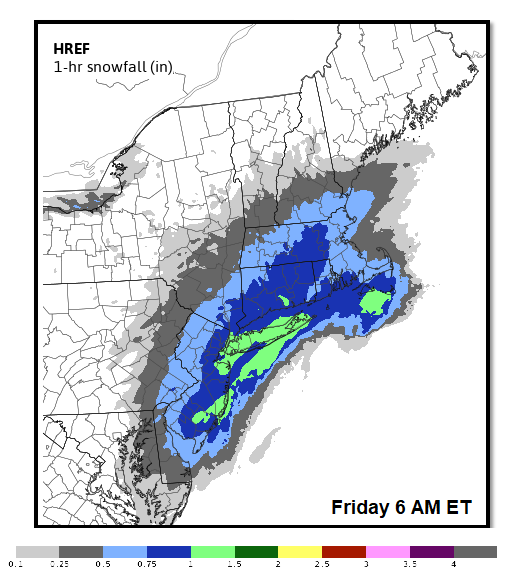
SHORT TERM /THURSDAY NIGHT THROUGH FRIDAY/...
The 12Z NAM, GFS, and ECMWF are all in good agreement with the track
and timing of low pres tracking se of the benchmark Thu ngt into
Fri. This would produce a 1-3 inch snowfall west and 2-4 inches
east. The fcst follows this thinking.

The overall model trend has been east with the sys, so it would not
be surprising to see a further ewd trend in future model runs. Any
trend w would produce more snow. Because of the trend, and current
snow totals blw advy criteria in many places, will not issue an advy
with this fcst. The snowfall potential will continue to be
highlighted in the hwo and idss briefing products.

Most of the snow will occur late Thu ngt into Fri mrng, which will
impact the mrng commute.
-
1
-
-
-
7 minutes ago, MJO812 said:
The little low today is ruining the storm. Suppressing the heights.
Nice storm for SNJ and parts of the Mid Atlantic
For our area, 1-3 inches is a good call unless the models trend favorable tonight and tomorrow.
Agreed. Main moisture transport is well out in the Atlantic (GFS) plus it's a quick mover.
-
1
-
-
NWS expanded the WWA to include NYC, Nassau and western Suffolk.
-
Freezing rain/drizzle over much of the area. Even in the city with temps of 33-34, some of the bridges and overpasses are beginning to get slippery. Especially Staten Island crossings.
-
 1
1
-
-
Flurries or what appears to be more like graupel falling in extreme SW Nassau County in Inwood just east of JFK.

January 28-30th Possible Nor'easter
in New York City Metro
Posted
Blizzard warning for Suffolk County.