

SchaumburgStormer
-
Posts
5,281 -
Joined
-
Last visited
Content Type
Profiles
Blogs
Forums
American Weather
Media Demo
Store
Gallery
Posts posted by SchaumburgStormer
-
-
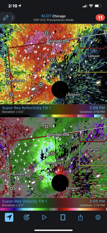
2 areas of rotation on the Burlington cell
-
Just now, SchaumburgStormer said:
This thing tightened up fast.
Basically on on top of LOT radar
-
Just now, janetjanet998 said:
not good
ULLETIN - EAS ACTIVATION REQUESTED
TORNADO WARNING
NATIONAL WEATHER SERVICE CHICAGO/ROMEOVILLE
207 PM CDT MON MAY 27 2019

THE NATIONAL WEATHER SERVICE IN CHICAGO HAS ISSUED A

* TORNADO WARNING FOR...
  NORTHWESTERN WILL COUNTY IN NORTHEASTERN ILLINOIS...
  SOUTHEASTERN COOK COUNTY IN NORTHEASTERN ILLINOIS...

* UNTIL 245 PM CDT.

* AT 206 PM CDT, A SEVERE THUNDERSTORM CAPABLE OF PRODUCING A TORNADO
  WAS LOCATED OVER ROMEOVILLE, MOVING EAST AT 35 MPH.

  HAZARD...TORNADO AND HAIL UP TO TWO INCHES IN DIAMETER.

  SOURCE...RADAR INDICATED ROTATION.
This thing tightened up fast.
Basically on on top of LOT radar
-
14 minutes ago, janetjanet998 said:
the SE IA disturbance is likely the trigger for the storms soon ahead of it or within it...in these set ups, very high 0-3 km CAPE , sometimes mini sups may develop within it...watch for higher reflectivity cores from DVN radar as a sign
If that is where our sups are coming from, storm it’s going to be a nightmare to chase.
-
12 minutes ago, RyanDe680 said:
I don’t see how the precip in central IL and SE Iowa won’t reduce this opportunity?. Seems that every chance we’ve had recently has been killed by morning convection. Any thoughts around this?
That chunk of storms is hauling ass. We will see how it plays out, but they should be well gone in a hour
-
69/64 in DKB with a sizable slug of storms to move through. Hopefully this won’t hold up the warm front, would like to see it push north of 88 for some hyper local chasing (familiarity of area/terrain) makes it much more enjoyable)
-
Going to head to Lasalle/Peru area later and set up shop. As cyclone said, good luck to everyone out and about today.
-
 1
1
-
-
31 minutes ago, RyanDe680 said:
Have to see how the activity near the river beats up the atmosphere
My bigger concern is the warm front getting hung up way south (as we have seen 1,000,000 times) and LOT ending up with boring rain and ruining a good local chase day.
-
2
-
-
22 minutes ago, RyanDe680 said:
Have to see how the activity near the river beats up the atmosphere
As long as a huge MCS doesn’t blaze through, it should leave plenty of nice boundaries for intensification.
-
10% hatched for northern up tornado probs. Been awhile since we have seen that.
-
1 minute ago, Hoosier said:
Just using the Kankakee forecast sounding as one example to point something out...
It's not one of those days with obnoxiously strong flow through the column, but it's certainly sufficient along with the nice CAPE. This is a nicely sheared forecast sounding with good turning with height all the way into the mid levels.

It just takes one discrete cell to take advantage of that and we will have a big one. Likely will chase locally tomorrow.
-
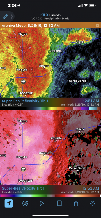
Good amount of damage in the Argenta-Oreana area in Macon county from last night. Luckily my parents had no damage, but quite a bit of large tree damage throughout town. May have spun one up pretty quickly along the line as it passed over Oreana.
-
May be cycling. Last grab on velocity didn’t look as good.
-
-
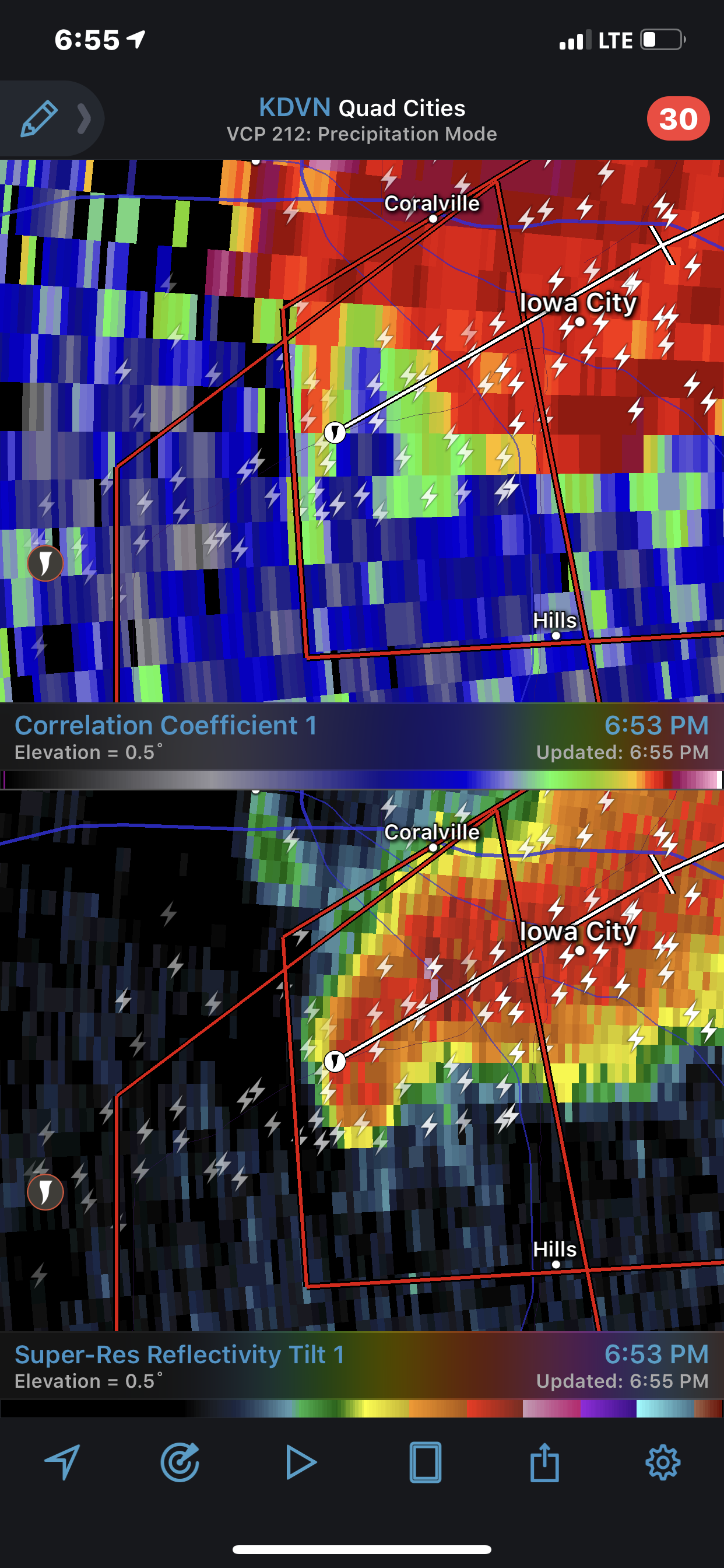
Iowa city is going to have a serious problem if this doesn’t cycle. Still a tight couplet
-
Strong tornado tracking to Iowa city
-
Full sun in RFD
-
1
-
-
1 minute ago, metallica470 said:
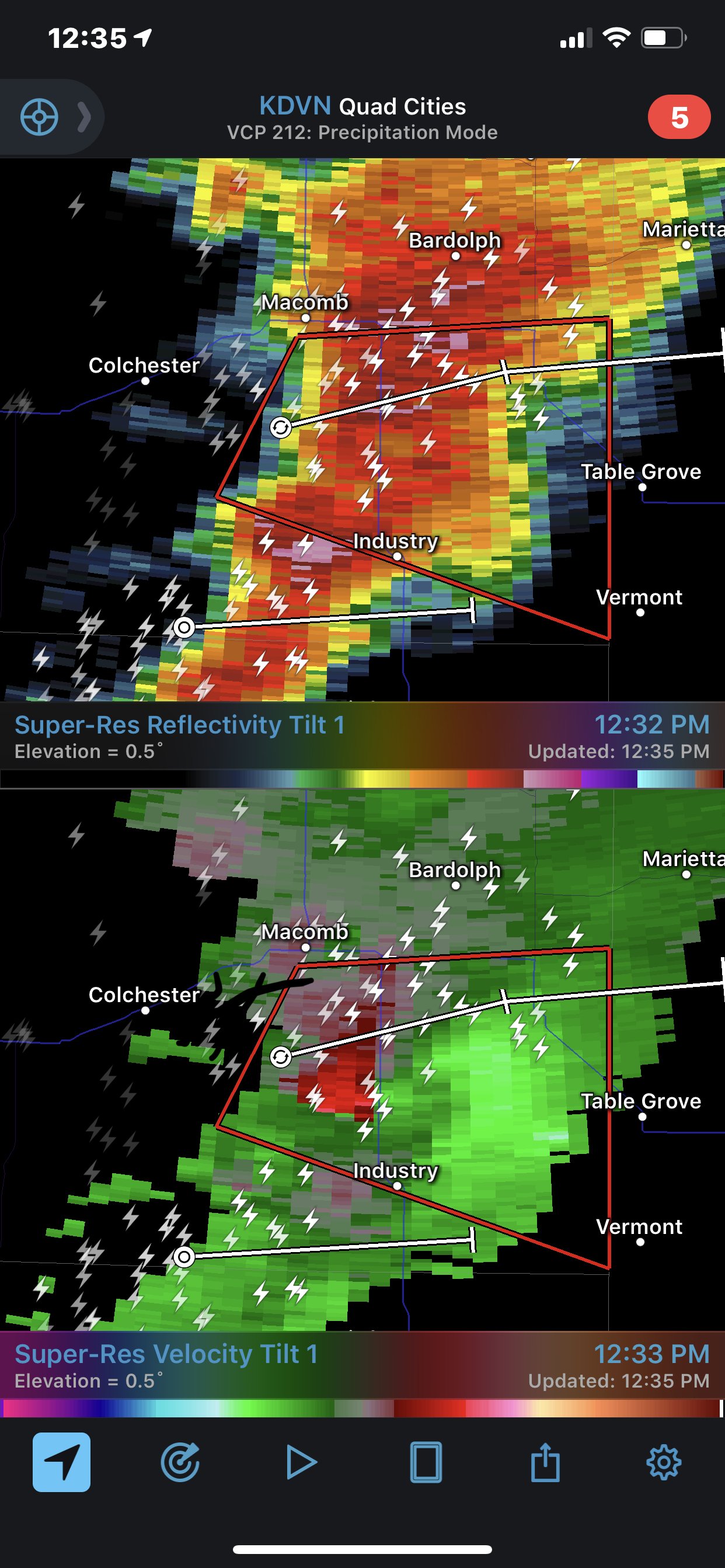
New warning says confirmed tornado over Lewistown
Velocity doesn’t look great at the moment. May be cycling
-
Hopefully this thing stays south of Lewistown. One of the bigger communities in that immediate area
-
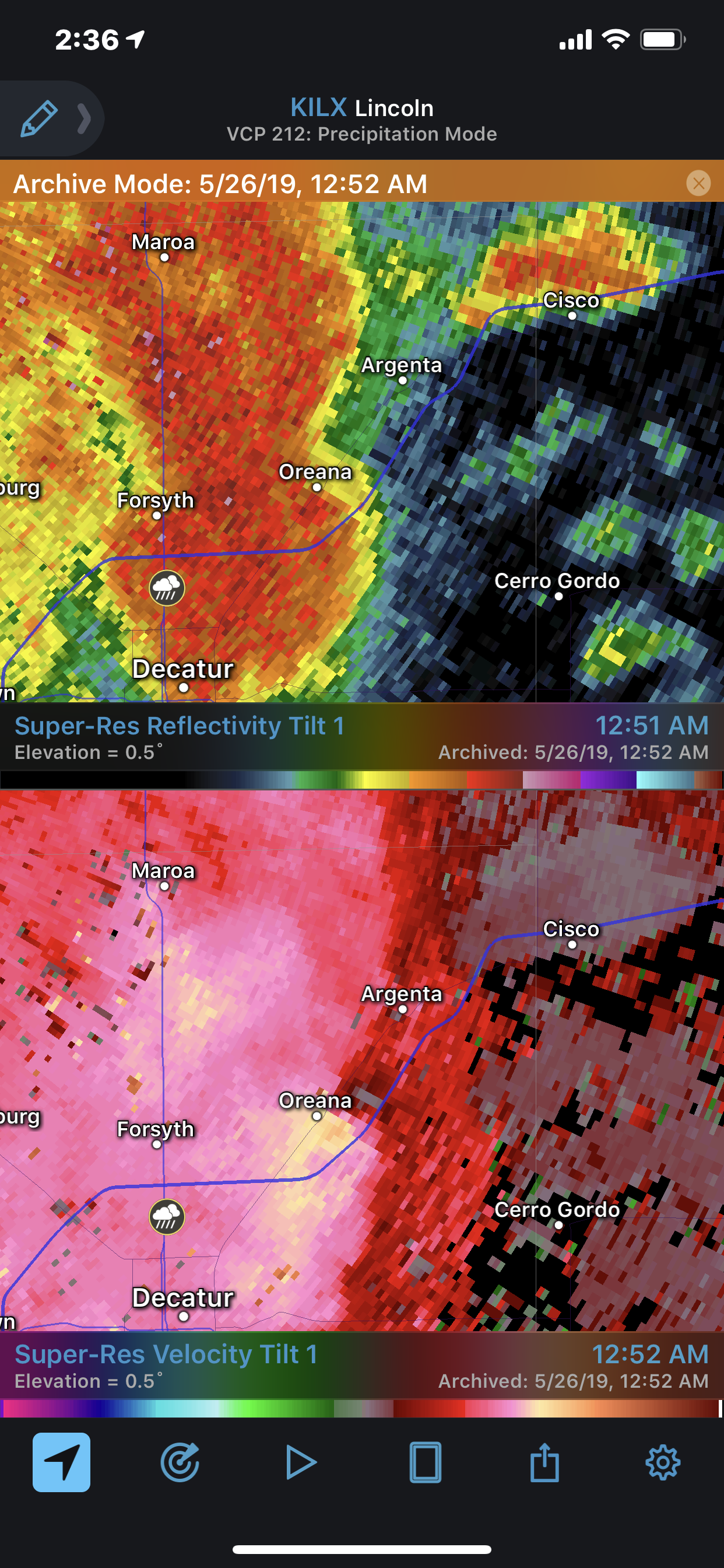
Cell near macomb will be heavily rain wrapped if it produces
-
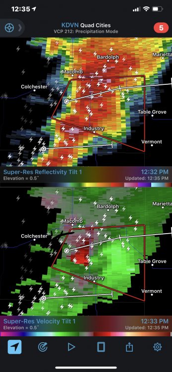
Rotation continues to tighten up on the Macomb cell
-
9 minutes ago, janetjanet998 said:
TOR warning for that cluster in western IL...becomng surface based with a small area of clearing ahead of it
BULLETIN - EAS ACTIVATION REQUESTED
TORNADO WARNING
NATIONAL WEATHER SERVICE QUAD CITIES IA/IL
1145 AM CDT FRI MAY 24 2019
THE NATIONAL WEATHER SERVICE IN THE QUAD CITIES HAS ISSUED A
* TORNADO WARNING FOR...
EASTERN HANCOCK COUNTY IN WEST CENTRAL ILLINOIS...
SOUTHWESTERN MCDONOUGH COUNTY IN WEST CENTRAL ILLINOIS...
* UNTIL 1215 PM CDT.
* AT 1144 AM CDT, A SEVERE THUNDERSTORM CAPABLE OF PRODUCING A
TORNADO WAS LOCATED NEAR WEST POINT, OR 7 MILES SOUTH OF CARTHAGE,
MOVING NORTHEAST AT 40 MPH.
2 separate nice areas of rotation on that storm
-
-
Cell near Lebanon has some tight rotation/couplet


May 27-29 Severe Potential
in Lakes/Ohio Valley
Posted
May need a warning for that area over Kirkwood