DopplerWx
-
Posts
3,398 -
Joined
-
Last visited
Content Type
Profiles
Blogs
Forums
American Weather
Media Demo
Store
Gallery
Everything posted by DopplerWx
-
Brad P noted that this will likely be the first year since 1933 that CLT hasn't dipped below 60. Crazy stat as our avg lows now should be around 55 right now. Are some low dew points too much to ask for!?
-
gfs finally showing some cold fronts coming down around the 27th. euro showing it too. would be nice to get our first crisp morning around the first of october!
-
12z gfs has no 50s (or even lows 60s) thru the end of the run.
-
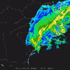
watch the radar, it is moving wnw, storms dont travel in a straight line. *click to animate
-
recon shows a near due west turn over the past 3 passes. https://www.tropicaltidbits.com/recon/
-
per the most recent recon pass the center as already begun the turn.
-
yeah, a lot of wishcasting it into northern nc it seems. literally every model shows a nw drift followed by a west southwest turn.
-
3k nam is ridiculous, widespread 10"+ totals inland and still raining late saturday.
-
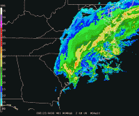
you can see the slowdown and slow drift westward here https://radar.weather.gov/radar.php?rid=MHX&product=N0Z&overlay=11101111&loop=yes
-
center tightening up and convection firing around the center now that she is over the gulf stream, several models showed strengthening as it approached the coast and took the left turn. https://www.tropicaltidbits.com/sat/satlooper.php?region=06L&product=ir
-
got a link? EDIT: nevermind, found it https://www.surfline.com/surf-report/oceanana-pier/584204204e65fad6a7709992
-
3k nam just offshore wilmington at 15hr. shows the core really tightening up as it approached the coast.
-
euro and gfs not far off, euro just a bit more offshore but both take very similar paths.
-
of course joe had to put the loop with a possible emergence off the northeast coast lol.
-
agree, western eyewall looks really good now, recon about to head thru it too, lets see how the winds have responded. https://weather.us/satellite/692-w-301-n/top-alert-superhd-1min/20180912-1243z.html
-
when is recon going back in? haven't had a flight since this morning?
-
ended up a tick slower than the 12z gfs but pretty close to the same landfall location.
-
identical to the gfs at 48 EDIT: now it is a bit further east at 54.
-
yep gfs south and west thru 36 as well.
-
great post, thanks for the verification maps. looks like it will all come down to that turn and how far the ridge stretches.
-
fv3 has shifted sw significantly the past 3 runs, comings towards the EPS solutions of a myrtle landfall. i think we see the eps score a coup here as models continue to converge on myrtle over the next 72hrs.
-
that is yesterday's run
-
gfs pretty far east this run, wtf?
-
posted in main thread but it is south of nhc track. https://media.giphy.com/media/wHZcnh2bTCBA2f0a8i/giphy.gif
-
if im on the sc coast the 00z EPS would reinforce the fact that preparation is vital. the nhc cone is there for a reason.