DopplerWx
-
Posts
3,398 -
Joined
-
Last visited
Content Type
Profiles
Blogs
Forums
American Weather
Media Demo
Store
Gallery
Everything posted by DopplerWx
-
charlotte to raleigh, toss in the towel. not sure we even see snowflakes at this point. writing is on the wall.
-
yea this isnt good for clt to rdu. lp inland and this will be a cold rain.
-
encouraging to see the icon bring the snow line south finally.
-
good find, yeah that's probably about right.
-
i know but i remember in jan 2017 every single ensemble member showed 12"+ for rdu, and i was thinking that there was no way they would all be wrong on temps. and they all were and we got a sleetfest.
-
yep, climo says no and we are dealing with marginal cold at best. anyone outside of the mountains that has their hopes up needs to save themselves a lot of heartbreak and expect rain. any snow falling before christmas is a win. these clown maps are ridiculous and they give people the expectation of monster totals, when in reality even an inch of snow in early december would be amazing.
-
for our decent storms the warm nose doesn't bring us back down to reality until 48-72hrs out, so to see this so early is not good. mountains and foothills are understandably excited but if anyone thinks CLT and RDU aren't in for a classic screwjob you're mistaken. That 2017 snow/ice map is probably going to be close to reality for this event.
-
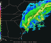
rain snow line is just north of clt it looks like at 120
-
gotta be careful to not let your weenie out.
-
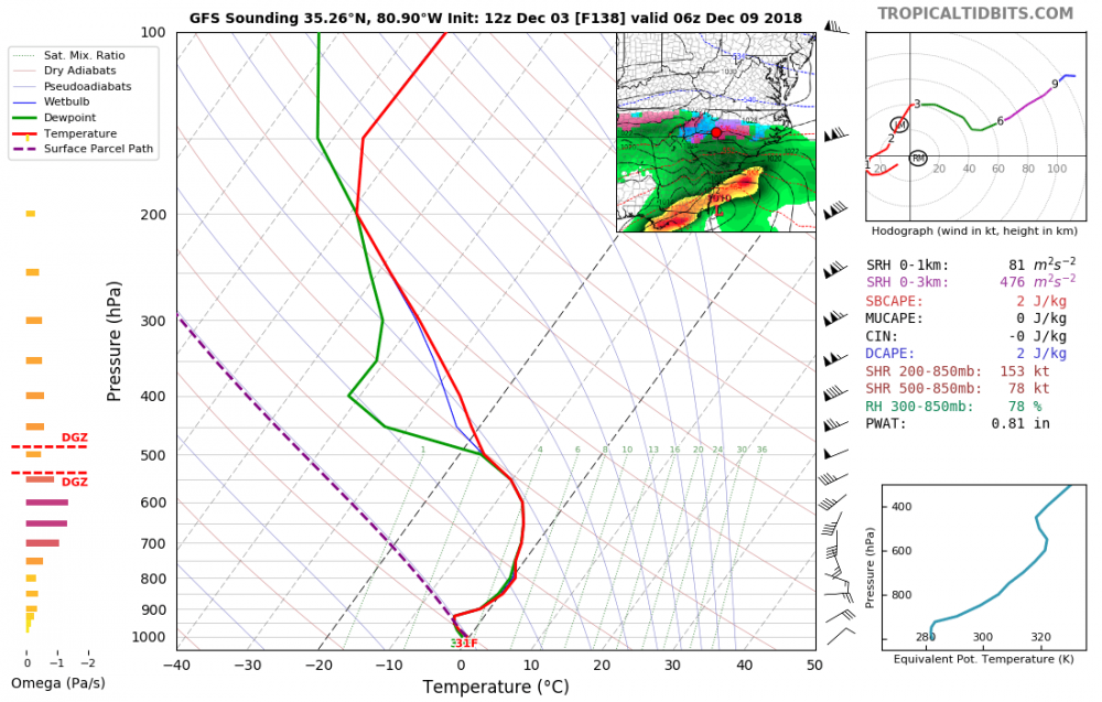
a little better than i first thought for CLT on the 12z gfs.
-
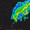
soundings for clt aren't good verbatim. a lot of sleet and frz rain with plain cold rain to start.
-
31 and sleet for clt in the middle of the storm.
-
good lord, i cannot imagine.
-
what a nice storm to welcome you back to the SE snow reality. hoping for the best but expecting the worst.
-
that is one thing that gives me a little hope, if we can get cad to over perform we will be in really good shape as qpf doesn't look to be an issue at all.
-
if we got even half the fantasy storms models showed 150hrs out for our area we'd have snowfall totals similar to buffalo. we will likely find a way to screw it up.
-
agree. we have seen so many times the past few years to take these clown maps with a grain of salt. expect mainly sleet and rain and then any snow you get will be a bonus. i don't care if every ensemble shows 12"+ (see RDU in Jan 2017), I won't expect a thing until snow is actually falling and accumulating. nam should be able to sniff out the transition zones and problem areas around 36-48hrs out.
-
lp location is nearly identical to 18z, hp just not cutting it
-
much warmer at 144, nice cold rain for much of nc.
-
looks like some amazing fall weather coming in behind michael friday, lows in the low 50s thru the weekend! FINALLY some crisp nights!
-
thinking the cold front showing around the 15th may be legit, will be one heck of a shock to most when/if we go from 80s and humidity to highs in the upper 50s and lows in the 40s!
-
don't even need a cold front, just getting us to near average would be a godsend. crazy our avg lows now are in the low to mid 50s! by 10/14 our avg low will be 49 and we likely won't even be sniffing upper 50s! brad p tweeted earlier that september was so warm in charlotte that it was warmer than 73 of the July's on record. (1878-2018).
-
yea i noticed it wasn't quite as hellish this morning, but still i would love some true fall dewpoints.
-
euro and gfs thru the end of the run are STILL ridiculously warm. this sucks.
-
he meant for the month of september. sorry i meant to say no temps below 60 for the month of sept.