frd
-
Posts
6,969 -
Joined
-
Last visited
Content Type
Profiles
Blogs
Forums
American Weather
Media Demo
Store
Gallery
Everything posted by frd
-
Given the proper set up it could have been a SECS, but alas the Pac did not allow it. At that time we did have a - AO and a -NAO. But the PNA was upgly.
-
Happens every year around the 22 nd of December like clockwork. Not surprising really, although we have a stout - WPO there is too much Pac jet momentum. The Pac always rules as seen the past two weeks with a - AO and a - NAO and still nothing to show for it. I don't really care what folks say about climo as we had extreme cold air in Canada and a - AO and a - NAO, but in December you need a good PAC and a + PNA . We lost out because of the PNA.

-
Euro seasonal is warm generally in the January to March period.
-
He rebranded!
-
GEFS also trending to a better, taller + PNA, hope it happens !
-
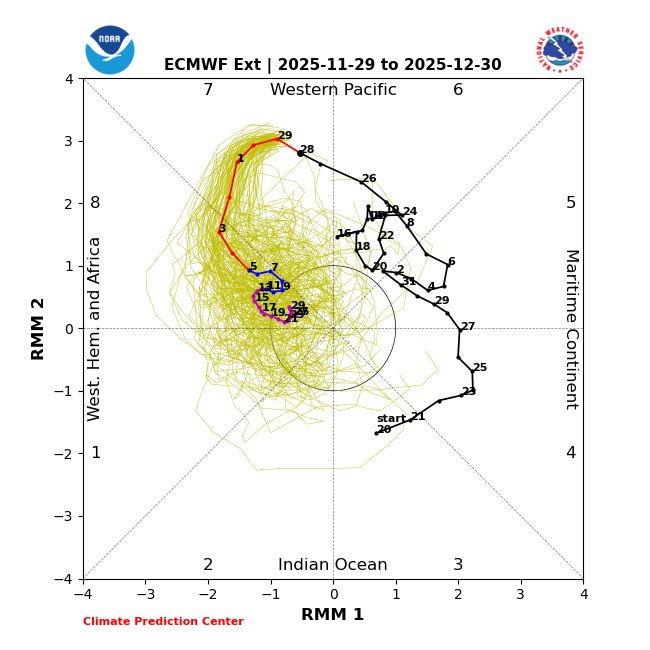
General odds of a moderate accumulating snow, at least should increase, the next 15 to 25 days with the - SOI dive and a re-set of the MJO.
-
Snow started here an hour ago. Nontreated surfaces have a coating currently. Looks winter-like. 27 F.
-
Rather dramatic drop in the AO forecast during the past 24 hours.
.thumb.png.323b78f0c4d57ef685159b4b80548620.png)
-
Update Dec 1
-
One slight bright spot is the AO is finally starting to drop, but the PNA sucks.
.thumb.png.82356425c93448d69cb2012897b16446.png)
-
This has been an ongoing issue for many years it seems. Believe even @bluewave posted on this a while back. And, its even more of an issue down in these parts. Need a locked in slowly moving high not racing due East.
-
Mount Holly for my area late week. Brrr Thursday Night Partly cloudy, with a low around 19. Friday Partly sunny, with a high near 33. Friday Night A chance of snow. Cloudy, with a low around 26. Chance of precipitation is 50%.
-
I keep checking bluesky to see whether HM ( aka Anthony M. ) posted any updats regarding his December weather thoughts. Not seeing anything. I know someone posted a while back he was enthused for this Jan.
-
Active and cold = I can dream.
-
That looks consistent with yesterday's I believe, or the day before. But, consistency does not prove accuracy in this case. Although maybe the ensembles here are better than the AI model itself.
-
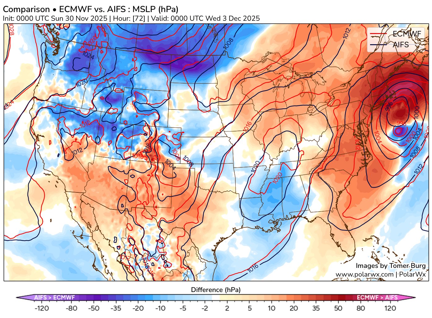
Interesting observation about the AIFS deterministic model by Tomer. ( for future reference ) Tomer Burg @burgwx 2h So far this case seems to be more of an AIFS Ensemble than an AIFS deterministic success (at least on the synoptic scale) - the AIFS quickly trended more amplified and now has a stronger and farther north cyclone than the deterministic ECMWF:

-
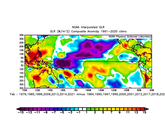
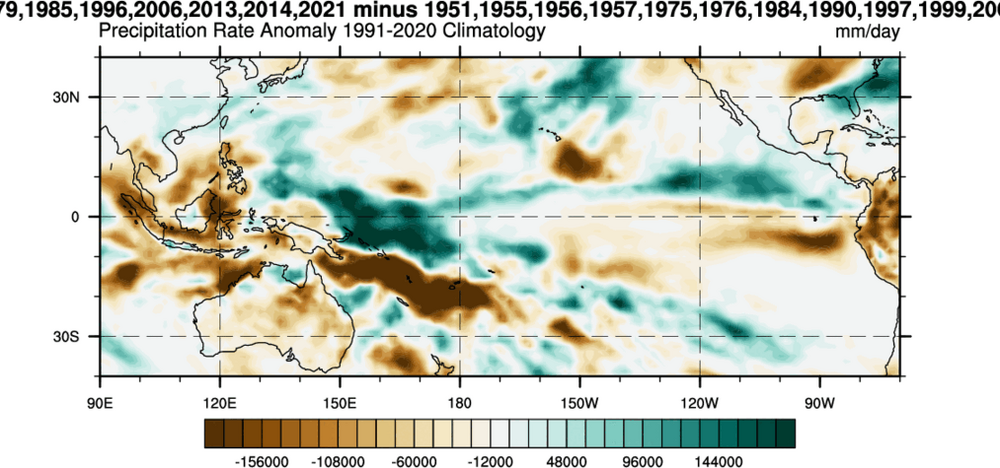
Eric Webb @webberweather 54m One key to this winter having a chance to break the -ENSO stereotype of a warm Feb in the E US is to nudge the IPWP eastward enough to focus convection just west of the Dateline in the Eq. Pacific Tropical Pacific OLR & Precip differences for cold vs warm -ENSO Febs in theE US:
-
I like this possibility. Mike Thomas @MikeTFox5 1h It's early! But definitely intrigued by next weekend. Compared to say, Tuesday, it is looking like a little better chance for the DC area. It's not perfect but again, it is a week out it doesn't need to be yet. Pattern wise definitely like that both -NAO and a 50/50 low are showing up in a lot of the modeling. Again, not perfect...the west could be a lot better and NAO could be more west based...but these are both features we are lacking with Tuesday so them showing up is a good start. Also of note is the Southern Oscillation Index, or SOI. One of my college professors loved the teleconnection that a sharp SOI dive was well correlated with East Coast storms. Well the SOI is forecast to take it's sharpest dive in at least 4 months around next weekend. So something interesting to keep an eye on!
-
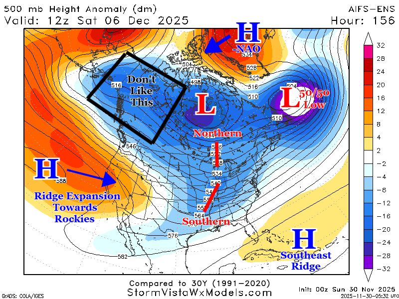
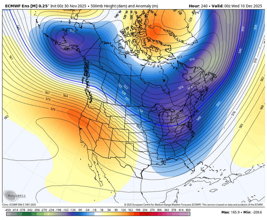
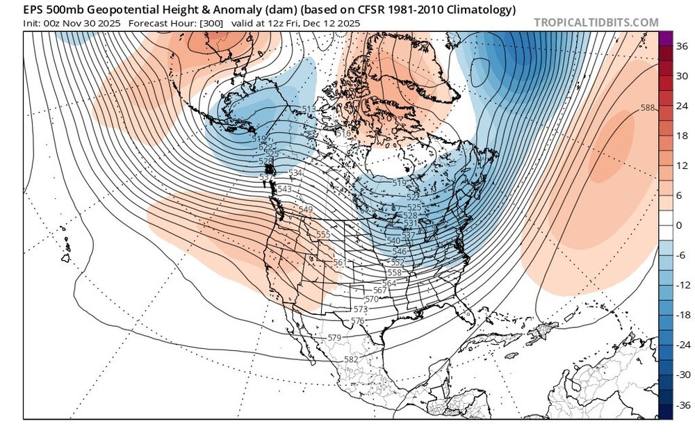
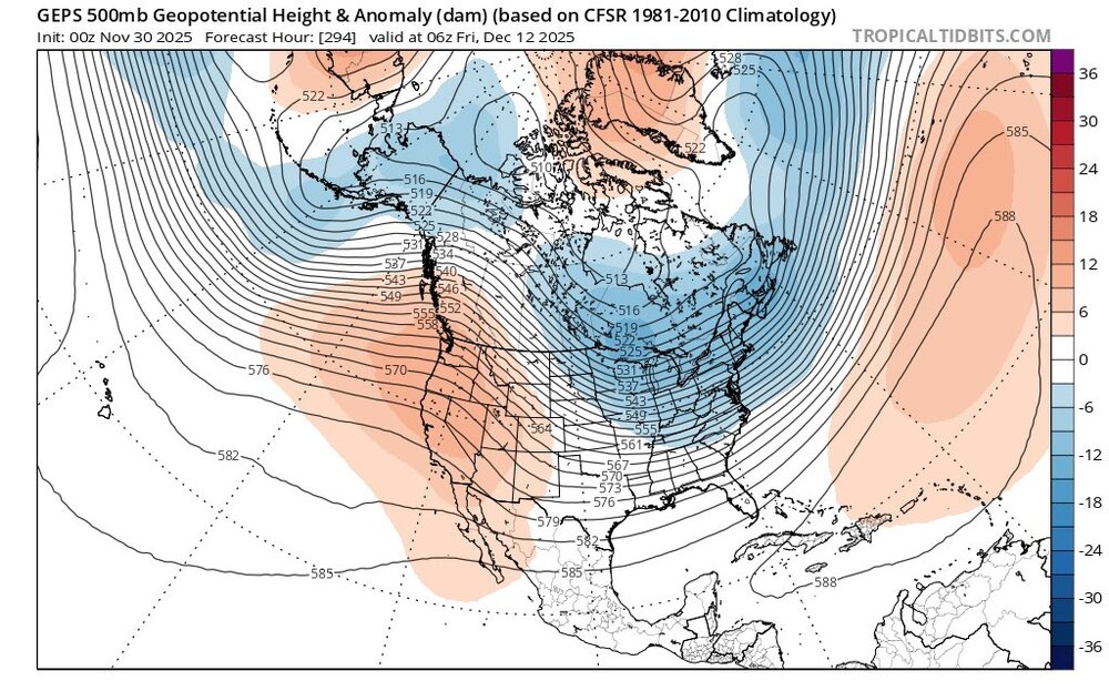
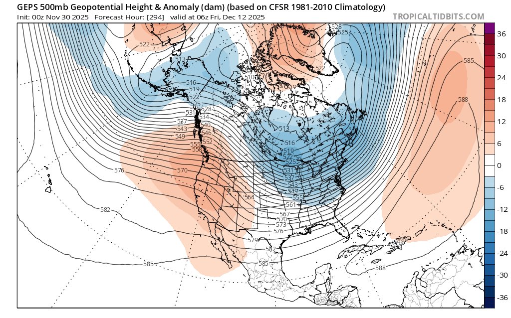
Close up on the 10 th. Wonder, and hoping, we get a better + PNA spike as we get closer to this time period.
-
Will not show the whacky GFS
-
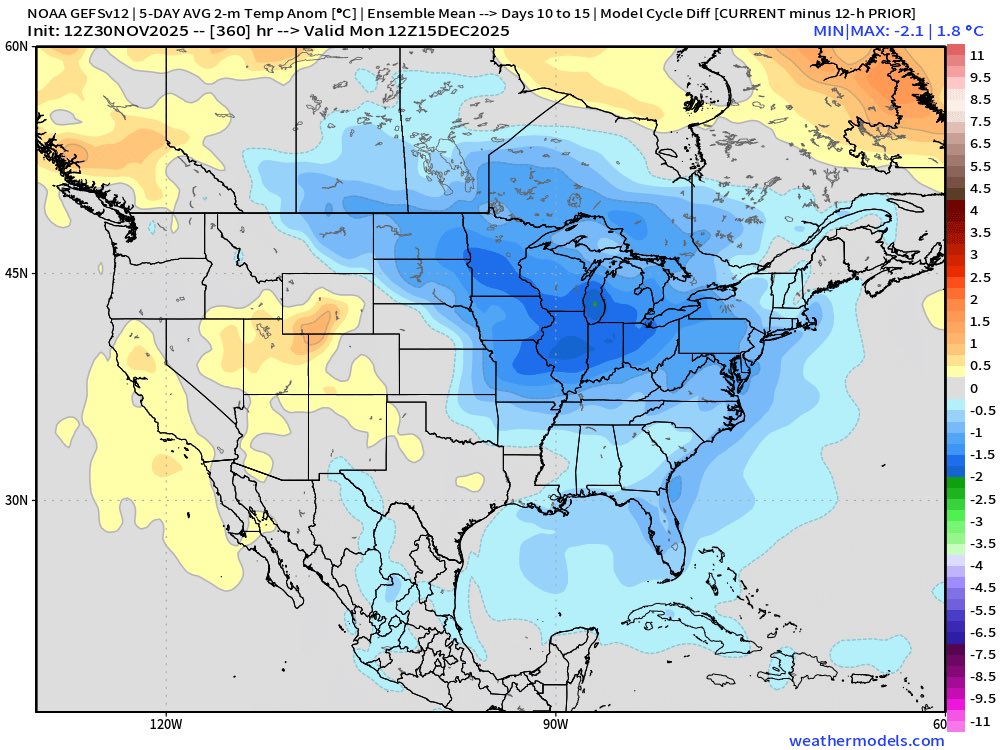
I see that in the modeling. Interesting I read the event was more of a reflective manner, and did not couple the SPV and the TPV. Of note is the current AO which despite Canada, and basically a large portion of North America cold, the AO has not dropped. Wonder if that changes going forward. I looked a couple days ago and believe long range modeling has the AO going negative.
.thumb.png.34e8ee1c06d472dab020d4714409ac23.png)
-
Here is the ext
-
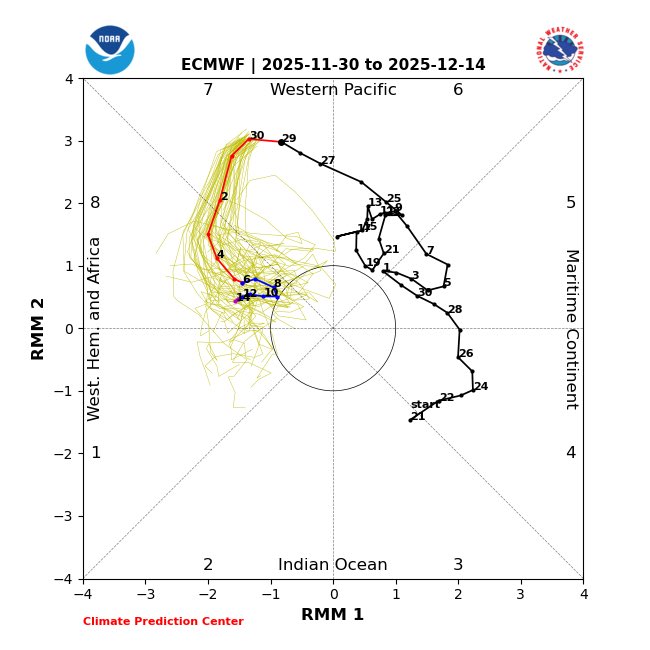
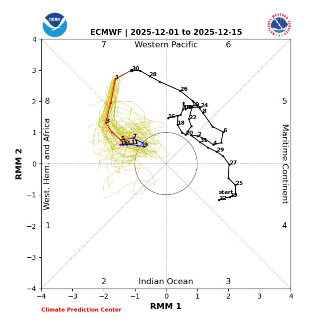
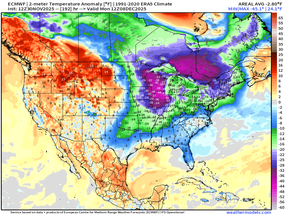
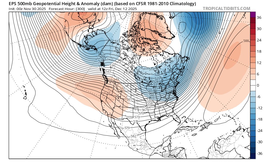
Looks so pretty. The weaker PV presently, and the MJO progression, along with increasing Atlantic blocking associated with the general background state actually support this cold and possibly snowy look in the East during December.


.png.1ad15cdd1219285a915289b710dd00fc.png)

.png.2aba82d76d9a5a02c1376403455ba699.png)

.png.5af30b1ed3915e1ee3b2489b13679234.png)