frd
-
Posts
6,229 -
Joined
-
Last visited
About frd

Recent Profile Visitors
9,159 profile views


-
Mount Holly mentioned this area a little while ago. Stated modeling did not do a good job with this feature. Appears to be holding together on its way East.
-
.NEAR TERM /THROUGH SUNDAY/... A few changes with this update. An MCS tracking through Pennsylvania has held its own as it rides the MD/PA border approaching Hagerstown. CAM guidance has been pretty awful handling this feature, but with a tongue of good DCAPE out ahead of it, there is a chance that this MCS could make it to our area or at the very least produce some showers. Added some 15-20% chance of showers/thunderstorms for portions of SE PA, northern DE, and southern NJ. Timing this out, the MCS would get into our SE zones just after 11 PM and into NJ around midnight. Also seeing some convective cells in far northern NJ, but these should move out shortly. SPC added the area ahead of the MCS into a Marginal Risk.
-
Looking ahead to next weekend, the next best chance for rain. Weekends recently have been on the wet side, if not wet, then clouds have ruled. Mount Holly AFD Next system begins approaching from the west Thursday night, but only a slight chance of showers currently expected. Lows mostly 50s. Chance of showers continues to slowly increase Friday on southwesterly flow ahead of the next system. Still warm, but clouds and any showers may hold temps back, with highs mainly mid 70s, 60s Poconos and coast. Front looks like it stalls in the vicinity with a relatively high chance of showers Friday night thru Saturday, but just chance pops still. Lows 50s, highs low 70s.
.gif.933a2295fb6186936ad9c082860c7d82.gif)
-
Many farms in the area applied fertilizers and compost, with the wind in the air, it really smells in these parts.
-
Early May ( 2 nd to the 4 th ) appears to be the first time significant humidity and dew points visit the Mid Atlantic. Also, might time well with next oppurtunity for significant rainfall.
-
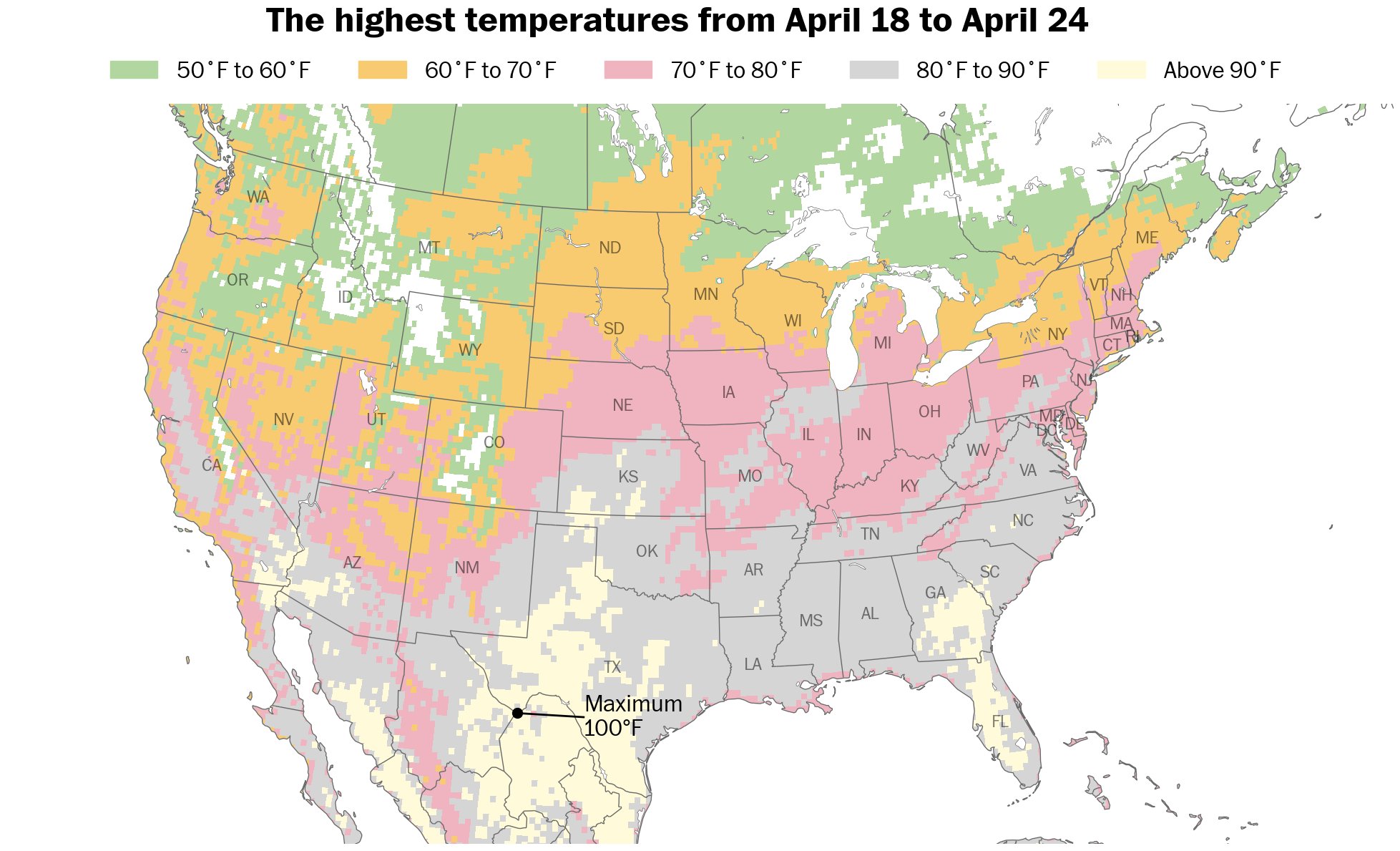
No, just referenced to many areas seeing 80 degree temps. Couple days next week look super nice!
-

-
Was pretty this morning, excellent walking weather for the dog park. 100 % sunshine and not too much wind, however, now it is windier and there are some clouds . Checking in on the surf zone, still mighty chilly. Ocean temp 49 degrees. Brrr.
-
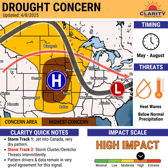
I believe it might have been a tad more West into the Plains versus the Midwest. At least a couple sources I follow were targeting the Kansas, Nebraska and Oklahoma for a developing and worsening drought as the summer starts. Midwest is going to get more rain soon.
-
-
35 here. Coldest morning until Fall arrives. Now the warmup begins
-
Yes, it was windy yet again.
-
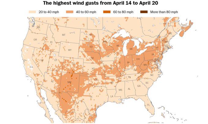
Winds forecast globally. May to July 2025

-
As per X our area is under some of the coldest air on the planet. ha ha, but OK. Way to go JB you nailed it bro.

-
Damn a gust front advisory leading to a special marine warning pecial Marine Warning ANZ530-531-538-539-152045- /O.NEW.KLWX.MA.W.0028.250415T1845Z-250415T2045Z/ BULLETIN - IMMEDIATE BROADCAST REQUESTED Special Marine Warning National Weather Service Baltimore MD/Washington DC 245 PM EDT Tue Apr 15 2025 The National Weather Service in Sterling Virginia has issued a * Special Marine Warning for... Chesapeake Bay from Pooles Island to Sandy Point MD... Chesapeake Bay north of Pooles Island MD... Chester River to Queenstown MD... Patapsco River including Baltimore Harbor... * Until 445 PM EDT. * At 245 PM EDT, gust fronts were located along a line extending from near Gunpowder River to 10 nm southwest of Fort Smallwood State Park, moving southeast at 25 knots. HAZARD...Wind gusts in excess of 48 knots. SOURCE...Radar indicated. IMPACT...Boaters could easily be thrown overboard by suddenly higher wind and waves capsizing their vessel. Boats could suffer significant damage in high winds. * Locations impacted include... Fort Smallwood State Park, Pinehurst, Turkey Point, North Point State Park, Magothy River, Hart Miller Island, Dobbins Island, Gibson Island, Bodkin Point, Tolchester Beach, Worton Point, Pooles Island, Spesutie Island, Love Point, Gunpowder River, Sandy Point State Park, Baltimore Light, Northeast River, Sevenfoot Knoll, and Chester River. PRECAUTIONARY/PREPAREDNESS ACTIONS... Move to safe harbor immediately as gusty winds and high waves are expected.