96blizz
-
Posts
2,530 -
Joined
-
Last visited
Content Type
Profiles
Blogs
Forums
American Weather
Media Demo
Store
Gallery
Everything posted by 96blizz
-
Tossin’ weenies!!!
-
Just quoting myself from Saturday.
-
What a wonderful day this has been.
-
Add the hires Canadian to the mix...
-
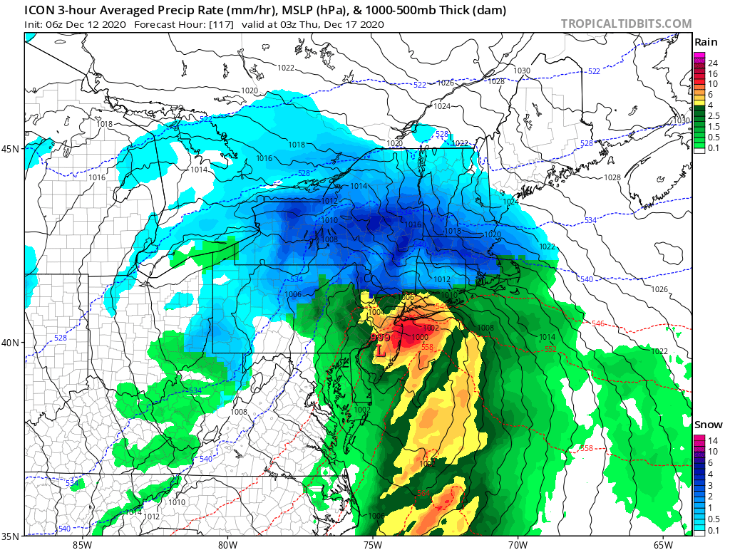
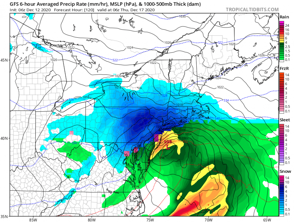
12z GFs is NW of 6z already.
-
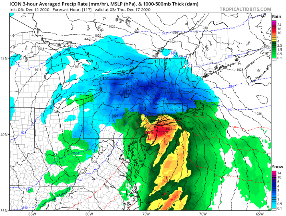
ICON buries us. Lol
-
RGEM is even further N than 6z.
-
Lockstep Wolfie!
-
Ratios will matter if this happens. Still a ways to go...
-
The nyc crew is going bonkers. Lol
-
“Was it over when the Germans bombed Pearl Harbor!!!!” We got this today boys. The NW climb continues!!!
-
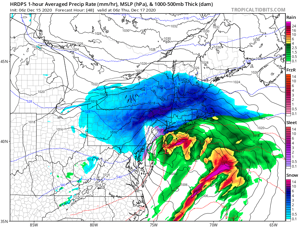
RGEM came north too (not enough for us). I 95ers back to the ledge! Lol
-
We still have the icon. 18z smokes us lol.
-
EPS
-
EPS are really nice. Don’t give up at all!
-
-
Solid shift NW on 6z euro.
-
Oh it’s happening. They never learn.
-
Ukie keeping us alive!

-
My apologies. Missed the (c). please note my post was at 5:30AM pre coffee. Lol
-
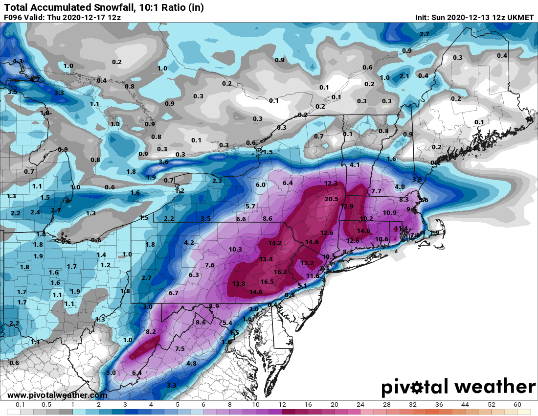
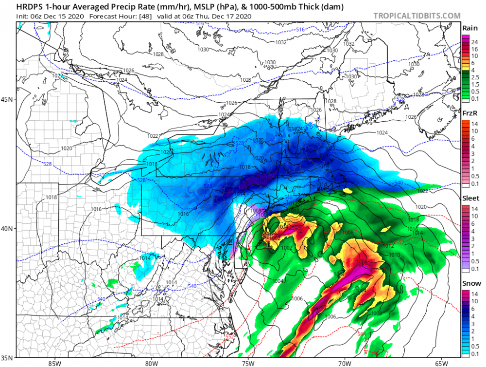
Then, for Wednesday night there remains some model spread. The GFS is waffling a bit from run to run with how far north the low pressure system and subsequent precip shield will get Wednesday night...the 00z run shifted back south slightly. Meanwhile, the 00z ECMWF and it`s ensemble members actually shifted the low and axis of heavier QPF/Snow a bit further north and west with the 00z run. The 00z CMC remains a compromised between the GFS and ECMWF. All 3 models show a closed 700mb low...but differ on its track. For this forecast used a blend of WPC/ECMWF and GFS then made minor edits. This gave QPF amounts of 0.75 to 1.30 inches across the southern tier and all of NE PA. Still feeling confident that ptype will be exclusively snow for our entire area, with very cold air in place...in fact as we wet bulb out and the steady snow begins, it`s likely temperatures will generally be in the upper 10s to mid-20s through the event. This should get snow to liquid ratios on the order of 14-18:1. Again, confidence is increasing that a swath of heavy snow will impact at least a portion of our forecast area...but exactly where this sets up remains to be seen. It`s still too early to pin down any storm total snow amounts from this potential storm, as it`s about 3.5 days out...but probabilities for 6"+ are increasing across NE PA and the Southern Tier/Catskills of CNY. Meanwhile, a tighter gradient is showing up on the NW edge of the system, with low snow totals noted by the latest guidance along and north of the NY Thruway...of course there is still potential for this storm system to shift further north...or south, which would greatly impact potential snowfall totals. https://forecast.weather.gov/product.php?site=BGM&issuedby=BGM&product=AFD&format=CI&version=1&glossary=1&highlight=off
-
And then there’s the stubborn EPS. Despite no Op runs of any model showing this - enough members must blitz our area for this. Until this changes, I will remain interested.
-
GFS is going to be better for us by a lot. My buddy may be on to something. NW trend y’all...
-
Lol. I’m not gonna bug him. You can extrapolate on geography, right! He’s a great guy and I will always try to get his thoughts for us. Check out his site if you’re in the FLX
-
My buddy runs www.flxweather.com and put together this EPS trend for Ithaca NY. Pretty cool graphics and reason for us to stay positive. Will try and get him here for some of us N and W posters. he even texted me and said “I may need to add an 18”+ category.”