rimetree
-
Posts
1,650 -
Joined
-
Last visited
Content Type
Profiles
Blogs
Forums
American Weather
Media Demo
Store
Gallery
Everything posted by rimetree
-
The weather barrier is starting to get old now. At this rate, the "desert of Maine" will be encroaching on my backyard. 2.37" of rain since August 26. Keep looking for signs of a shake-up but that doesn't seem to be in the cards. At least the lows have consistently been in the 30s now with some frost most days.
-
Should be coldest night so far. Down to 38.5F. Surprised we hit 35.6 this morning for first frost...totally expected a breeze to interfere.
-
First 30s of the season here...36.9F. Hoping for at least a frost this week. Maybe Thursday has a chance.
-
-

September vibes - Last 90s for some, 1st frost for others
rimetree replied to tamarack's topic in New England
Maybe turning the page to more active mid-month? Hopefully the first real autumn cold shot anyway. -
Went to check out the page and it initially timed out but then loaded. I've kept a personal record in the past but think I'll join this year. Thanks for keeping this going.
-
September vibes - Last 90s for some, 1st frost for others
rimetree replied to tamarack's topic in New England
Flipped on the mini-split to heat mode last night. Too cloudy and cool to hold temps at a decent level, and this old house still has some weird wool insulation from like the 50s that's not cutting it. Probably need to look into something else. 55/52 -
September vibes - Last 90s for some, 1st frost for others
rimetree replied to tamarack's topic in New England
Broke .26" for the month after 19 straight days of 0.0. Cool and raw sitting at 58F. Fall is here. -
September vibes - Last 90s for some, 1st frost for others
rimetree replied to tamarack's topic in New England
Holy crap it's raining -
September vibes - Last 90s for some, 1st frost for others
rimetree replied to tamarack's topic in New England
Not as good as 07-08 but would gladly take the snowfall result from 13-14 -
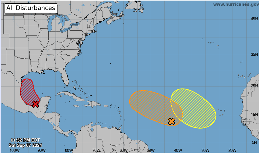
Nice fall color showing up down in the tropics
-
September vibes - Last 90s for some, 1st frost for others
rimetree replied to tamarack's topic in New England
83F nice summer vibe today. -
3.88" for the month and the first 2 days were 90+ but nothing since then. Wouldn't be surprised if that's it for 90s this year...currently at 14. Last year had only 4 while 2020 had 25 of them.
-
49F...first 40s since 6/16. Stepping down.
-
Everything side-stepped today until now. Picked up .4 in this batch so far.
-
In this period of the doldrums, watched the Eye of the Storm series on Discovery to fill the void. Some crazy footage I hadn't seen before from recent tornado outbreaks, hurricane Ida, Buffalo snowmaggedon, etc. Pretty good.
-
Will be driving back home from the Finger Lakes area on Saturday. Looks like it could be white knuckle most of the way.
-
Cells to the SW look to die quickly on approach. Stein in firm control here. Down to 80F with the sea breeze.
-
.04 so far today. Beats the .03 of the previous 11 days combined.
-
The deer flies and mosquitoes were a problem in June but have really been cut back with the dry conditions. Actually enjoyed dinner outside on the patio for the first time this summer and had no issues. Perfect weather with a light sea breeze too.
-
Just dumping right now. This was the sky about 25 minutes ago.
-
.04 today, .66 MTD yet the dews have been relentless. The only use for this is sitting on a deck by the ocean with a cold drink. 77/75
-
Avoiding the rains with precision this month...have .01 so far. Exposed areas of the yard definitely crispy now. 76/75 misery dews.
-
83/72 off a high of 86. Caved to the AC just now after running around getting BBQ and grill stuff done. Thick out there. Happy 4th!