

Birds~69
-
Posts
32,001 -
Joined
-
Last visited
Content Type
Profiles
Blogs
Forums
American Weather
Media Demo
Store
Gallery
Everything posted by Birds~69
-
Yeah, you missed out. It was like a couple hour death band...easily 1" rates and sometimes 2" I would think. Better luck next time year... 38F/Partly sunny
-
Sun out in full force with some blue skies, let the drip-drip begin. Wouldn't be surprised if I lose 50%+ of my accumulation this afternoon. We are getting drilled by the sun and 40 degree temps and from below since the ground was/is still warm. The only reason we received any significant accumulation was the insane rates... 38F
-
Watching Kathy Orr now and she was showing snow totals....Telford 8.9". Correct? Who knows? Sun really doing a number on any totals... 37F
-
Whoever is in the path of this....good 1"+ stuff. Edit: I think some 2" rates...
-
This will be a 2"+ batch that's going to roll through soon....going to be cool along w/the wind. 32F
-
I can see this thing done for the burbs by 10-11am and some sun by 2pm or earlier. Gotta get you stuff in now...it's trucking.
-
Back to pancake size flakes from sleet...this alley is pretty nice.
-
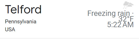
It's still raising hell out there (pings galore), wind as well. Hope I kick back to snow. Like Telford, I've been going through rain, snow, big time sleet, frz rain....right now Telford Frz rain. Hell, just call out or show up this afternoon...
-
-
-
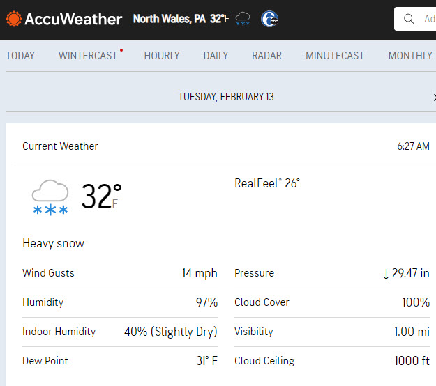
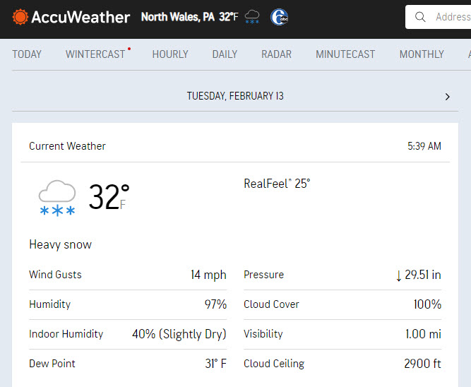
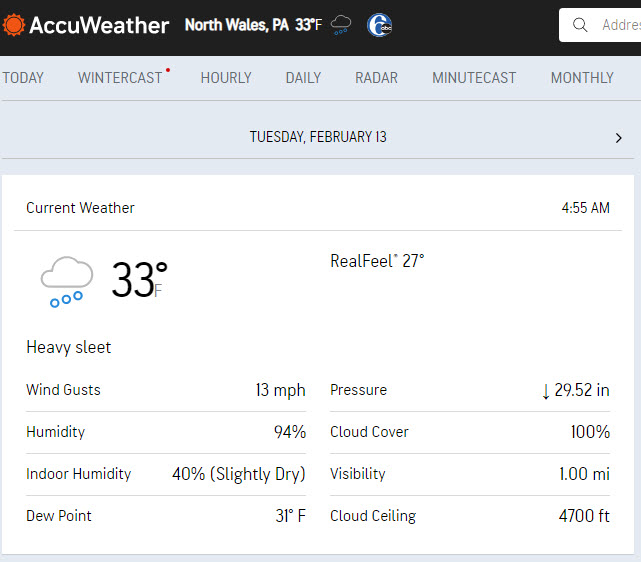
Odd, I was at 34F w/snow...now, 33F w/heavy duty sleet pegging the windows. Just watching Fox29 news and the guy traveling around in Allentown w/sleet as well...
-
33F/snow Spotters to my N/W/E in the 2-4" range at 4:40am...
-
That didn't take long for a complete changeover...34F.
-
Sleet and a flakes mixing in...34F.
-
Latest update, NWS really cranking the winds in my area...cool.
-
Snow line slowly but surely moving south.... 36F/Rain
-
We're ahead of changeover schedule. Just ticked down to 36F/Rain...

-
Looks like the snow line is ready to hit Allentown if it hasn't already... Steady rain/37F
-
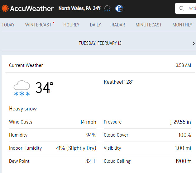
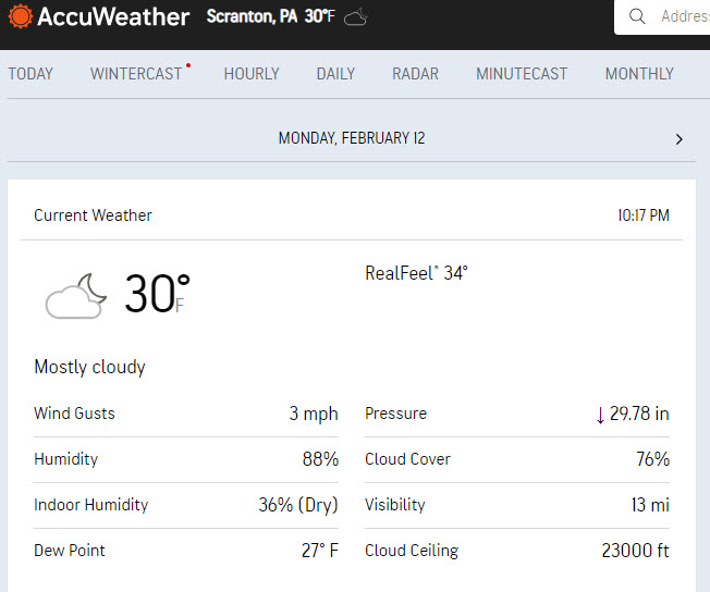
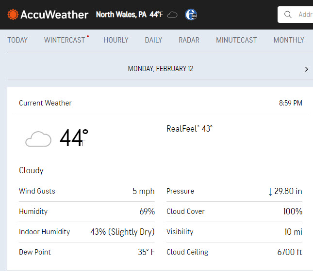
42F here...Scranton down to 30F so colder air around.
-
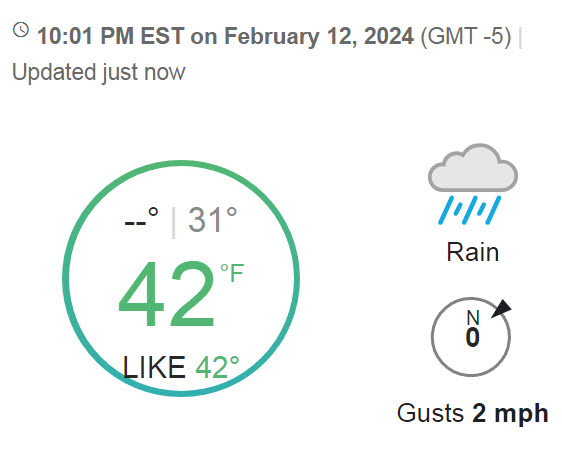
WV radar and stuff/yellows are building heading our way, it kinda looks on schedule. Down to 43F. If I'm in the 30s by midnight and radar is filling in I'd consider that a win...
-
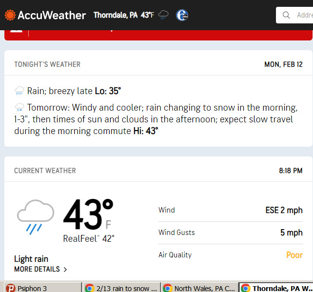
Messing w/you. Could be graupel or minor hallucinations? Happens to the best of weenies. Thinking some frozen stuff mixing in/changing by 3am for the far burbs, by 5am for mid/upper Mont/Bucks counties and 6am+ for Philly and lower Mont/Bucks counties. The earlier the better of course... 44F/light rain
-
Must be hail, it's 43F...
-
Some drips starting to fall... 45F
-
Down to 44F...at least it's starting to make its move.
-
So would I!! Thing is, the 3 major networks snow total maps are in the same general area and it's not just 1 network. I think they are pretty much locked into this. This kind of setup is difficult to predict snow amounts...

