-
Posts
26,552 -
Joined
-
Last visited
Content Type
Profiles
Blogs
Forums
American Weather
Media Demo
Store
Gallery
Everything posted by WxUSAF
-
Only 1 out of 51 with nothing
- 2,509 replies
-
- 2
-

-
- weenie fest or weenie roast?
- weenies got roasted
- (and 2 more)
-

2024 Valentines Day Who the Hell Knows - Comeback Thread
WxUSAF replied to DDweatherman's topic in Mid Atlantic
Wtf crazy uncle Ukie -

April 8th Eclipse- Last Easy One To See In My Lifetime
WxUSAF replied to Interstate's topic in Mid Atlantic
Trip to Austin booked and paid -
Seeing an MJO chart is starting to make my eye twitch
-
@yoda is 900 years old and we’re losing him
-
5” DCA, 7” BWI, 8” IAD all with mixing. 16” Mt PSU. Final call
- 2,509 replies
-
- weenie fest or weenie roast?
- weenies got roasted
- (and 2 more)
-
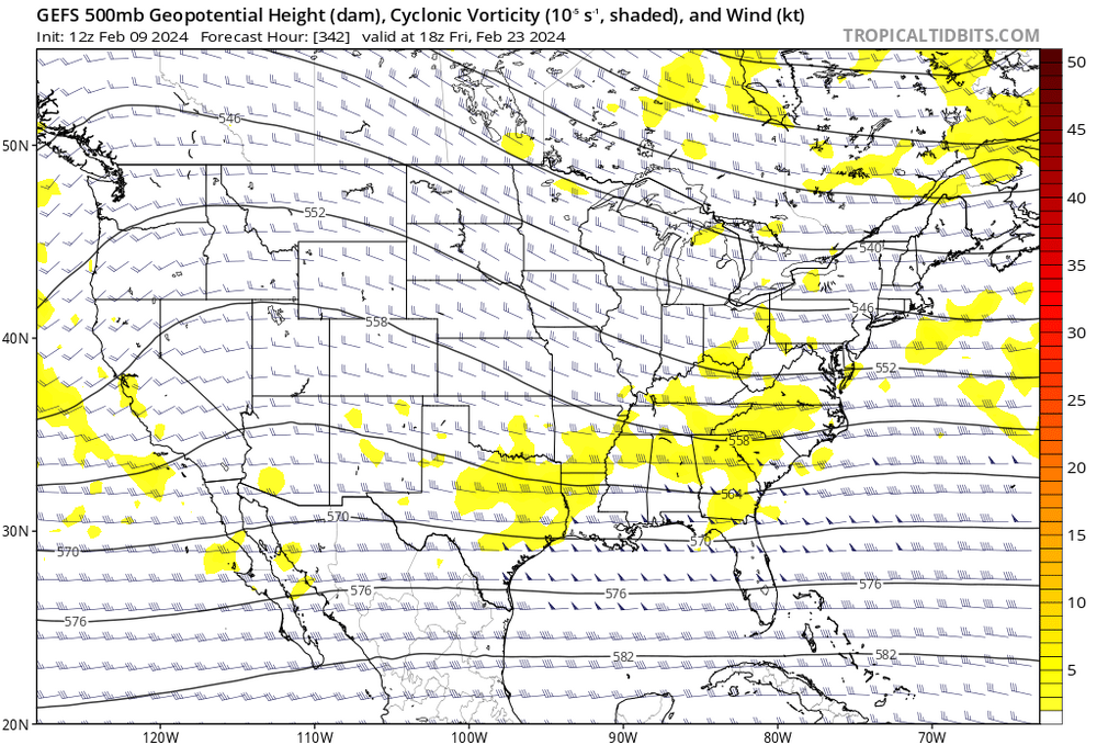
If this thing happens, that’s certainly the longest lead I’ve ever seen verify for a storm.
- 2,509 replies
-
- 5
-

-
- weenie fest or weenie roast?
- weenies got roasted
- (and 2 more)
-
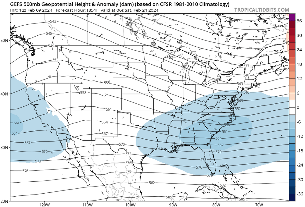
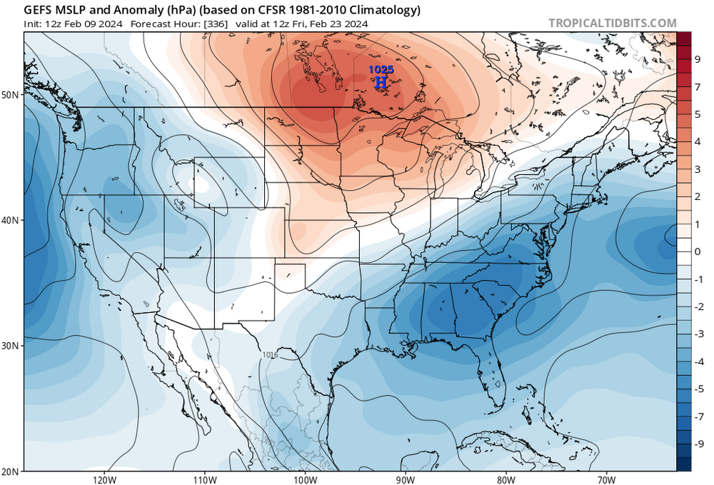
^thats an amazing signal given the lead time
- 2,509 replies
-
- weenie fest or weenie roast?
- weenies got roasted
- (and 2 more)
-
^looks like even an indication of northern stream energy phasing in?
- 2,509 replies
-
- 3
-

-
- weenie fest or weenie roast?
- weenies got roasted
- (and 2 more)
-
More and more it seems to me that the MJO is just one forcing factor among many others. So many Mets have been taking it as some purely prescriptive forecaster.
- 2,509 replies
-
- 2
-

-

-
- weenie fest or weenie roast?
- weenies got roasted
- (and 2 more)
-
We’ve already been tracking this period for 2+ weeks and have 2 weeks to go. People are antsy and irritable. I know I’m looking forward to not hearing “MJO” for 8 more months starting March 15th.
- 2,509 replies
-
- 9
-

-
- weenie fest or weenie roast?
- weenies got roasted
- (and 2 more)
-
Yeah it’s something. At least euro still shows a favorable pattern at D10. New gfs SOP is that everything after D10 is to revert to April basically.
- 2,509 replies
-
- weenie fest or weenie roast?
- weenies got roasted
- (and 2 more)
-
- 2,509 replies
-
- 5
-

-
- weenie fest or weenie roast?
- weenies got roasted
- (and 2 more)
-
Obviously some scatter still, but 12z GEFS looks fairly bullish for the psu storm
- 2,509 replies
-
- weenie fest or weenie roast?
- weenies got roasted
- (and 2 more)
-
I know this PD3 wave will likely be suppressed, but damn, the look of that storm brewing in the plains on all the globals around D7 gets my loins movin’…
- 2,509 replies
-
- 6
-

-

-
- weenie fest or weenie roast?
- weenies got roasted
- (and 2 more)
-
Early word is JB’s favoring 95-96 as his top analog
- 2,509 replies
-
- 2
-

-
- weenie fest or weenie roast?
- weenies got roasted
- (and 2 more)
-

2024 Valentines Day Rain/Snow/Who The Hell Knows Thread
WxUSAF replied to WinterWxLuvr's topic in Mid Atlantic
Gets northern MD and the eastern shore actually -

2024 Valentines Day Rain/Snow/Who The Hell Knows Thread
WxUSAF replied to WinterWxLuvr's topic in Mid Atlantic
Meanwhile the GGEM took a huge jump slower and stronger -
Just so I’m following, is the point of this conversation that the current D10 period does not look as favorable for a big snowstorm as it did when it was D15-25?
- 2,509 replies
-
- 2
-

-

-
- weenie fest or weenie roast?
- weenies got roasted
- (and 2 more)
-
More snow for us. Is that how that works?
- 2,509 replies
-
- 5
-

-

-
- weenie fest or weenie roast?
- weenies got roasted
- (and 2 more)
-
lol I don’t think our winter week in January held firm at all besides it being chilly. It was looking plausibly snowless even 48 hours before the Monday storm.
- 2,509 replies
-
- 6
-

-
- weenie fest or weenie roast?
- weenies got roasted
- (and 2 more)
-
JB promised us Michelangelo’s own personal arctic hounds, so I’m sure it’s coming!
-
GEFS seems to like a few days earlier, but there’s a signal roughly at the same time as the eps on the 6z GEFS.
- 2,509 replies
-
- weenie fest or weenie roast?
- weenies got roasted
- (and 2 more)
-
It somehow unfathomably misses two phases and then partially catches the 3rd. Bizarre.
- 2,509 replies
-
- 2
-

-
- weenie fest or weenie roast?
- weenies got roasted
- (and 2 more)
-

2024 Valentines Day Rain/Snow/Who The Hell Knows Thread
WxUSAF replied to WinterWxLuvr's topic in Mid Atlantic
This probably will slip away in the end, but at least we have something to watch while we wait for our HECS to lock in at D10 and never waver.


