-
Posts
28,489 -
Joined
-
Last visited
Content Type
Profiles
Blogs
Forums
American Weather
Media Demo
Store
Gallery
Everything posted by WxUSAF
-
Still some smoke but bluer sky than yesterday
-
Ha, I was just coming to post something similar. Hazy, milky summer skies in the 20th century were definitely due to pollution. Maybe there was occasional wildfire smoke but I don’t remember it. We have drastically improved air quality in the last 30 years, but now we get these smoky skies annually it seems. I know the last 3 years have been the worse for Canadian wildfires in modern history. I think there’s debate on how much wildfires are “normal” and what pre-colonization levels were.
-
10/10 June day. Not ready for summer humidity.
-
45 for the low again.
-
I’m guessing we’re cooked, but hope to be wrong
-
Was just about to say that. Looks like smoke aloft this morning.
-
Solar storm arrived earlier than expected. Aurora pics from central MD around 4am posted on Twitter by JB2 and others.
-
Low of 45. Heat came on.
-
61 and very breezy. Feels like October.
-
Thunder and dark clouds
-
- 1,378 replies
-
- severe
- thunderstorms
-
(and 2 more)
Tagged with:
-
Deluge at the moment. Very little wind IMBY
- 1,378 replies
-
- 3
-

-

-
- severe
- thunderstorms
-
(and 2 more)
Tagged with:
-
Flash flood warning for southern HoCo now
- 1,378 replies
-
- 1
-

-
- severe
- thunderstorms
-
(and 2 more)
Tagged with:
-
- 1,378 replies
-
- severe
- thunderstorms
-
(and 2 more)
Tagged with:
-
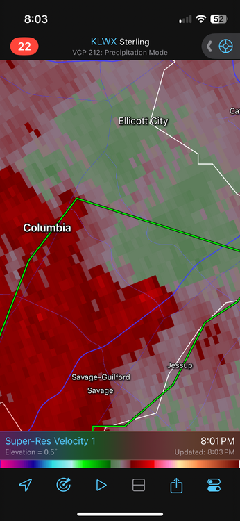
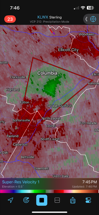
Yeah rotation looks fairly broad on radar
- 1,378 replies
-
- 1
-

-
- severe
- thunderstorms
-
(and 2 more)
Tagged with:
-
Mrs WxUSAF is in downtown Columbia and I told her to move to interior areas of the building
- 1,378 replies
-
- 2
-

-
- severe
- thunderstorms
-
(and 2 more)
Tagged with:
-
Still 5-8 miles or so. Southwest. Just heavy rain and thunder here. No wind to speak of. >4”/hr rainfall rates
- 1,378 replies
-
- 1
-

-
- severe
- thunderstorms
-
(and 2 more)
Tagged with:
-
TOR warning on our phones again and again on the tippy tip of the box. Don’t want to teach anyone to ignore these but it’s not nearby MBY…
- 1,378 replies
-
- severe
- thunderstorms
-
(and 2 more)
Tagged with:
-
Phone alarmed for the TOR warning but seems like the hook will pass well south of MBY
- 1,378 replies
-
- severe
- thunderstorms
-
(and 2 more)
Tagged with:
-
WPC flash flooding meso out for metro areas and points north
- 1,378 replies
-
- 1
-

-
- severe
- thunderstorms
-
(and 2 more)
Tagged with:
-
Radar seems ahead of schedule relative to meso models
- 1,378 replies
-
- severe
- thunderstorms
-
(and 2 more)
Tagged with:
-
Someone posted it on a different site that I saw


