-
Posts
28,482 -
Joined
-
Last visited
Content Type
Profiles
Blogs
Forums
American Weather
Media Demo
Store
Gallery
Everything posted by WxUSAF
-
Euro has a little too now
-

Late January and February Medium/Long Range Discussion
WxUSAF replied to WinterWxLuvr's topic in Mid Atlantic
lol and I thought the GFS solution was goofy- 4,130 replies
-
- 1
-

-
- prime climo
- cold canada
-
(and 1 more)
Tagged with:
-

Late January and February Medium/Long Range Discussion
WxUSAF replied to WinterWxLuvr's topic in Mid Atlantic
Damn...for at least the 140-162hr period, the Euro evolution is way more classic, simple, and pretty than the convoluted hot messes that the GFS and GGEM show.- 4,130 replies
-
- 3
-

-
- prime climo
- cold canada
-
(and 1 more)
Tagged with:
-

Late January and February Medium/Long Range Discussion
WxUSAF replied to WinterWxLuvr's topic in Mid Atlantic
The northern stream wave that the GFS phases into the monster just scoots through the Lakes quickly on the GGEM. But then this beastly closed 500mb low appears out of nowhere and partially phases. Both look like very simple and clean solutions, so obviously a lot of model consistency coming up!- 4,130 replies
-
- 4
-

-

-
- prime climo
- cold canada
-
(and 1 more)
Tagged with:
-

Late January and February Medium/Long Range Discussion
WxUSAF replied to WinterWxLuvr's topic in Mid Atlantic
Oh man, GGEM does it too. SE weenies climaxing.- 4,130 replies
-
- 10
-

-
- prime climo
- cold canada
-
(and 1 more)
Tagged with:
-

Late January and February Medium/Long Range Discussion
WxUSAF replied to WinterWxLuvr's topic in Mid Atlantic
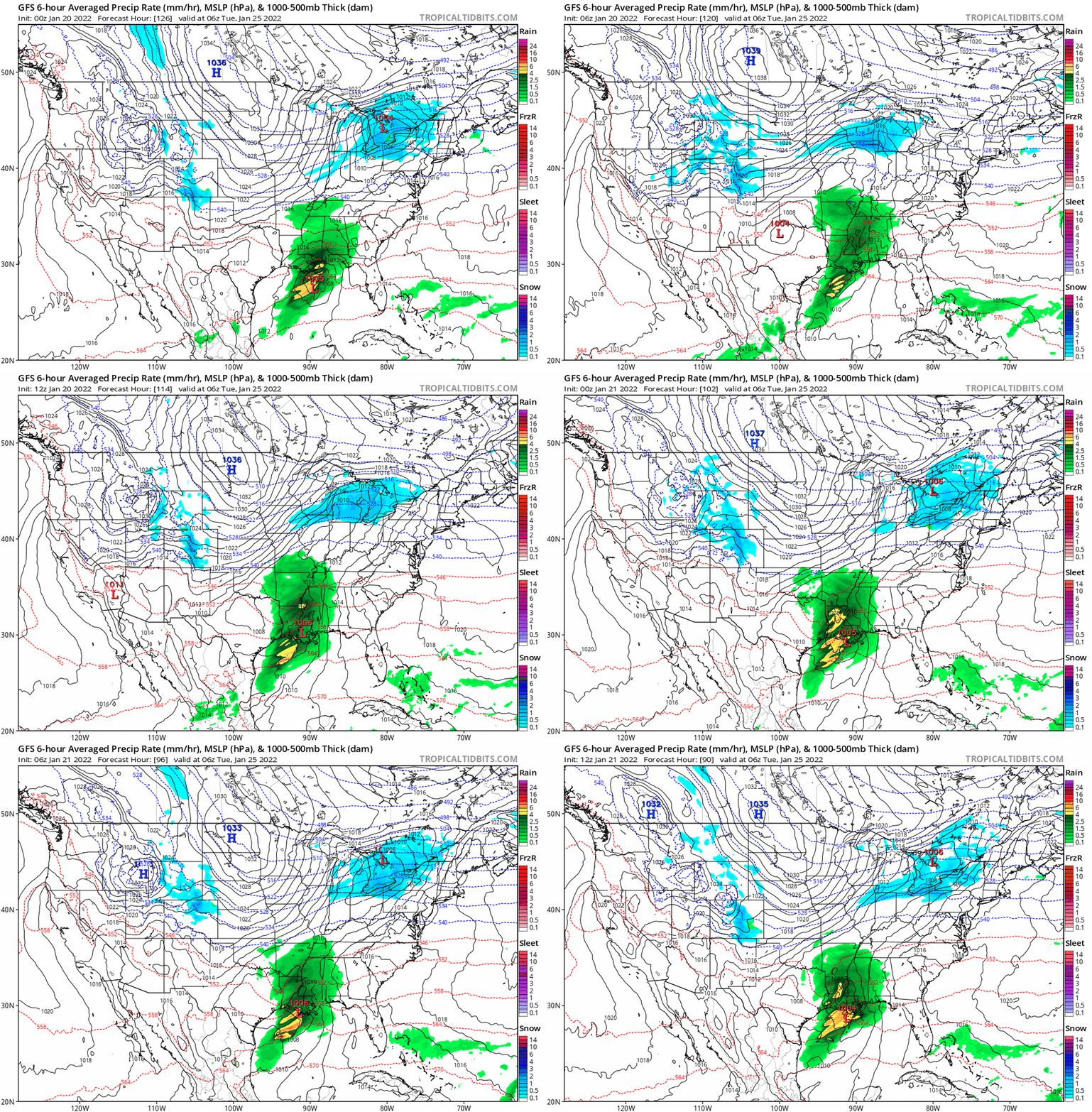
GGEM and GFS both working slowly in the right direction for Tuesday next week with more spacing between the northern and southern waves. Need that to continue so the northern stream can drag the cold air in enough. GGEM today is very close to that and has a strong enough southern wave to flip us to 1-3" of snow after some rain by dragging in some colder air.- 4,130 replies
-
- 6
-

-
- prime climo
- cold canada
-
(and 1 more)
Tagged with:
-

Late January and February Medium/Long Range Discussion
WxUSAF replied to WinterWxLuvr's topic in Mid Atlantic
- 4,130 replies
-
- 9
-

-

-
- prime climo
- cold canada
-
(and 1 more)
Tagged with:
-

Late January and February Medium/Long Range Discussion
WxUSAF replied to WinterWxLuvr's topic in Mid Atlantic
At hour 150 I hit the “Prev. Run” and “Next Run” buttons on TT like 6 times because I thought I was looking at the wrong thing. To be generous, 6z looks like it got bad chili. 12z isn’t THAT different from earlier runs at that point.- 4,130 replies
-
- 1
-

-
- prime climo
- cold canada
-
(and 1 more)
Tagged with:
-
Thanks for the feedback!
-

Late January and February Medium/Long Range Discussion
WxUSAF replied to WinterWxLuvr's topic in Mid Atlantic
Updated thread title because I’m still planning for 10” more of January snow- 4,130 replies
-
- 8
-

-

-
- prime climo
- cold canada
-
(and 1 more)
Tagged with:
-
Wow...I actually think I had this happen today. Heard a small boom from just outside the back of my house.
-
14.7 is the morning low IMBY
-
Snowshoe people @Potvinsux @jonjon and others: is April a bad time to visit? Looking for a small spring break trip somewhere with the family. Guessing it might be a lot of 40-50F clouds and wind?
-
^precip pattern looks Miller B-ish?
-

Jan 21 - 22 Weekend SE VA and Eastern Shore Snow
WxUSAF replied to stormtracker's topic in Mid Atlantic
@CAPE may like the 18z RGEM -
Ridge axis over Boise is classic. But that +AO and +NAO should temper everyone’s hope for a KU.
-
No deal!
-
Next Tuesday-Wednesday and then next weekend have been threat “windows” on the ensembles for several days already with transient Op run hits and teases. This is obviously a fun solution that will be gone in 6 hours, but its still a time period to watch. We should have a good idea in a week lol.
-
@psuhoffman Storm about to rock and roll on the GFS
-
Major Jan 3 vibes from how the Icon develops next weeks chance. Northern stream gets out of the way, brings cold air, and let’s the southern stream ride over us.
-

Thursday 1/20/22 Stat Padder Discussion and Observations
WxUSAF replied to stormtracker's topic in Mid Atlantic
Mixing in Greenbelt starting -

Thursday 1/20/22 Stat Padder Discussion and Observations
WxUSAF replied to stormtracker's topic in Mid Atlantic
@Herb@MAWS and @Scraff, I’m at work so let me know if we can slant stick a pity 0.1-0.3”. My PWS is down to 35.0F -

Thursday 1/20/22 Stat Padder Discussion and Observations
WxUSAF replied to stormtracker's topic in Mid Atlantic
Snow mixing in Columbia per my daughter -

Thursday 1/20/22 Stat Padder Discussion and Observations
WxUSAF replied to stormtracker's topic in Mid Atlantic
Temp finally turned over at home as I was driving to work and dropping steadily now. But probably too little too late. -

Thursday 1/20/22 Stat Padder Discussion and Observations
WxUSAF replied to stormtracker's topic in Mid Atlantic
Lol my temp refuses to budge


