WxUSAF
-
Posts
28,768 -
Joined
-
Last visited
Content Type
Profiles
Blogs
Forums
American Weather
Media Demo
Store
Gallery
Everything posted by WxUSAF
-

3/12 Event: Winters Last Hurrah at Least East of Mountains
WxUSAF replied to Weather Will's topic in Mid Atlantic
DCA up to 0.9” officially -
3/12 Event: Winters Last Hurrah at Least East of Mountains
WxUSAF replied to Weather Will's topic in Mid Atlantic
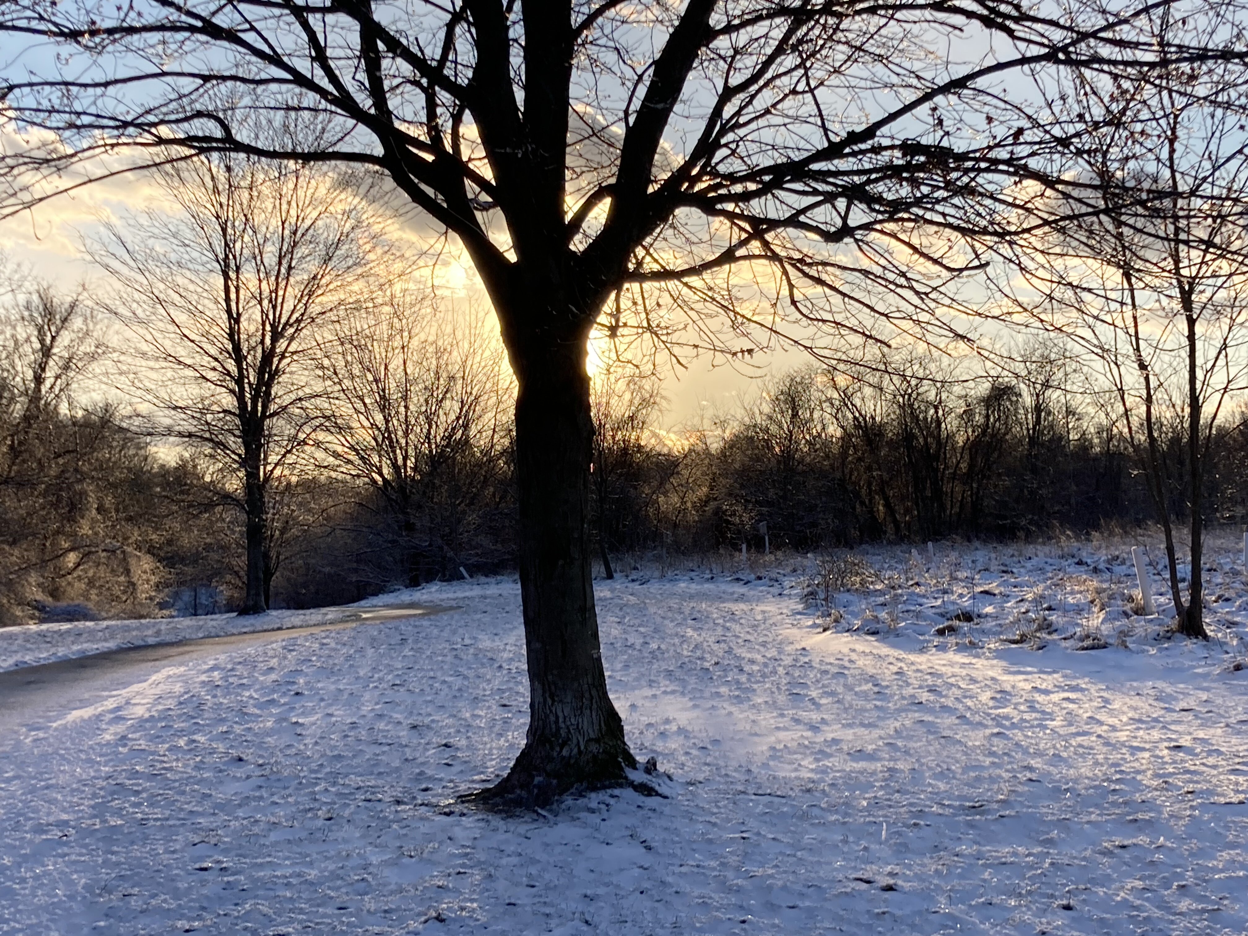
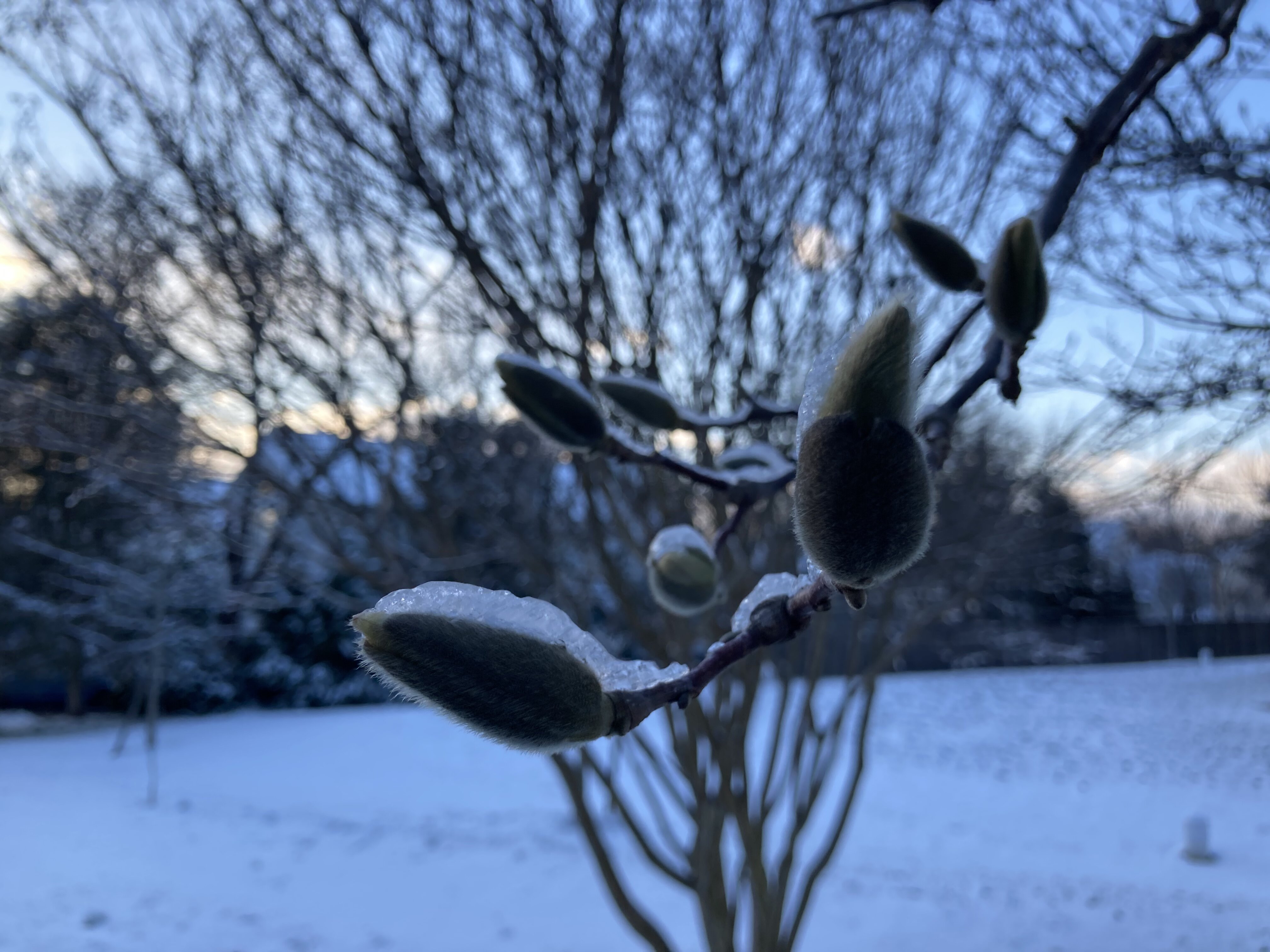
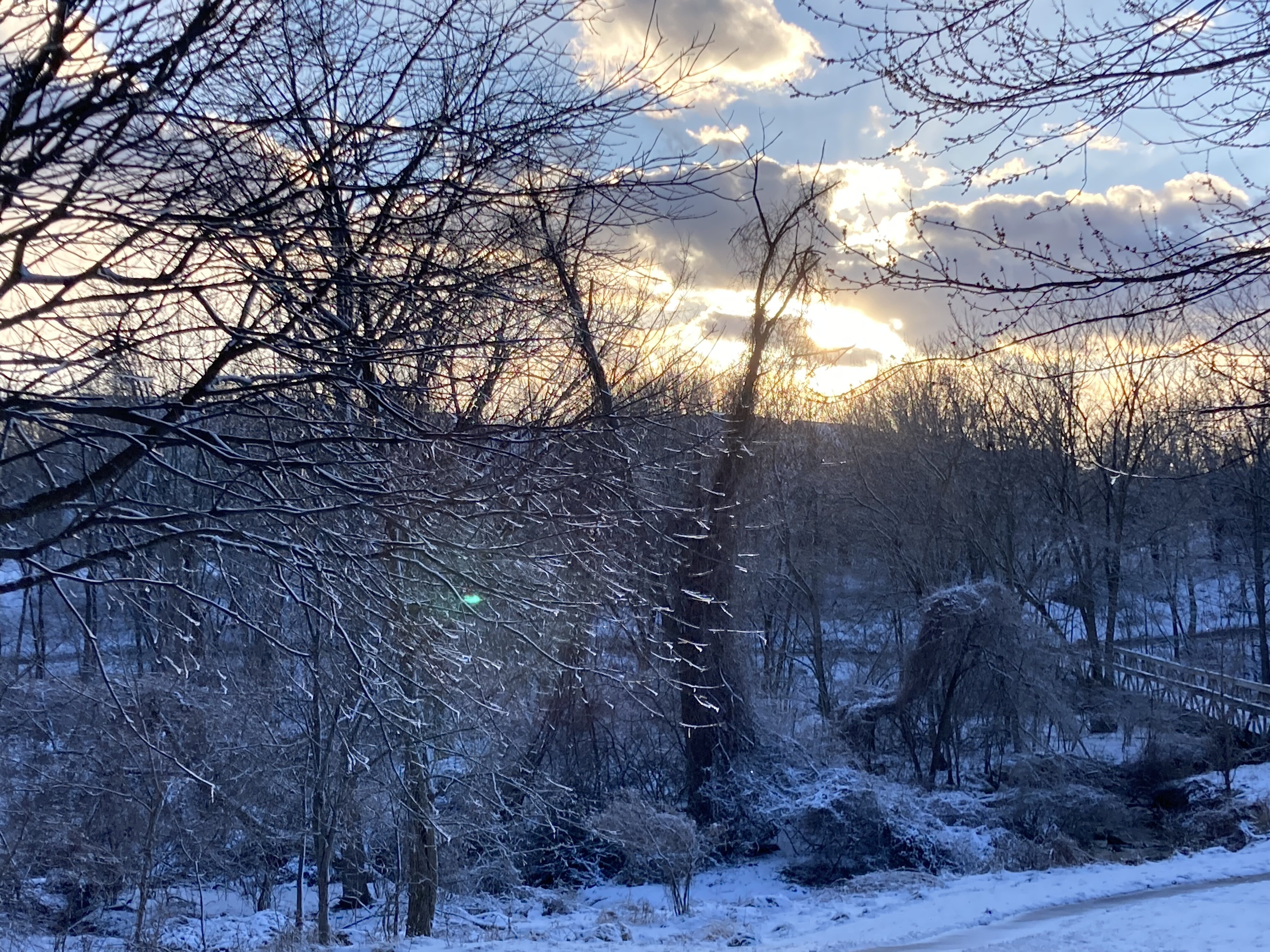
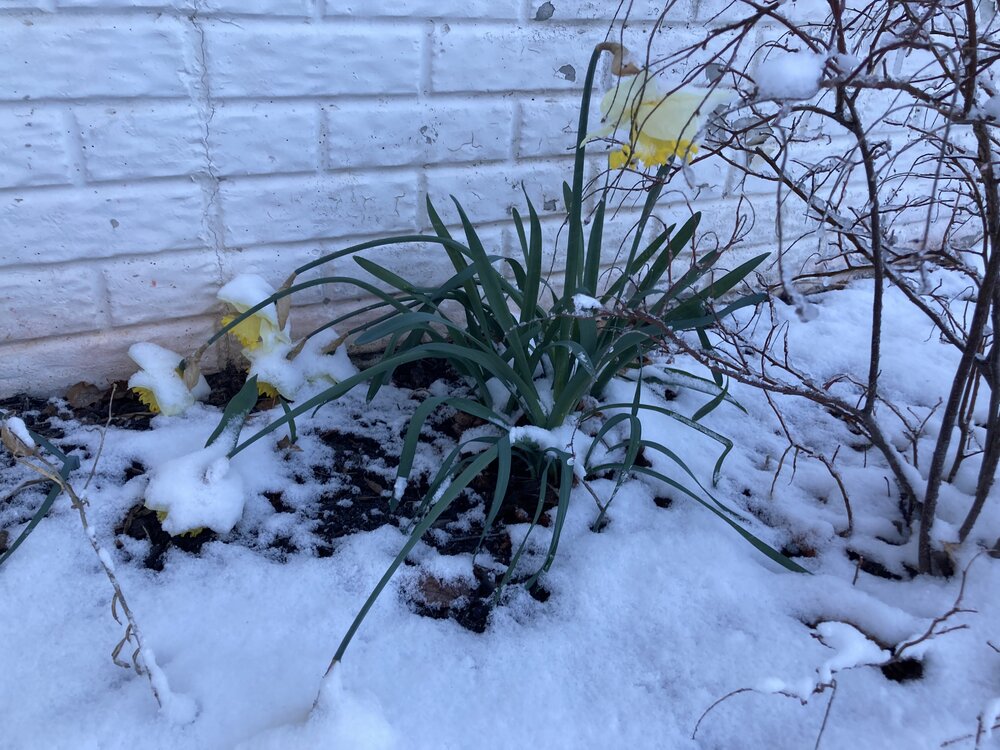
Few pictures from the yard and neighborhood


-
3/12 Event: Winters Last Hurrah at Least East of Mountains
WxUSAF replied to Weather Will's topic in Mid Atlantic
My snowboard and car have lost snow since noon, but there’s clearly more snow on everything. Kids patio table has almost 2.5”. Grill has 2”. Both look relatively unaffected by wind. -
3/12 Event: Winters Last Hurrah at Least East of Mountains
WxUSAF replied to Weather Will's topic in Mid Atlantic
Agree. Still, this would have been widespread 2-6” or more if it had fallen at night. You’re west of me and BWI and it made a notable difference -
3/12 Event: Winters Last Hurrah at Least East of Mountains
WxUSAF replied to Weather Will's topic in Mid Atlantic
IAD 3.5” DCA 0.8” BWI 0.4” West is best -
3/12 Event: Winters Last Hurrah at Least East of Mountains
WxUSAF replied to Weather Will's topic in Mid Atlantic
Wintry AF in Columbia. Vis down to 1/4-1/2mi, blowing like crazy. -
3/12 Event: Winters Last Hurrah at Least East of Mountains
WxUSAF replied to Weather Will's topic in Mid Atlantic
Just got home and measured 1.5”. Rockville definitely had more. Being west helped today as I sorta expected it would. -
3/12 Event: Winters Last Hurrah at Least East of Mountains
WxUSAF replied to Weather Will's topic in Mid Atlantic
Lightened up in Rockville but a beautiful wintry scene -
3/12 Event: Winters Last Hurrah at Least East of Mountains
WxUSAF replied to Weather Will's topic in Mid Atlantic
Hope it’s snowing like this at home in Columbia because it’s crushing in Rockville -
3/12 Event: Winters Last Hurrah at Least East of Mountains
WxUSAF replied to Weather Will's topic in Mid Atlantic
About 1” on car tops in Rockville. Bit of a lull, snow down to moderate-light -
3/12 Event: Winters Last Hurrah at Least East of Mountains
WxUSAF replied to Weather Will's topic in Mid Atlantic
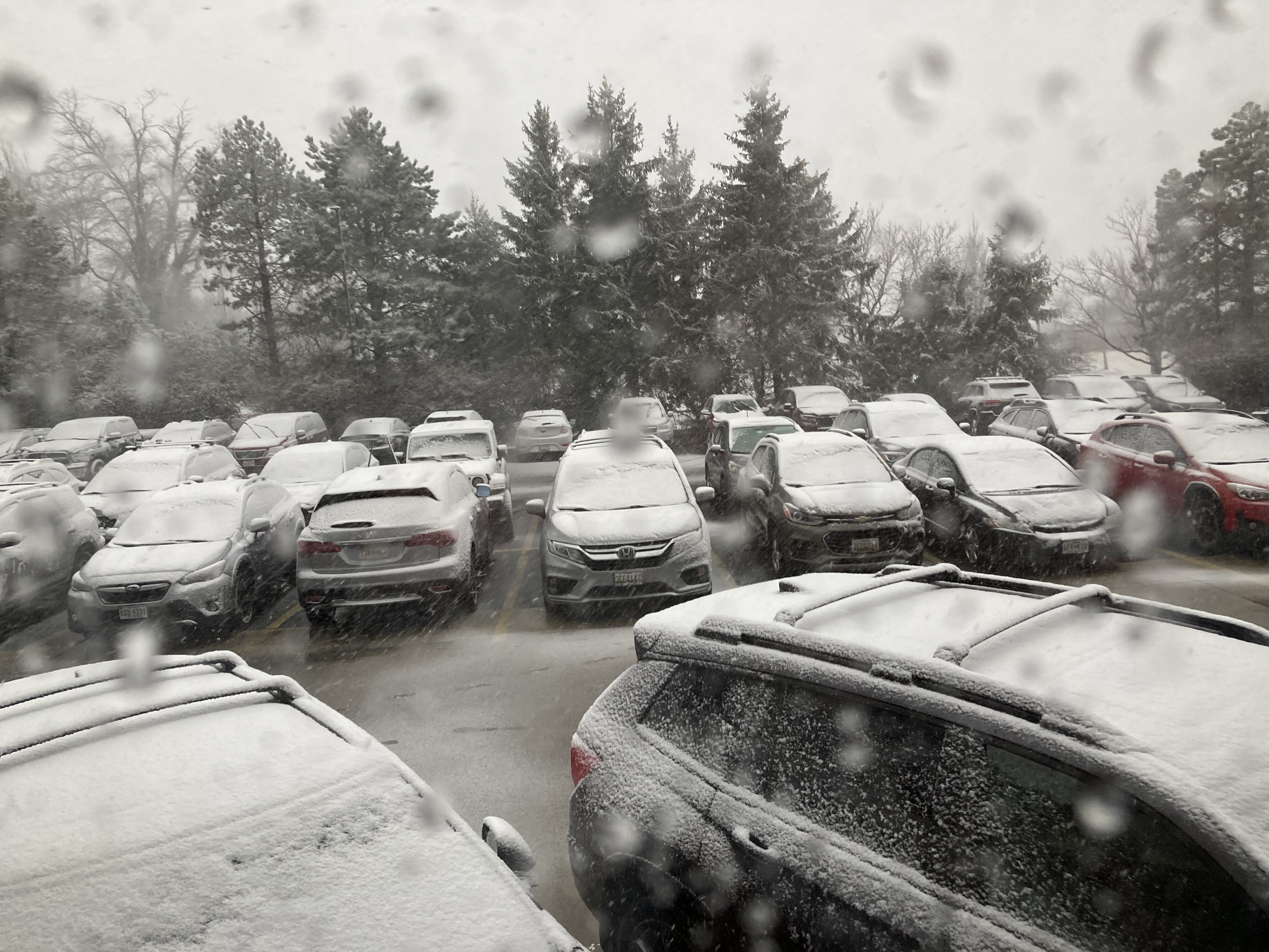
View out the window from Rockville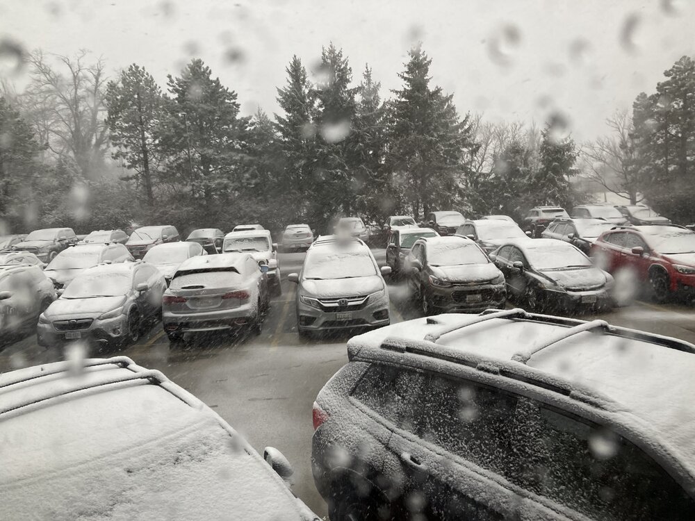
-
3/12 Event: Winters Last Hurrah at Least East of Mountains
WxUSAF replied to Weather Will's topic in Mid Atlantic
Ripping in Rockville. -
3/12 Event: Winters Last Hurrah at Least East of Mountains
WxUSAF replied to Weather Will's topic in Mid Atlantic
Looks like probably 1/4-1/2” on cars in Rockville. Temp at home in Columbia down to 33 and all snow per Mrs WxUSAF. -
3/12 Event: Winters Last Hurrah at Least East of Mountains
WxUSAF replied to Weather Will's topic in Mid Atlantic
All snow in downtown Rockville. Car tops and mulch whitening. -
3/12 Event: Winters Last Hurrah at Least East of Mountains
WxUSAF replied to Weather Will's topic in Mid Atlantic
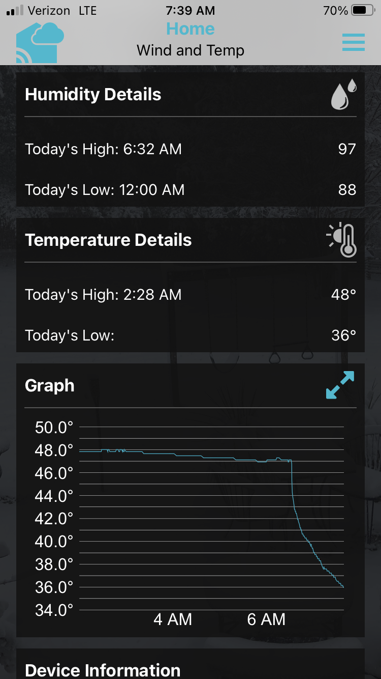
Using my red tag, I deduce a cold front has passed my house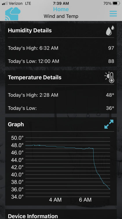
-
3/12 Event: Winters Last Hurrah at Least East of Mountains
WxUSAF replied to Weather Will's topic in Mid Atlantic
Was 41F with heavy rain when I left Columbia at 645. Started mixing with sleet on Rt200, all snow and sleet with a temp of 34F when I got to the Rt200/I270 interchange. Same in downtown Rockville where I am for my daughters rock climbing competition that was foolishly not cancelled. -
3/12 Event: Winters Last Hurrah at Least East of Mountains
WxUSAF replied to Weather Will's topic in Mid Atlantic
47/46 with light rain. -
3/12 Event: Winters Last Hurrah at Least East of Mountains
WxUSAF replied to Weather Will's topic in Mid Atlantic
Blizzard warning issued for the Blue Ridge in VA -
3/12 Event: Winters Last Hurrah at Least East of Mountains
WxUSAF replied to Weather Will's topic in Mid Atlantic
Based on turn Super Bowl halftime show, Fiddy could use a drop of fiddy -
3/12 Event: Winters Last Hurrah at Least East of Mountains
WxUSAF replied to Weather Will's topic in Mid Atlantic
45.0/40.5 -
3/12 Event: Winters Last Hurrah at Least East of Mountains
WxUSAF replied to Weather Will's topic in Mid Atlantic
Red! -
3/12 Event: Winters Last Hurrah at Least East of Mountains
WxUSAF replied to Weather Will's topic in Mid Atlantic
Storm threads are going to be unreadable -
3/12 Event: Winters Last Hurrah at Least East of Mountains
WxUSAF replied to Weather Will's topic in Mid Atlantic
The 200km grid point spacing they use for plotting also seems like a poor decision -
3/12 Event: Winters Last Hurrah at Least East of Mountains
WxUSAF replied to Weather Will's topic in Mid Atlantic
You rang? -
3/12 Event: Winters Last Hurrah at Least East of Mountains
WxUSAF replied to Weather Will's topic in Mid Atlantic
Sweet! North side of my yard is in the @Ellinwood blue! South side is eating grey. Got to move the snowboard tonight…