WxUSAF
-
Posts
28,779 -
Joined
-
Last visited
Content Type
Profiles
Blogs
Forums
American Weather
Media Demo
Store
Gallery
Everything posted by WxUSAF
-
Better close the blinds until the GFS comes out
-
The blinds have been opening and closing with lightning speed
-
Yeah. We want some lead energy that suppresses the flow over the eastern conus. That helps our shortwave dig farther southwest.
-
I finally looked at it. Actually farther west than 12z. This next week is going to be nuts in here White Christmas fever going to make crazy weenies
-
Best if we close the blinds until we get a PNA ridge that’s not so far east and also not so far west.
-
I feel like that’s still not happened…
-
Ya’ll are missing my sarcasm
-
Uh oh…fish storm??
-
Kicker shortwave appears out of nowhere and shoved it east. Still a pretty gorgeous H5 look as I posted above.
-
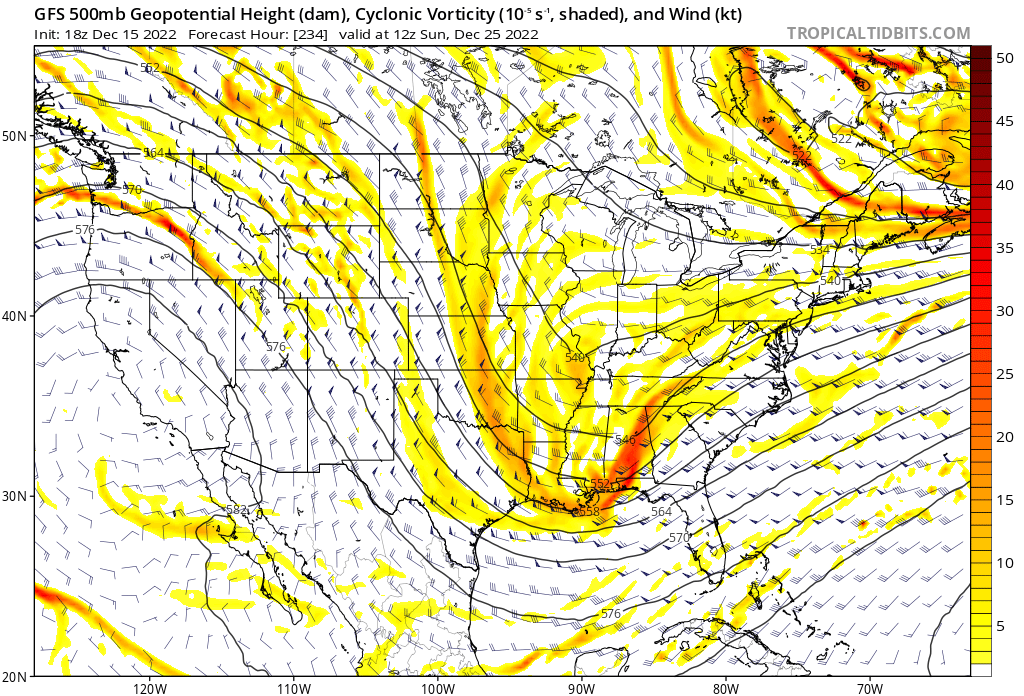
Something I noticed. Trying to figure out why our shortwave for the 22-23rd is digging so much more in the last 24hrs worth of runs. I think it’s this lead shortwave that moves through the Lakes around D4-5. It sort of merges with and pulls a piece of the 50-50 low west. This provides a lot more suppression of our shortwave and forces it well south. Compare yesterday and todays 18z GFS runs.
-
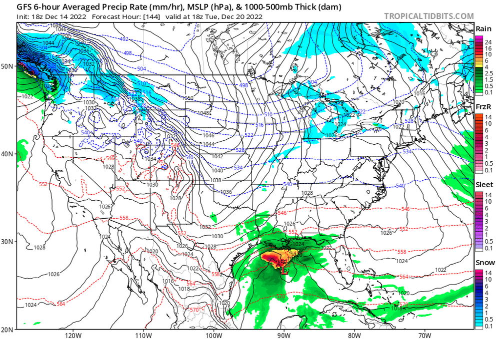
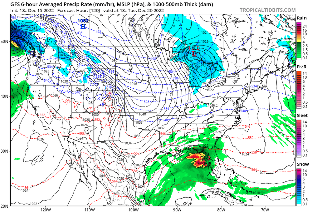
Not sure if it will come together, but if we didn’t have a digital HECS 48hrs before this panel, I’d be stoked. This is a canonical look. #CAPEStorm2022

-
We’re basically at D7 for the storm being on our door step. Long way to go but I like where we sit for now. I’d like to see us in a similar position (with wiggle room to maintain a nice event) around 0z Sunday. Everyone should also remember that even an area wide 3-6” type event would be HIGH TIER for mid-Atlantic La Niña December’s.
-
We have sooooo much more leeway and margin for error if we get the shortwave to get south of our latitude. Increases the floor AND the ceiling.
-
Solid week? We got teased a couple times that it would get forced to our south, but think that was all like D9? I’d have to go back in the thread to be sure.
-
Snow into the cities by 0z next Thursday. Looks a bit euro like. But think this will end satisfactorily for most.
-
Good snow shower here at O’Hare as I wait for my flight home. Vis around 1mi? Hoping it doesn’t screw up departures…
-
@Heisy has gone from having his blinds closed because cutter to having them closed because fish storm in 48hrs
-
Oh you sweet summer child. No self respecting weenie shows snow DEPTH.
-
Woooo baby. Classic.
-
Really nice trends the last 12-24 hours. Long way to go still, but I wanted to see the shortwave dig more , and that’s exactly what we’re getting. I’d expect a few monsters in the EPS.
-
Just Misses the full phase, capture, and TUCK, but this is a very merry Christmas from the euro.
-
Hohoho bitches
-
If it’s next Monday and Hoffman is complaining about being fringed, we’ll finally know itshappening.gif
-
12z GGEM waves hello lol
-