WxUSAF
-
Posts
28,575 -
Joined
-
Last visited
Content Type
Profiles
Blogs
Forums
American Weather
Media Demo
Store
Gallery
Everything posted by WxUSAF
-
Don’t forget wind!!
-
Most solar production today since October 18. #sunangle
-
Yeah, the punditocracy seems pleased with the OC hire. Still skeptical they get a Lamar deal done.
-
Punditocracy seems excited
-

Late February will be rocking. February Long range Discussion thread
WxUSAF replied to Ji's topic in Mid Atlantic
Dr. Amy Butler had a good thread on Twitter yesterday about late SSWs and the MJO phase when they occur. Long story short, this current setup and SSW is conducive to producing a durable -NAO in a couple/few weeks. -
Radar would be pretty sweet if this was snow
-
2023 Mid-Atlantic Garden, Lawn, and Other Green Stuff Thread
WxUSAF replied to mattie g's topic in Mid Atlantic
Blooming daffodils in my neighbors yard. My patch on the warm sunny side of my house will likely bloom this week. -
Basically +30F on the morning low
-
Been dry here for awhile. Might get an early start on the drought thread this year
-
Late February will be rocking. February Long range Discussion thread
WxUSAF replied to Ji's topic in Mid Atlantic
Think you accidentally posted this here -
Late February will be rocking. February Long range Discussion thread
WxUSAF replied to Ji's topic in Mid Atlantic
After this mess, seems like we get a PD weekend cold shot, but looks very transient so would need a well timed storm hot on its heels to take advantage.
-
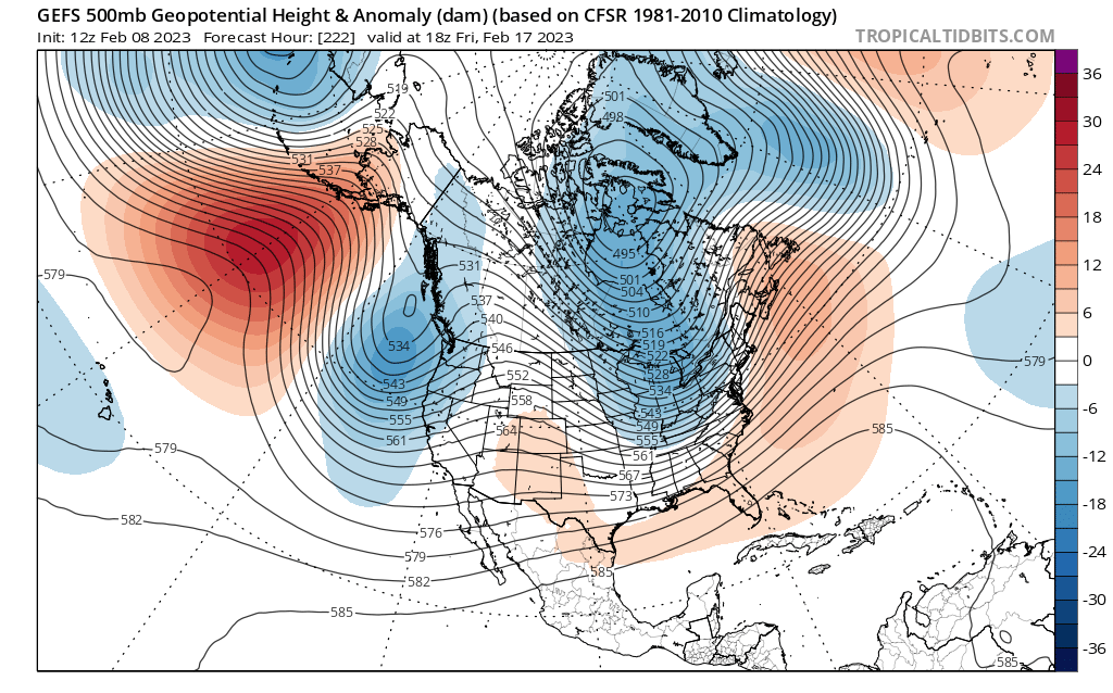
Late February will be rocking. February Long range Discussion thread
WxUSAF replied to Ji's topic in Mid Atlantic
This thing cutting off so far south isn’t going to do us any favors. We need it to cutoff farther north so there’s still some meager amount of cold air aloft when it gets here. -
Late February will be rocking. February Long range Discussion thread
WxUSAF replied to Ji's topic in Mid Atlantic
Smarch is happening. Book it. -
Late February will be rocking. February Long range Discussion thread
WxUSAF replied to Ji's topic in Mid Atlantic
Ukie has the canonical track…500mb low cruises along the Va/NC border. No cold air. -
Late February will be rocking. February Long range Discussion thread
WxUSAF replied to Ji's topic in Mid Atlantic
Well I was a bit premature. Not OTS so much as too far south. Just becomes a cutoff low. And loses what meager cold air source it was working with. -
Late February will be rocking. February Long range Discussion thread
WxUSAF replied to Ji's topic in Mid Atlantic
It’s suppressed and OTS -
Late February will be rocking. February Long range Discussion thread
WxUSAF replied to Ji's topic in Mid Atlantic
Euro nearly gets it done for Saturday…but those surface temps -
2023 Mid-Atlantic Garden, Lawn, and Other Green Stuff Thread
WxUSAF replied to mattie g's topic in Mid Atlantic
February 5th daffodils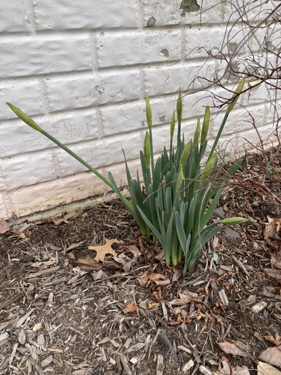
-
Late February will be rocking. February Long range Discussion thread
WxUSAF replied to Ji's topic in Mid Atlantic
Going to be right in time for those 40F deform band rainstorms in late March! -
12.6 for the low
-
Winter! Crazy right?
-
Late February will be rocking. February Long range Discussion thread
WxUSAF replied to Ji's topic in Mid Atlantic
JB2 doesn’t believe what THEY want to tell you about the February torch! #FITF -
My daughter reports a few flurries heading out to get her ride to school. I was in the shower and missed it
-
Anyone getting snow from those radar returns?
-
The “is it ever going to snow again” discussion.
WxUSAF replied to psuhoffman's topic in Mid Atlantic
Yes. Is reading comprehension tough for you?