WxUSAF
-
Posts
28,776 -
Joined
-
Last visited
Content Type
Profiles
Blogs
Forums
American Weather
Media Demo
Store
Gallery
Everything posted by WxUSAF
-
Today falls in the “no lead is safe” category
-
Ravens stunting on dolphins D
-
This game is going to be about which defense can get off the field ever
-

Jan Medium/Long Range Disco: Winter is coming
WxUSAF replied to stormtracker's topic in Mid Atlantic
Far be it from me to get in the way of performative angst, but this time period has already been on the radar for a week or more. For most of that time, it’s been clear we may have temp issues. So N/W areas favored, but not hopeless for folks below the fall line. Not sure what should at all change that basic mindset now or probably for at least the next 3-4 days. -
Dolphins stunting on ravens D
-
It’s a D7 event. We’ve got time to make at least 2 more full revolutions.
-
Should be lots of eagles!
-
Lot of action in the long range thread given we cancelled winter yesterday morning.
-
Jan Medium/Long Range Disco: Winter is coming
WxUSAF replied to stormtracker's topic in Mid Atlantic
Seems like an encouraging 12z suite on balance. -
Allar looks like Joe Montana against the Delawares and Northwesterns and is a total deer in the headlights against the teams that PSU considers peers.
-
As a penn state fan, it’s just remarkable how bad Franklin and Allar are in big games.
-
Jan Medium/Long Range Disco: Winter is coming
WxUSAF replied to stormtracker's topic in Mid Atlantic
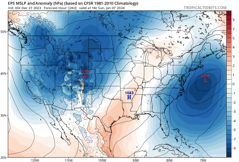
I never thought this period between today and the 7-10th would be frigid. But I have to say I’m disappointed that it’s not even seasonable. The storm on the 4th and 7th “should” at least be frozen majority for the N/W burbs. -
Jan Medium/Long Range Disco: Winter is coming
WxUSAF replied to stormtracker's topic in Mid Atlantic
@psuhoffman is right that we’ve seen this -WPO/-NAO combo a bunch in recent years and it has mostly burned us big time. Difference this year is that Niño forcing and the response to the strat vortex weakening *should* move that PAC ridge east into AK and the west coast and it can quickly evolve into a woofwoof KU type pattern. In recent years, Niña forcing reinforces the WPO and hence the western trough and so we only got transient periods when the ridge moved east. -
Working outside in short sleeves as one does on…December 28?
-
Jan Medium/Long Range Disco: Winter is coming
WxUSAF replied to stormtracker's topic in Mid Atlantic
Positive vibes from (checks notes) Eric Webb? -
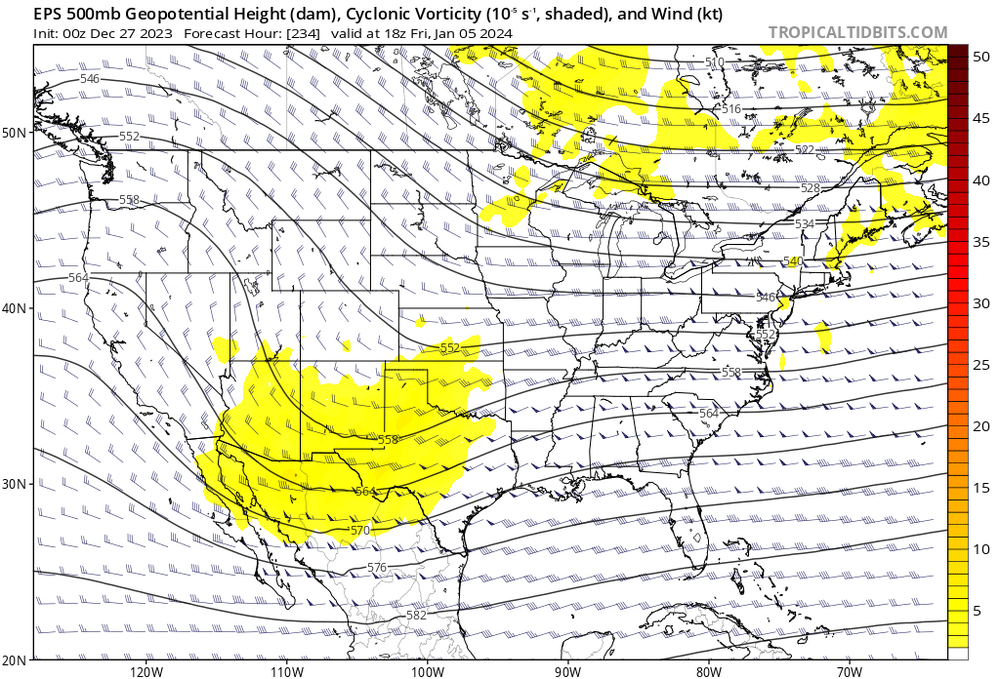
To my eye, surface and H5 look good on the GEFS for the 4-5th and 6-8th. Snow mean just looks like trash though if you care about such things. Don’t fully understand the disconnect.
-
SSWs happen in about 60% of seasons in the northern hemisphere. How and if they influence the troposphere is much more variable. The current background forcing: Nino, -PDO, east QBO, and solar forcing is about primo for a SSW this winter. But those factors also already support northern blocking! And that northern blocking forces the SSW, which reinforces that block! So there’s some chicken and the egg arguments here.
-
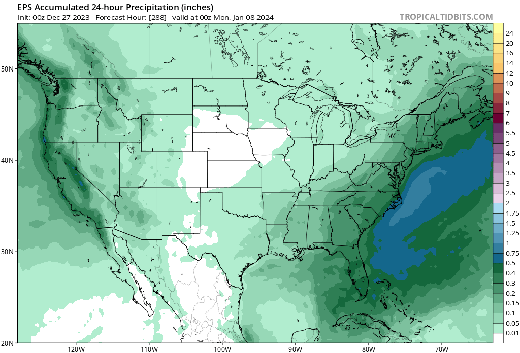
EPS still with a strong signal on the 7th. A little offshore vs our preference, but a good look for a D11-12 event.

-
Lowes was done with Christmas last week! But I went to Walmart yesterday morning and got a bunch of lights for 50% off.
-
Good thread from Tomer tonight
-
See…shamed it into performance!
-
GFS working overtime to avoid giving us digital blue after the Christmas miracle fantasy HECS.
-
No idea
-
The point is that the -PNA is already on its way out as a ridge builds in and the +EPO heads toward an Aleutian low.
-
It’s an interesting argument on Twitter and I’m not sure how if this is really a disagreement or just confusion. But it seems 12z eps was a pretty huge outlier from a long trend. So either way I’d wait for some confirmation before jumping off a cliff.