-
Posts
28,487 -
Joined
-
Last visited
Content Type
Profiles
Blogs
Forums
American Weather
Media Demo
Store
Gallery
Everything posted by WxUSAF
-
10 freezing or sub freezing lows at BWI to date, which is actually 1 behind 2022. But 2022 had an average November low temp of 40.1 compared to this years 35.2.
-
Happy winter!
-
One of the potential wild cards this winter was the very high stratospheric water vapor from the Hunga Tonga eruption. Water vapor strongly emits thermal IR radiation, which serves to cool the atmosphere in the winter stratosphere where little or no sunlight reaches. So potentially, that could lead to a colder and stronger strat winter polar vortex, that if coupled with the troposphere, would encourage +AO. Obviously it’s early, but the strat vortex is going to be quite weak most likely at least well into December and potentially beyond.
-

2023 Mid-Atlantic Garden, Lawn, and Other Green Stuff Thread
WxUSAF replied to mattie g's topic in Mid Atlantic
Did my final mow/leaf mulching this evening. Got it nice and short so next week's HECS looks primo! -
Loudon and Mt. PSU bullseye at happy hour
-
Whole winter depends on it, but yeah, no pressure.
-
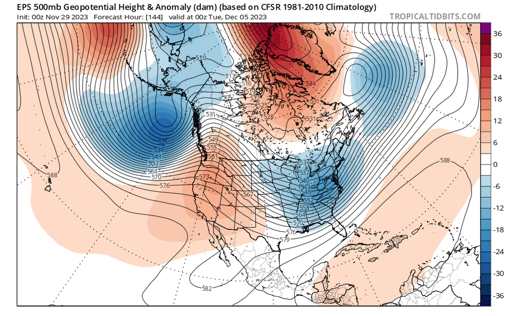
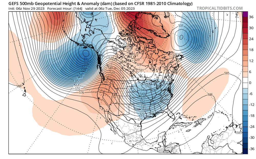
12z euro digs the shortwave quite a bit more than 0z. 0z gave us a little snow/mix with the low itself, but kept it all very progressive. 12z is really pretty close to the GFS. GFS just manages to get a little more neutral tilt. Looks like Ukie is maybe focusing on a different shortwave so it’s slower with the progression?
-
We want that ridge standing straight N-S and not rolling over quickly. That’s the danger to watch for. It’s forecast for December 6th
-
Supposed to be flying back to DC in the middle of that epic winter-saving early season SECS. Time to rebook?
-
Icon is a slightly weaker version of the GFS. GGEM trough stays too progressive and positively tilted, maybe show showers for some.
-
This is all connected of course. Models always bias MJO waves to dissipate too quickly. Moving through 7-8-1-2 from mid-December to early January with the cold air on our side of the globe and a very weak strat PV is an enticing combination. And throw in a Nino STJ.
-
Low of 27. After yesterday, BWI is exactly “normal” on the month for temps and IAD, DCA and RIC are very slightly below normal (-0.1 - -0.3F). Today should end up slightly below normal temps as well.
-
High of 40 and low of 23 at BWI today. Only 6 days in November 2022-March 2023 were as cold or colder by mean daily temperature.
-
We don’t HAVE to have below normal temps to get snow. Just trickier without it.
-
“usually” what happens is that all those features (NPac trough and western ridge) are west of those positions leading into the storm and then they roll east with the big storm.
-
There’s definitely some good juju percolating for second half of December and beyond. Hopefully some of our more sensitive subforum posters can make it!
-
How do I just get the Cat Fancy subscription?
-
Depending on your expectations for @stormtrackers 12z promise, Euro and GFS certainly keep us in the game for “something” next week.
-
Yeah, but at the time I couldn’t find any literature measuring that. Maybe it’s been done since.
-
I don’t know if there’s any literature about it, but I started dabbling with a project in grad school that would have shown that UHI is minimized during cold air advection as opposed to basic radiational cooling. Never got very far with it, but I think last night is a good demonstration of that idea.
-
Plus Decembers in Ninos are usually mild and the least snowy month? Last December we had a pretty canonical Niña cold pattern the second half of that month and we got boned in the snow department.
-
Plus the ensembles seem to keep adjusting to more -AO which I also quite enjoy! People are gonna gripe going forward even if we can pull a small event out of our hats next week, but I still think we will have chances for snow and cold this month. This does not look like December 2015 at all.
-
I like seeing a Scandinavian ridge showing up on guidance toward mid-month. That should slowly retrograde and help reinforce a -NAO.


