-
Posts
28,310 -
Joined
-
Last visited
Content Type
Profiles
Blogs
Forums
American Weather
Media Demo
Store
Gallery
Everything posted by WxUSAF
-
Not just this one. We’re preemptively cancelling until 29-30.
-
Ravens look out of sorts
-
Euro not wavering. Chips fall time.
-
Back to fog. Epic fog winter.
-
Started as rain and temps seem far from freezing
-
The 10:1 maps are obviously ludicrous for this event, but I think we went all winter last year without seeing 4-6”+ on a 10:1 map inside 48 hours.
-
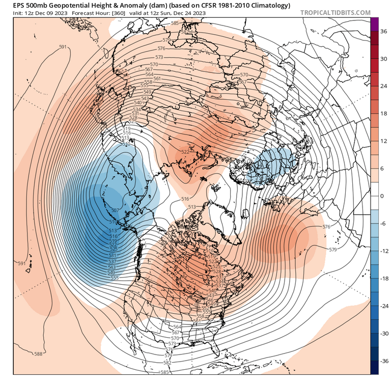
I agree with you in the sense it seems the transition is taking longer, although we’re seeing that transition start earlier than it was initially progged. This cankicking, as you’re terming it, seems based off of the euro now thinking that MJO will die in phase 7. Well, at one point it was killing it off in phase 3/4. Models always seem to underestimate MJO amplitude so I’m not sold on permanent phase 7 despite Eric Webb using 38 flame emojis. And phase 7 is actually good in Nino Januarys! Couple that with a tendency for more +PNA in the midrange plus the strat vortex disruptions and…we’ll see if it’s just shorts and tshirt weather from the 15th into new years.
-
Euro seems locked in
-
Proper weenies going to wake up at 3-4am to measure maximum mashed potato depth
-
^said this in the MA forum, but if the euro is right and the vortex is displaced toward the eastern CONUS, there may be more cold-side risk than people are appreciating despite the mega winter ending grinch torch PAC jet.
-
During overnight hours, I think you could accumulate on cold surfaces with temps of 34, maybe 35 if it’s ripping. Anything above that is probably white rain.
-
Fog weenies having an epic winter
-
6z gfs is pretty wintry considering winter is already over
-
There’s another pretty key difference between the bad ninos and good ninos. The bad ninos have the huge NPac low in the gulf of Alaska and not over the Aleutians. The good winters have an Aleutian low. And that’s what’s progged for this awful horrible winter ending torch coming up…
-
Twitter randos saying we need the Aleutian low to dissipate before winter temps arrive. Feel like I’m taking crazy pills.
-
That 3k is the best look I’ve seen for this.
-
With the strat vortex being stretched toward us later in the month, I think there’s more cold-side risk than you’d think otherwise. But I agree we’ll cool steadily in the means as we approach and then pass Xmas. It’s rare that we’ve had 4-6 week outlooks stick in time and now we’re seeing it inside D15. Things look totally in track to me.
-
3-4 tweets into the thread he admits the pattern is good for eastern cold/snow after that
-
Overnight hours obviously help, but I’d sell on accumulations below higher elevations in the far burbs. Rates will also matter.
-
Correct
-
Continuing to anti-cankick on 12z GEFS. Bad news for the Debs.
-
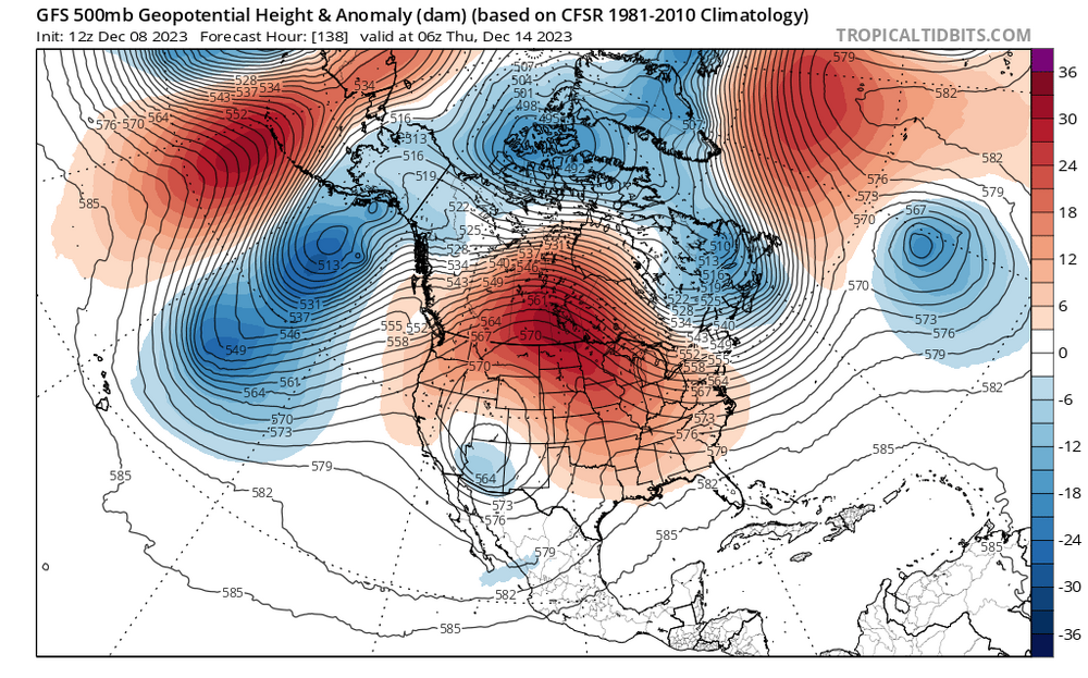
Look earlier. That big PAC trough just scrours the continent of cold air while the big low moves underneath
-
4th out of last 5 GFS runs with a big phasing/near-phasing coastal D8-11. Hopefully we see that again with some colder air in another few weeks.


