WxUSAF
-
Posts
28,764 -
Joined
-
Last visited
Content Type
Profiles
Blogs
Forums
American Weather
Media Demo
Store
Gallery
Everything posted by WxUSAF
-
Calling bust for MBY. Under 0.1”
-
Seems like you're in a favorable spot with that convergence on the east side of the BR
-
12z euro says a lot more to come, but it’s totally blown it for the western edge up through now.
-
0.03” back home. Drought busting drizzle. But i think it fills in and I wouldn’t call bust yet.
-
-
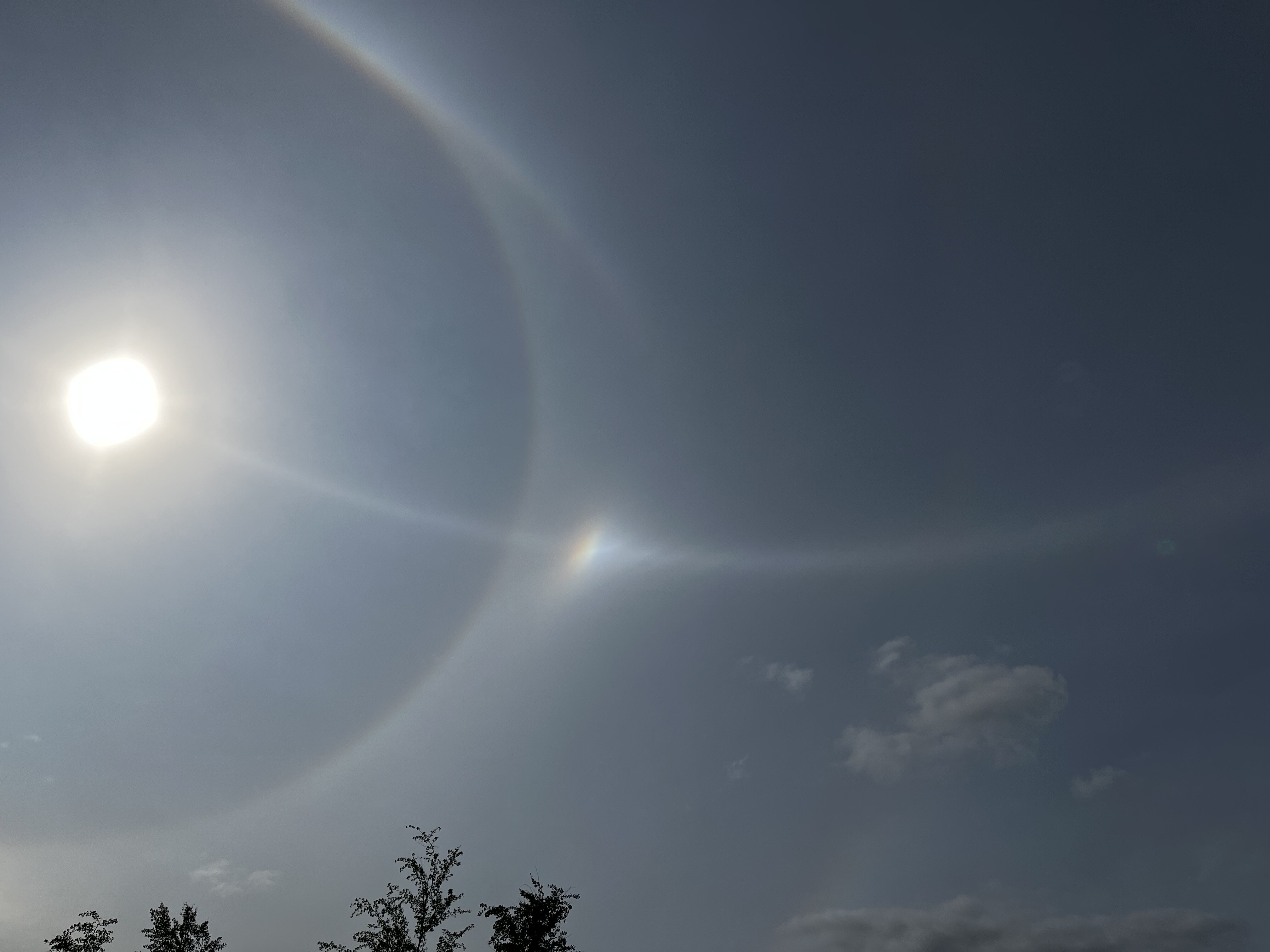
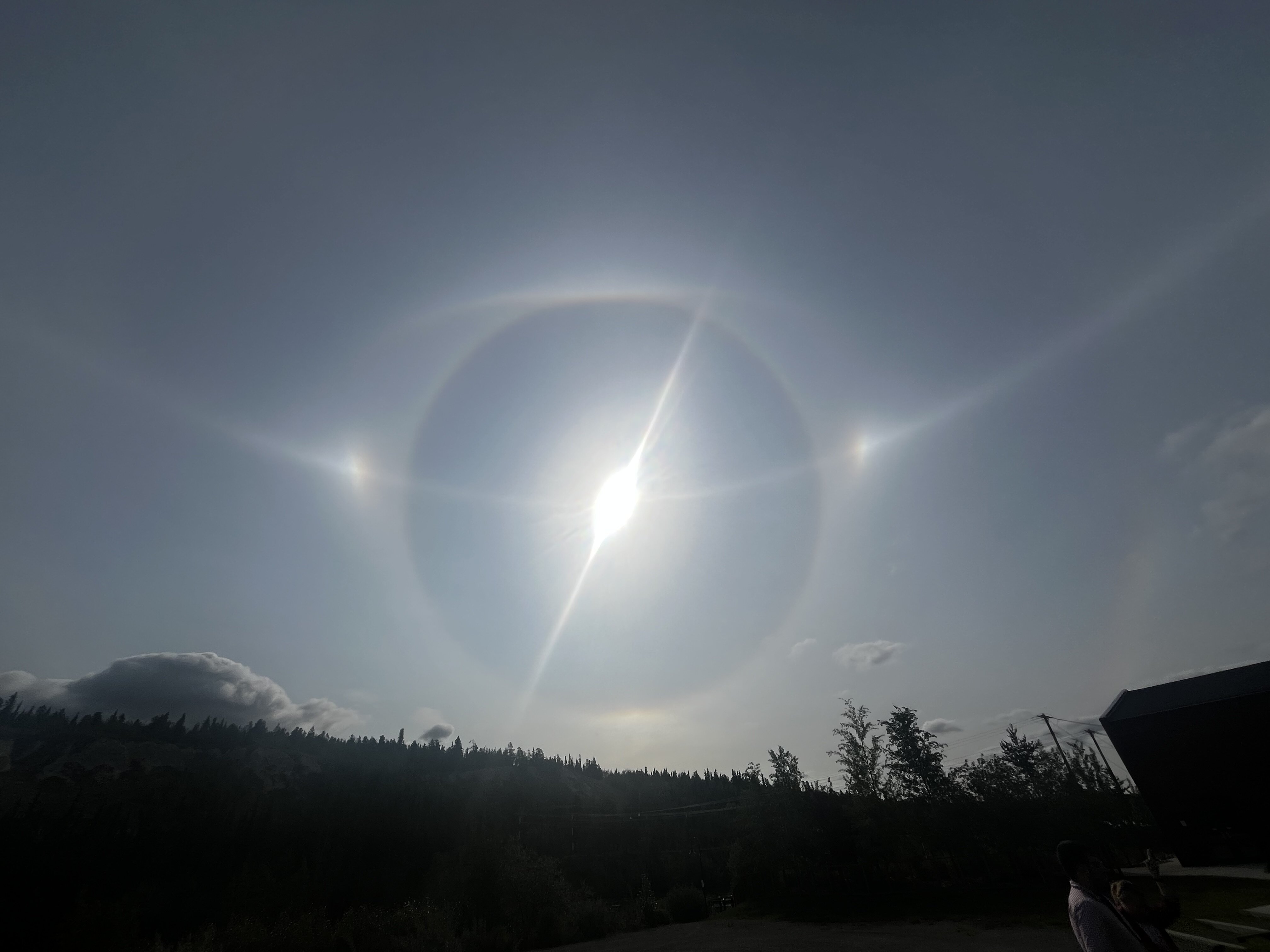
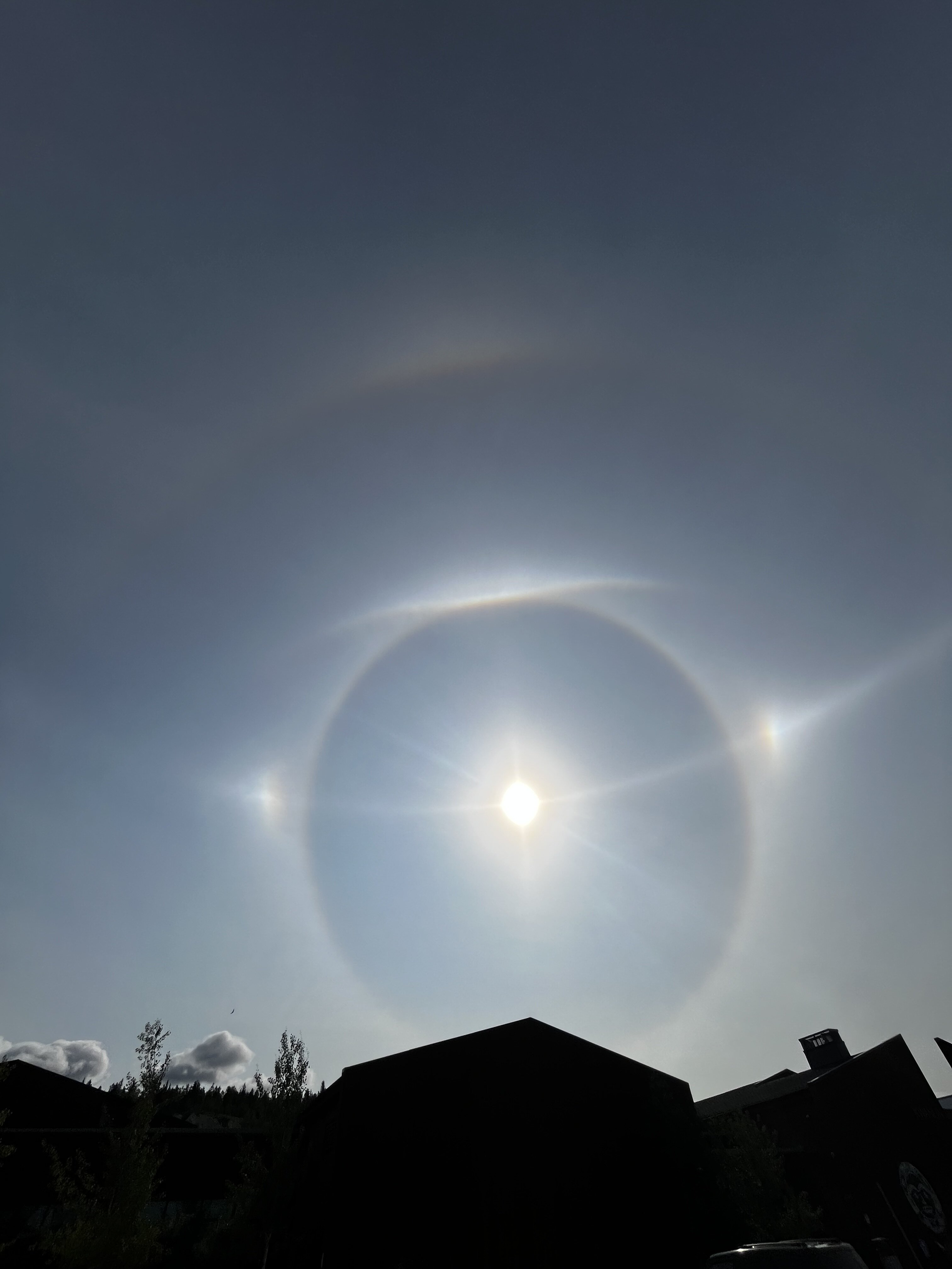
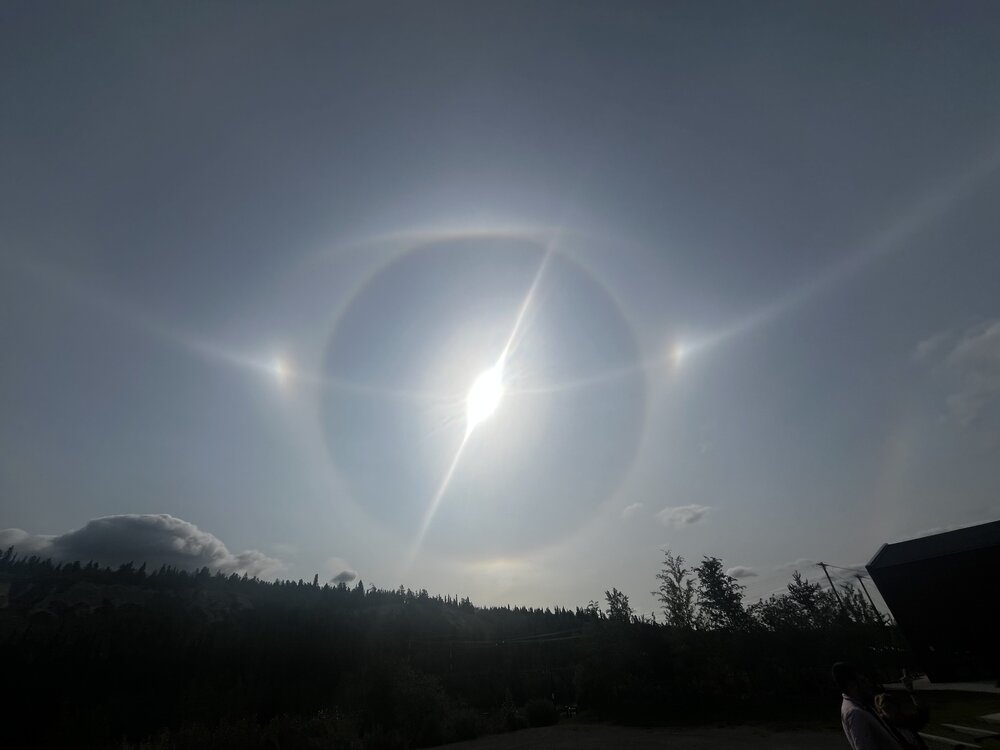
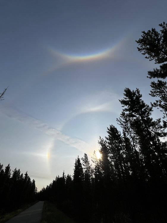
A literal textbook of cloud optical effects in the Yukon this morning. Sun dogs, 22 and 46 degree halos, circumzenithal arc, tangent arc, and perihelic circle. Oh, and 48F low temp


- 156 replies
-
- 19
-

-

-
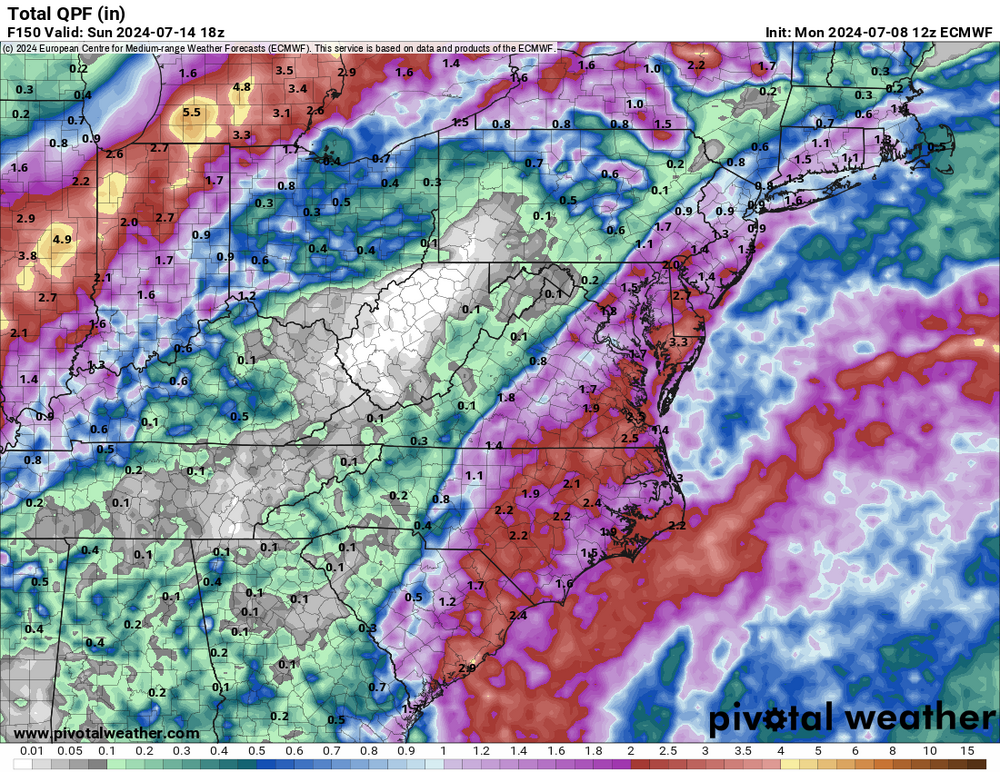
Yeah 12z is west again, so the globals are pretty aligned with where the gradient will fall. Amounts are still variable though.
-
Euro and GGEM bumped west with rain Friday and Saturday. Gfs farthest east although 6z is an asshair west of 0z. Gfs is most bullish on rain with storms this evening though.
-
Friday’s rain event may fail, but mid-late next week is starting to look really nice!
-
Nope
-
Hoping that back builds into HoCo…
-
Oh good, this sunny breezy low 70s weather in Canada is wearing on me
-
12z euro is a nut punch
-
GFS way less enthusiastic for late week rain and Euro has a brrrruuuutttaaalll gradient just west of 95.
-
To make you all rather jealous. I’m in Whitehorse, Canada this week. It’s 53 this morning. Above normal low temp!
- 156 replies
-
- 12
-

-
-
Yeah, I don't doubt that the setup is real, just that it seems to be a fairly narrow corridor of heavy rain and as 12z euro shows today, there could be a fairly tight gradient between quasi-drought buster and light showers. P.S. Icon is the most friendly-to-everyone solution with the entire subform getting in on a healthy rain.
-
A direct hit from Beryl remnants would be a lot simpler. Much higher fail potential with the setup your post shows.
-
So close…but a miss
-
We knew they’d hit capacity. Just figured it wouldn’t be by 10am!
-
Yeah crazy. Figured we’d be golden at 10am.
-
Tried to escape to Cunningham Falls SP, but it reached capacity just before we got there at 10am! Hiked instead.
-
Woof. 90 by 10am is Ian’s old rule of thumb for a 100 day.
-
0z euro and GGEM take what’s left of Beryl to our northwest next week, but pull in some moisture from it to give everyone rain and storms. GFS keeps the remnants south, but still maybe pulls in a little moisture.
-
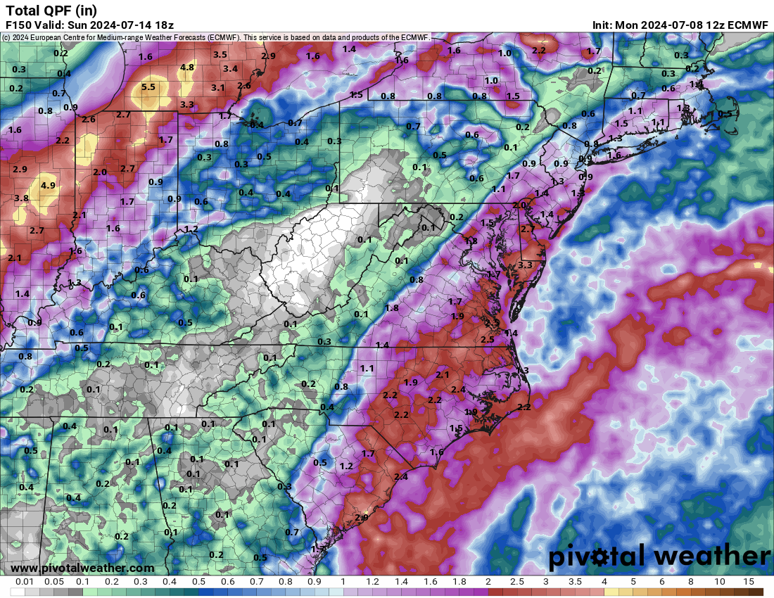
12z euro says Beryl busts the drought next week. 3-6” of rain for the area. Don’t hold your breath.
-
0z euro actually brought the remnants of Beryl pretty close to us as a defined low pressure area