WxUSAF
-
Posts
28,462 -
Joined
-
Last visited
Content Type
Profiles
Blogs
Forums
American Weather
Media Demo
Store
Gallery
Everything posted by WxUSAF
-
Been quite pleasant the last couple days actually. Strong breeze has kept it feeling cooler.
-
Hi friends. I’m in SC this week. Today was hot.
-
2 pitchers already done due to TJ this season, top reliever TJ last fall, this years top reliever out with elbow inflammation, top prospect just hit the IL with elbow inflammation, and now this.
-
How do some of you live here???
-
16z hrrr not terrible by todays standards
-
Almost 0.2” of welcome rain overnight.
-
12z about equally huggable.
- 1,696 replies
-
- 3
-

-
- severe
- thunderstorms
- (and 5 more)
-
SLGT risk extended for far N/W burbs tomorrow.
-
Hugging 6z 3k NAM
- 1,696 replies
-
- 1
-
-
- severe
- thunderstorms
- (and 5 more)
-
Subtle differences in the ridge axis next week might be the difference between daily afternoon scattered storms and just hot, muggy, and dry.
-
The tornado day last week was exceptional for a lot of reasons obviously, but it seems like we are in a multi-year drought for thunderstorm frequency alone. Not even counting severe storms.
- 1,696 replies
-
- 6
-
-
- severe
- thunderstorms
- (and 5 more)
-
Low of 52.5. Mid September before it gets this cool again?
-
Definite big heat potential next week. Luckily I’ll be in Hilton head with some sea breeze relief!
-
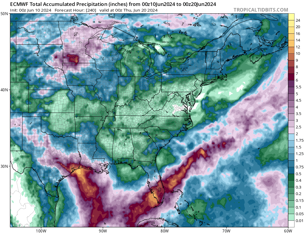
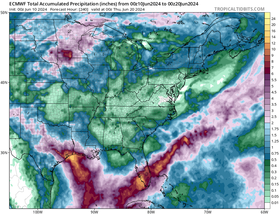
12z euro most robust I’ve seen yet, at least from a rain POV.
-
Any chance the Friday FROPA gets a little more interesting? Big heat with a cold front on the same today suggests interest to me, but guidance is pretty dry.
-
Gorgeous windows open sleeping weather these last several days. Except for the catbird that starts squawking at 4am….
-
Here we go
-
We don’t get summer days much nicer than this…
-
Tornado confirmed very near me in Columbia yesterday.
- 1,696 replies
-
- 4
-
-
- severe
- thunderstorms
- (and 5 more)
-
weather.cod.edu/satrad
-
- 1,696 replies
-
- 5
-

-
-
- severe
- thunderstorms
- (and 5 more)
-
Tamar and High Tor Hill is VERY close to me
- 1,696 replies
-
- 1
-
-
- severe
- thunderstorms
- (and 5 more)
-
Dang…this storm over Baltimore is a long track supercell. Probably 40-50 miles and counting? We don’t get a lot of those.
- 1,696 replies
-
- 1
-
-
- severe
- thunderstorms
- (and 5 more)
-