WxUSAF
-
Posts
26,550 -
Joined
-
Last visited
Content Type
Profiles
Blogs
Forums
American Weather
Media Demo
Store
Gallery
Everything posted by WxUSAF
-
After today’s showers and storms it looks like 7-10 days or more of big SE ridge with warm temps and absolutely zero rain. Going to need a switch flip soon or going to be a very crispy summer.
-
O’s have preemptively postponed tomorrows home opener to Friday.
-
Large drought-fueled wildfire at Soldiers Delight in Baltimore county with smoke showing up on radar.

-
Measuring on grass…smdh
-
Seems like a decent chance a line of showers/storms interferes with the orioles home opener on Thursday. I’ll be in Williamsburg and looks like we’ll have to watch it a bit later that evening.
-
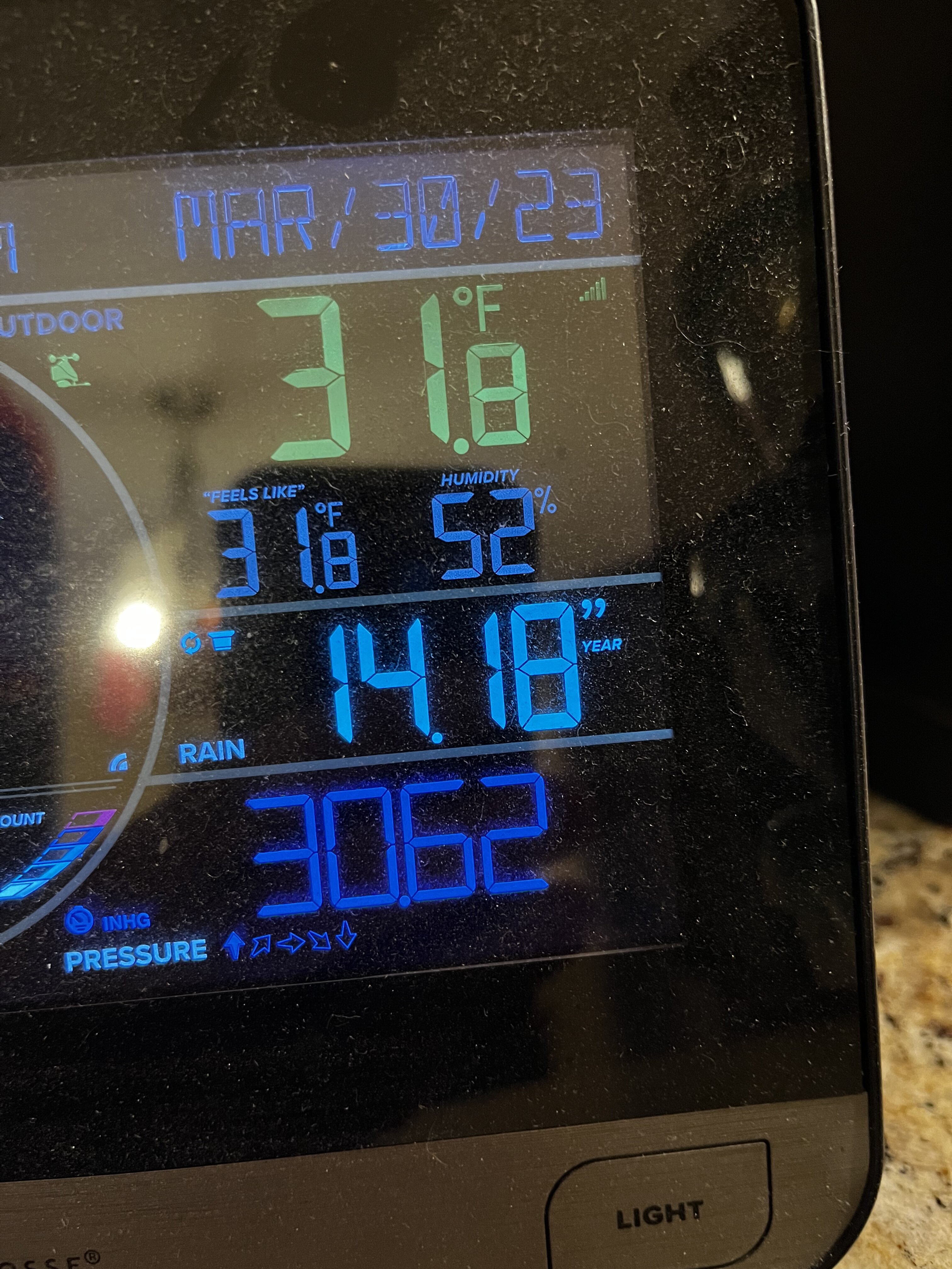
Low of 35 p.s. With frost on cartops
-

2023 Mid-Atlantic Severe Wx Thread (General Discussion)
WxUSAF replied to Kmlwx's topic in Mid Atlantic
Confirmed EF1 in Cecil county- 2,785 replies
-
- 3
-

-
- severe
- thunderstorms
- (and 3 more)
-
2023 Mid-Atlantic Severe Wx Thread (General Discussion)
WxUSAF replied to Kmlwx's topic in Mid Atlantic
Our basketball hoop blew over. That’s never happened before and we’ve had some strong winds. Luckily it rotated a bit first or it would have smashed into my car.- 2,785 replies
-
- 1
-
-
- severe
- thunderstorms
- (and 3 more)
-
Thunder! First of 2023
-
2023 Mid-Atlantic Severe Wx Thread (General Discussion)
WxUSAF replied to Kmlwx's topic in Mid Atlantic
1” hail in Baltimore county -
2023 Mid-Atlantic Severe Wx Thread (General Discussion)
WxUSAF replied to Kmlwx's topic in Mid Atlantic
Been there many times for performances. Some big gusts the last few minutes. But not sustained yet. -
2023 Mid-Atlantic Severe Wx Thread (General Discussion)
WxUSAF replied to Kmlwx's topic in Mid Atlantic
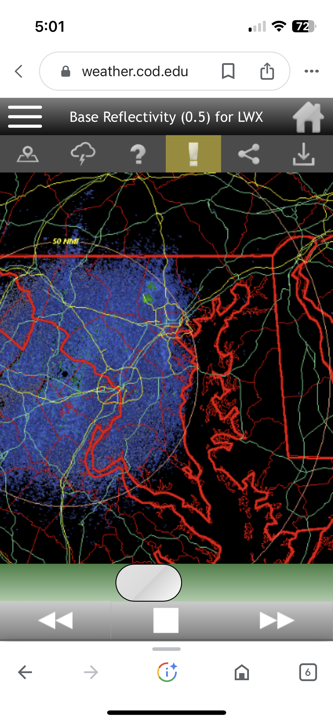
Hi! Light rain at the moment but I’m certainly intrigued with the radar. Solid look for April 1. -
Hail at BWI
-
We don’t need to do this
-
68/59 with full sun
-
Jeez…I had to stop watching when it was 10-4 and then I peak at it when it was B9 and had a freak out.
-
In the metro areas? This month will be AN without doubt.
-
Dude, been there (as a coach). Best part is when people still ignore your prediction because “my app says…” and so you still have to drive 30+ minutes to personally attend the rainout.
-
Happy opening day!!
-
+1.8-2.9F at the 3 airports as of yesterday.
-
With super-mega-Nino coming? Oh yeah, it’s a near-lock globally.
-
Remember when this month was going to be cooler than normal?