WxUSAF
-
Posts
26,466 -
Joined
-
Last visited
Content Type
Profiles
Blogs
Forums
American Weather
Media Demo
Store
Gallery
Everything posted by WxUSAF
-
There’s definitely some good juju percolating for second half of December and beyond. Hopefully some of our more sensitive subforum posters can make it!
-
How do I just get the Cat Fancy subscription?
-
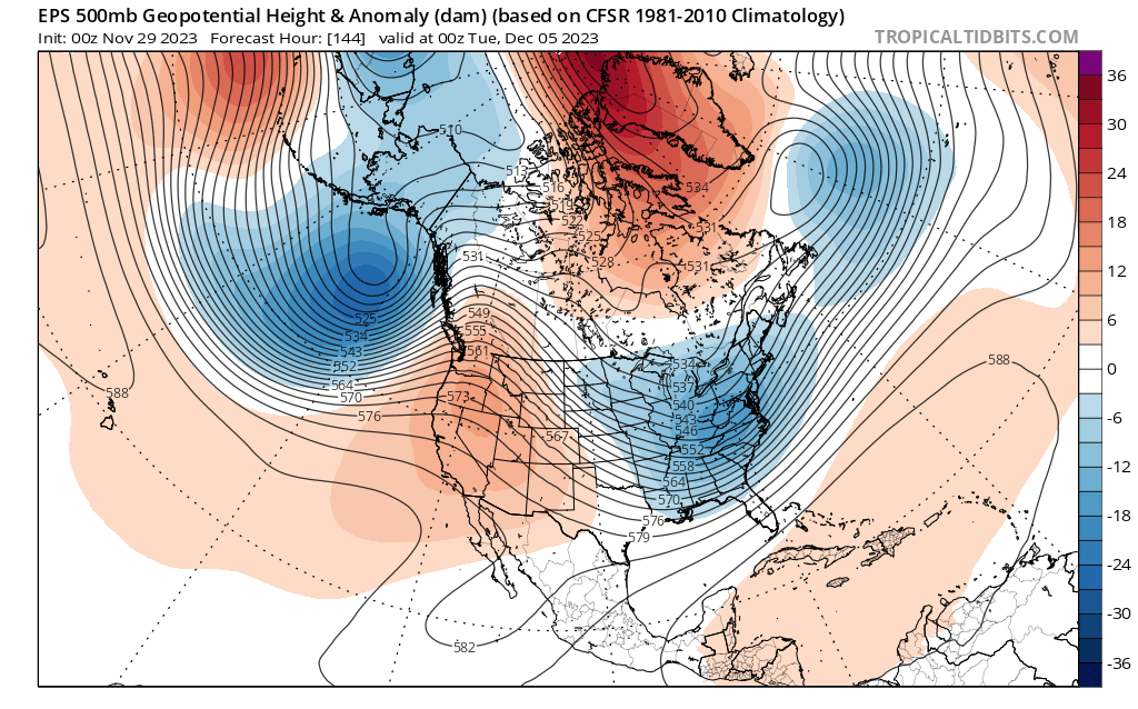
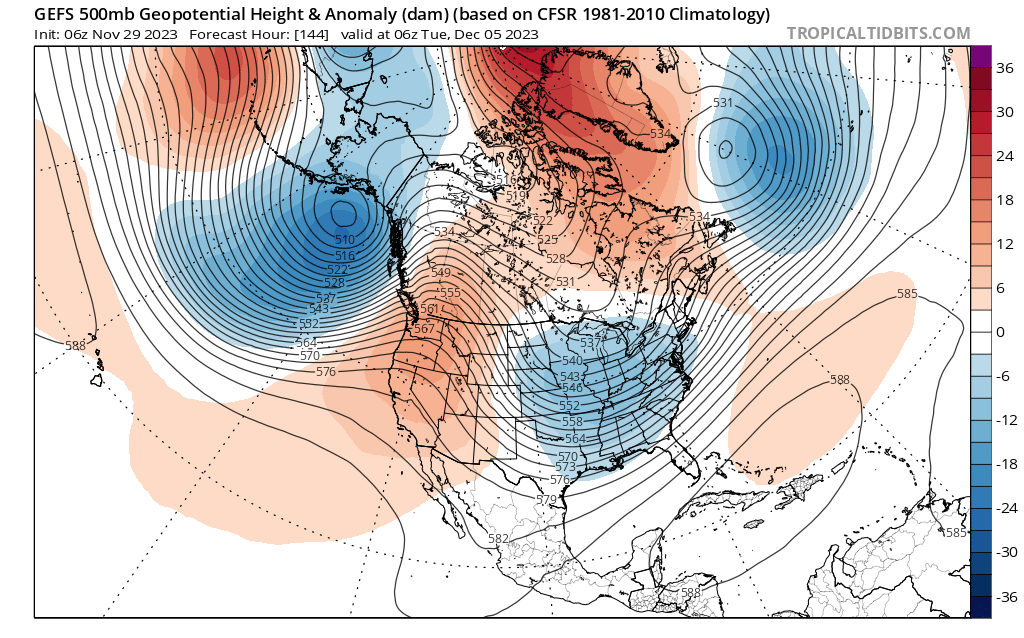
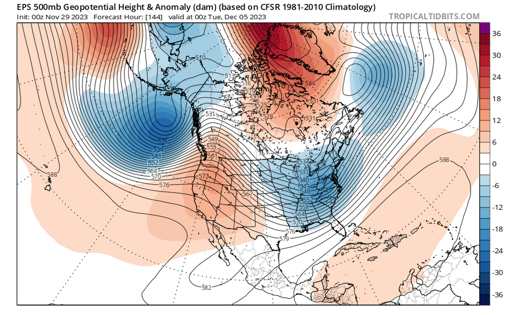
Depending on your expectations for @stormtrackers 12z promise, Euro and GFS certainly keep us in the game for “something” next week.
-
Yeah, but at the time I couldn’t find any literature measuring that. Maybe it’s been done since.
-
I don’t know if there’s any literature about it, but I started dabbling with a project in grad school that would have shown that UHI is minimized during cold air advection as opposed to basic radiational cooling. Never got very far with it, but I think last night is a good demonstration of that idea.
-
Plus Decembers in Ninos are usually mild and the least snowy month? Last December we had a pretty canonical Niña cold pattern the second half of that month and we got boned in the snow department.
-
Plus the ensembles seem to keep adjusting to more -AO which I also quite enjoy! People are gonna gripe going forward even if we can pull a small event out of our hats next week, but I still think we will have chances for snow and cold this month. This does not look like December 2015 at all.
-
I like seeing a Scandinavian ridge showing up on guidance toward mid-month. That should slowly retrograde and help reinforce a -NAO.
-
Low of 22
-
A lot to like here, just don’t look at surface temps.

-
“faint to modest indications” is a good motto for our subforum
-
Congrats @GATECH!! A very impressive performance with a single day departure for BWI, IAD, and RIC and only 3 days for DCA. @BristowWx was second place with a total departure of 10 days and @southmdwatcher was third with a departure of 13 days.
-
Our long nightmare is over
-
If BWI has an average temp of 32 tomorrow (high of 40 low of 24), there were only a handful of colder days in the Nov 22-March 23 cold season.
-
It’s quite typical for strat vortex disruptions to impact Europe first.
-
If you're into Strat vortex talk, today is a good day. A weak Strat vortex plus MJO that should be propagating into favorable phases is a good combo for the week before Xmas and beyond. @griteater and DT both talking about that time period as well.
-
30 at home. Stayed in the 30s today. Frigid with the wind.
-
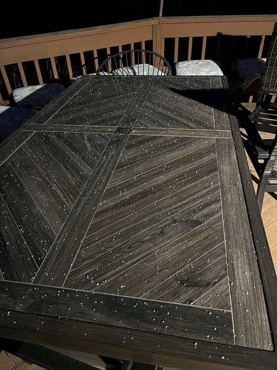
Big area of flurries and snow showers moving toward the M/D line. Hoffman better get that dry ice-cooled snow board out so he can rack up the flakes.
-
FFS @psuhoffman, please tell us you’re shoveling this morning!!! The subforum’s hopes are teetering!
- 727 replies
-
- 12
-

-

-

Mid-Atlantic Snow Totals Thread - Winter 2023-2024
WxUSAF replied to mattie g's topic in Mid Atlantic
T: 11/28/2023 Normally, I don’t count traces, but figure I better make a note in case this is all we get -
Pretty much equivalent to the 2nd heaviest snow of last winter
-
Pounding snow (Winter 22-23 definition applies)
- 727 replies
-
- 11
-
-
-
Flurries in Columbia!!!
-
Some northern stream energy has consistently been showing up behind those rainstorms. That will be a short range track if it happens.
-
GFS and GGEM both showing coastal development in the Dec 5-7 period that @CAPE has shown a few times on the ensembles. Timing is key with active flow, but there’s cold air nearby.