-
Posts
26,466 -
Joined
-
Last visited
Content Type
Profiles
Blogs
Forums
American Weather
Media Demo
Store
Gallery
Everything posted by WxUSAF
-
6z gfs is pretty wintry considering winter is already over
-
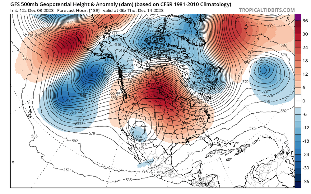
There’s another pretty key difference between the bad ninos and good ninos. The bad ninos have the huge NPac low in the gulf of Alaska and not over the Aleutians. The good winters have an Aleutian low. And that’s what’s progged for this awful horrible winter ending torch coming up…
-
Twitter randos saying we need the Aleutian low to dissipate before winter temps arrive. Feel like I’m taking crazy pills.
-
That 3k is the best look I’ve seen for this.
-
With the strat vortex being stretched toward us later in the month, I think there’s more cold-side risk than you’d think otherwise. But I agree we’ll cool steadily in the means as we approach and then pass Xmas. It’s rare that we’ve had 4-6 week outlooks stick in time and now we’re seeing it inside D15. Things look totally in track to me.
-
3-4 tweets into the thread he admits the pattern is good for eastern cold/snow after that
-
Overnight hours obviously help, but I’d sell on accumulations below higher elevations in the far burbs. Rates will also matter.
-
Correct
-
Continuing to anti-cankick on 12z GEFS. Bad news for the Debs.
-
Look earlier. That big PAC trough just scrours the continent of cold air while the big low moves underneath
-
4th out of last 5 GFS runs with a big phasing/near-phasing coastal D8-11. Hopefully we see that again with some colder air in another few weeks.
-
I think if last year wasn’t the worst ever maybe people would have a little more patience. I still think we get on the board this month and maybe really rock the first half of January. Yes
-
I’m always cautious but the weeklies fit the MJO and strat progression. And now we’re seeing the transition on the ensembles inside D15. We’re not going to flip to an epic pattern from Xmas through March, but I’m feeling pretty good right now about late month into the first 1-2 weeks of January at least.
-
Dude…I know being a Deb is a coping mechanism, but we’re seeing the transition to the drool worthy euro weekly pattern and you’re complaining about that?
-
I know what freaking NYC always is…what about the less lunatic subforums?
-
Been busy today. Are we in winter cancel or winter uncancel today?
-
Catoctins have had a couple dustings at this point.
-

Mid-Atlantic Snow Totals Thread - Winter 2023-2024
WxUSAF replied to mattie g's topic in Mid Atlantic
T: 12/7/2023 Just won’t stop snowing this winter! -
Light dusting in Harford county per pictures from my sister. I’d guess an area from @mappy over through Cecil county could get something measurable here.
-
Based on my calculations, winters where snow has fallen 3 times by December 7 average 63.8” of snow at BWI*. *may not be real statistics
-
Flurries in Columbia! #snowtown
-
You and @psuhoffmanneed to actually measure your snow this time and not be too snobby for accumulations under 6” or whatever
-
Euro still has some snow for N/W areas although less than 12z yesterday. GFS and GGEM only for mountains and areas in PA/NY.
-
Only people on this board will know how good a beer is going to taste sometime in the weeks ahead while we watch some sexy happy hour GFS run clobber us at short lead times. Gah I can’t wait…
-
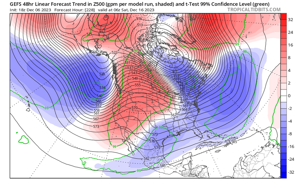
And we’re seeing those differences already. Juicy STJ and we’ve already seen models correct to more +PNA as we get closer in time. This isn’t last year folks.


