-
Posts
26,470 -
Joined
-
Last visited
Content Type
Profiles
Blogs
Forums
American Weather
Media Demo
Store
Gallery
Everything posted by WxUSAF
-
I think we’re gonna get a 2-3 week heater at some point, especially if we get SSW-induced blocking in late January or early February. This period starting after Xmas into the first week or two of January is different, but still looks quite promising if we believe the weeklies for now. Strange though, I’d heard it on good authority the Uber pac jet was going to last until early January.
-
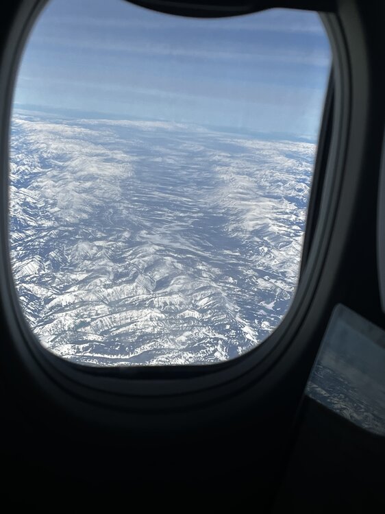
Snowcover in southwest Wyoming as viewed out my plane window. Alert Webber that winter is uncanceled!
-
Dunno…worried about lack of snowcover in New Mexico. Southwesterly flow is going to be dangerously warm. Hopefully we can get a small event in early February.
-
Need more snow over Nevada and Utah or our winter is doomed
-
Odd how that works
-
I legit lol’d
-
Debs in disarray
-
Webb’s got a good short thread for all you today. Saying it might be best to root for a deep western trough and build up snowcover. Then hopefully we can sneak something in by early February before the inevitable March torch. Fingers crossed!
-
So for argument’s sake, let’s say the ensembles are currently correct and we get a mean trough over us around Xmas or so. How far off is that from expectations 10 days ago? A couple days? Maybe 5 at most? Rough outcome for the never ending torch crowd.
-
Yes and yes ideally
-
A megalopolis HECS screams El Niño.
-
I’ll be sure to post Webb’s 9 tweet thread about it and the never ending torch when he gets it posted
-
If we pull another rabbit out of the hat somehow, I’m doing to double my snowfall prediction for the year because it’s clearly one of THOSE winters.
-
12z GEPS is the best looking ensemble mean I’ve seen in days fwiw
-
12z euro similar with Atlantic side wave breaking and a big high nosing in Xmas weekend. Guess we’ll see if all this can last even 6-12 hours, but I guess it’s something. Could at least prevent shorts for Santa??
-
@40/70 Benchmark has mentioned a colder 2015-16 several times as well. I think we’d be pretty happy if that’s what we got in the end.
-
I thought that was last winter? I think the GEFS has been upgraded. @high risk?
-
A trillion times is probably a few hundred billion too many, but GFS and GGEM both show wavebreaking on the Atlantic side that improves the NAO domain and brings some man highs toward us Xmas weekend. With the active storm track, there’s at least some intrigue if timing works out. So yeah, could be worse. Temps still don’t look like a blowtorch for our little corner of the world. Is the whole CONUS well AN? Totally. Will we have a AN December? Very likely, but still nowhere near 2015 for us.
-
Good to know Apple exclusively uses the Icon for its app!
-
Yes
-
Compare the similar time on the last 4 GEFS runs. All the major features are the same, but subtle placement differences can vary my impression of it from: blech to pretty good.
-
Ava Marie showed a picture from pre-dawn very near BWI that was clearly measurable. I drove to Elkridge near BWI around 8am and it was a trace there and then. So I think if BWI had measured at 4-6am, they would have recorded something.
-
WBAL Mets are crying foul on Twitter


